Page Type Page Type: Mountain/Rock
Location Lat/Lon: 35.88368°N / 115.11965°W
Additional Information County: Clark
Activities Activities: Hiking, Scrambling
Seasons Season: Spring, Fall, Winter
Additional Information Elevation: 4186 ft / 1276 m
Sign the Climber's Log

Overview


Another view of Sutor Peak

Sutor Peak in the distance

This is an interesting vantage point which combines a hike through Sloan Canyon which has numerous Petroglyphs (hundreds) which are attributed to early natives who lived here thousands of years before Christ. There is lots of evidence of significant volcanic activity in the past. To get to the trailhead, you should have high clearance 4 wheel drive as it is a rough stretch from Las Vegas Blvd to the trailhead. Numerous other objectives, including some nice crags, will gain your attention in the vicinity and a loop across several of them can readily be negotiated. The hike to the peak itself is about 2 miles one way gaining about 1,200’ in elevation.  The rock is extremely rotten in this area and you need to be careful not to place much reliance on any holds you use.

Getting There

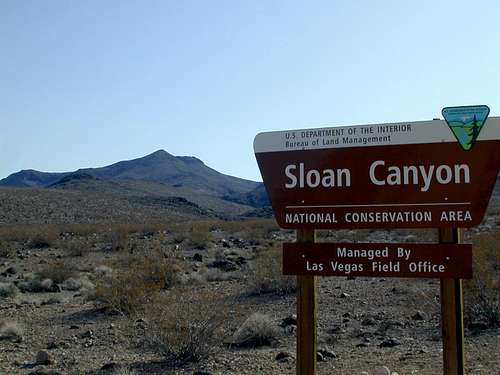
From Las Vegas, follow I 15 South to St Rose Parkway (exit 27) and cross the freeway east toward the “M” resort. Take Las Vegas Blvd south to Volunteer Blvd and head east about 4 miles to Via Inspirata. Go south about 1 1/2 mi and turn left on Bicentennial parkway about 1/2 mi to Via Frienze turning south for another 2 miles to Democracy Drive.  Turn right and travel .3 mi to Nawghaw Poa road and turn left going .7 mi to the Sloan Canyon Visitor Center.  Nawghaw Poa road is paved and gated to prevent entry before opening time which was 8 am 2/25/18.  

Red Tape

Sloan Canyon has been designated as a National Conservation Area, but there are no fees required at this time.  No climbing is allowed so be sure to treat this as a hike.  

Camping

Camping could be done in the desert near the NCA, but wouldn’t you rather be staying near or on the strip in Vegas?

Route Description


Exit point from canyon

Exit point from canyon

Starting at the mouth of the canyon, hike up the canyon while looking along the sides for the hundreds of examples of native artwork after 10 – 15 minutes, especially on your right hand side. Continue up the canyon to a major fork located near GPS N 35.39540 W 115.12097. Take the left fork and continue to a point at N 35.89539 W 115.12396 where you can climb out of the canyon heading for the summit which will be visible in the distance.

final approach to summit

Final approach to summit


USGS survey marker

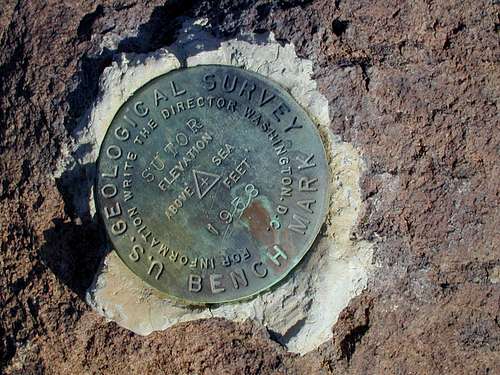
USGS marker on summit

Additions and CorrectionsPost an Addition or Correction

Viewing: 1-1 of 1
RaymondShevsky

RaymondShevsky - Jan 23, 2019 1:45 pm - Hasn't voted

HC/4WD no longer necessary

Paved roads all the way to the trailhead. Perhaps as a consequence of all the new development going on in that part of Henderson.

Viewing: 1-1 of 1