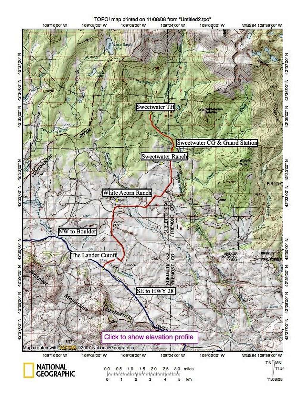
Sweetwater Trailhead access road map

Sweetwater Trailhead access road map

Blue=The Lander Cutoff that goes from Wy Hwy 28 to Boulder Red=The Sweetwater Road Please disregard the "click to show elevation profile" box. It took me many hours to get this far with the Topo software and this is as good as it gets for now.
Bill Reed
on Nov 8, 2008 2:12 pm
Image Type(s): Informational
Image ID: 461731

Comments

Post a Comment
Viewing: 1-2 of 2
tomlauren

tomlauren - Jun 5, 2009 5:16 pm - Hasn't voted

Click to show elevation profile

Have you figured out how to eliminate the "Click to show elevation profile" box? I recently purchased Topo! and am having the same issue.

Bill Reed

Bill Reed - Jun 5, 2009 7:55 pm - Hasn't voted

Re: Click to show elevation profile

No can do, unless you remove the bottom of the map.

Viewing: 1-2 of 2