Toggle navigation
Mountains
Routes
Images
Trip Reports
Forum
What's New
People
Areas & Ranges
Articles
Trailheads
Canyons
Huts & Campgrounds
Albums
Logistical Centers
Fact Sheets
Lists
Custom Objects
Gear
Plans & Partners
WELCOME TO SUMMITPOST
SIGN IN
REGISTER
T-Bone
Additional Parents
Image
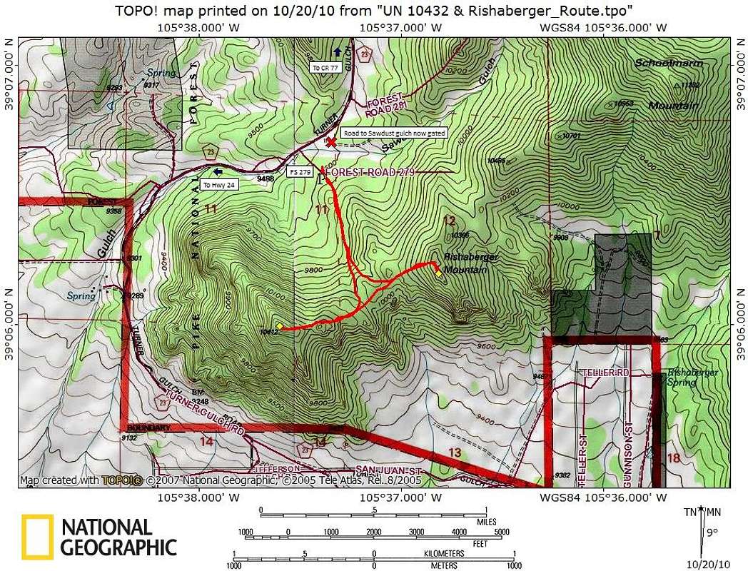
T-Bone Route Map
View High-Resolution Image
T-Bone Route Map
This is typical Puma Hills bushwacking, complete with fallen logs and almost no view of the summit until you’re “there.”
Map created October 2010
« PREV
NEXT »
Sarah Simon
on
Oct 21, 2010 6:43 pm
Comments & voting
Other parents
Image Type(s):
Topo/Diagram
Image ID:
672992
1234 Hits
75.81
% Score
6
Votes
Log in to vote
Comments
No comments posted yet.
to post!
Don't have an account?
T-Bone
(Route)
« PREV
Viewing
#2 of 6
GALLERY
NEXT »
Sarah Simon's Image Gallery
« PREV
Viewing
#895 of 5480
GALLERY
NEXT »
×
You need to login in order to vote!
User Name
Password
Remember me
Forgot your password?
Log me out when I close my browser.
Keep me logged in all the time.
sign in as a user
Don't have an account?
Register now for FREE
Rating available
Suggested routes for you
People who climb the same things as you
Comments Available
Create Albums
Register Here


