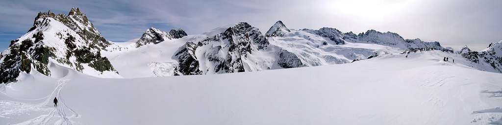
Large mountain, to west of the Dent d'Hérens between Valpelline Pass (north), Westiefimattenjoch (southeast) and De The Division Pass (west). The peak is formed from a large snowy dome. Grandiose panorama on the mountains: Matterhorn, Dent d'Hérens, Dent Blanche, Dents des Bouquetins and numerous large glaciers.
Grande montagna, a ovest della Dent d'Hérens tra Valpelline Pass (nord), Westiefimattenjoch (sud-est) e de La Division Pass (ovest). La vetta è formata da una grande cupola nevosa. Grandioso panorama sui monti: Cervino, Dent d'Hérens, Dent Blanche, Dents des Bouquetins e numerosi grandi ghiacciai.
First Ascents
First on the summit (N Slope): Edward Whymper and mountain guide of Zermatt Franz Biner, (Aug 03th, 1866).
In winter: Unknown.
W slope and W Arête (from Division Pass-normal route): Unknown.
E Wall and SE Arête: Mountain guide Oskar Supersaxo and company, (?).
SE Arête (from Westiefmattenjoch): John Taylor and mountain guide Ambros Supersaxo, (Jul/Aug ? 1880).
S-SW Arête and SW Wall: Aldo Bonacossa and Carlo Prochownich, (Sep 09th, 1920).
S-SW Wall: Gino Costa, Giorgio Monetti and Leopoldo Saletti, (Jul 07th, 1942).
SW Wall (of Quota 2.584 and W Arête) Luciano Pasi and Marco Pasi, (Jul 13th, 1969).
W-SW Spur: G. V. Amoretti, Gino Bruschi and Donato di Vestea, (Sep 12th, 1928).
Great Crossing-Tour Tsa de Tsan Basin (Division Pass-Tête de Valpelline-Tête Blanche-Tête de Chavanne-S Wall, first ascent-Division Pass): Osvaldo Cardellina, Marco Cossard and Giuseppe Lamazzi, (Jul 04th, 1976), in day from Place Moulin.
Getting There
BY CAR:
From Torino, Milano, etc: Motorway A5. Exit at Aosta Est.
From Switzerland: through the Grand Saint Bernard Tunnel or the namesake pass.
From France: through Mont Blanc Tunnel or Petit Saint Bernard Pass. It isn't necessary to take Motorway A5: you can drive on SS.26, in the direction of Aosta.
BY PLANE:
Aeroporto "Corrado Gex" Saint Christophe (Aosta).
Route
From Aosta-Est highway exit follow along the SS.27 toward Gran San Bernardo Tunnel for about 10km and leave it turning to the right toward Valpelline (964m). Don't follow to Ollomont (1.335m) but toward Bionaz (1.606m), and, on the left side up to the wide car parking on the western side of the huge dam of Places Moulin (1.968m).
Dall'uscita del casello autostradale di Aosta-Est, proseguire sulla SS.27 in direzione del tunnel del Gran San Bernardo; dopo circa un decina di chilometri svoltare sulla destra verso il Paese di Valpelline (964 m) e, dopo averlo superato ed aver ignorato il bivio sulla sinistra che conduce all'abitato di Ollomont (1.335 m), proseguire verso il Paese di Bionaz (1.606 m). Continuare sulla sinistra sino all'ampio parcheggio posto sul lato occidentale del gigantesco sbarramento di Places Moulin (1.968 m).
Itinerary
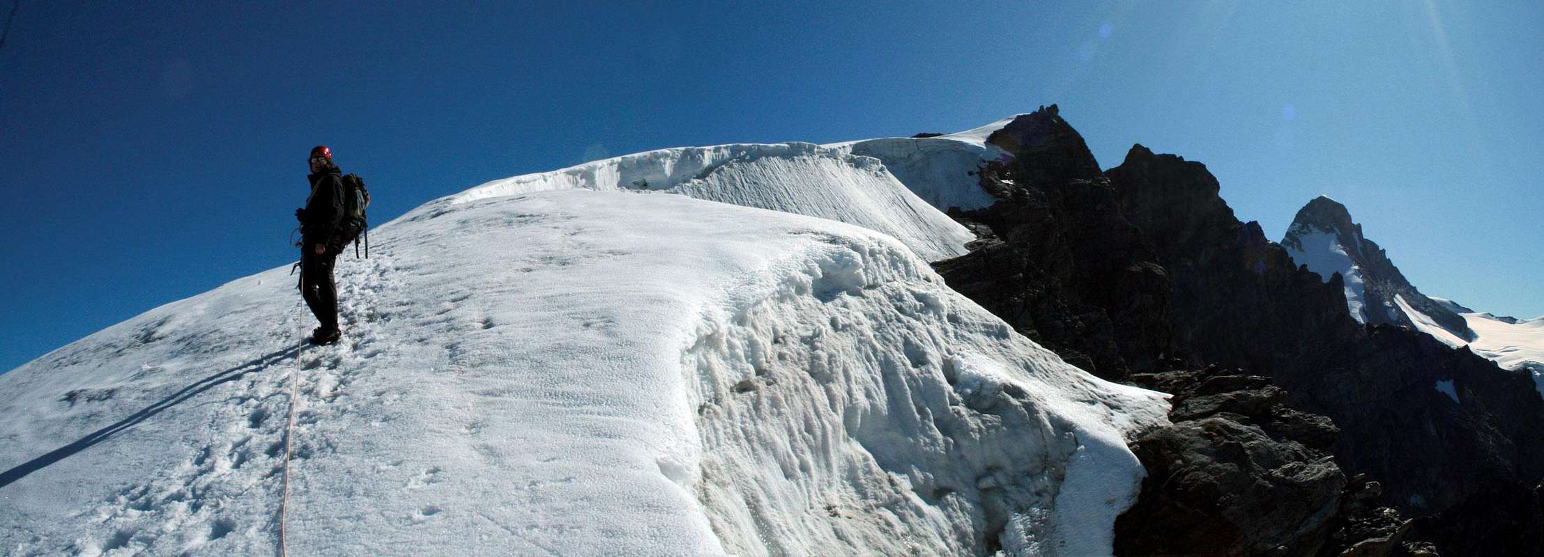
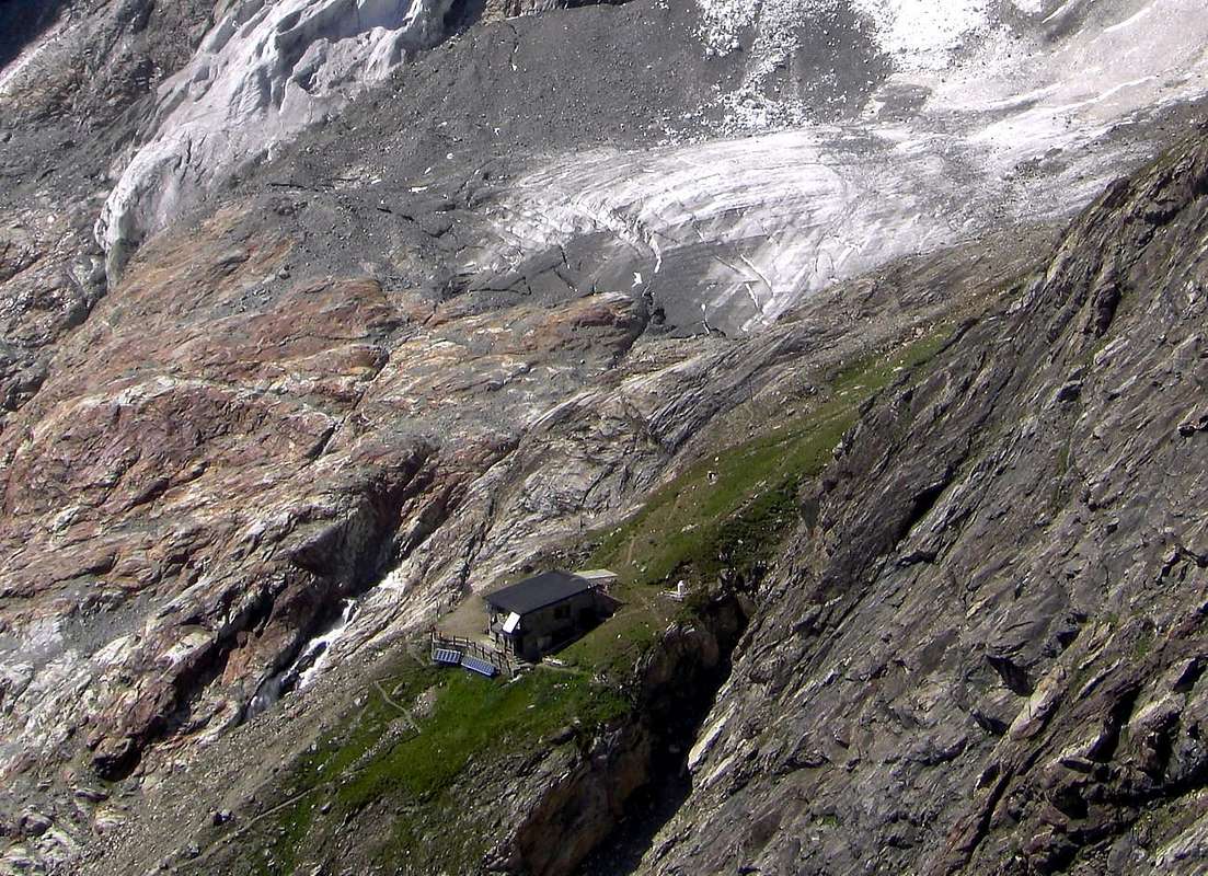
From Places Moulin (1.968m) walk along the dirt road on the N side of the lake to get the Rifugio Prarayer (2.005m), then a path to the border of the larches wood "Bois de Grand Plan". To continue to north the path for the Aosta Refuge (Old Hut Tsa de Tsan) and to overcome to quota 2.250m~ the Stream Buthier de Valpelline. To cross the whole Vallone to the Aosta Refuge (2.788m4h'00). To continue toward north going beyond the rests of the Bas Glacier Tsa de Tsan; overcome a rocky band of 70/80 meters (I°/II°, exposed passages) to reach the Division Pass (3.338m). With east direction to go up again the West Slope of the Tête de Valpelline particular attention for the numerous crevasses! (6h'30/7h'00).
Descent: from the same route.
Da Places Moulin (1.968 m) percorrere la strada poderale a nord del lago artificiale che conduce al Rifugio Prarayer (2.005 m), per il sentiero alle pendici del bosco di larici "Bois de Grand Plan". Prendere a nord il sentiero per il Rifugio Aosta (Vecchia Capanna Tsa de Tsan) e superare a quota 2.250 m~ il Torrente Buthier de Valpelline portandosi dalla sponda est a quella ovest (non seguire le tracce a est del vecchio percorso, ormai abbandonato). Percorrere tutto il Vallone sino al Rifugio Aosta (2.788 m4h'00). Continuare verso nord oltrepassando i resti del Bas Glacier Tsa de Tsan; superare una fascia rocciosa di 70/80 metri (I°/II°, a tratti esposto) per raggiungere il Col de la Division (3.338 m). Con direzione est risalire il Versante Ovest della Tête de Valpelline facendo particolare attenzione ai numerosi crepacci! (6h'30/7h'00).
Discesa: per la stessa via di salita.
Difficulty
The route is for Expert Hikers with some alpinistic experience F+.
Parents refers to a larger category under which an object falls. For example, theAconcagua mountain page has the 'Aconcagua Group' and the 'Seven Summits' asparents and is a parent itself to many routes, photos, and Trip Reports.

 13072 Hits
 89.01% Score
 28 Votes