
|
|
Route |
|---|---|
|
|
46.70630°N / 121.66312°W |
|
|
Hiking |
|
|
Summer, Fall |
|
|
Most of a day |
|
|
walk-up / scramble |
|
|
Overview
The easiest route to the summit is via the Tatoosh Trail (#161) from either end. The hike in appears to be equally distant from either trailhead (~10mi RT); the northern one is arguably more scenic of the two but also may be more difficult to get to per rough gravel washed out roads. Check with the local ranger station on conditions before driving here -- the road was very rough in July 2007 and likely not passable to most passenger cars.North Approach:
From Hwy 12 at the east end of town, turn off onto Skate Creek Rd (Rd 52). Cross the Cowlitz River in 0.5mi and continue for 3.5mi to turn off north/right on FR 5270 (gravel). Follow for 5.8mi to a junction and continue straight on 5270 for another 1.5mi to the trailhead.
South Approach:
As above although on crossing the Cowlitz River, turn right onto Cannon Rd. Continue upriver (the road becomes FR 5290 shortly) for 9mi. On arriving at an intersection, turn right and continue on 5290 for another 1.2mi to the trailhead.
Route Description
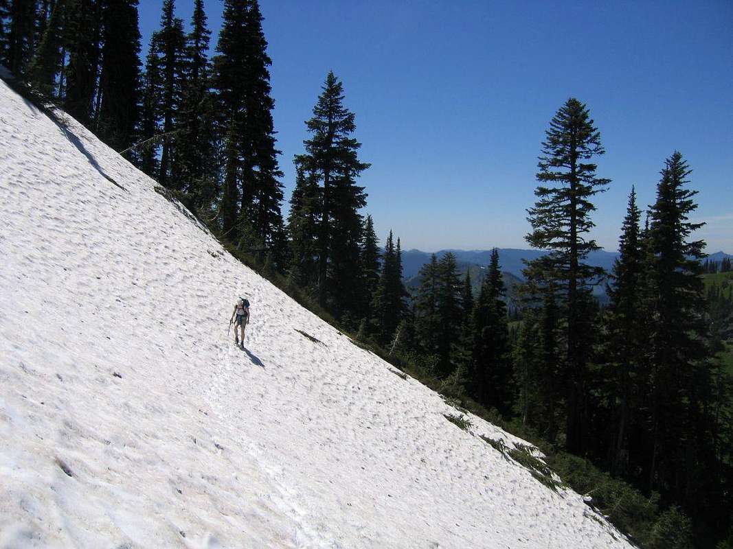
North Approach:From the trailhead (~2900') head upwards through numerous switchbacks until it opens onto the ridge at about 5400' in 2.5mi. On breaking out into the meadows reach an old junction with an "Abandoned Trail" sign on the right. Ignore it and continuing left on the main route before shortly arriving at another unmarked junction. Continue right to reach a third junction signed for the Tatoosh Lakes. Bear right and continue on a very long traverse along the grassy/meadowed ridge. The trail stays at about the same elevation and continues south and east for ~1.5mi to a last junction just before a saddle where it meets the southern approach trail (see below). Note that the traverse on the west side of Tatoosh Peak holds its snow well into early July and may make it impassible to hikers. At the junction bear left on a signed trail up the ridge north to the summit (6310').
South Approach:
The approach from the southern trailhead (~2500') is much less complicated in terms of junctions. Simply follow the Tatoosh trail north up a series of switchbacks along Hinkle Tinkle Creek and continue upwards just east of Butter Peak and then north along the ridge on a slow rising traverse to meet the northern approach trail just past a saddle as mentioned above. Follow the spur trail from here to the summit (6310'). Note that a good portion of this trail may be covered with snow into mid-July.