
-
 13575 Hits
-
 71.85% Score
-
 2 Votes
|
|
Mountain/Rock |
|---|---|
|
|
36.95281°N / 22.34996°E |
|
|
Download GPX » View Route on Map |
|
|
Lakonia |
|
|
Hiking, Mountaineering |
|
|
Spring, Summer, Fall, Winter |
|
|
7897 ft / 2407 m |
|
|
Overview
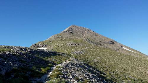
Profitis Hlias (2,405m) is the highest peak of the Taygetos mountain range. It is also the 12th highest peak in Greece and the highest one in the Peloponnese. With relatively easy access and the distinctive pyramid shape, it is a popular summit with hikers, all year round.
 The summit as seen from the village of kardamyli
Getting There
Taygetos lays between Kalamata and Sparti in the southern part of the Peloponnese. Sitting in the middle 'leg' 100km long and 30km wide it is pretty massive. Profitis Hlias lays east of the central massif (see Taygetos main page) just south of Sparti.
Refuge Access
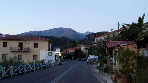
The main route is the refuge route (east direct) which to access you should drive to Sparti and head south towards Guthio. Exit at the village of Xirokambi and head West. The road is generally good and asphalt until it reaches the forest road towards the refuge. The road continues to be pretty good but it now consists of dirt. Use a GPS to get there since there are many linked roads and you don't want to get lost.
Reaching Sparti or Kalamata
To get to Kalamata or Sparti you could drive from Athens (approx 2h) or fly to Kalamata airport and drive from there.
General Access Concerns
If you are going to head into the deeper trailheads it is recommended that you drive or rent a 4x4 car since Peloponnese roads are known to be shit, but you can also hike from trailheads in villages where you won't need a 4x4.
Route(s)
East Direct Route (From Taygetos Refuge)
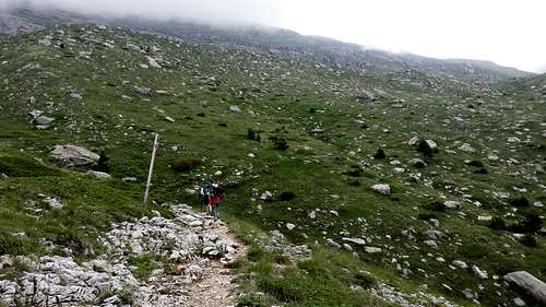
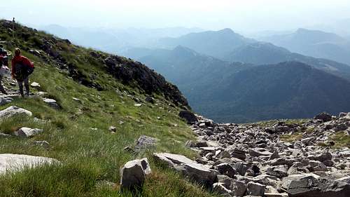
It is the fastest and easiest route up the mountain. It is around 4.5 hours round trip and 3 hours up. Starting at the refuge at 1550m of elevation the route heads Westwards and starts just behind the refuge. The sign says it's just 2:45h to the summit. First the trail takes one through a nice mellow forest before reaching a steep and rocky outcorp that must be climbed. At this point hikers should be about 30 minutes in. Once above the outcrop the terrain turns into fields of sorts, with large rocks from the mountain above, here walk along the trail North, to North West slowly gaining elevation. After about 1 hour the "Gouves" location should have been reached at 1,860m. It is marked with a wooden sign.
|
|
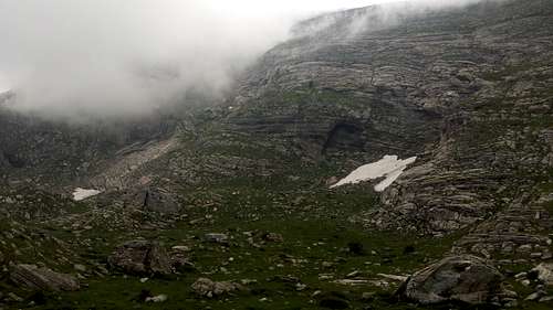
The trail is mainly dirt and not that steep with the exception of two or three parts that are quite steep and rocky. The rock traverse after "Gouves" and on the way to "Plakes" is the most exposed section. After this traverse the "Plakes" section start and the trail goes South, and gains elevation faster. "Plakes" is at 1,990 while the entrance of the ridge at the top is "Portes" (Doors) at 2,238m, this should also take about 1 hour. The section is steep throughout and the whole section is on a rock with very good views all around.
|
|
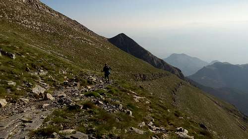
Now from Portes at 2,238m the summit of Profitis Ilias (2,405m) should be visible to ones left (South) as they come up on the ridge. From here it is about 30 minutes to Profitis Ilias (2,405m) but with the trail being very steep and rocky with rock pebbles. The trail is clearly visible but is not very wide.
|
|
When to Climb
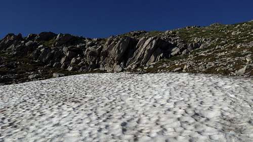
The mountain is summited year-round although you will be needing winter gear to summit during the cold months. During the summer there is the 'Profitis Hlias day' where many people summit the mountain and stay at the summit and party.
Camping
You can like many people do camp at the summit and enjoy the sunrise. The summit has a small church built by rocks as a wind cover where you can camp. There are also many wind walls throughout the summit where you can camp. There are many people climbing and camping during the weekends. Most people go there to see,
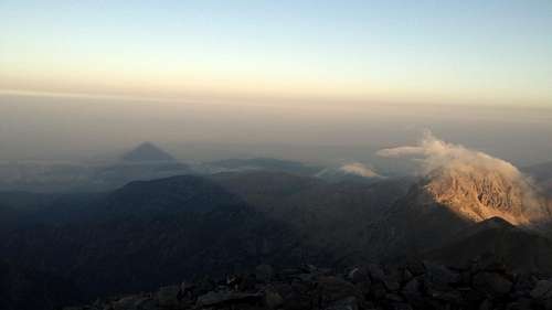
The Pyramid Shadow
An effect that happens while the sun sets or rises due to the pyramid shape of the summit, where the shadow cast by the peak is a perfect triangle projected onto the ground.
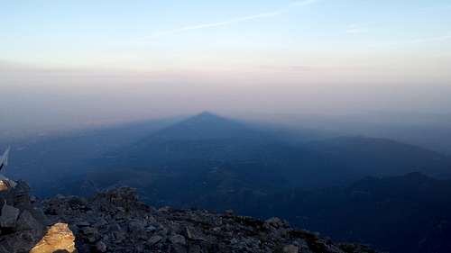
The shadow seen during the sunset
The sadow during the sunrise with view of Xalasmeno
Summit Views
The Summit of Taygetos offers insane views, here is a time-lapse of a sunset from the summit and a 360-degree pic.
Weather
External Links
All the marked trails on the mountain: http://www.hellaspath.gr/index.php?p=2&m=1&mntid=54