
-
 25364 Hits
-
 79.04% Score
-
 10 Votes
|
|
Mountain/Rock |
|---|---|
|
|
38.80550°N / 104.9261°W |
|
|
El Paso |
|
|
Hiking |
|
|
Spring, Summer, Fall, Winter |
|
|
10093 ft / 3076 m |
|
|
Special Note
14 September 2012I was recently granted ownership of this page from the original creator of the page, csmcgranahan. Special thanks goes to csmcgranahan for all of his hard work establishing many area, mountain & route pages for the Pikes Peak region on SummitPost.
Sarah
Overview
 The Five Teners from the summit of Mt. Rosa
The Tenney Crags (10,093’) is located in the eastern foothills of Pikes Peak and is one of five 10,000 foot peaks located between the Ruxton Creek drainage and the Bear Creek drainage. The others are Mt. Garfield (10,930’), Tuckaway Mountain (10,825’), Mt. Arthur (10,807’) and Cameron Cone (10,707’).
The Tenney Crags are an interesting rock playground with numerous rock formations and minor summits. Many of the rock formations are similar to those commonly seen in the Lost Creek Wilderness to the northwest. It is little wonder that Tenney Crags is a quiet local classic.
Rank: Unranked
Prominence: 279 feet
USGS Quad: Manitou Springs
Planning Map: Pikes Peak Atlas or Trails Illustrated #137 Pikes Peak / Cañon City
Rank & Prominence: Lists of John
Getting There
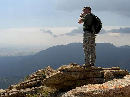 Enjoying the views
Take US Highway 24 West, also known as Cimarron Street, to 8th Street. Go south on 8th Street. Turn right on Cheyenne Boulevard. Continue straight at Cresta Road. When you come to a fork in the road, take the right fork, which is North Cheyenne Canyon Road. The left fork goes to Seven Falls. Follow the road past Helen Hunt Falls and continue up switchbacks until you reach the end of the paved roadway. There is a large gravel parking lot on the left that is the first trailhead for the Tenney Crags – this is the Lower Gold Camp Road trailhead. It is also the only trailhead accessible by vehicle between December and April when High Drive is closed.
If the gate to the one-way northbound High Drive is open, usually from May to November, you can proceed past this parking lot up along High Drive to the Mt. Buckhorn / Mays Peak saddle. At the saddle is a second trailhead, the Captain Jacks, which accesses the Buckhorn Trail #667.
A third trailhead beyond the saddle is located at the last major switchback below the saddle on the left. This trailhead accesses the lower Bear Creek Trail #666.
As can be seen on the Pikes Peak Atlas, all three of these trailheads provide access to the faint Tenney Crags trail located on the north side of Trail #667 just above the junction with the Bear Creek Trail #666. The Tenney Crags trail and junction is easy to miss and is not located on the Pikes Peak Atlas or any other local topographic map I have seen. It is located at approximately 38.79438N, 104.92886W.
For those lucky enough to live or know someone who lives in the private Crystal Park residential area, Tenney Crags is accessible from the north.
Red Tape
 Boulders on Tenney Crags
There are no permits necessary for this section of Pike National Forest and no fees required for parking.
Weather Conditions / When to Climb
 Downtown Colorado Springs
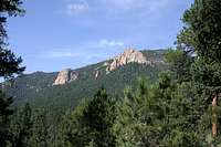 Tenney Crags
 Northwest from Tenney Crags
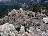 Typical Tenney Crags formations
The Lower Gold Camp Road trailhead is accessible year round. The two High Drive trailheads are typically closed to vehicles from December to April. The Tenney Crags trail primarily has southern exposure but the approach trails are located in Bear Creek Canyon and could be difficult during the winter months. For the hardy winter hiker the summit is accessible year round.
Check Colorado Springs weather at: Colorado Springs weather
Check conditions on Pikes Peak above 11,000 feet here.
Camping
 Cookstove Mountain
There is no camping allowed at any of the three trailheads. The saddle to the west of Tenney Crags is relatively flat and would be ideal for backcountry camping – if you want to lug a backpack up to 10,000 feet!