
-
 25108 Hits
-
 83.1% Score
-
 16 Votes
|
|
Mountain/Rock |
|---|---|
|
|
41.53257°S / 147.65828°E |
|
|
Hiking, Skiing |
|
|
Spring, Summer, Fall, Winter |
|
|
5157 ft / 1572 m |
|
|
Overview
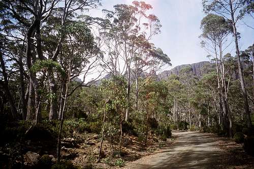 Ben Lomond from the road to Carr Villa Ben Lomond from the road to Carr Villa |
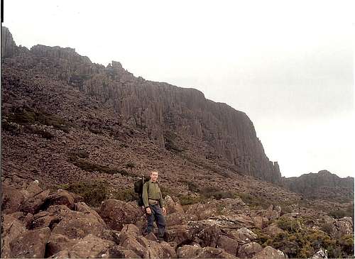
Because so much of the alpine on Tasmania conforms to this geological pattern, you might be initially seduced into a “done one, done ‘em all” attitude. Don’t be. Within the overall similarity, each area has it’s own unique experiences to offer to the hiker who is prepared to keep an open mind as well as open eyes. In the case of Ben Lomond, it’s the sheer size of the thing. Once you’re up there, the plateau is nearly 100 square kilometres in area and almost completely featureless. In fact the barrenness of the place is itself rather attractive presenting, as it does, such a huge contrast to the eucalypt forest just a few minutes and a few hundred metres below. Getting lost if visibility degrades is not a possibility; it’s a distinct probability. If the weather is at all iffy, make sure you’re equipped with the right map as well as navigational aids.
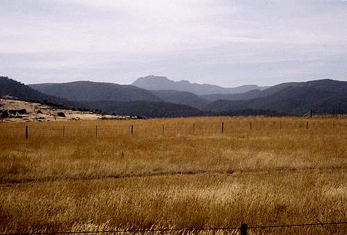 Ben Lomond from the Fingal Valley |
Getting There
I’m not aware of public transport options, so the following assumes you have a car available.The usual approach to Ben Lomond is from Launceston to the west. From Launceston find the C401 leaving the city through St Leonards along the valley of the Esk River to White Hills and Upper Blessington. From Upper Blessington there are signs for the national park. Shortly after leaving the latter the road becomes gravel but is easily navigable with a regular car.
It is also possible to approach from the Fingal Valley and the east coast via the B43 from Fingal to Mathinna and then on relatively rough dirt back roads to Upper Blessington. Get a good road map for this one though. I didn’t and spent quite a bit of time back tracking before finally emerging at Upper Blessington.
After entering the national park climb up almost 1000m over 12km to a road junction signed for Carr Villa. You have the option to park here and walk up through the forest to Carr Villa or drive up and leave your car there.
Route
From Carr Villa at ~1,100m find a well marked track running south and then south east up through the last of the eucalypt forest and over a huge dolerite scree field. The track then turns south again before making a beeline for the obvious gap in the plateau ramparts just west of Misery Bluff. It takes no more than 15-20 minutes of moderate climbing before you emerge on the flat plateau just south of Misery Bluff. A 30 minute return side trip up the latter is perfectly feasible and gives a good view of the (optional) return leg of the hike.The route across the plateau is well marked by snow poles. Follow these 3.5km south and then east to the base of Legges Tor and several (locked) club huts. According to my information, the high point of Legges Tor lies to the right as the snow pole marked route forks left and right. Once there, however, the view of the ski village and runs below didn’t seem to agree with my map and the true summit appeared to be even further to the right (roughly south). So I went over there as well. With hindsight, this last might have been Giblin Peak but my altimeter showed the same as it had on the previous high point, so who knows. You decide – just remember (unlike me) to take your GPS. One was the second highest point in Tasmania anyway. Because Legges Tor lies right on the eastern edge of the Ben Lomond Plateau, views of anything but the plateau itself are largely restricted to that direction.
 Ben Lomond | 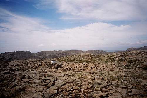 View SE | 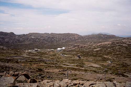 View E | 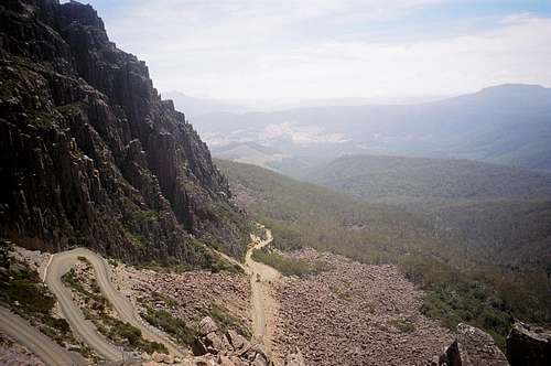 Jacobs Ladder |
The total distance is approximately 13km with an elevation difference of ~550m. Round trip time from the car; a very leisurely 4 hours including breaks.
Red Tape
NoneExternal Links
Any map you may need for Tasmania can be obtained at TasMapsBen Lomond National Park website