The Cathedral of the Uintas- Executive Summary
First, the short version: the Cathedral is a beautiful and impressive peak rarely climbed in the High Uintas of Utah. Access is long but pleasant, views are stunning, there are lovely lawns to camp on, other nearby peaks are attractive, and the route is mildly challenging and eclectic (varied). The most common ascent route involves finding a crossing over the creek, picking your way through forest and boulders, then scrambling over big rocking quartzite stones for a couple of hours through sticky spider webs of spiders about the size and shape of black widows, but which I am told, are not the same species.
Very few get up here. Take gloves. Going down will be more tedious than going up. Other possible routes to separate summits of the peak are up 3 fine snow chimneys, best targeted in June, and possibly still in season in early July. From the summit, Yard Peak, Mount Beulah, Priod Lake, and the 4 summits of the Cathedral will make your efforts worth it. The view is extra special because even among neglected Uinta gems, the aptly-named Cathedral is a diamond in the ruff.
The only sensible approach is via the East Fork Bear River Trail which forms a "Y" which opens to the South, the left fork going to Priod Lake and the right fork leading to Alsop Lake, both very nice destinations popular with rugged fishermen, but few others. The trail forks after about 4 miles and then either fork will continue for about 4 miles. All distances approximate by my casual topo skills.
A potentially magnificent "extreme" battle plan would be to go up the Cathedral from the Alsop Lake (East) side, and then descend the West slops to Priod Lake, taking that trail back to a campsite set up at the the fork in the "Y". If you look at a map that will all make quite obvious sense, even if my explanation is a little mangled. You would need excellent route-finding skills to try that.
The East Fork Bear River Trail is accessed by 20+ miles of dirt road network, which are passable for any passenger vehicle. I made it with a Toyota Camry without worries, though Camries sit very low. There are some bumps and ruts, so go slow, and if the road is especially muddy or flooded, you may need to walk some of the last stretch. From the Bear River Snowpark/near some Bear River Cabins, take USF Road 0375 to Road 0059, or follow the signs when you get there. Just keep aiming toward the East Fork Bear River Trailhead.
It sounded daunting when I was heading out, but the forest dirt roads are easy to follow. Just finding the correct turnoff from Mirror Lake Highway (Utah 150) is the challenge. This is a pay area and so have a pen with you to fill out a parking permit, and have $6 in cash available. No change will be available unless you can work it out with another hiker, if there are any. There is a vault toilet at the trailhead and plenty of parking. Pay before you get to the trailhead because there is no payment tube once there and you may be ticketed. Pay as you first turn onto the dirt road network.
My Story
Day 1
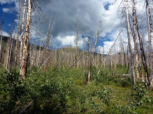
![Cathedral TR 2]() Burn zone near the beginning of the trail.
Burn zone near the beginning of the trail.Now for those of you still with me, I will talk about more specifics from my trip. The trail is very easy to follow almost the whole way, though depending on the season you may lose a turn or two in a mud swamp. If your trail withers or fades, turn back and look for any slop you might have lost the real trail in. Horses travel this trail so it is very wide until the fork that splits with paths going to Priod or Alsop Lake.
Fires from years back have left the first part of the trail a burn zone, which was particularly pretty (as far as burn zones go) when I was there. Huge trees with their root network intact are turned over beside the trail, making neat pictures. Flowers were popping up from between the charred skins of aspens. This stretch has many bridges crossing over bubbling little streams.
After a few miles, you come to a long bowling green of a meadow and the first view of easy to spot Mount Beulah is the reward. This is one of the spots where the trail is not intuitive. As one expects to head to Beulah, seeing her there on the left makes one want to traipse right through the long, pretty meadow, but the trail turns to your Right (the West) and this may be masked by a) lots of people intuitively walking straight towards Beulah with their necks craned up creating a fake faint path, B) a mud swamp hiding the real trail for about 100 feet which is certainly enough to miss a bend. The trail stays flattish to the fork in the "Y" and then either path will veer upwards.
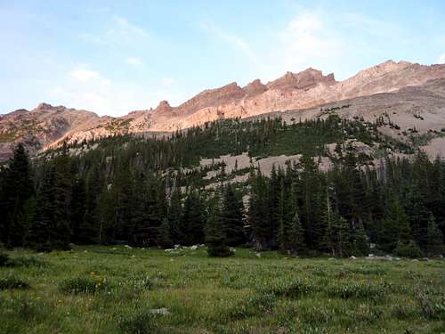
![Cathedral TR 1]() The first view of Mount Beulah. Trail does not go through this meadow. Turn to your Right (West).
The first view of Mount Beulah. Trail does not go through this meadow. Turn to your Right (West).
If you are heading to Lake Alsop and taking the strangely named "Left Hand Fork Trail", you will now encounter some switchbacks, which with a starting elevation of nearly 9,000 feet over sea level, and (likely) a very heavy pack, will mean you are in for a few hours of groaning, cursing, and sweating. Another option is to set up camp at the fork and then explore from there, using it as a remote base camp.
As mentioned in the executive summary above, a strong solo-ist, or preferably, a strong team, could go up one fork quickly with limited light gear and descend the other way. You would need to make any such attempt starting before sunrise and planning to be out until near sunset. Water would be very easy to filter the entire way and it could be done, in my opinion, without any gear. Ice axes and crampons would open up more interesting route possibilities, but scrambling would get it done for an ultra-light attempt. That would be a long day, but I've done worse, and it would be very rewarding.
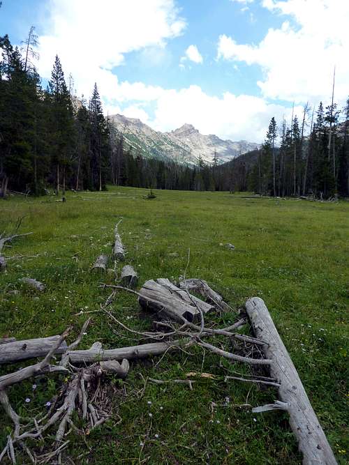
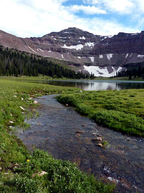
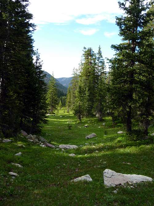
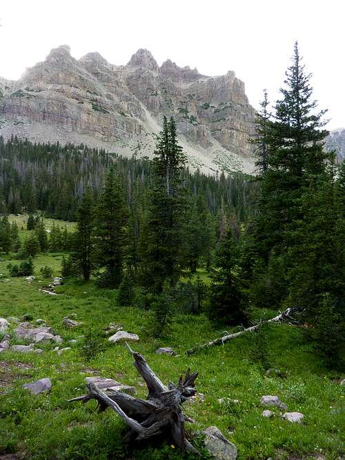
The switchbacks remain easy to follow and begin to yield to pretty flatter turf again after a mile or so. There are good spots for lunch or a snack, with Beulah looming larger to your left on the East. The final approach to Alsop Lake is through a narrow valley which is seemingly all one long gentle meadow, full of flowers, pine trees, plenty of open lawn, and that pleasant gentle creek gurgling on your right the entire way, cutting the valley in twain (two). I like archaic (nearly-extinct, out-dated) words. So sue me if you don't like it.
You can set up camp at any point between the opening up of the valley and Lake Alsop. The views remain admirable the whole way. I chose to drop my gear just beneath the flanks of Mount Beulah as I was aiming to summit her as well as The Cathedral, if I had time and energy and inclination. Also, I hate carrying gear, and usually do not take a tent or the heavy rig, but as the Uintas see a lot of rainstorms, I thought it best to leave the army pack and bivy sack at home and bring my 4-season tent. My legs were tired and this really is a very fine spot.
![Cathedral TR 3]() Clouds drift over the cliffs to the East along Beulah's long ridges.
Clouds drift over the cliffs to the East along Beulah's long ridges.I would not summit Beulah as from closer inspection the route was annoying and my right flexor muscle became sore a little after I stopped for the day. I had favored it on the ascent due to a left flexor injury from the previous autumn which took a long time to fully heal. Flexor strains are generally a fatigue-injury from taking a ton of steps uphill.
I stopped in the early afternoon with plans to relax and do some reconnaissance for summit runs the next day. My right leg kept getting worse despite stretching and it turned into a light strain. (As an aside, I would like to mention that the two best exercises I have found to prevent flexor injuries are rollerblading and pool sprints.
I do the pool sprints when there is snow on the ground and skate whenever I can off-season and have not had any leg strains since. Epsom salt rubs for arthritis relief also do great things for me and I use them after any strenuous exercise now and as prevention on the quads and on my knees.) Stretching can only do so much, but I set out for Alsop Lake hoping to get some great pictures of the beautiful Cathedral.
I learned about Cathedral here on Summitpost, and I am quite glad I did. The weather that afternoon was fine. Low 70 degrees with a gentle breeze and plenty of sun, with light cloud cover. I hiked leisurely enjoying the mountain air and the now-totally flat ground with springy grass below me.
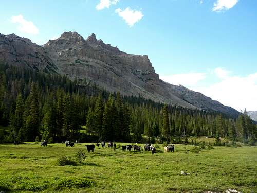
There were, however, a lot of mud holes, which I took to have been caused by cows. When I called the Forest Service to inquire after the Lake Alsop area, I was told the trail was open, but "they have let the cows in". This raised further questions, and the answers I got confused me further, an annoyed me some. Apparently this is a wonderful little enclosed valley which is given for free to ranchers each summer. Once the snow clears, a herd of cows is allowed in. Now I had yet to see a cow, but I was finding an increasing prevalence of cow-pies, so I had to watch my footing. This was another reason to stop near Mount Beulah.
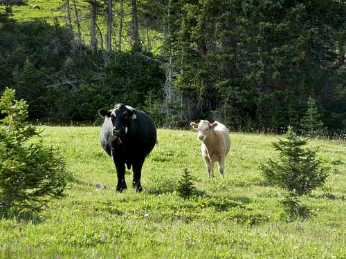
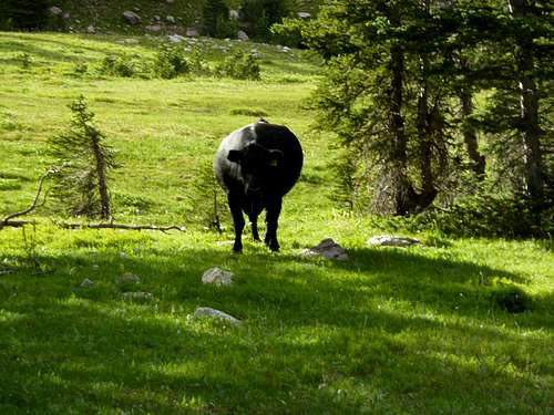
![Cathedral TR 4]() My good friend Blackie poses with a calf for me.
My good friend Blackie poses with a calf for me.![Cathedral TR 5]() The cows go on high alert as I return after visiting Alsop Lake. That's the Cathedral from its bad side behind.
The cows go on high alert as I return after visiting Alsop Lake. That's the Cathedral from its bad side behind.
I had 2+ miles until I would reach Lake Alsop, and with my neck craned up to take in the growing Cathedral, I hardly noticed the herd of cows suddenly around me. Some low mooing alerted me to them. And yes, there they were: at least a hundred cows, dotting the meadow all around me. I was in their midst. And thus begins the part of the trip report where I am menaced by bovines.
A giant beast of a cow (a bull actually I would figure out later, with the horns removed) snorted and grunted at me from my right and began hoofing the ground, warning me. I took the cue and got out my mountain axe. I am sure a mountain axe would do little good against cow or bull in a fight, but that is no reason not to have it in your hands. The giant black bull kept this hoofing up as cows flanked him on both sides.
Then they began marching at me. What the hey, I am thinking to myself, aren't cows docile and passive creatures who do little but choo? Well, to my left I heard a tiny little moo and looking behind me as the cows marched slowly toward me in a line, I see a wee baby calf amble shakily out of the pine trees and moo sadly. As she did not want to move, I backed away from her until she wobbled and trotted right by me toward the approaching fleet.
I had been between a mother and her calf without knowing. So that ended the standoff, but as the big black bull was still making ornery gestures, I tipped my cap and was on my way, walking in circles now, avoiding both cow-pies and cows, I hoped, trying to keep an eye out for lonely babies straying from their mothers. These cows clearly had been owning this valley for weeks and had not seen any predators until now. So I tiptoed around like a guest. The main bulk of the herd faded away and I had no events the rest of the way to Lake Alsop. Once at the lake, another cluster got tense as I came near, and tried to keep the lake between us.
![Cathedral TR 6]() Alsop Lake with Deadhorse Peak and a herd of cows behind.
Alsop Lake with Deadhorse Peak and a herd of cows behind.
![Cathedral TR 7]() Heading back through the long meadows to the tent. Trying to avoid cows.
Heading back through the long meadows to the tent. Trying to avoid cows.
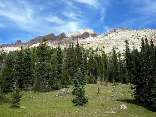
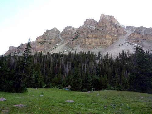
Alsop Lake is lovely. Yard Peak and Dead Horse Peaks towers overhead, sharing that typical Uinta rocky ridge, very climbable, and probably offering some view. With my leg and the daylight fading, I did not look too closely for routes.
Returning to camp, I was cautious, with the axe out and in front of me, and when I heard the faint moos of the herd scouts spotting me, and saw cow-heads spring up on terse cow-necks, I dodged into some nearby pine trees and tried to pick my way through without offending any ruminants (which is a scientific name that includes cows)- see how much fun we're having with vocabulary?!
This was going very well until I merrily rounded one large pine and ran right into old Blackie, the herd-boss slobbering and staring crazy-eyed at me from 50 feet away, as if to say, oh yes I remember you and I know right where you are.
I took a step forward cautiously. No response. I took another. No response. I tried turning toward Blackie and putting my foot. Hoofing of the ground and grunting. So I tipped my cap again and drifted further to my right through the trees and away from the herd. ![Cathedral TR 8]() My best friend Blackie was nice enough to find me and escort me through the herd.
My best friend Blackie was nice enough to find me and escort me through the herd.
Day 2
![Cathedral TR 9]() Nearing sunset.
Nearing sunset.![Cathedral TR 10]() The Cathedral, aptly backlit and haloed by late afternoon's light.
The Cathedral, aptly backlit and haloed by late afternoon's light.Sunset in the valley is pleasant with the cliffs to the immediate east along Beulah's ridge glowing bright red briefly on a clear night. I heard the calls of caribou, I think, and possibly wolves, during the night.
Go get Blackie, I mumbled briefly to myself, not really meaning it. I slept well, but woke stiff, early, and doubted the wisdom or possibility of summiting a peak. Still, one should never take the first impression of the morning too seriously and so to test my leg I went halfway up Beulah just to try and get loose.
I had a great view of sunrise but decided I had only one mountain in me for that trip. That mountain was certainly going to be the Cathedral. So I headed back down, ate heavily as I lingered and stretched, and then started out again with a slight limp.
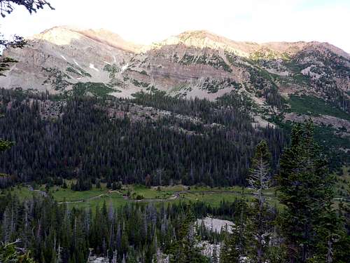
![Cathedral TR 11]() You can see my tent (and plenty of dying pine-beetle infested trees from halfway up Beulah.
You can see my tent (and plenty of dying pine-beetle infested trees from halfway up Beulah.![Cathedral TR 17]() Sunrise from Beulah's slopes. This was high enough for that morning. The Cathedral of the Uintas is left of the tree.
Sunrise from Beulah's slopes. This was high enough for that morning. The Cathedral of the Uintas is left of the tree.Finding a place to cross the creek while staying dry was a challenge for a half an hour, though I eventually managed it. How could I worry about harming the fields with my boots when they were already gouged by cow hooves? Still, even with the mud puddles everywhere, I think the cow-pies probably do the valley good as fertilizer, and as hikers rarely go up here, its nice someone at least enjoys the place, and these cows seemed really quite at home.
![Cathedral TR 14]() Back at camp after a quick warm up.
Back at camp after a quick warm up.
![Cathedral TR 13]() A good as any spot to cross and head up.
A good as any spot to cross and head up.
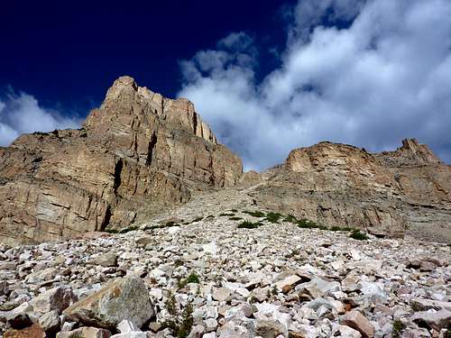
The snow gullies were not in season and with my bad "wheel" I was not about to try them anyway. It was the Northwest Shoulder for me, a grim, shattered ramp of boulders detailed here on Summitpost on the page for this mountain. The early going for the route is pretty fun with a few short garden-covered cliffs, and views opening up and impressing more and more. Then the sunburn boulder stretch begins.
They rock, they roll, they are populated by many a spider, all of them are big and fat and pissed you are there to go through their elegant, strategically-placed webs (which will all be re-formed by the time you descend), and they are hot and will wear your gloves away or your fingerprints if you don't have gloves. If you are a wanted criminal and could benefit by losing your fingerprints permanently, then do not take gloves.
Otherwise, gloves are a good idea. As this was early in my mountain career and I did not bring gloves, I thought about them a lot on the way up. But at least I know my fingerprints won't get me caught if I do take up any cat-burglarizing. This whole stretch is slow-going, but not horrific. The view down is great and the view up remains interesting most of the way.
![Cathedral TR 15]() Starting the rugged shoulder boulder run.
Starting the rugged shoulder boulder run.![Cathedral TR 16]() Further up the Northwest Shoulder Boulder Route.
Further up the Northwest Shoulder Boulder Route.
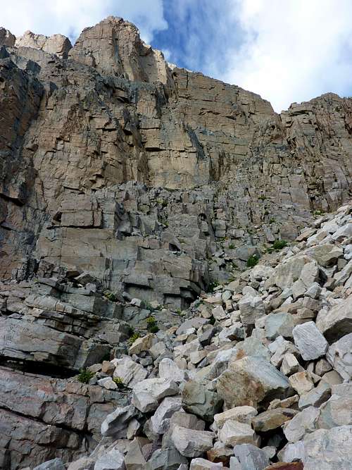
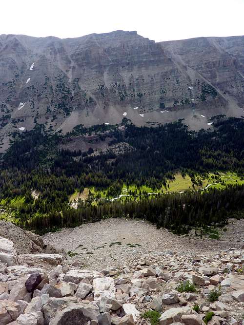
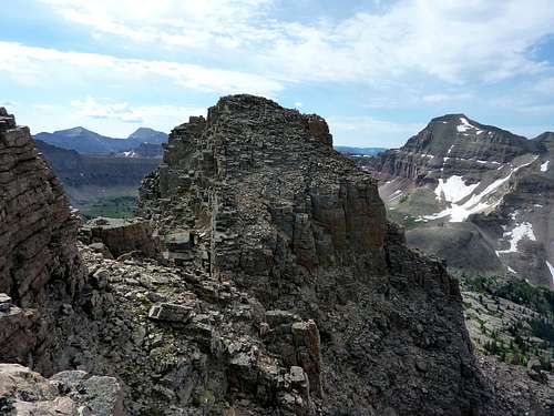
![Northwest Shoulder Route]() This is looking down the route of rocky boulders full of spiderwebs and spiders. The lighting makes the valley floor below stand out nicely.
This is looking down the route of rocky boulders full of spiderwebs and spiders. The lighting makes the valley floor below stand out nicely.
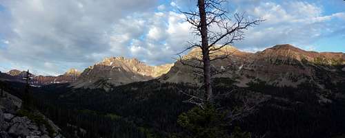
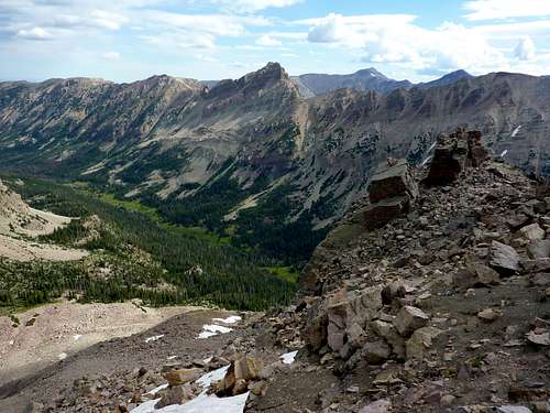
From the summit, things open up wonderfully. You get an expansive view South and East of other rare peaks of the Uintas, plus fine views North to another peak on the ridge, un-named to my knowledge and my map's knowledge, and Mount Beulah, probably better to look at than to ascend. The other summits of the Cathedral are very close, and yet very far away, with scattered nasty stacks of rocks piled up for seeming miles making them unwelcoming possibilities.
With a sigh, and an eye to zooming, looming dark clouds, and an aching leg, I headed back down the same way I'd come. At times, I would try to speed up the acrobatic descent among huge boulders, but each time the land slide I kicked off would convince me of the prudence of being a tortoise and not a hare, even as those clouds kept darkening and looming.
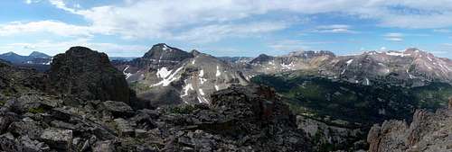
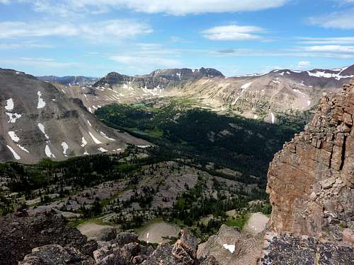
![Summit Panorama]() This is from the true summit of the peak. View is to the East and South with the light blue lake visible in the distance Priod Lake.Taken in July 2011 after an above normal snowpack.
This is from the true summit of the peak. View is to the East and South with the light blue lake visible in the distance Priod Lake.Taken in July 2011 after an above normal snowpack.![Cathedral TR 18]() Looking North to a neighboring peak.
Looking North to a neighboring peak.I kept dry, and hitting the forested lower slopes, cows began to appear at every conceivable, and several inconceivable angles. Lone cows picking at flowers while teetering on loose scree almost vertical, without a care in the world. Big clumsy-looking cows would glance at me from across a teeny trickle of water, doing slow double-takes as if wondering how a two-legged man could have made it up here. We were reciprocally curious about one another.
Taps of rain kept poking me to keep moving, even when I did not want to. As I crossed the creek, tiny pellets of hail began. Now we're in the Uintas, I told my cow friends. I made it back to the tent thinking about what con-men cows are. You hear about cow-tipping and how placid the farm beasts are, but do not believe it. Cows, while lazy, are quite capable. Sure you might be able to tip one while it snores, but I know human beings who can be tipsy themselves.
I have been on another trip in Utah where I spooked some cows and they sprinted up a scree channel so steep it would have given me pause even with climbing gear. They just know better than to let on that they are fit. They've seen how farmers put horses and mules to work.
![Cathedral TR 19]() Looking East to Mount Beulah.
Looking East to Mount Beulah.A brief rest in my tent was all I took. I spent the rest of the morning racing a mild Uinta storm to my car, which is my most common activity in the Uinta range. As I had merely a Camry waiting for me, and the road had been a little wet on the way in, I worried waiting out the storm might get me stuck for a day or two. So I limped with my pack back through the switchbacks, cursing, and groaning, and sweating.
Each time I took off a layer, it would rain lightly. When I put the layer back on, the sun came out. This same game was played with my sunglasses. "Do you think this is a game? Is this funny? Are you that bored?" I screamed up at the sky at one point, because the "old man" and I do converse sometimes, and when one is alone in the mountains without another human for miles, one does take a thing like the weather personally.
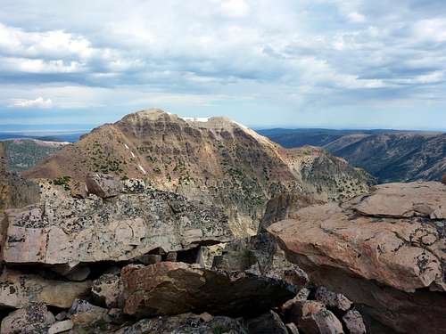
![Cathedral TR 20]() Another summit of the Cathedral would take a while to reach.
Another summit of the Cathedral would take a while to reach.
So go to the Cathedral if you want solitude, to learn how you respond in a cow crisis situation, and excellent views. As always, I hope you enjoyed this or had the sense to stop reading before now.
![Cathedral TR 22]() A bonus shot of Priod Lake for those without wide screen to take in that panorama easily.
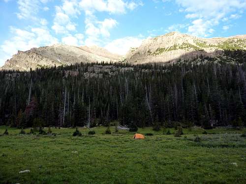
A bonus shot of Priod Lake for those without wide screen to take in that panorama easily.![Cathedral TR 21]() The long meadow back to camp. You can pick out my orange tent tiny in the distance.
The long meadow back to camp. You can pick out my orange tent tiny in the distance.![Cathedral TR 23]() Yard Peak (R) and Deadhorse Peak (L) sunrise from the sides of Beulah. The pine beetles are quick workers, so visit the Uintas soon.
Yard Peak (R) and Deadhorse Peak (L) sunrise from the sides of Beulah. The pine beetles are quick workers, so visit the Uintas soon.


Comments
Post a Comment