Exhausted and exhilarated is how I usually reach a pass from an eastern Sierra trailhead, and Piute Pass, although relatively easy, was no exception. At the pass stood an elderly woman surrounded by a group of younger weary people sprawled on the surrounding rocks. Upon hearing me marvel at the scenery, she calmly stated in a thick Germanic accent, "These are the most beautiful mountains in the world." At my prompting the Belgian lady listed an extensive set of alpine treks she'd made throughout the world. Her relaxed presence within her tired group gave her words admirable credibility. She had seen more mountain ranges than the well-traveled Muir, but they reached the same conclusion.
But this isn’t about the Sierra. “What is second on your list?” I asked. “The mountains of Norway” she replied with little hesitation. I’ve only experienced one mountain range outside the US, so I felt especially fortunate to have seen the top two on her list. What these ranges have in common is that they are both located on the western edge of northern hemisphere continents, perfectly situated to receive plentiful snow that formed massive glaciers during the ice ages. Now the glaciers have all but disappeared, revealing the results of the intense glaciation including steep, highly sculpted mountain sides, waterfalls from hanging valleys, and numerous glacially carved lakes and fjords.
My experience in the Scandes began with a highly recommended ocean cruise, the Hurtigruten, “The World's Most Beautiful Sea Voyage”. Leaving daily from Bergen for the 11 day round trip, Hurtigruten heads north along the fjord-incised coast and turns around at Kirkenes (same latitude as Barrow, Alaska) an arctic outpost near the Russian border, stopping for one to three hours at 34 uniquely picturesque ports along the way. The ships still fulfill their original (1893) purpose of carrying freight and mail, but over the years more and more people have taken the trip as tourists.
From Kirkenes I drove south through northern Finland, Sweden, and Norway, arriving at the Lofoten Islands where I wanted to spend a few days hiking in what I was told was the most scenic part of the range.
![Moskenes]() Moskenes Harbor (foreground) and Sørvågen (distant)
Moskenes Harbor (foreground) and Sørvågen (distant)
Near the tip of the Lofoten Island chain, about 300 km north of the arctic Circle on the island of Moskensøya, I checked into a hotel in Sørvågen, the 3rd village from the end of road E-10. This incredibly scenic 250 km route traverses the islands (including a short ferry ride) through dozens of small cod-fishing towns and ends 2 km beyond Sørvågen near the tip of the island chain at the town appropriately named Å, the last letter in the Norsk alphabet, pronounced as in
awesome (which also happens to describe the scenery).
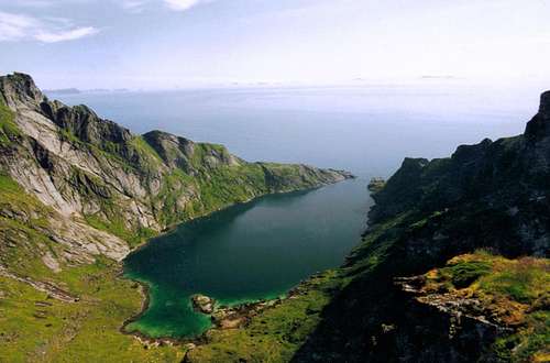
![Å is the last letter of the...]() Part of the town of Å (lower left) and Åvatnet, a lake that is almost a fjord
Part of the town of Å (lower left) and Åvatnet, a lake that is almost a fjord![Djupfjorden]() Djupfjorden with the Norwegian mainland in the distance to the east
Djupfjorden with the Norwegian mainland in the distance to the east
At breakfast the next day I asked the innkeeper, Audun Rasmussen, if he could recommend a good dayhike in the local mountains. After judging my ability he offered to take me up on Munkan (Monk’s Mtn) a nearby peak (800 m. 2,600 ft) surrounded by fjords and glacial lakes. His wife packed me a lunch from the traditional Norwegian breakfast smorgasbord and off we went. What hospitality! a guided mountain hike and a free prepared lunch.
On the northbound cruise, a local described the Lofoten’s as a “gloomy melancholy type of place” because of it’s perpetual fog and rain. (Due to the Gulf Stream surprisingly little snow at sea level despite being the same latitude as Fairbanks Alaska) However, when we started up the valley the air was cool and dry and the sky couldn’t have been clearer. Just outside town the trail passes between Tindsvatnet and Sørvågvatnet, the lowest of a chain of 7 glacial lakes north of Sørvågen. We continued up the trail past Studvalsvatnet, but before the next lake, Audun said that we would depart from the muddy trail and take the scenic route via the ridge to the east.
The slope to the east was covered with unappealing thick brush reminiscent of dense Sierra chaparral, but before I could ask any questions Audun was heading up and I had no choice but to follow. It turns out this a regular route for Audun when he hunted rabbits in the winter. The route cleverly wound its way through the brush without any of the thrashing that I imagined would be required. I soon discovered that the route wasn’t a visible trail but a well-used set of flat and easy foot placements, often hidden among the rocks and grasses that made ascending the rugged slope as easy as climbing stairs. Fortunately I was in decent shape because I had to keep up with Audun’s brisk pace in order to see exactly where he put his feet on every step, otherwise I would have been stranded and flailing. The whole ascent, with about 200 meters gain, was class 2 (by Sierra standards) with only one or two places where hands were needed for a quick tug on a shrub.
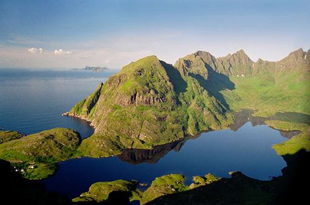
![Hermannsdalstinden]() Looking west from Munkan, Hermannsdalstinden (1029m) is the largest peak on the island of Moskenesöya. Krokvatnet (bent lake) is on the left, the other two lakes aren't named on my map. Kjerkfjorden (church fjord) is on the far right.
Looking west from Munkan, Hermannsdalstinden (1029m) is the largest peak on the island of Moskenesöya. Krokvatnet (bent lake) is on the left, the other two lakes aren't named on my map. Kjerkfjorden (church fjord) is on the far right.
In a short time we reached a high point on Munkan’s south ridge and were treated to splendid views in all directions. Looking south across the Norwegian Sea to the mainland, Audun, amazed, but of course maintaining his understated Norwegian composure said, “This is the clearest day I have ever seen. I can see islands I have never seen from here before.” Again, I was certainly fortunate.
Audun had to get back to his hotel duties, but first he pointed out the easy cross-country route to the top of Munkan, and the muddier but better return route since I would never be able to find my way down the route we just ascended. I thanked him for his help and expertise and he headed back.
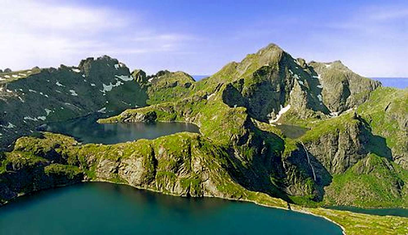
![From the top of Mt. Munkan...]() View north up the Lofoten Island chain from Munkan
View north up the Lofoten Island chain from Munkan
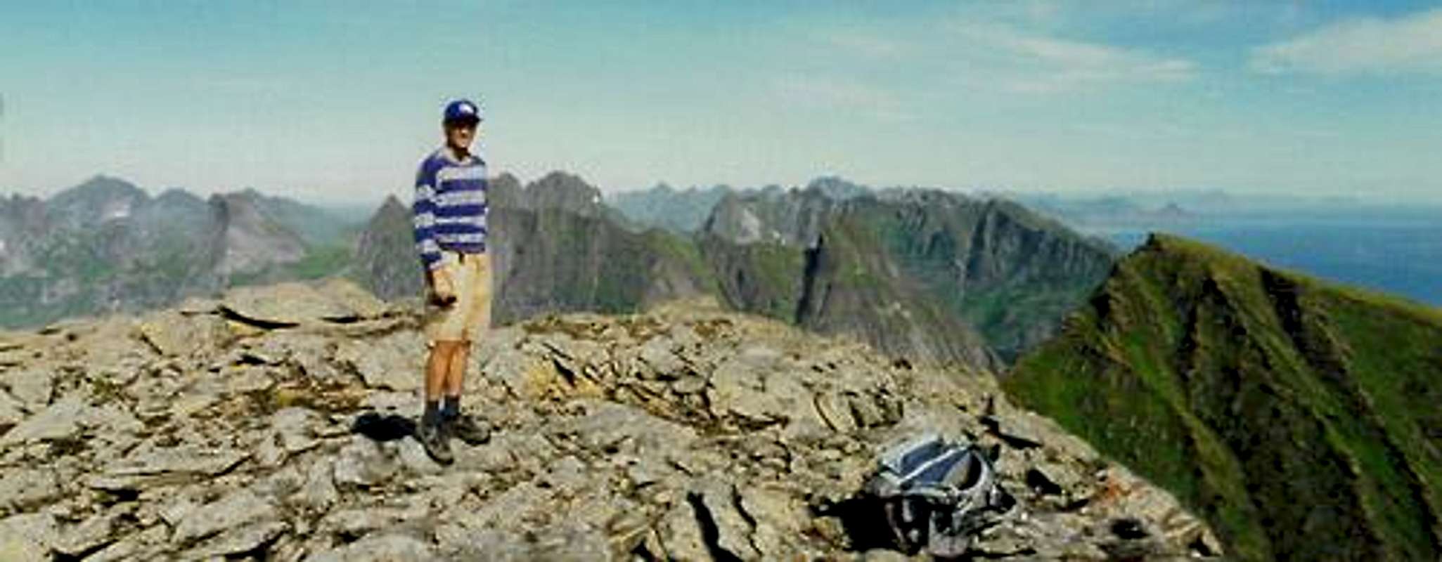
The rest of the Munkan ascent was a straight forward hike on open terrain of rock slabs and steep grassy meadows. The only remarkable event was passing a group of French “alpinists” dressed in the most hideously garish colors I’ve ever seen in the wilderness (neon pink tights with green polka dots combined with a blue and yellow checked jacket. Really!?) At the top a more appropriately dressed German hiker snapped my picture with the chain of the Lofoten as a backdrop.
![Lofoten Islands]() Looking northeast up the Lofoten Island chain from Munkan
Looking northeast up the Lofoten Island chain from Munkan![On Munkan]() Me on Munkan Me on Munkan | [img:733536:alignleft:medium:Me on Munkan] |


Comments
Post a Comment