The first part (in case you missed it): The Clutches (I)
The Clutches (II)
September 6
I was surprised by how light the rain was as I drove my van along the windy road through the Sierra foothills. The scenery was soggy, but amazing along that part of SR168 just northeast of Clovis. Most of the abrupt hills had tatters of clouds clinging to them making them appear much more impressive than they usually do during fair weather. Visibility alternated between acceptable and poor as I drove my VW van through fragments of local fog banks lying in small pocket valleys.
The reason I was surprised by the lightness of the rain was because all the way from San Jose, I'd been listening to weather reports regarding the intensity of the storm. Travelers advisories were broadcast about road closures- especially in the mountains. There was a report of intense flooding in Kings Canyon that had closed the road to Cedar Grove due to a major washout. Many other roads and communities were mentioned with floods, downed power lines and trees. I was paying particular attention for any mention of the roads or communities that I would be traveling though this morning- but there were none.
After several miles of winding through the foothills, the road widens and smoothly climbs a long steep grade- I've always enjoyed this part of the drive. The transition from open grasslands and scattered oak trees to lush forests of conifers is striking as one rapidly gains altitude. On this particular day, the rainfall also transitioned from light to heavy as I climbed up seemingly into the heart of the storm.
I cruised slowly through the small resort town of Shaver Lake and nearly missed my turn onto Dinky Creek Road due to the poor visibility. I drove very slowly east out of town through what at times was an unbelievably heavy downpour. Even on full power, my wipers were barely able to keep up with the deluge.
After what felt like hours of white-knuckle driving, I arrived at the Dinky Creek Ranger Station where I stopped to acquire a Wilderness Permit. The ranger on duty must have thought I was a complete fool. (He was right!)
“You know, this isn't a very good time to be heading into the mountains...”
I explained my plan to stay low in the shelter of the forests for a couple of days until the storm dissipated as it was forecast to. By the time I reached the high country, the storm should be long gone.
He seemed skeptical as he tore off my copy of the permit and handed it to me, “Be very cautious near streams and rivers. The water levels are very high.”
“Sure thing. Thanks.”
The driving part of my journey continued for at least another hour as I traveled the slippery wet road deeper into the mountains and the storm. I inserted what was currently one of my favorite tapes into the cassette player, Eldorado by ELO. I listened to Jeff Lynne sing about some dude named “Boy Blue” while I negotiated the narrow one lane road on the Wishon Lake dam. “Yup, Boy Blue is back.” I thought to myself. This trip was finally happening!
After driving a few more miles further south, I finally came to the Rancheria Creek trailhead. The parking area was off on the right side of the road and down a short steep driveway. My van slipped a little on the saturated mud and I worried a bit about getting back out of there at the end of the trip. Oh well, I decided to worry about that when I got back. Due to the weather, it was no surprise to me that mine was the only vehicle parked there.
I did some last minute gear management, donned my boots and backpack and set out in the pouring rain wearing my nylon poncho for protection. Like my van, I also slipped a bit in the mud on the steep driveway as I hiked away from my van and crossed the wet pavement to the actual trailhead. I made some adjustments to my boot laces and set out on what was intended to be a 10 day trip that would include tagging a peak or two in the distant Palisades.
This promised to be an interesting journey through a huge area that I'd never visited before. I was excited about finally visiting the mysterious Tehipite Valley and remote Simpson Meadow along the way.
Just beyond the trailhead, the trail climbs a low berm- perhaps an ancient glacier moraine. A relic of the ice age. Near the top, the trail passes between two huge Pondorosa(?) pine trees. I'll never forget that just as I was approaching them and was within a few feet of them, I heard a loud cracking of wood from high up in the trees. A bear?! I stopped to look up and that's when a large branch whooshed down and landed with a loud WHAP! right about where I would have been if I hadn't stopped. The branch was about 5 inches in diameter and about 5 or 6 feet long. It had shattered into about 3 or 4 pieces and laid across the trail like a barricade a mere 2 or 3 feet in front of me.
If I was superstitious or if I believed in omens, I would have been tempted to think that a higher power was warning me to turn back. I was still only about 10 minutes from my car. Keeping my ears open for more surprises, I stepped carefully over the piece of wood and kept hiking. The rain continued to pour down as I hiked ever deeper into the wilderness. I thought about the near miss of that falling branch and wondered what else was in store for me on this trip...
September 10
It was probably sometime after midnight when I woke up to the sound of heavy rain pelting my tent at my camp near Cartridge Creek. I was snuggled deep inside my sleeping bag- warm and comfortable. It was as black and wet a night as any I have ever experienced. It would have been wonderful to just lay there and allow the sound of the rain lull me back to sleep, but, of course, wouldn't you know it? I had to pee.
As usual, instead of just getting up and getting it over with, I laid there and obsessed on it. Mentally, over and over again, I dragged myself out of my sleeping bag, put on my damp muddy jeans, my damp socks, my jacket, my hat, my rain poncho, my headlamp, and finally, with my feet sticking out the door, my muddy boots.
For once, though, procrastination paid off. About the sixth or seventh time I mentally got up to pee, the sound of the rain on my tent fly diminished and stopped. All I could hear out there in the night was the sound of water dripping from about 4 million wet leaves and pine needles and the distant roar of the river. No time to lose! I unzipped my sleeping bag and went through the unpleasant ritual that I'd been dreading- this time for real.
After I struggled to my feet on the muddy ground in front of my tent, I shut off my headlamp and looked up- hoping to see the stars, but there was only deep chilly blackness all around. I turned my light back on. Locally, the canyon seemed to have filled with a light misty fog.
I moved a good distance from my tent towards some bushes and began to take care of business. I was nearly finished when I happened to look up at the bushes in front of me. What I saw made the hair on the back of my neck literally stand on end. The nearby branches were illuminated by my headlamp, but in the dark regions between the branches I saw 4 or 5 pairs of large glowing eyes staring at me!
I instantly knew that they had to be bears! It was a good thing that I was already done peeing... What to do?? I thought about my ice ax lying next to my sleeping bag in my tent. I zipped myself up and started walking slowly backwards toward the tent- no sudden movements. Just stay calm, walk slowly, and get the ax.
Slowly, the eyes began to move and bob up and down a bit. They were coming! They were stalking me- sizing me up for an attack! Shit! The bushes moved as the eyes came through them towards me and my camp. I'm just going to have to lunge for the door of my tent, grab my ax and, if necessary, hurt one or two just enough to scare them all away. I hoped it wouldn't come to that. They might not scare so easily.
The eyes kept coming towards me. The branches of the bushes were in motion. I was almost to my tent when I saw their hooves step into the clearing! This is it! I... I... wait... hooves?! At last my headlamp revealed them to be a family of deer- adults and fawns. They paid very little attention to the strange creature with the light on its head- its knees knocking together. There were just too many tender wet leaves for them to munch on.
“Geez Louise!”
Shaking my head, I reentered my tent, removed my damp things and crawled back into my sleeping bag. There was still too much adrenaline in my system to fall asleep right away. After a time, the rain began to patter on my tent lulling me into sleep once more.
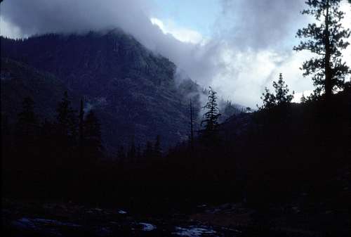
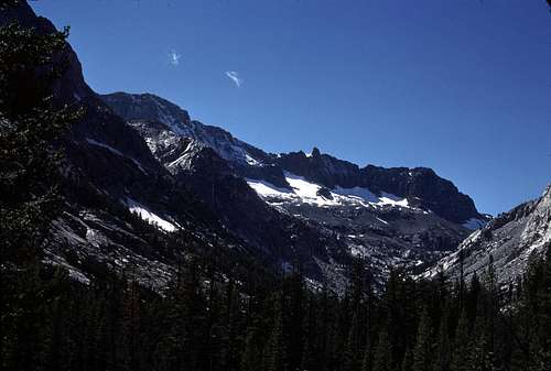
I awoke the next morning with the sound of drizzle lightly tapping the rain fly. At first I moaned a bit at the thought of packing up my wet heavy tent and proceeding up the trail in the mud, but then I noticed that it wasn't as dark as one might have expected. I peeked outside and saw that there were actual openings in the clouds revealing the most beautiful fragments of blue sky I'd ever seen.
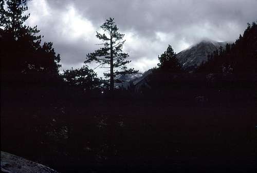
![Windy Peak]() Fragments of blue sky around Windy Peak from my Cartridge Creek camp.
Fragments of blue sky around Windy Peak from my Cartridge Creek camp.
Now I felt motivated. I thought that this was likely a lull in a much longer storm system. I needed to take advantage of it as much as possible to make some progress on this trip.
I ate a quick nutritious breakfast of a couple of handfuls of nuts and raisins, packed up and got underway. My wet tent seemed to really weigh down my backpack slowing my pace in spite of my desire to move faster.
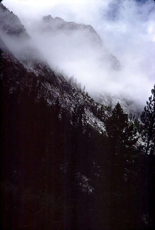
![Steep Canyon Wall]() Wall in narrow section of the Middle Fork of the Kings canyon.
Wall in narrow section of the Middle Fork of the Kings canyon.
| ![Middle Fork Canyon]() Looking upstream from Devil's Washbowl.
Looking upstream from Devil's Washbowl.
|
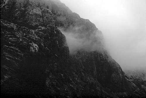
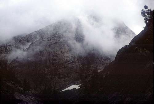
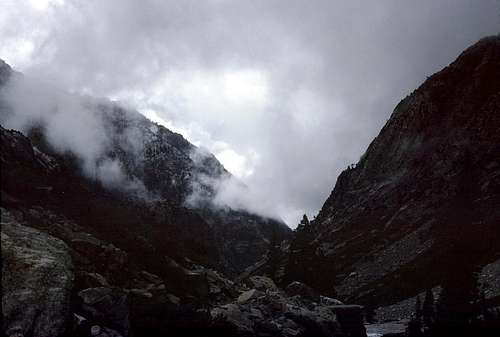
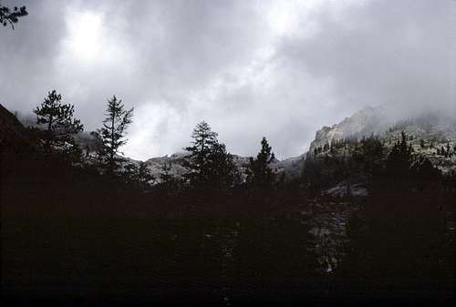
The next several miles up the canyon- well, gorge actually- were almost surreal. The trail was quite interesting as it alternated between steep talus slopes and naked bedrock where considerable blasting must have taken place during its construction. I knew from the topo map that there were high cliffs, jagged ridges and fantastic pinnacles all around above me, but I had to use my imagination, since only the lower several hundred feet were visible due to a persistent ceiling of clouds. Once in a while there would be a brief opening and a tantalizing glimpse of a crag or two high above me, but then it would be quickly obscured once more. At least there was little or no rain and the clouds did seem to be thinning, albeit very slowly.
![Devil's Washbowl]() Devil's Washbowl in the Middle Fork canyon.
Devil's Washbowl in the Middle Fork canyon.
| ![Down Canyon]() Looking down the Middle Fork canyon from the vicinity of Devil's Washbowl.
Looking down the Middle Fork canyon from the vicinity of Devil's Washbowl.
|
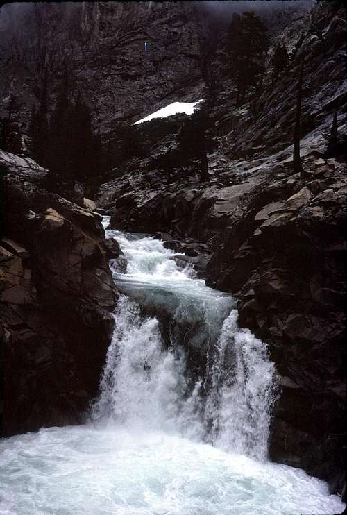
After a short time, I rounded a bend and reached Devil’s Washbowl- a deep looking pool that was fed by the Kings River via a small but elegantly beautiful waterfall. I stopped for a short time to snack on some Slim Jims and nuts. It was no surprise that the 'breakfast' I had earlier was proving to be very inadequate. I watched the waterfall as I sat and ate. It had a mesmerizing and relaxing affect on me.
Shortly after the Washbowl, the trail comes to the first major tributary since Cartridge Creek. I had been stressing a little about what this crossing would be like, but, as it turned out, there was almost nothing to it. A couple of boulder hops and I was on my way.
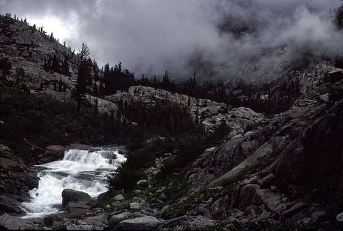
The trail made a long climb up a talus covered slide area until it was hundreds of feet above the river. Then it contoured for about a mile or so before the river rose up to meet it. It was along this stretch that I noticed that the clouds were really beginning to break up and dissolve into more and more blue sky. It was definitely looking like the storm was ending and my morale began to improve considerably. In fact, I was thoroughly enjoying this part of the hike.
![Cascade on the Middle Fork of the Kings River.]() Approaching the junction with Palisade Creek.
Approaching the junction with Palisade Creek.
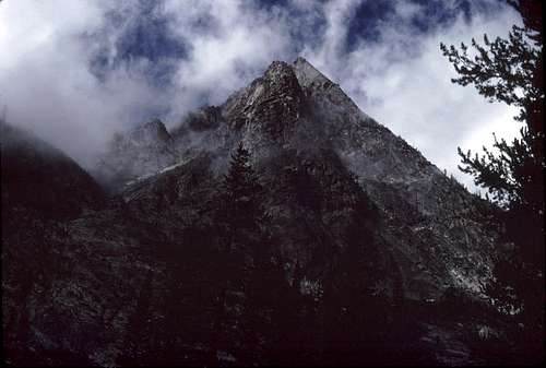
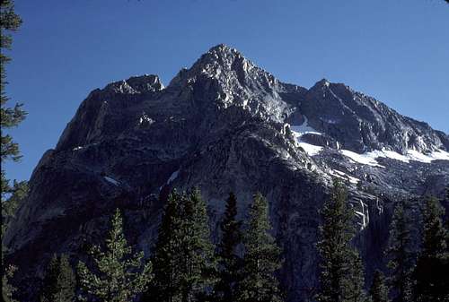
| ![Rambaud Peak]() Looking up the canyon just south of Rambaud Peak.
Looking up the canyon just south of Rambaud Peak.
|
At last, I reached Palisade Creek which was crossed on a creaky steel bridge (much to my relief!) and the John Muir Trail. The trail was very wide and obviously well traveled. I felt as though I had returned to civilization! I knew it would only be a matter of time before I met other humans- perhaps the only time in my hiking career that I happily anticipated this.
My original plan for this trip was to go east up Palisade Creek to the lower Palisade Lake. From there, I would hike up over Cirque Pass and continue on to Potluck and Knapsack Passes before arriving at the Bishop Pass Trail in Dusy Basin which I would follow back down to LeConte Canyon. Along the way, I had hoped to tag Mount Sill and perhaps even North Palisade- two peaks that I'd been obsessing on during much of the late seventies, but haven't had much luck with.
But, it looked like my luck with those peaks hadn't improved much on this trip. They would just have to wait for some other time. I still didn't completely trust this weather pattern. I turned north away from Palisade Creek and began to travel north along the John Muir Trail through the incredibly beautiful scenery of LeConte Canyon.
![Lower LeConte Canyon]() Entering LeConte Canyon
Entering LeConte Canyon
| ![LeConte Canyon Clouds]() Clouds and crags in LeConte Canyon
Clouds and crags in LeConte Canyon
|
It didn't take long before I saw up ahead something that I really missed: actual other humans. Two backpackers were approaching several hundred feet up the trail. They would be the first people I'd seen since that young couple I saw along the trail near Crown Valley- four long days ago. What was I going to say? How do I tell them what I'd been through?
They appeared to be a young couple- clean and fresh as they hiked towards me. As they got nearer, I stood off the trail and smiled, “Howdy.” Their pace picked up ever so slightly as they passed by me. “Hey.” “Hi.” was all they said as they hurried on.
Well, I was a bit surprised. Don't they know what I'd been through for the last several days and how significant our brief encounter was (to me)? I then realized how I must have appeared to them. Looking down at my feet and legs, I could see that my jeans were caked with patches of mostly dried mud from the knees down. There were rips and tears here and there from the off trail portions of the lower parts of the canyon. My boots were battered and dirty. I could only imagine what my face must have looked like- washed, but unshaven with a full beard. My hair hanging down to my shoulders from under a hat that probably looked like I found it in a landfill. I might as well have been Charles Manson to them.
![LeConte Canyon]() Near Grouse Meadows
Near Grouse Meadows
| ![LeConte Canyon Crags]() Impressive Crags in LeConte Canyon
Impressive Crags in LeConte Canyon
|
Only slightly fazed, I continued my hike. A short time later, I passed a very wet and swampy looking Grouse Meadows. The clouds were clearing away nicely revealing a beautiful blue sky over the magnificent crags and peaks that lined this great canyon.
Since this was my first trip to this region, I still didn't know the names of any of them. I took several pictures (hoping my camera was functioning normally) so I could match the peaks with names on the topo map after I got home.
Dusy Creek was crossed on a bridge- again, to my great relief. The sky was almost completely clear as I reached Big Pete Meadow in the late afternoon. It was here that I decided to camp for the night. I found a nice spot well off the trail above the meadow.
The view was superb. I could see several miles straight down LeConte Canyon and beyond to the snowy Observation Peak area. Closer by- just across the canyon, Langille Peak rose majestically- a huge well sculpted piece of granite.
![Down LeConte Canyon from the North]() A view looking down LeConte Canyon from my camp at Big Pete Meadow.
A view looking down LeConte Canyon from my camp at Big Pete Meadow.
| ![Middle Fork Kings River Canyon above LeConte Canyon]() Looking up canyon from my Big Pete Meadow camp.
Looking up canyon from my Big Pete Meadow camp.
|
I started a small fire to help dry out my still damp boots and other articles of clothing that had never quite completely dried out since my Crown Creek fiasco. It was (and is) very rare for me to have a camp fire while backpacking. This time, however, I felt justified since it was serving a useful purpose (drying my gear). But, it also did wonders to improve my morale with the comfort and warmth it provided. I sipped some hot instant coffee as I sat and enjoyed the fire and the amazing view. It felt good to be back in the mountains again!
![Langille Peak]() Langille Peak from my camp at Big Pete Meadow.
Langille Peak from my camp at Big Pete Meadow.
| ![Moon Over Giraud Peak]() Moon and Giraud Peak from Big Pete Meadow.
Moon and Giraud Peak from Big Pete Meadow.
|
It was very late in the day when I was visited by a back country ranger. He was stationed at the LeConte Ranger Station down the canyon from my camp and had been returning there along the JMT, when he spotted me and my campfire.
At first I was concerned that my fire or choice of campsite had violated some regulation, but nothing of the kind was ever mentioned. He just seemed to enjoyed connecting with those he encountered in 'his' territory.
His greeting was friendly enough, but when he saw my appearance- the battered muddy condition of my clothes and gear, he seemed somewhat concerned.
“Wow! Are you okay? Where are you coming from?”
“I'm okay. I started about 4 or 5 days ago from Rancheria Creek and traveled through Crown Valley to Tehipite and then up the Middle Fork Canyon to here.” I laughed a little. “It's been pretty wild.” I was too embarrassed to mention my Crown Creek mishap.
“You started during the storm? How did you get across the river at Simpson? Did you cross the log or ford upstream?”
“The log.” I shook my head slightly as I remembered my terror.
He seemed a bit surprised at my answer. “Hmmm. I didn't think too many people would try to cross that. ” It turns out that he was the one who wrote the “cross at your own risk...” note. I wish I could remember his name.
[Note: I just recently read “The Last Season” by Eric Blehm. Was this ranger Randy Morgenson? Well, apparently, not. According to the book, Ranger Morgenson was stationed at the Big Five Lakes station at the time of my trip.]
He asked me about my intended route and I told him my plans to make my way over to Hell-For-Sure-Pass and then to exit near Wishon Reservoir. I expressed my concerns about the crossing of the South Fork of the San Joaquin River. He assured me that there shouldn't be any more serious creek or river crossing issues along my intended route.
I thanked him and he bade be a good trip and was gone- heading back to his station near Dusy Creek. I felt extremely relieved and comforted by our brief conversation. It was the kind of human contact that I'd been longing for ever since Crown Creek.
I put out my fire a short time after sunset. It took about 20 minutes for me to make the several trips to the nearby creek and back to pour enough water on the fire ring to be sure it was 'dead out'. A lot of work when I would have rather been sinking down into my soft warm sleeping bag. All that extra work is one of the reasons that I don't usually have camp fires.
As usual, before lights out, I took a look at my now mangled topo map to plan the next day's hike and to educate myself on what mountains and landmarks would be in view along the trail. It was then that I realized that I was at the 'farpoint' of my trip. From this point onward, every step I took would take me closer instead of farther from the trailhead and my van.
September 11
I decided to 'reward' myself with powdered scrambled eggs for breakfast that morning in my camp near Big Pete Meadow. I usually carried just a few packs of the stuff on a long trip as an occasional 'treat'. When I test cooked and ate a package at home, they seemed just barely tolerable. But, for some reason, on these longer trips, they can seem like a gourmet meal. I just add plenty of pepper and an unhealthy amount of salt.
Today's itinerary was to follow the JMT up over Muir Pass and camp at or near Wanda Lake. It promised to be the first really fine day I'd had on this whole journey. The air was crisp, and the sky was deep blue and cloud-free. Just the kind of day that makes being in the mountains worth all the effort and hardship it sometimes takes to get there.
Ahead of me, as I hiked, I could see the impressive east face of Black Giant and the northern Black Divide. There was a lot of evidence of the recent storms. The higher elevations seemed to have an unusually high amount of snow for this time of year. I remembered the unseasonable snow cover that I'd seen on Kettle Ridge several days earlier.
![Black Giant]() East face of the Black Giant from the JMT.
East face of the Black Giant from the JMT.
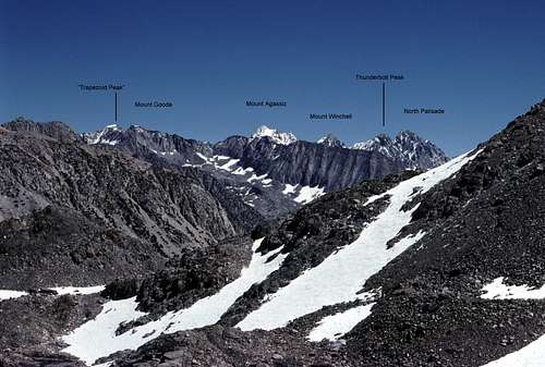
| ![The Palisades]() Annotated view of the Palisades from near Muir Pass
Annotated view of the Palisades from near Muir Pass
|
Soon timberline was reached and more views opened up. To the east, the Palisades loomed like distant giants from another world. Mount Agassiz was plastered white with snow. In fact I was now beginning to see that many of the higher peaks around me were indeed snowbound as if winter had arrived very early. Technically, there was still more than a week of summer left before the beginning of autumn. The trail wound its way past several small lakes and tarns that were still lined with snow banks as it climbed steadily towards Muir Pass.
![Mount Powell]() East toward Mount Powell from the JMT.
East toward Mount Powell from the JMT.
| ![Mount Solomons]() Unseasonably heavy snow on Mount Solomons from near Muir Pass.
Unseasonably heavy snow on Mount Solomons from near Muir Pass.
|
I was happy to note that the altitude wasn't having much of an adverse affect on me as I climbed toward Muir Pass- the high point of my trip at about 12,000 feet. One of the benefits of that long slow approach from the west is a more gradual increase in altitude giving one more time to acclimatize.
It seemed unfortunate that I wasn't going to be taking advantage of my acclimatization to bag a peak or two in the Palisades as I'd originally planned. In fact, looking around, I didn't think I would be climbing anything on this trip. The snow accumulation from those recent storms seemed pretty extreme and I wasn't prepared for anything like this.
I was also still a bit worried about my camera. I was taking pictures, but was it actually functioning normally? I wouldn't know until I got my pictures back from processing. If there were issues, I would need to got it into a repair shop as soon as possible to try and avoid any more unnecessary consequences.
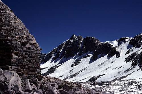
Eventually, I reached the top of the pass and the John Muir Hut- a small stone shelter built by the Sierra Club for emergencies. The door was open and there were several backpackers lounging around the exterior of the building- their backpacks lined up and leaning against the outside wall.
![Muir Hut and Crags]() Nearby crags and the John Muir Hut.
Nearby crags and the John Muir Hut.
| ![Goddard Divide]() A snowbound Goddard Divide in late summer.
A snowbound Goddard Divide in late summer.
|
They were deeply tanned, clean-cut, and fairly fresh looking and, well, very clean. They seemed friendly enough, but seemed regard me and my shabbiness with some distance and, perhaps a bit of suspicion. It was understandable. I was hoping to get to camp at Wanda Lake early enough to try and do some laundry. Basically, rinsing my muddy jeans and shirts in the lake and letting them dry in the sun. No soap needed. The catch was that I needed enough hours of sunlight to be able to sufficiently dry them out before changing into them or packing them away.
I took a short break at the pass- marveling at the unseasonably large amounts of snow coating the surrounding peaks as I ate a simple lunch of Slim Jims and nuts. Before long, I hefted my pack onto my shoulders and began following the easy trail down to Wanda Lake.
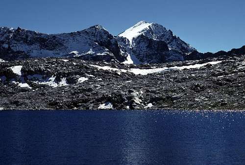
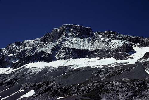
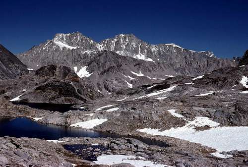
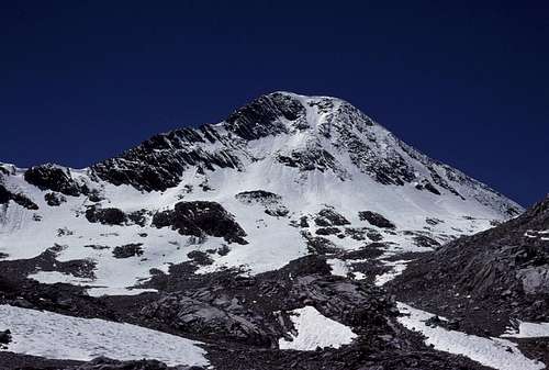
There was a stumpy peninsula just southeast of the outlet where I decided to camp among some slabs and boulders. The surrounding landscape was starkly beautiful- the mountains were sublime. Mount Goddard was thickly covered with fresh snow. It was the first time I'd ever seen that mountain up close.
![Mount Goddard and Wanda Lake]() A view of Mount Goddard from my Wanda Lake camp.
A view of Mount Goddard from my Wanda Lake camp. Eventually, I took a short hike over an open slabby area to the northeast to take a look at Mount Darwin. I was curious to see what it looked like since I'd never seen it before- not even in photographs. I could only guess at it's appearance from looking at the contour map and using my imagination. I was not disappointed. It truly dominated this region- the Evolution Region. There were many other peaks around me that I would have to look up on a map to identify.
![Mount Darwin]() From near the outlet of Wanda Lake, my first ever view of Mount Darwin. Mount Mendel is on the left.
From near the outlet of Wanda Lake, my first ever view of Mount Darwin. Mount Mendel is on the left.
| ![Goddard Divide and Wanda Lake]() View of Goddard Divide from my camp at Wanda Lake.
View of Goddard Divide from my camp at Wanda Lake.
|
I didn't think that there would be enough sunlight left in the day to do any laundry so I decided to let it go another day. (Hmmm... I'm pretty good at making excuses not to do laundry when I'm at home, too.)
The sunset was beautiful and it was fun to sit on a rock overlooking Wanda Lake enjoying it. I did a little star gazing after dark before dragging myself into my sleeping bag. I would be sleeping under the stars, tonight. Air temps were cold, but there wasn't a cloud in the sky. The thin air at 11,400 feet was dead calm. I noted the 'deafening' silence as I started to drift off. Not a single sound- except a distant creek. Maybe the outlet stream? Maybe it wasn't as far away as I'd thought. Sound carries very well over calm water... The sound of the creek gradually seemed to grow louder.. It was...
...just beneath my dangling feet as I straddled the log. Crown Creek rushing by in a crazy torrent. Uncomfortable and frightened, I began to slowly inch my way along the downward angled log. Geez, what the hell am I doing?? This was stupid!! Why hadn't I simply turned back?? Or waited for the high water to recede?? Too late now!!
...I slowly inched along. Don't hurry. Just need to be careful and take my time. My left hand gripped the log in front of me. My other hand was above my head gripping the tree branch which provided a bit more balance and security. I concentrated on moving one contact point at a time- inch my left hand forward on the log, inch the hand over my head on the branch, inch my butt sitting on the log. Over and over slowly making progress. Three feet... four feet... six feet. I began to relax a little as I moved along. Piece of cake. That was about when my heavy pack suddenly shifted sideways and pulled me off balance...
...”F**K!!” The sudden jolt of adrenaline almost made me jump out of my sleeping bag. Did I yell that out loud? I hoped that if others were camping nearby, they wouldn't come running. Gradually, my heart rate settled back to normal. All was silent. Not even the sound of a nearby creek.
Once again I found myself wishing that I was back at the car and that this trip was over. What was wrong with me? Was it lack of confidence? Inexperience? A fear of the unknown and possible hardship? I think it was all of the above. Nearly all my life I dreamed of doing trips like this in the high mountains. Maybe I'm just too much of a big pussy.
I thought for a moment of taking up golf upon my return. The thought made me smile and chuckle for a second. “Yeah, right!.”
I felt a little better and it didn't take long to drift back off to sleep.
Comments
No comments posted yet.