In case you haven't read them yet:
The Clutches (I)
The Clutches (II)
The Clutches (III)
September 6
Miles past the spot where that tree branch almost clobbered me, my mind became occupied with other thoughts as the trail climbed relentlessly up a long grade. The rain came down pretty hard at times. My view was mostly the ground in front of my feet as I kept my head down to avoid getting battered by the rain in my face.
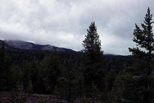
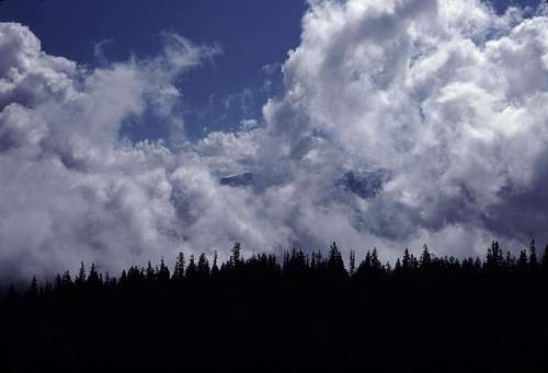
There was an occasional clearing in the forest and an opening in the low clouds that would reveal a interesting glimpse of nearby ridges or domes. It was difficult to take pictures, though, since I was carrying my camera under my poncho. It was almost brand new and I didn't want to risk getting it wet.
![Wet Forest]() Looking toward Spanish Mountain
Looking toward Spanish Mountain
As the day wore on, the rain diminished greatly and finally stopped altogether. The sun even made a few appearances here and there from time to time. I ate a lunch of sourdough bread and cheese near Cabin Creek. The weather had improved enough that I decided to put away my poncho.
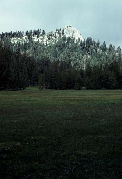
The trail continued past several beautiful, though wet, meadows. ( One meadow near Crown Rock is actually called, “Wet Meadow”. Go figure.) Eventually, it passed by the Crown Valley Guard Station (at the boundary of Kings Canyon National Park) and drops down into Crown Valley.
![Crown Rock]() Crown Rock and Wet Meadow.
Crown Rock and Wet Meadow.
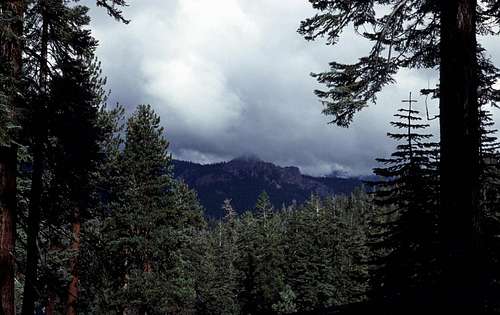
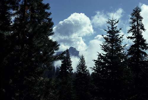
| ![Kettle Dome]() Kettle Dome emerges from storm clouds.
Kettle Dome emerges from storm clouds.
|
There wasn't much to see at Crown Valley. Low clouds to the east blocked whatever views there might have been. After skirting the south side of the meadow, I arrived at what appeared to be some ranch buildings and the junction with the trail that goes south toward Tehipite Valley. This was my turnoff.
I met a young couple on the trail who claimed to have come down the Kings River Middle Fork several days ago. They had climbed up out of Tehipite Valley just before the storm and then waited a couple of days near Geraldine Lakes for the storm to end. They were now taking advantage of the brief let up in the rain to make some progress towards the trailhead. We wished each other good luck and parted ways.
They turned out to be the last people I would see until I reached the John Muir Trail- four days and dozens of miles later.
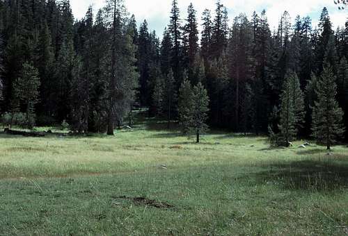
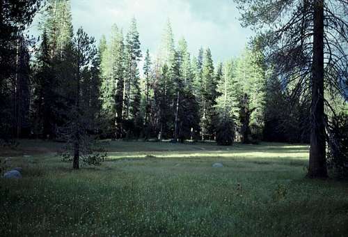
![Unnamed Meadow]() Unnamed meadow near Rogers Creek where I camped on the first night.
Unnamed meadow near Rogers Creek where I camped on the first night.
| ![Camp I Meadow]() My tent is just visible at the foot of the tree in the center of the photo.
My tent is just visible at the foot of the tree in the center of the photo.
|
I camped at the edge of a soggy meadow near Rodgers Creek. The sun continued to make brief appearances late that afternoon and into the early evening. Was the storm ending? Not quite as it turned out. I awoke late that first night to the sound of a very hard rain battering my tent. It seemed to last for hours keeping me awake much of the time. Not for the first or last time I found myself questioning my own judgment for being on this long solo trip under these conditions.
September 7
The following morning, I woke up in my tent to the welcome sound of silence. Sometime deep in the night, I'd finally fallen asleep and the heavy rains had stopped. There was still a gentle sound of water dripping on my tent from some overhanging branches that almost lulled me back to sleep, but...
I snapped out of it when I remembered that this was the day that I would finally visit Tehipite Valley. I was very excited and hurriedly pulled on my clothes and boots.
While my coffee and oatmeal water was coming to a boil, I packed up my gear and took down my tent. I shook as much water off the tent as I could in the grassy meadow- trying to keep it out of the mud before rolling it up and strapping it to my heavy pack. The clouds were breaking up and the sun was coming out. It promised to be a great day.
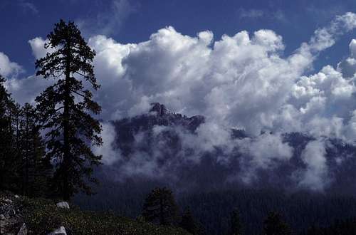
![Kettle Dome]() Kettle Dome
Kettle Dome
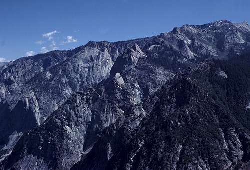
I hit the trail and was delighted at the warm sun and blue sky. I saw the Kettle Dome emerge from enormous cloud banks to the east. Further up Kettle Ridge, I saw something I wasn't expecting to see. The upper regions of Kettle Ridge seemed to be completely snowbound. There was a solid layer of snow covering everything above the 9 or 10 thousand foot level. I didn't worry about it too much. It would be several days before I got to that elevation. By then most of it should be melted away.
![Snow on Kettle Ridge]() Snow on Kettle Ridge
Snow on Kettle Ridge
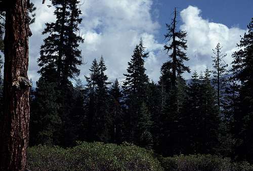
| ![Kettle Dome]() Kettle Dome continued to emerge from the waning storm clouds.
Kettle Dome continued to emerge from the waning storm clouds.
|
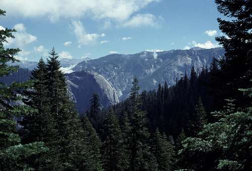
The trail contours through several ravines and intervening ridges as it winds its way toward the Middle Fork of the Kings River Canyon. Crossing the creeks in the ravines was usually a messy and muddy affair. Then, every time I gained the next ridge, I'd peer ahead for a glimpse of Tehipite Dome or other features of the great canyon. Usually trees would block the views, but as I got closer I could sense a great absence of terrain up ahead. The immense as yet unseen canyon was looming.
![Cloudscape]() Clouds over the Middle Fork Canyon.
Clouds over the Middle Fork Canyon.
| ![Tehipite Dome]() My first good view of the Tehipite Dome. This was just a tease for what was yet to come.
My first good view of the Tehipite Dome. This was just a tease for what was yet to come.
|
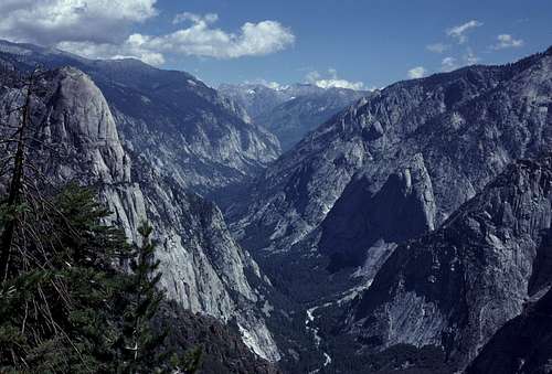
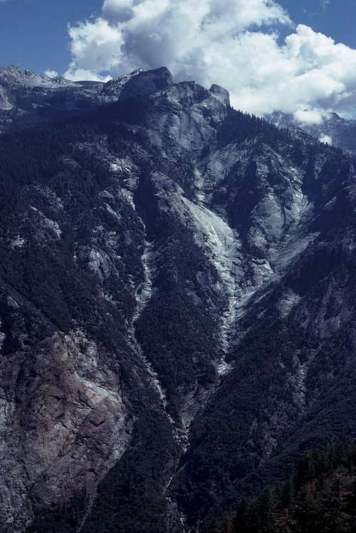
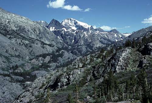
Finally, I came around a bend and there it was- my first view of the Tehipite Dome and a portion of the canyon beyond. My god! This was going to be intense! Another couple of twists and turns and I came to the edge of the great canyon itself. What a view! My inadequate words just can't describe how impressively beautiful it was.
![Tehipite Dome and the Middle Fork Canyon]() Looking up the Middle Fork of the Kings River canyon. This picture was taken early on the second day of my Kings Canyon trip.
Looking up the Middle Fork of the Kings River canyon. This picture was taken early on the second day of my Kings Canyon trip.
I used up the last few pictures on the roll of film that was in my camera and loaded in a fresh roll. With a great anticipation, I began to follow the trail steeply down the countless switchbacks that would drop thousands of feet to the floor of Tehipite Valley. I took a lot of pictures on the way down.
September 12
I awoke at first light to a clear calm morning next to Wanda Lake. Looking down, I saw that my sleeping bag was coated with frost. I stayed in the sack until the sun rose on me and evaporated most of it. It turned out to be a good night- I was well rested for the upcoming challenges that this day would bring. Whatever they may be.
![Mount Goddard and Wanda Lake]() Calm early morning view from my Wanda Lake camp. Mount Goddard.
Calm early morning view from my Wanda Lake camp. Mount Goddard.Today I would be leaving the John Muir Trail and head toward the west. Much of the route would be cross country- perhaps more than I'd ever experienced on any previous trip.
After a simple breakfast, I packed and began my hike by following the JMT a very short distance to the north end of Wanda Lake. I left the trail and crossed the easily negotiated outlet and began my cross country trek.
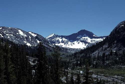
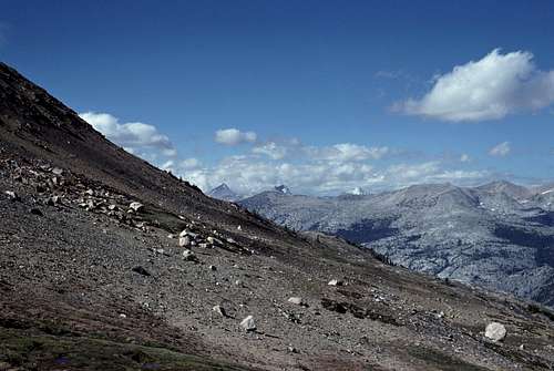
There was a short trivial hike to the top of a low divide just west of Wanda Lake. Wow! What an incredible view there was! The basin before me seemed mostly barren. A vast alpine world of boulders, lakes, and snowfields. Steams of melt water flowed in sinuous channels toward the lakes. The streams were mostly lined with what appeared to be grassy meadows.
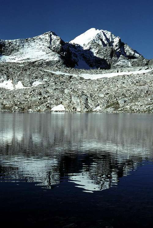
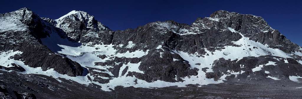
![Mount Goddard Massif]() Panorama of the Mount Goddard Massif from the low pass just west of Wanda Lake. Mount Goddard is on the left.
Panorama of the Mount Goddard Massif from the low pass just west of Wanda Lake. Mount Goddard is on the left.
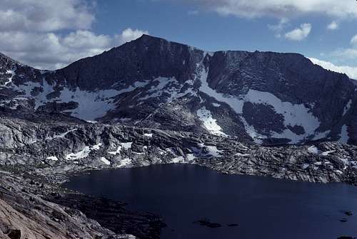
Some of the lakes such as Davis Lake were quite large. The lack of wind allowed for some very picturesque reflections of the surrounding mountains. I knew and recognized Mount Goddard- snow capped and beautifully adorned with an impressive (by Sierra standards) glacier. There were dozens of other impressive peaks all around. Did they have names? I didn't know. I was just a 'newbie' here.
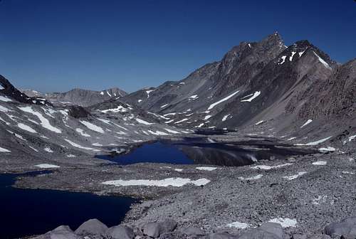
![Davis Lake and Mount McGee]() Mount McGee (right) rises above Davis Lake.
Mount McGee (right) rises above Davis Lake.
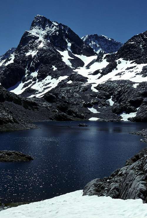
| ![Mount Goddard (left) and Peak 12,964]() From North Goddard Creek: Mount Goddard (background) and Peak 12,964 (left).
From North Goddard Creek: Mount Goddard (background) and Peak 12,964 (left).
|
Traveling was quite easy for a cross country route in the Sierra arctic alpine zone. There were boulder fields to navigate through, but the rocks were very stable and reasonably sized. I aimed for the north shore of Davis Lake which turned out to be easier to navigate than it looked. A short rise was crossed and then I followed a faint use trail down the canyon of North Goddard Creek through some beautiful grassy slopes and scattered scrub pines.
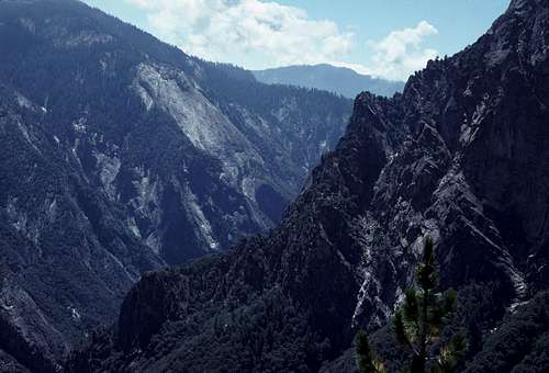
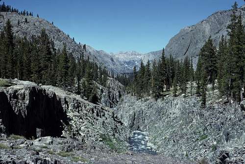
![North Goddard Creek Canyon]() A view looking up North Goddard Creek canyon.
A view looking up North Goddard Creek canyon.
| ![Up the South Fork of the San Joaquin River canyon.]() Up canyon view along the South Fork of the San Joaquin River.
Up canyon view along the South Fork of the San Joaquin River.
|
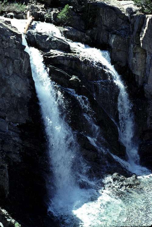
The map shows the trail junction for Hell-For-Sure-Pass is just upstream from where North Goddard Creek meets the San Joaquin River, so I took a short cut down a steep chute that met the river closer to that point. I had had some anxiety about this river crossing. But, the 'river' was more like a creek at this altitude, and crossing it was as easy as jumping a few well placed boulders just below one of the many beautiful waterfalls that are found along this portion of the river.
![San Joaquin River Waterfall]() Waterfall along the South Fork of the San Joaquin River.
Waterfall along the South Fork of the San Joaquin River.
| ![San Joaquin River South Fork Canyon]() Looking down canyon along the San Joaquin River's South Fork.
Looking down canyon along the San Joaquin River's South Fork.
|
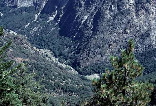
I took a lunch break next to the river, while soaking in the magnificent scenery. Looking down canyon I could see the region where Evolution Creek joins the San Joaquin River and the mountains beyond. Just to the north, the canyon opened up into a beautiful basin surrounded by snowy peaks. I knew from the map that Martha Lake would be up there. At that time I didn't know the names of the peaks I was looking at- except for Mount Goddard.
It was tempting to stay where I was and camp for the night. It was a beautiful area and fine looking campsites close to the river were quite abundant. The weather was good and I still had plenty of supplies, but, for some reason, I was still in 'escape mode' and nothing- not even the striking beauty of this part of Kings Canyon National Park was going to shake that. The regret I have of losing a glorious day or two of exploring the peaks of this area still haunts me from time to time. (But I made up for it in years to come.)
I shouldered my pack and began hiking up the Hell-For-Sure-Pass trail. I'd been a bit apprehensive about this trail and this pass because of its ominous name, but I thoroughly enjoyed this portion of the hike. The trail climbs steeply up the side of the canyon for several hundred feet and then begins a long ascending traverse to the north along benches and ledges high above the canyon floor. The route is very scenic and not in the least bit strenuous.
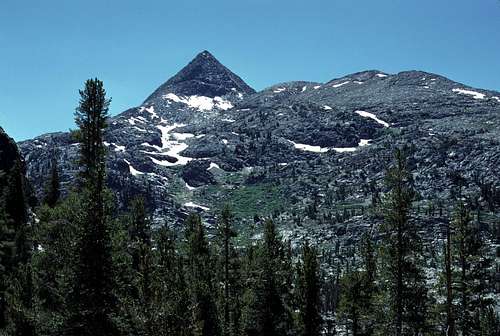
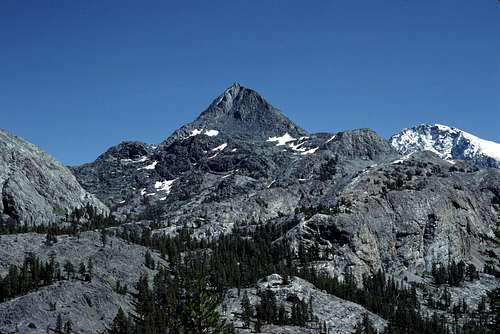
![Peak 12,243 and Mount Goddard]() Peak 12,243 and Mount Goddard (right) from the Hell-For-Sure-Pass Trail.
Peak 12,243 and Mount Goddard (right) from the Hell-For-Sure-Pass Trail.
| ![South Fork of the San Joaquin River Canyon]() Looking up the canyon to snowy Mount Goddard from the Hell-For-Sure-Pass Trail.
Looking up the canyon to snowy Mount Goddard from the Hell-For-Sure-Pass Trail. |
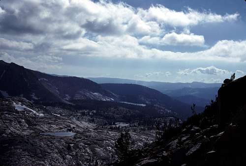
![North From Hell-For-Sure Pass]() A view north from the Hell-For-Sure Pass Trail. The three peaks in the distance are (L to R): Seven Gables, Gemini, and Mount Gabb.
A view north from the Hell-For-Sure Pass Trail. The three peaks in the distance are (L to R): Seven Gables, Gemini, and Mount Gabb.Eventually, when one is just under Hell-For-Sure-Pass itself, the trail makes some steep switchbacks to the top of the pass which is situated on the LeConte Divide and the western boundary of Kings Canyon National Park. When I reached this point it was already late in the afternoon. I considered camping next to one of the lakes in Red Mountain Basin, but decided to stay on the trail a bit further.
![Mount Hutton]() Mount Hutton from Hell-For-Sure Pass
Mount Hutton from Hell-For-Sure Pass
| ![Red Mountain Basin]() Red Mountain Basin from Hell-For-Sure Pass looking southwest.
Red Mountain Basin from Hell-For-Sure Pass looking southwest.
|
As I traveled west down the steep trail from Hell-For-Sure Pass, I realized that an important decision was looming just ahead. Which route should I take back to the trailhead and my car? My original plan was to simply follow the North Fork of the Kings River cross country back to the inlet at the north end of Wishon Reservoir. Turn the reservoir on its east side and continue south back to the trailhead. Looking at the map, my 'wiser' and more experienced eyes now realized that there could be another 2 or 3 days of difficult travel by going that way. I was weary of adventure, so it wasn't hard to abandon those plans for something easier.
This left me with a couple of choices. I could head southwest along the trail past Devil's Punchbowl and follow a maze of trails past Crown Pass and Woodchuck Country to eventually reach my car at Rancheria Creek. This was also long- perhaps another 2 days, but at least it was all trail. The other option was to head on down Fleming Creek toward Post Corral Creek and follow those trails out to Courtright Reservoir. That would take less than a day. Then, well, maybe hitch a ride back to my car at the trailhead.
The second option seemed like cheating, but that was the way I decided to go. I knew that this would be an unaesthetic way to end the trip, but don't worry. I mentally made some plans to start shopping for golf clubs when I got home. Maybe I just wasn't cut out for this backpacking and mountaineering shit.
At the junction for the Devil's Punchbowl trail, I turned south and followed it down to its junction with Fleming Creek where I set up my camp. I chose a spot at the edge of a small grassy meadow on the floor of the canyon. It was late and I ended up cooking, eating and cleaning up by headlamp. I went to bed greatly anticipating the next day when I'd finally be hiking out of the wilderness. I would have been downright happy if I hadn't felt like such a douche.
September 13
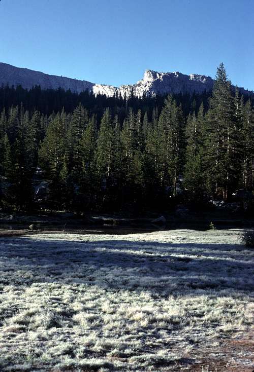
It had been a cold night- perhaps the coldest on the entire trip. I think it was because I was on the actual floor of a canyon and experiencing the affects of the cold air that naturally draws down the course of mountain canyons. The grassy meadow near my camp and my tent were coated with frost. In spite of the cold, I was up very early in anticipation of the long hike that I'd be doing that day. With any luck, I'd be sleeping in my own bed tonight.
![Meadow Along Flemming Creek]() Frosted meadow near my Flemming Creek Camp.
Frosted meadow near my Flemming Creek Camp.I rushed through a simple breakfast and assemble my gear to my pack and began by leaving the trail and traveling cross country down the canyon. According to the map, it looked like I could eliminate almost 2 miles of hiking by avoiding the trail and taking this little shortcut. I traveled west past the junction of the two main branches of Fleming Creek and contoured up to meet the trail just prior to where it crossed a low divide between Fleming and Post Corral Creeks.
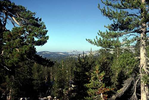
![Three Sisters]() A distant view of the Three Sisters from Flemming Creek.
A distant view of the Three Sisters from Flemming Creek.
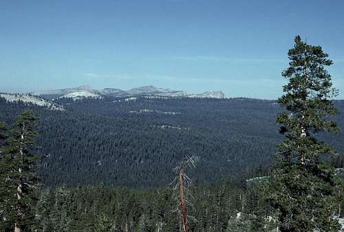
| ![West From Above Post Corral Creek.]() Looking toward (left to right) Brown Peak, Three Sisters and Dogtooth Peak.
Looking toward (left to right) Brown Peak, Three Sisters and Dogtooth Peak.
|
From the divide, the trail drops down to Post Corral Creek and I followed this trail northward as it gradually climbs toward another low divide that overlooks Courtright Reservoir. The day was beautiful and warm. There seemed to be music in the air. No, really! As I approached Post Corral Meadow, I could definitely hear... what was that?
“Dirty deeds and they're done dirt cheap.”
What the...? It got louder and louder until just ahead I saw four backpackers coming towards me on the trail. The one in front was carrying a large 'boom-box'. AC/DC blasting away. I had been missing my music and my record albums, but really? Are you kidding? On hikes, the sounds of nature are music to my ears. I thought about how these guys probably don't see much wildlife on their hikes.
They stopped when I approached. The guy in front lowered the music so we could chat.
He looked me up and down (no, I still hadn't done my laundry), “Whoa, dude! You've been in the mountains for a while, huh?”
“Yeah, a little more than a week.” I smiled. Like me, they all had long hair and enjoyed the same music I did. Except for blasting rock and roll in the wilderness, I knew they were kindred spirits. (If only they'd been listening to Pink Floyd...)
During our brief conversation, I learned that 4 people had succumbed during the big storm the week before. It had been in the news. No details were given and I wondered if any of them were swept away by flooding rivers or creeks. It would be years before I would actually find out what happened to some of them. Shortly, we went our separate ways. I could hear the slowing fading rock and roll for several minutes after we parted.
I crossed a low divide and entered the huge basin containing Courtright Reservoir. The trail winds through a thick forest and eventually comes upon an unpaved road. There were a couple granite domes nearby that looked pretty impressive. As I followed the road, a view to the east opened up that revealed areas of domes and open expanses of granite slabs. I later learned that this was the North Fork of the Kings River Canyon that I'd originally planned to hike through.
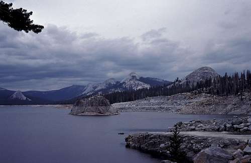
Many sections of the road was blasted out of the granite bedrock. Eventually, the road made a dogleg to the south then swung north and, just before the dam, I had my first view of Courtright Reservoir. The scene was both impressive and ugly. The basin was ringed by beautiful granite domes rising out of thick forests. The center piece was the lake itself. Courtright was partly drained revealing a dead barren shore where once there had been a continuation of the beautiful forest. To me, it looked like what Tuolumne Meadows would look like if a dam had been built and a huge lake created in the middle of it all. Pretty sad.
![Courtright Reservoir]() Courtright Reservoir from the dam
Courtright Reservoir from the damI crossed the dam and found a hikers parking lot at the west end. There were the usual passenger cars, vans, pickup trucks, etc. All of them patiently collecting dust while their owners were out in the wild on their own adventures. I thought about how great it would be if one of these vehicles were mine, but my car was still at a trailhead parking lot many miles to the south. Even though I'd arrived back into civilization, my journey was far from over.
I had been watching the sky fill with some ominous looking clouds for the last several hours. It reminded me of the way the sky looked that dark evening at Cartridge Creek several days ago just before that latest storm. Damn!
It was mid afternoon by the time I'd left the lake and followed the road as it went south through a granite ravine. Every now and then a car would go by down the hill and I would put out my thumb, but no one stopped. Oh, geez. I remembered my appearance. I thought that the next time I went for a long trip like this, I should include a small shaving kit in case I had to hitchhike.
The road came to an east facing hillside and the view opened up. Mount Goddard dominated the mountains that were visible to the east. It seemed hard to believe that I was over there in that vicinity just the day before.
I came to a vista point that was off the main road. The view was magnificent and I thought seriously about camping there. My feet were sore and my shoulders were aching from my pack. The problem was that I was very low on water, and there didn't seem to be any water sources nearby. I continued down the road as the late afternoon became darker with more and more of the sky filling with thickening clouds.
The map showed that a creek called Short Hair Creek was about 2 or 3 miles ahead. If I couldn't get a ride by then, I'd reluctantly have to camp there for just one more night. Wow! This wasn't how I'd envisioned this trip playing out during those planning sessions with my maps spread out on my living room floor.
But, here I was. Hiking down a paved road. Sore feet. Aching shoulders and hips. Short on water, daylight and strength. Clouds moving in thickening and threatening. Miles from my van.
A pickup truck with a cab over camper on the back roared up from behind me. I stuck out my thumb and watched indifferently as it sped by. I didn't blame them. I myself only rarely pick up hitchhikers. Usually only if they're backpackers and only if I don't have to clear too much of my gear and crap off of the passenger seat(s) in my van.
I continued on. As if hypnotized. Zombie-like. Just like I was after my Crown Creek mishap. Mindless endless hiking. The combination of walking on pavement and going downhill was really causing my feet to hurt.
September 7
Descending all those switchbacks really did a number on my feet, but it was finally over. I was in Tehipite Valley! It was beautiful and impressive, but not quite what I'd expected. I'd read that it was 'Yosemite like', so I expected vast green meadows lined with groves of beautiful trees. The river picturesquely meandering through it all- enhanced by a backdrop of incredible granite walls and cliffs.
Well, the walls and cliffs were here in abundance, but rather than 'meandering', the Kings River had become like an enormous bulldozer smashing and laying waste any meadows that may have been here before the storm. It was a brownish color and massive beyond belief. It seemed to stretch nearly the entire breadth of the valley. I suppose that I shouldn't have been too surprised, since I knew that it would be flooding due to the big storm that had ended the night before.
I followed the trail, looking for somewhere to camp. I spotted a beautiful packers camp just off the trail in a shady grove of trees. There was a large fire ring. A well built table made of native rock. Plenty of flat space not just for my tent, but many others as well. The trouble was that it was under about a foot of that brown muddy swirling river water.
Before long, I came to Crown Creek. Since I'd struck out on finding a campsite on the west end of Tehipite Valley, I thought I might as well cross and see what was on the east side. Maybe easier said than done.
The trail ended abruptly at a freshly cut bank of sand that dropped about a foot to the surface of the creek. The creek itself was about 15 or 20 feet wide and was the color of oatmeal. I could see the continuation of the trail on the opposite side just above a similar freshly cut bank.
It didn't look so bad. I'd recently bragged to a couple of friends that I haven't met a stream yet that I couldn't cross.
I cautiously stepped down off the bank and stuck my booted foot into the water. It was immediately pummeled by small rocks and gravel being carried by the strong current. The sand under my boot eroded away so quickly, that I nearly lost my balance and fell in. That would surely have been a bad thing to do since the creek pitched itself into the monstrous Kings River almost immediately downstream. It was likely that getting swept into that tumultuous torrent would not have been survivable.
I decided to look for other options. I followed Crown Creek upstream a very short distance to where the creek had divided into two channels. Between the channels was a sizable island- heavily wooded.
Crossing the first channel was very easy. A couple of boulder hops over relatively shallow water. The second channel turned out to be the main one and it looked very serious indeed. Very fast moving turbulent water at least 12 to 15 feet wide.
A previous hiker had created a makeshift crossing aid by placing the end of a 4 or 5 inch diameter log or pole into a fork of a tree that was next to the creek. The far end rested on the ground of the opposite bank about 20 or so feet away. The fork of the tree, where the near end of the log rested, was at about chest level and looked quite difficult to climb up to while wearing a backpack- even with the help of the several large rocks that had been piled at the foot of the tree to assist those foolish enough to try it. The log looked solid enough, but whole rig sloping down from the fork in the tree to the rocky ground on the opposite bank looked steep and dangerous. The water racing past underneath looked unforgiving. I didn't need much convincing to continue upstream to try and find something safer.
Upstream from the island, the creek was very wide- at least 50 feet or more. The current was slow enough that I could see the sandy bottom. This seemed like the best and safest place to cross. I made a few preparations. I removed my boots and socks and then put my boots back on sans socks. I left my boots untied- tucking the laces into the boot so I wouldn't trip on them. I put my pack back on leaving the waist-belt unbuckled in case I had to jettison it in a hurry. After a bit of hesitation, I began to wade into the freezing stream. I used my ice ax as a 'third leg' for extra support.
I was almost halfway across the creek when I stopped. The icy cold water was up to my waist and my feet were just barely able to hold me from being dragged downstream by the current which was fairly strong here in spite of the calm appearance of the water. I probed my next underwater step with my ice ax. It was quite a bit deeper than where I was standing. Would I still be able to maintain contact with the bottom of the creek? Maybe. A few more steps further on, I could see that the creek got shallower- I would be home free. But what if I couldn't resist the strong current?
I looked downstream at the island and the turbulent channel next to it. It was so easy to imagine my self helplessly being swept down there struggling to remove my pack and boots so I could swim and possibly avoid being cast into the Kings River. Yikes! I'd better really give this some serious thought.
Looking down at my feet, I was startled to see the movement of something big. It was a trout! A big one! I looked around and saw at least a couple more. Have I really been standing there hesitating that long? Reluctantly, I returned back to the bank where I started from. I decided to go back to the island and check out that log again...
It didn't look any easier than it did the first time I saw it. Maybe it could be straddled if one could get up there to it. I found a couple large rocks and stacked them on the already existing pile at the foot of the tree. Even with the extra boost these provided, it was still very strenuous hauling my ass up into the fork of the tree with my pack on.
Somehow, I managed to squat down and straddle the log. Wearing my heavy pack made everything very awkward and extra difficult. Luckily, there was a nice fairly stout branch just above my head that I could hold onto for extra balance and support. It extended most of the way across the creek just above and parallel to the log. My backpack with the waist belt unbuckled hung awkwardly off my shoulders. Below my dangling feet, the creek rushed by in a crazy torrent. Geez Louise, I'm a f**king moron!
Uncomfortable and frightened, I began to slowly inch my way across the downward angled log. The dark waters of Crown Creek rushing by beneath my feet made me feel a bit dizzy as I slowly inched along. Oh, god! Okay, no need to hurry. Just need to be careful and take my time. My left hand gripped the log in front of me. My other hand was above my head still gripping the tree branch for a bit more balance and security.
I concentrated on moving just one contact point at a time- inch my left hand forward on the log, inch the hand over my head on the branch, inch my butt sitting on the log. Over and over slowly making progress. This is going to work! I began to relax a little as I moved along. That was about when my heavy pack shifted to the side pulling me off balance...
“F**k!!” I gripped the log harder with my left hand and something totally unexpected happened. The shift in balance caused the log itself to actually rotate under me. Suddenly I found myself with my right leg hooked over the log at my knee, my right hand on the branch overhead and my left hand gripping the log. My backpack was hanging heavily from my shoulders. My left foot was dangling down into the creek- bouncing and skimming the surface of the fast moving water. I tried to pull myself back up onto the log, but there was no way; not with that heavy backpack on. So I hung there for several moments pondering my predicament.
“Heeeellllppp.” I whispered- mostly to myself. It was meant as a joke, but I didn't laugh. I was all alone. I hadn't met anyone since Crown Valley the previous afternoon. I'll have to provide my own rescue, but what am I going to do? With one knee hooked over the log I had been straddling, and my heavy backpack hanging from my sore shoulders, it seem impossible for me to inch along that log. I was only about 6 or 8 feet from the opposite bank. Then I thought that maybe if I unhooked my knee, I could let my legs dangle into the water and I could continue 'hand over hand'.
I paused for a moment before I let go of the branch that had been above my head. I knew that once I let it go, there was no getting it back. Was I sure? It snapped up with leaves whooshing through the air. With both hands on the log now, I was able to unhook my leg and lower myself into the rushing stream.
What happened next took me completely by surprise. Instead of my legs dangling into the stream, I was instantly dragged to a horizontal position- face up under the log. I somehow hung onto it- gripping, clutching with both hands. My arms raised over my head- my hands in a death grip. I bounced on the surface of the creek like a flag flapping in a strong wind. I could see the sky through the arching tree branches above me. My pack beneath me was mostly under water. The current was relentlessly attempting to tear it violently from my shoulders. My hands began to ache, but I knew that if I lost my grip, it would have meant getting swept down the creek and into the Kings River to a cold dark terrifying death...
I was losing strength! I had to do something! I somehow turned my body over so I was now face down- Crown Creek rushed by just a foot or so below my face. I remained mostly horizontal as I was bounced and violently jerked by the current. It was like hanging onto the tow rope on the back of a fast moving speed boat. With the last remaining ounces of strength, I was able to travel hand over hand until I could feel the rocks on the shore of the creek beneath my knees and lower legs. I brought my legs up and wobbled to my feet. Painfully, I let go of the log.
Exhausted, I stumbled away from the creek and nearly collapsed...
September 13
Another vehicle was coming up from behind. I turned and saw it was one of those light green official Forest Service pickup trucks. I stuck out my thumb and the driver stopped just in front of me. I threw my backpack into the bed next to some shovels and bow saws and jumped into the cab.
He wore a Forest Ranger's uniform and told me he was heading back to Dinky Creek, but, sure... he'd be happy to drive a bit out of his way to drop me off at my van at the Rancheria Creek trailhead. I was grateful almost beyond words.
He asked about my trip and I gave him a brief synopsis. I even mentioned my near calamity at Crown Creek, though I left out most of the details.
“You're lucky. That storm has been blamed for five deaths.” He didn't know most of the particulars, but he knew that there had been hypothermia involved in at least a couple of them.
He turned left onto the road that goes to Wishon Reservoir and soon we were crossing the dam in a light rain. What a contrast to the sheets of rain and poor visibility that had prevailed when I drove across a week or so earlier. The sun was low enough in the west that it was illuminating the bottoms of the clouds and the forest in an eerie light. To me it was so strange to be riding instead of walking. Soon, he drove down the little driveway that had been so muddy eight long days ago and parked next to my van. It was a beautiful sight. I retrieved my gear from his truck and shook his hand gratefully before he started back up the steep dirt driveway.
I put on the clean socks and tennis shoes and also a clean shirt that I usually keep in my van for driving home from trips. It felt strange to sit behind the wheel and start the engine. It wasn't exactly a good feeling. True I was finally back to the car and about to drive home and sleep in my own bed, but... it felt unearned.
Driving home, conditions were nearly the opposite of what they were when I drove in eight days earlier. Instead of blinding sheets of rain, there was diffuse sunlight and a light sprinkle here and there. For the first time, I could see how beautiful this region actually was.
Afterward
I never did take up golf after this trip. In fact, less than two weeks later I was back in the high country with a couple of friends from work on a climbing trip. There were several more trips that fall before the snows of winter closed the passes.
The following summer I pretty much quit my job and put all my non-hiking junk into storage so I could spend a summer of backpacking and climbing in the High Sierra. It was epic!
I guess I was still in the clutches...
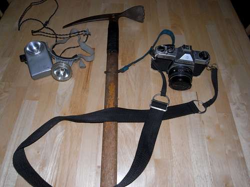
Oh! By the way... My camera... The one that got dunked into Crown Creek. It continued to work quite well for the next 7+ years until I finally replaced it in 1985. I couldn't afford the new one either. :-)
![Antiquated Gear]() Ice ax, headlamp, and, yes, that is the actual camera that got dunked in Crown Creek and nearly flung into the Kings River on that trip in 1978.
Ice ax, headlamp, and, yes, that is the actual camera that got dunked in Crown Creek and nearly flung into the Kings River on that trip in 1978.~^~^~^~^~^~^~^~^~^~^~^~^~^~^~^~^~^~^~^~^~^~^~^~^~^~^~^~^~^~^~^~^~^~^~^~^~^~^~^~^~^~^~^~^~^~^~^~^~^
Tropical Storm Norman slammed into California and the Sierra Nevada during Labor Day weekend, 1978 and lasted for about 3 or 4 days. This storm caused the closure of many approaches to the mountains due to flooding, wash-outs, and unseasonably heavy snowfall.
There were also several back country fatalities. Many summer hikers were unprepared for its ferocity and the winter-like conditions it brought.
A couple of well written SAR reports from that storm are here.
At the age of 23, this was only my 3rd full season as a backpacker/ mountaineer and though I probably wouldn't have admitted it before this trip, I still had much to learn. (The education still continues even after 30 years.)
The End [Kudos if you actually read the whole damn thing! :-) ]


Comments
Post a Comment