The geo-history of Lavanttal fault
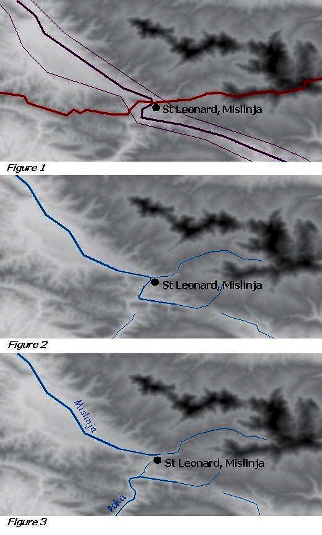
The church St Leonard of Mislinja is in a special position. It is at the point where the watershed of the Drava and Save valleys crosses the Lavanttal/Labot fault. On Figure 1 you can see the mainline and the borders of the Lavanttal/Labot fault with purple lines, while the red line indicated the watershed between the Drava and Save valleys.
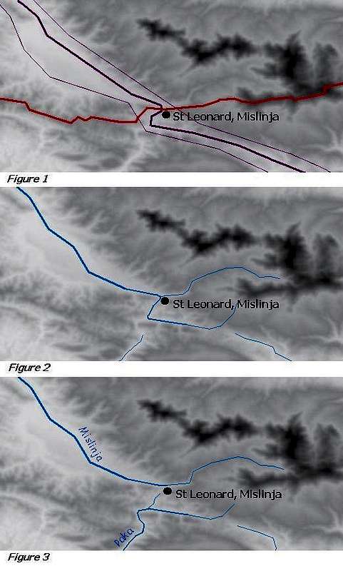
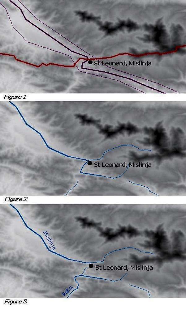
The Pohorje mountain range is a very young formation: it elevated east to the older Lavanttal/Labot fault only in the last 15 million years. It’s likely that the elevation of the Pohorje mass changed the way of some rivers. Now the river Paka having its first kilometres in the Lavanttal/Labot fault turns to south at the village Gornji Dolič, cutting over a mountain with a canyon-like valley (see Figure 3). But it’s likely that more than 7-8 million years ago – when the elevation of the Pohorje mass was not so advanced yet – the same river followed the way of Lavanttal/Labot fault, and instead of turning to south at “Gornji Dolič”, it continued its way further along the fault. Please see Figure 2 for the details (please note that the hills and valleys were not exactly the same 7-8 million years ago – the illustration gives only the logic and not the exact topography). Of course at that time the watershed didn’t cross the fault at the location of the present day St Leonard church, but 6 km south-east to it, near the present-day source of Paka river.


