The gravel road to the...
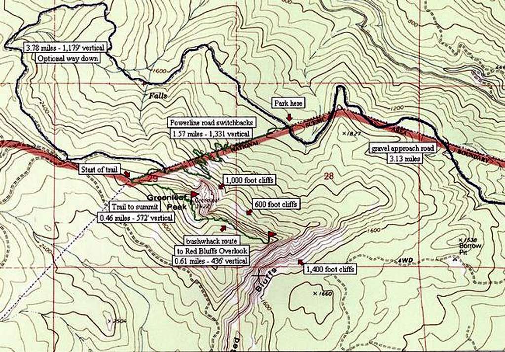
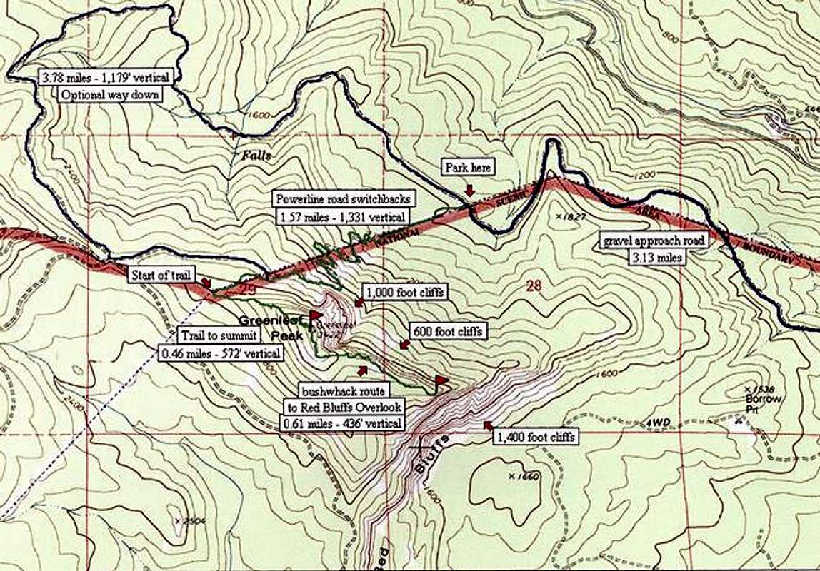
The gravel road to the trailhead, CG2020, in blue, is passable for 4WD vehicles, but rough.
The trail, and the bushwhack to the top of the Red Bluffs is in green on this USGS map drawn with TOPO software.
The wide red line is both the boundary of the Columbia Gorge National Scenic Area and the route of a major powerline.


