Toggle navigation
Mountains
Routes
Images
Trip Reports
Forum
What's New
People
Areas & Ranges
Articles
Trailheads
Canyons
Huts & Campgrounds
Albums
Logistical Centers
Fact Sheets
Lists
Custom Objects
Gear
Plans & Partners
WELCOME TO SUMMITPOST
SIGN IN
REGISTER
Hoher Sonnblick
Additional Parents
Image
The marked route from the...
View High-Resolution Image
The marked route from the...
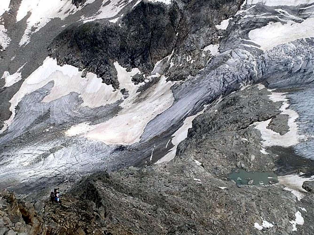
The marked route from the Rojacher hut to Zittel hut on the east ridge. In the background the remnants of the former large Vogelmaier - Ochsenkarkees (glacier) can be seen.
« PREV
NEXT »
wuedesau
on
Jan 12, 2004 10:13 am
Comments & voting
Other parents
Lat/Lon:
47.05400°N / 12.95760°E
Image ID:
38240
1832 Hits
73.44
% Score
4
Votes
Log in to vote
Comments
No comments posted yet.
to post!
Don't have an account?
Hoher Sonnblick
(Mountain/Rock)
« PREV
Viewing
#60 of 115
GALLERY
NEXT »
wuedesau's Image Gallery
« PREV
Viewing
#639 of 814
GALLERY
NEXT »
×
You need to login in order to vote!
User Name
Password
Remember me
Forgot your password?
Log me out when I close my browser.
Keep me logged in all the time.
sign in as a user
Don't have an account?
Register now for FREE
Rating available
Suggested routes for you
People who climb the same things as you
Comments Available
Create Albums
Register Here


