
|
|
Area/Range |
|---|---|
|
|
54.54700°N / 3.249°W |
|
|
2473 ft / 754 m |
|
|
Region Overview
The Newlands Horseshoe is a circular hike in the North of the English Lake District which, as a National Park, occupies most of the county of Cumbria. Formerly a combination of parts of the old counties of Cumberland, Westmoreland and Lancashire, it is also my home. I grew up amongst these mountains and you’d be hard pressed to name any I haven’t summited except in the far North East. The English Lake District is a popular area for outdoor recreation including hiking, climbing, kayaking, sailing and many more. But it is also the home and birthplace of many other people and things including:
• The poets Wordsworth, Coleridge and Ruskin
• English rock climbing with the first ascent of Napes Needle by Walter Parry Hasket-Smith in 1866 marking the beginning of rock climbing
• Rheged, the national mountaineering exhibition at Penrith
• Sir Chris Bonnington
• Doug Scott
• The first nuclear power station in the UK at Sellafield
• Kendal Mint Cake, the instant energy boost as used on many Everest expeditions
• Alfred Wainwright, the late great creator of the seven guidebooks to the region
So as you wander amongst these peaks, feel the history and presence of those who have gone before you. Take your time to look around you beyond the summits, see the industrial archaelogy, the wildlife, the people.
 |  |  |  |
Getting There
Whether you are travelling from the North or South of the country the best way to the area is to take the M6 to Junction 40 at Penrith. Now take the A66 heading west. From here it’s 17 miles to Keswick.
Red Tape
None
When To Climb
All year round
Camping
Camping would not be necessary across this hike though some may want to consider an overnight wild-camp as part of the overall experience. In Braithwaite there is a good campsite, Scotgate, Tel. 01768 778343
Mountains Overview
The Newlands valley runs to the West of the town of Keswick and begins at the foot of Catbells approximately 1km or so from the hamlet of Swinside.
The first small peak is Catbells and you are likely to have a host of companions on this first part of the hike, including small children and grandmothers! Don't despair, once you reach Hause Gate they will be leaving your trail as you continue upwards to Maiden Moor. This is a lofty and airy plateau once you gain the top and provides great views in all directions. To your right is the Coledale Group and your view to the left may take in the Langdale Pikes.
Your next peak is High Spy, virtually a continuation of Maiden Moor, before a despairing loss of height down to Dale Head Tarn then a steep pull up to Dale Head summit.
Now descend Dale Head in the direction of Buttermere along Hindscarth Edge before taking a sharp right to ascend Hindscarth.
You have now reversed direction 180 degrees and have some great views back down Scope End and the whole of the Newlands valley. Continue down the ridge, zig zagging at the Goldscope mines to join the road at Little Town making your way back to Catbells car park.
 |  |  |
Route Information & Waypoints
The map I use for this area is Ordnance Survey, Outdoor Leisure 4, The English Lakes, North Western Area, 1:25,000 scale. The table below shows a set of waypoints for each fell together with start and finish points which can be programmed into a GPS. Note that these are OS grid references and NOT Lat. & Long. Positions and that the Bearing and Distance information is an “as the crow flies” bearing and distance to the next peak or waypoint.
| Position | Elevation (ft) | GridRef. | GridRef | Bearing | Distance (km) |
| Cat Bells Car Park | 440 | NY24695 | 21210 | 190 | 1.36 |
| Cat Bells | 1,481 | NY24405 | 19835 | 176 | 0.64 |
| Hause Gate | 1,183 | NY24430 | 19210 | 215 | 1.23 |
| Maiden Moor | 1,887 | NY23690 | 18220 | 186 | 1.95 |
| High Spy | 2,143 | NY23410 | 16250 | 198 | 1.15 |
| Dale Head Tarn | 1,628 | NY23060 | 15200 | 279 | 0.77 |
| Dale Head | 2,473 | NY22300 | 15335 | 297 | 0.94 |
| Hindscarth Edge | 2,161 | NY21470 | 15780 | 008 | 0.84 |
| Hindscarth | 2,385 | NY21590 | 16615 | 013 | 1.26 |
| High Crags | 1,546 | NY21930 | 17830 | 043 | 0.71 |
| Scope End | 1,296 | NY22420 | 18345 | various | 2.40 |
| Little Town Car Park | 560 | NY23345 | 19510 | various | 2.30 |
| Cat Bells car Park | 440 | NY24695 | 21210 |
Mountain Conditions & Weather
This hike can be completed at any time of the year. It’s on the extreme northern edge of the Lake District. My own preference is to make this trip in winter. The main “condition” to cope with is the weather, and if you think that British weather is generally unpredictable then the unpredictable scale isn’t big enough to accommodate the Lake District. As a “visitor” the first thing you need to understand it that there are at least three mini zones of weather within the area. First, to the extreme west is the Irish Sea and the coastal zone leading up towards the western and central fells. Second, the central fells from Borrowdale to the eastern side of Helvellyn, and lastly the far east beyond the Helvellyn range. Each of these can also be divided into north and south, but it’s the west-east line that seems to have the greatest variation in weather. So, it can be sunny in the west, raining in the centre, and merely cloudy in the east. I’m sure that true meteorologists will be having a fit at my divisions and generalisations, but I think you are getting the picture. The upshot of this is that the weather can change very rapidly, mostly from the west except under the winter conditions when we frequently have fronts from the Arctic descending on us. Always check the forecast before you set off:
Lakes weatherline tel: 01768 775757
Web: http://www.lake-district.gov.uk/weatherline/home/index.php
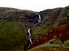
Try to learn something about cloud formations, especially how to spot lenticular formations and what they might mean for the rest of the day. The two photos appended to this section show how the weather has changed on Grisedale Pike within about 7 hours but it had been heralded by some lenticular formations to the west which my camera wasn’t good enough to distinguish in the pale watery sky.
 |  |  |  |
Accommodation & Getting Around
There is lots of accommodation in the area to suit all budgets including:
• Scotgate Campsite 01768 778342
• Keswick Youth Hostel 0870 770 5894
• Coledale Inn 01768 778272
• Lots of further information and accommodation help at the Keswick Tourist Office 01768 772645
• If you need transport to get around call Traveline 0870608 2608 for bus informaton
• Don’t forget the National Mountaineering Exhibition, Rheged, at Penrith, www.rheged.com which is also an exhibition of Cumbrian history and heritage. Not to be missed by all mountaineers!
• The Keswick Mining Museum, 017687 80055
Some Local History
The local history of the Lake District can not be summarised in one or two paragraphs here, but there are some issues of industrial archaelogy specifically which have a bearing on one’s enjoyment of the mountain landscape. In particular I refer to the mining industry and for several centuries the region has been famed for it’s mining of coal, iron ore, lead ore (galena), and graphite
The Goldscope mine is to be found in theNewlands valley and current day evidence of its presence is indicated mainly by spoil heaps on the Newlands beck side of Scope End (part of Hindscarth). Pan holes can also be spotted by the eagle eyed even though this mine was abandoned almost 150 years ago after intermittent operation over a period of six centuries. This has been one of the district’s most important mines which had rich veins of lead and copper with smaller amounts of gold and silver.
 |
Lake District Geology
I can only scratch the surface here (a pun!) so I hope all you professional geologists, including my wife who worked for the geological survey in Kathmandu, can be tolerant of my amateurish attempt. The shaping of the mountains in this region and the origins of it’s rocks represent separate and dramatically different periods of time. The hills, lakes and valleys are mainly the result of glacial events of which the most significant took place during the Devensian period between 25,000 and 10,000 years ago. The bedrocks record a much longer and more exotic series of events in earth’s history extending back more than four hundred million years.
During the last half million years glaciation has affected the lakes area in the form of repeatedly advancing and retreating ice sheets, culminating in the present inter-glacial stage during which human civilisation has developed. At it’s most extensive ice covered the Lakes in a way similar to the present day Greenland ice-cap. The ice from Scotland which filled the Irish Sea basin, covered virtually the whole of the area and occasionally exposed scattered peaks or rocky mounds projecting from the ice.
As the ice melted sea levels were raised to flood the valleys of the Solway and West Cumbrian coast. Most of the characteristic glacial erosion features, including corries and lakes in U-shaped over-deepened valleys, originated during the last glacial stage. The ice sheets deposited huge quantities of rock debris as moraines, several of which dam lakes, and a blanket of boulder clay which obscures bedrock over much of the lowland areas.
During and after the ice melt some 10,000 years ago, water run-off became the main agent of erosion and rivers cut deep V-shaped valleys into moraines, unconsolidated boulder clay and softer bedrock, notably Skiddaw slate. River debris was washed down into the lakes to create deltas like the one separating Derwentwater and Bassenthwaite on which Keswick stands. The end of glaciation was also marked by widespread landsliding which is now stabilised.
Overall then, the mountaineer in Lakeland views a landscape shaped mainly by the events which took place as the ice shrank to valley glaciers and then to isolated corries before finally melting away, leaving the streams and rivers which became the main agents shaping the modern landscape.
At this point I will end, leaving a gap for someone to fill by writing up information on the regions bedrock. This is your chance to describe the Borrowdale Volcanics, Skiddaw Slate and Silurian Slates.