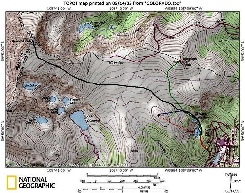
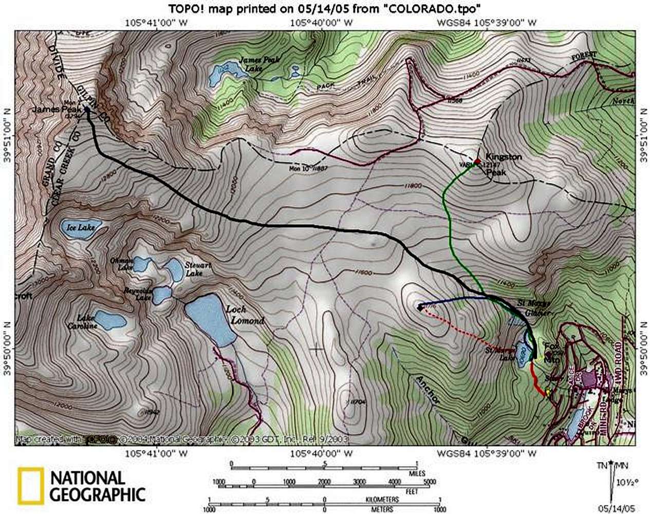
This map shows the Saint Mary's Glacier area and shows the various routes described on this page.
The bold red shows the approach to the lake.
The dashed red line represents the climb up the central gully.
The black line represent the east slopes route up James Peak.
The green line represents the route up Kingston Peak.
The dashed yellow line represents the route up Fox Mtn.


