
|
|
Mountain/Rock |
|---|---|
|
|
33.68922°N / 112.17962°W |
|
|
Maricopa |
|
|
Hiking |
|
|
Spring, Fall, Winter |
|
|
1862 ft / 568 m |
|
|
Overview
 North Thunderbird Peak
There are a lot of references to "Thunderbird" in the Phoenix metropolitan area, although there is one major hiking area that is home to several mountains named Thunderbird. This is part of the Thunderbird Conservation Park in Glendale, AZ. It is easily accessible with the main parking area is just one and a half miles north of the 101 Freeway. There are numerous trails, well maintained, with excellent views. The area is relatively popular. The summits are all under 2,000’. The highest is Thunderbird Peak at 1,862’. The Park has two other named peaks, North Thunderbird Peak 1,831’ and West Thunderbird Peak 1,682’. The main trailhead is at about 1,330-1,350’. Interestingly enough, there is a higher summit just one mile southeast of Thunderbird Peak. It is not part of the park, but it is part of the larger Hedgpeth Hills area. This mountain, called the Hedgpeth Hills Highpoint, is 1,905’, and does not have a standard trail to the summit; although it can be reached from either trailhead as described below.
The best time to hike in the Thunderbird Conservation Park is between November and March.

Getting There
The primary entrance to the Thunderbird Conservation Park is reached from the 101 Freeway. There is a primary parking area on 59th Avenue that offers access to all three primary summits. It is easy to find. Just take the 101 Freeway to 59th Avenue, and drive north for 1 ½ miles and it is on the left. There is also a parking area for Thunderbird Peak and North Thunderbird Peak if you drive 2 ¼ miles up from the 101 Freeway. Finally, there is parking for West Thunderbird Peak off 67th Avenue at the Thunderbird Park Trailhead (East) Parking Lot. That is 1 3/4 miles north of the 101 Freeway.
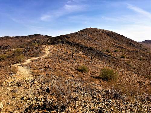
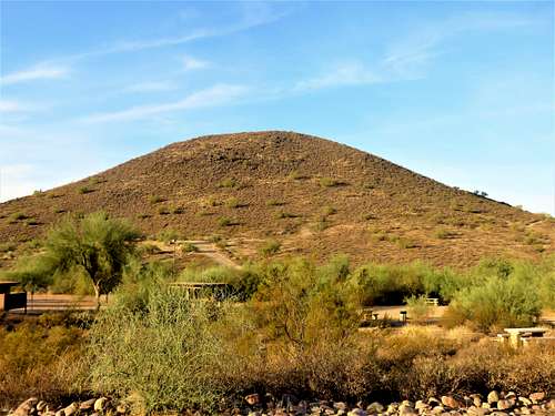 West Thunderbird Peak from the Southern trailhead
Park Trails
Here is a map of park trails: Hike Trails All three summits are easy to hike. West Thunderbird is most easily hiked from the main trailhead. North Thunderbird Peak is most easily hiked from the northern trailhead. It is only about a mile up, as opposed to two miles from the main trailhead. That is because from the main trailhead the Cholla Trail is a long loop around the ridge, while from the northern trailhead, it heads straight up to the summit. The map linked above is helpful for planning a hike.
Below are options for each summit: Thunderbird Peak From the Southern Trailhead, you can take the Coach Whip trail that parallels 59th Avenue about a quarter mile to the pedestrian bridge across 59th Avenue. Then take the Arrowhead Point loop (about 2 miles, including the summit). It is 3 to 3¼ miles round trip gaining about 550’ (depending on where you park). From the Northern Trailhead it is about 1.1 miles to the summit, gaining 475’. If taking the Arrowhead Loop up and over the summit, it is about 2 ½ miles round trip, gaining about 500’.
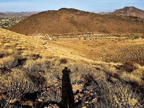
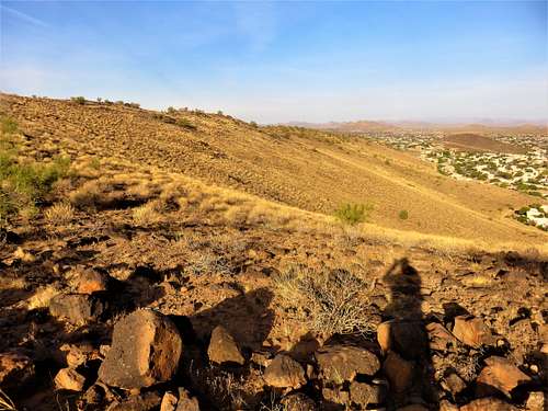
 North end of Thunderbird Peak
North Thunderbird Peak From the Southern Trailhead, you can take the Cholla Loop Trail about 1.8 miles to 2 miles to the summit (depending on where you park), gaining up to 600’. On the descent, you can loop down to Coach Whip, and take it back south as it parallels 59th Avenue, for a total hike of up to 4 miles, gaining about 720’.
 Cholla Trail up the ridge to North Thunderbird Peak
From the Northern Trailhead, cross the road and take the Cholla Loop Trail. It is a little over a mile 1.1 miles to the summit, gaining 450’.
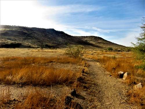
 North side of North Thunderbird Peak
West Thunderbird Peak West Thunderbird Peak is accessed from the main trailhead. The shortest trail is from the northeast side up the Sunrise Trail at the Amphitheater. It is only three-quarters of a mile and 350’ of gain to the summit. From the Thunderbird Park Trailhead (East) Parking Lot it is less than three quarters of a mile and 330’gain. However, there is a loop trail from the southeast at the Horse Staging Area. You can take Coach Whip up to the Ridgeline Trail and back down to the Amphitheater in a little over 2 miles round trip, gaining 475’. This can be elongated by taking Coach Whip around the circumference of the mountain, and then go back up Chuckwalla to the summit. That’s about 530’ of gain and 2.8 miles round trip.
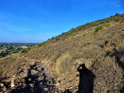
 View from the Ridgeline Trail to West Thunderbird Peak
Bonus Points – Hedgpeth Hills Highpoint The Coach Whip Trail continues east around the south side of Thunderbird Peak. The base of the Hedgpeth Hills Highpoint can be reached by crossing the W. Arrowhead Lakes Drive and getting back on the trail, which continues on the southern side of the mountain. The base is reached after about 1 ¼ miles of hiking from the pedestrian bridge across 59th Avenue. Once at the base, just past the houses, you can bushwhack about 300’ up to the ridge, and then pick your way across the rocky ridge to the summit. Distance from the pedestrian bridge is about 2 miles, gaining about 750’. 650’ of the gain is accomplished going from the base to the ridgetop in less than a third of a mile.
Red Tape
There is no red tape, but make sure to follow park rules, which are shown in the link section.