
-
 14502 Hits
-
 90.48% Score
-
 32 Votes
|
|
Mountain/Rock |
|---|---|
|
|
48.52500°N / 113.506°W |
|
|
Hiking, Mountaineering, Scrambling |
|
|
Summer, Fall |
|
|
8442 ft / 2573 m |
|
|
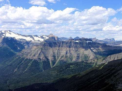
The Short and Easy Overview PartLieutenant A. W. Tinkham was an Army engineer sent by Governor Isaac Stevens to look for Marias Pass and who, in the fall of 1853, crossed Pitamakan Pass, thinking it was the Marias. His was the first recorded journal of the crossing of a pass in the park by a white man. This, from the GNP web site, means Tinkham Mountain was named after someone who got lost. Fair enough, I guess—at least he could enjoy the views. 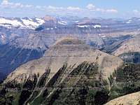 Tinkham, from Flinsch Peak Tinkham, from Flinsch PeakThe trek takes off from the Two Medicine Campground, and is 10.5 miles from start to summit, 21 miles round trip, mostly on a good trail, except for the last mile or so, when the way is via a goat trail circumnavigating around the mountain's upper reaches, and you find yourself dealing with exposure and cliffs enough to get your attention. Elevation gain from trailhead to peak is 3279 feet, very moderate by GNP standards, although in traversing onto the mountain proper from the continental divide at Cut Bank Pass you lose approximately 700 feet elevation, which of course must be accounted for both coming and going. You know, the sort of thing that's particularly fun on a hike out. So I guess elevation gain is actually more than 3279 feet. You can add it up if you wish.
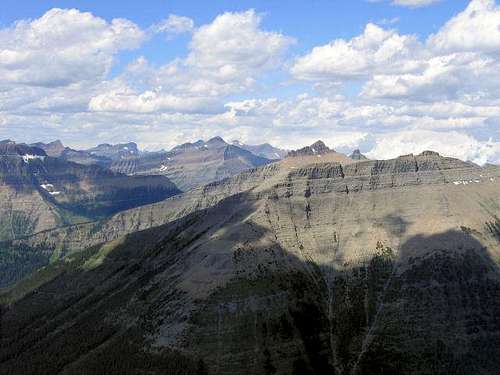
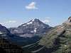
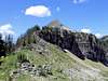
 From access ridge below Cut Bank Pass, looking directly at Tinkham Mountain. From access ridge below Cut Bank Pass, looking directly at Tinkham Mountain....is that there is nothing geological or physical about this mountain to place it in the dramatic hierarchy of the area's great peaks. It is not one of the "Big Names," and even locals aren't familiar with the peak unless they're avid climbers (an illustration of this relative obscurity is that it is not in J. Gordon Edwards' A Climber's Guide to Glacier National Park). And besides, for crying out loud Lieutenant Tinkham was lost! Almost, the word "diminutive" comes to mind, or the even more damning, "is this something we really want to do?" "Almost," that is......until you get there, and then you don't think like that any more. The good Lieutenant Tinkham probably wasn't lost at all; I suspect once he actually saw the land, that he went into the area on purpose, then lied about being lost so as to justify his presence. The surprise is he ever left. What I'm getting at is something visual that likely as not will result in a heartfelt, "Wow!"—leaving you to marvel at how what you are looking at defines mountains...and thinking about the necessity and means of entering a towering, sculpted neighborhood.  From Cut Bank Pass. From Cut Bank Pass.
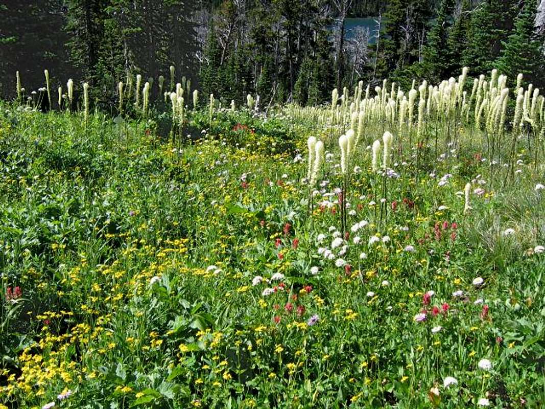
 The wonderful, serpentine access ridge to Tinkham Mountain. The wonderful, serpentine access ridge to Tinkham Mountain.The Definition of Glacial Valleys
The Neighborhood I
The Neighborhood II
The Neighborhood III
Getting ThereFrom the north, take Hwy 89 south from Saint Mary, turning on Hwy 49—a paved road, but very winding and slow going; relax, enjoy the wonderful views!—for approximately eight miles until the Two Medicine turnoff, then it is seven easy miles to the campground, ranger station, store, boat dock, and ample parking. From the south, take Hwy 2 to East Glacier, and in town turn on Hwy 49, head north out of town four miles, to the Two Medicine road. Standard Precautionary Note: All GNP roads are closed in winter, with Going-to-the-Sun Road (the major route through the park; its eastern terminus is at Saint Mary) sometimes not opening until July (average opening is second week in June; earliest opening ever is May 16, 1987, with the second earliest being May 22, 2005). Don't head out early in the year (i.e., June/early July) without checking the status of these roads—it is not unusual to have repeated, sometimes lengthy, road closures due to storms, avalanches, rock slides, or all three! The same holds true for late in the year; weather changes dramatically, beginning usually around the end of August, with road closures normally becoming more and more frequent through the month of September (although don't shy away from going, there can also be very nice—albeit cool or cold—days of Indian Summer throughout this time frame; plus the park is relatively free of people after Labor Day). The following links are pretty much self-explanatory, and provide all sorts of useful and interesting information: Map of Waterton/Glacier International Peace Park And finally, click here for current information, as well as easy access to some Route
Trail head is at the northwest end of the Two Medicine Campground, is well marked, there is plenty of parking, and is quite easy to locate. Several trails take off from this point, so pay attention to the signs. (You'll take a right almost immediately after crossing the bridge, which is the starting point.) The route to Tinkham Mountain crosses two passes: Pitamakan and Cut Bank (7,900' elevation, and the Continental Divide) which are surprisingly close together, being separated by only about half a mile. Upon leaving the campground the signs will direct you to Pitamakan Pass, which makes sense, as it is the first one you'll come to. Distance is approximately 8 miles to Pitamakan, another half mile or so after that to Cut Bank, and is a very good, well-signed trail all the way. It is a beautiful hike, with many (very nice) mountains to hold your attention. Upon reaching Cut Bank Pass, after spending a while being impressed with the scenery, you'll notice a good trail angling down and off the pass (that is, angling to your right as you face Tinkham Mountain from the pass). This trail descends approximately 700 feet to the saddle, at which point you're on the ridge leading to Tinkham Mountain, and from this point on it is intuitive and correct to simply stay on top the ridge and let it guide you three-fourths of the way up the mountain. The accompanying photos in this "route" section draw attention to the snow bank, which, of course, may or may not be there every year. Snow or no snow, head south (left) shortly before reaching the cliffs (which make direct summit access difficult, even with proper technical gear). Angling left at this point you'll soon see a goat trail, which will take you completely around the mountain, following a ledge all the way. This part of the climb is probably only half a mile in length or a bit more, but is exciting because not only are you always aware of the exposure at your feet, but the view as you round the mountain to the south and then west brings you face to face with first Mount Pinchot, then Mount Stimson, and if you're like me you can't trust yourself to simultaneously walk and gawk on a relatively narrow path—so you stop, and let the scene do its number on you. (Excuse my enthusiasm, but those mountains are huge, and magnificent, and...thrilling!) Okay, to continue. The goat trail takes you from the east side of Tinkham Mountain to almost the exact western opposite, where you will (hopefully) see the cairn, turn sharply right, and scramble up some steep cliffs, then more or less jaunt to the summit. Upon leaving the goat trail and turning upward, for a short distance the cliffs stop just short of needing ropes (which we had along, but no one in our group used them), and are a fun scramble. A final word: the goat trail around the mountain was fun, as were the cliffs leading to the top, but this is the kind of terrain you don't want to be hustling along (you won't be able to) in bad weather, so—as is true of almost all mountain excursions—watch the sky! Last note: this is one of those relatively rare GNP trails which late in the year won't have much water, and if the snow is completely gone from the mountain, there'll be none. In other words, plan and pack accordingly.
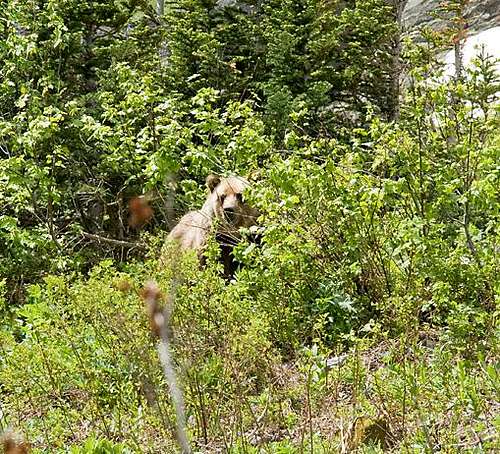
The Red Tape, Wildlife, & Cautions Section
When to Climb, & Climbing ConsiderationsFrom late June/early July (during this time frame expect LOTS of snow in the high elevations) to early fall, depending on snow conditions. Traditional climbing season in the Northern Rockies is July, August, and September—with September weather becoming progressively colder and more unstable (sometimes dramatically so: PAY ATTENTION!) as the month progresses—but does of course vary from year to year. There are occasional winter climbs in the park, but not often, and then only by well-equipped, area-wise, extremely competent individuals. Basically, most of GNP is inaccessable through the winter, and avalanche danger, to put it mildly, is extreme almost everywhere.
Because of the nature of the rock, there are special considerations regarding climbing in Glacier National Park, and grading systems unique to the Park have been developed by both J. Gordon Edwards and the Glacier Mountaineering Society. Anyone doing more than just "trail" hiking in this part of the Rockies should read the excellent and important information put together by Fred and Moni Spicker. Much—if not most—of the rock in GNP is sedimentary and rotten, and you need to know about it: Glacier National Park Rock & Grading Systems. CampingThere are numerous campgrounds available within Glacier National Park (including the Two Medicine area), of which only Fish Creek and Saint Mary take reservations (not required, but probably a good idea during the peak summer tourist period, especially on weekends). There are also many campgrounds as well as motels just outside the park on both the west and east sides. Click here for General Camping Information, and click here for Current Site Availability in specific campgrounds. Also, for those so inclined...GNP does have Backcountry Campsites throughout the park, including a site at Oldman Lake (not far from Pitamakan Pass—but this site is frequently closed due to bear activity; ALWAYS check with the Park Service before heading out!). Some of these sites can be reserved; others are on a first come basis. Anyone doing extensive, several day, remote hiking/climbing would be well advised to check this out. Mountain Conditions/Web CamsWeather page—an overview, plus current conditions and forecast This is the New NPS Web Cam Page.
External Links/Additional Information/Items of Related Interest
In TributeOn March 1, 2011, Vernon Garner, Saintgrizzly, left us after losing a bold, inspiring fight against pancreatic cancer. Or maybe he won, for he is at last free of his pain and has "shuffle[d] off this mortal coil."Vernon was an important contributor on SummitPost, but beyond merely making good, informative pages, he actually inspired many who read his work. No one put more work into his or her pages than Vernon did, and many of those pages, especially those related to Glacier National Park, the place he loved above all others, are works of art in both the writing and layout. More than one person has wanted to visit Glacier or go back to Glacier largely due to what he shared about that magnificent place. Many people on SP counted Vernon among their friends, and many more saw him as one of the best, one of those who exemplified the spirit of this site. He was one of the best of us, he will be missed, and he will not be forgotten. As a tribute to him, Vernon's pages will remain in his name. Any member who sees a need for an addition or correction should please contact site management via the "Send PM to the Elves" feature. Rest well and climb on, Vernon. |


