
-
 6154 Hits
-
 75.81% Score
-
 6 Votes
|
|
Mountain/Rock |
|---|---|
|
|
35.22122°N / 106.45336°W |
|
|
Hiking, Mountaineering, Trad Climbing |
|
|
Spring, Summer, Fall |
|
|
10000 ft / 3048 m |
|
|
Overview
At 210+ feet tall and about 100 feet wide, Tombstone is a interesting granite buttress that serves as the center-piece of Upper Pinnacle Valley. Nestled between the radio towers and the Needle, this rock offers some amazing views. It contains two 2-pitch routes, one rated at 5.5 and the other at 5.8. Keep in mind that this is Sandia Granite, which can be crumbly, grating, and slippery.Getting There

The Drive:
Take the Tijeras exit off of I-40 east of Albuquerque and drive north on Highway 14 to San Antonito. A left onto Road 536 (Sandia Crest Road) will take you an additional 14 miles to the Sandia Crest Parking Lot.
The Walk:
Park and walk to the trailhead on the north side of parking lot to the right/east of the radio towers. Once on the North Crest Trail, travel past the meadow overlooking the road and enter the forested wilderness.
The plethora of cliff bands ranging from 10 feet to 90 feet along the west side of the crest make this hurdle the most difficult on the way into Pinnacle Valley. There’s really only one small stretch that allows you to descend without rappelling. The specific spot from which a direct descent can be made is marked by a small cairn amongst 2 tree stumps immediately next to the main North Crest Trail, which is:
-250 paces north from the first fork encountered once you enter the wilderness.
-75 paces past the next fork that includes the main trail that veers right, another that travels along the rocks on the cusp of the crest on the left, and another that actually rejoins the main trail after about 50 feet. The Second Fork
-30 paces past a window in the treeline right off the trail. The Window
The Cliff-bands, Slopes, and Gully:
Once off the North Crest Trail, there are 4-5 short (<15 feet) passable cliff-bands connected by a faint trail. The terrain remains steep throughout and can be slippery at points.
Below the cliff-bands, continue to follow the climber’s trail, which meanders to a fork with the top of the Tombstone in sight. The trail on the right will take you to the top of the Tombstone while the other will continue steeply along its southern edge to get to the west face.
Red Tape
Protected as part of the Sandia District of the Cibola National Forest and the Sandia Mountains Wilderness Area, The Tombstone has several restrictions. No motorized vehicles or mountain bikes are allowed on the trails and a $3 parking fee is required at all trailheads within the national forest or wilderness. They now accept National Parks Passes in the parking areas.Camping
There are no campgrounds on the mountain but camping is allowed as long as fires are not made. However, all climbs are done within a day so camping is unnecessary for most people.When to Climb
The rock is climbable spring through early winter. The best period is between April and September, which is true for most peaks in New Mexico. Afternoon thunderstorms are common on this mountain, more frequently during the spring, summer, and fall. Due to the dry air, altitude, and intense sun that drain you of water it is important to pack plenty of it (a liter or 2 per person is good).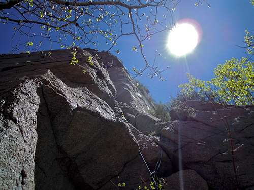
Mountain Conditions
For mountain conditions you can take one of the following links.Sandia Peak Ski Area Weather
National Weather Service Forecast
It is also possible to e-mail, call, or mail the district ranger of the Sandia Mountains. His e-mail is jcandrew@fs.fed.us, his address is 11776 Highway 337, Tijeras, New Mexico USA 87059-8619, and his phone numbers are (505) 281-3304 [voice] and (505) 281-1176 [fax].