
|
|
Area/Range |
|---|---|
|
|
Hiking |
|
|
Spring, Summer, Fall, Winter |
|
|
2256 ft / 688 m |
|
|
Overview
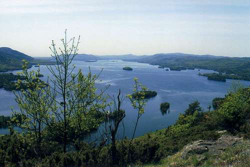
The 11-mile long Tongue Mountain Range may not be one of the loftiest areas within the six million acre Adirondack Park of northern New York, but it is arguably one of the most interesting. True to its name, the Tongue Range juts into the northern waters of Lake George more than 1,000 feet below. The resulting views for the hiker who traverses the ridge are sometimes spectacular with vistas of the Lake on both the east and west sides of the Range. At its thickest point, the Range is only about three miles wide.
Running north to south, there are five primary mountain summits - Brown Mountain, Five Mile Mountain, Fifth Peak, French Point Mountain and First Peak - in addition to several other named and unnamed bumps in between. At 2,256 feet, Five Mile Mountain is the highpoint of the Range. The route along the ridge is never excessively steep but the ups and downs are relentless, giving an outstanding workout to even the most seasoned hiker.
Eventually, as one move south through the Tongue Range, the real estate simply runs out as the waters close in from three sides. The southern terminus of the Range is at Montcalm Point, an area popular with boaters and sunbathers. In 2005, Backpacker Magazine listed the Tongue Mountain Range Loop as a favorite hike. This 12-14 mile loop (depending on short side trips) ascends to the ridge from the west (at the northernmost edge of the water on that side) and traverses the southern half of the Range before dropping to Montcalm Point and following the shore back north. In the second half of the loop hike, many areas can be found along the way to take a swim in the sparkling waters of Lake George.
The Peaks - North to South
Brown Mountain - Elevation 1,966
From the northern parking area on Route 9N in the Town of Hague, the well-marked Range trail (blue disks) ascends about 1,000 feet over 1.6 miles to the summit of Brown. A few outlooks can be found but the summit area is dominated by open woods.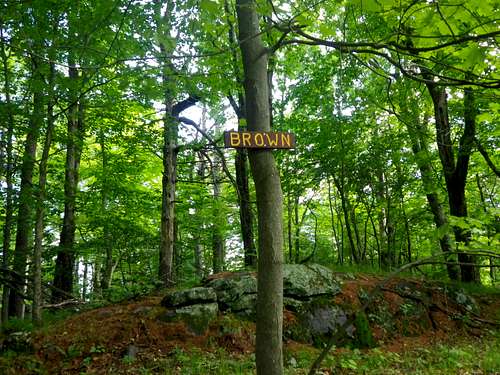
Five Mile Mountain - Elevation 2,256
This peak can reached by continuing about two miles south from Brown Mountain. Halfway in between the two summits is the outstanding Five Mile Mountain lean-to (AKA Tongue Mountain lean-to). Just under one mile south of the lean-to is the highpoint of the Range. Five Mile Mountain has a bit of a double summit. The trailside southernmost summit appears to be the true highpoint and offers a rocky outlook. A few hundred yards north is a second peak that one needs to leave the trail and scramble up some rocks to reach. Not a bad idea to visit both, but be wary of rattlesnakes if leaving the trail during the hot months of summer. The summit of Five Mile Mountain is 1.7 miles from the trail that marks the beginning of the Tongue Mountain Loop (described in the overview section) and thus offers a possibility for an ascent from the south.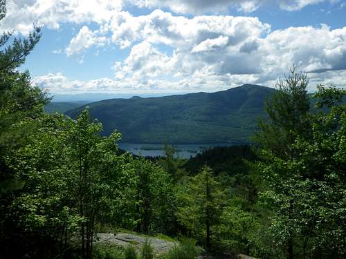
Fifth Peak - Elevation 1,813
Quite possibly the most popular peak in the Range, Fifth Peak offers big rewards for relatively little effort. The peak is less than 2.5 miles from the parking at Clay Meadow and its summit lean-to offers the possibility of overnight camping on the peak. Views are outstanding and the trail to the top is well-trodden. If traversing the Range, Fifth Peak is reached on a short side path off the main trail (only about 2/10 of a mile long).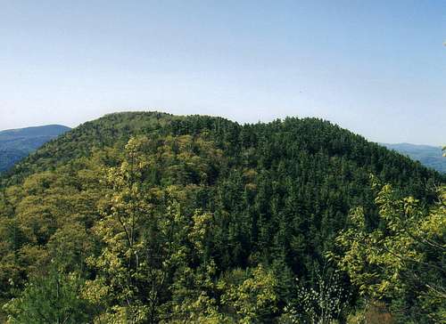
French Point Mountain - Elevation 1,756
The name of this peak harkens back to colonial America when the French and English battled in the area around Lake George with one notable skirmish taking place in 1755. French Point itself is located to the east of the mountain summit on the shore of the Lake. To reach the summit, simply continue about two miles south from Fifth Peak with the minor Third Peak being a fairly significant bump in between. The terrain in the area between Fifth Peak and French Point Mountain is the most rugged that you will find in the Range.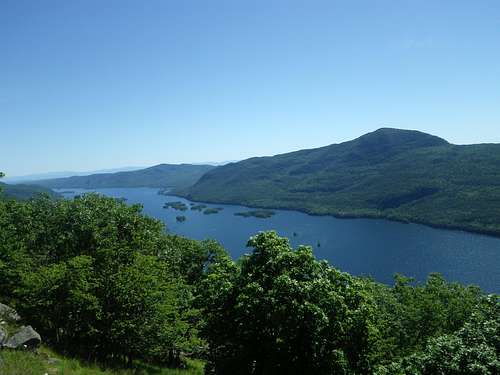


Getting There
Take the Adirondack Northway (I-87) to Exit 24 and head east on Valley Wood Road (your only choice upon exiting the Northway) and continue toward Bolton Landing and the shore of Lake George. After about five miles, Valley Wood Road ends at a T-intersection with State Route 9N. Turn left (north). The southern Clay Meadow trailhead is located about 4.5 miles north of the above intersection. Parking is on the east side of the road. For the northern trailhead, continue another five miles past the Clay Meadow Trailhead where you will find parking on the northwest side of the road.Red Tape
Nothing significant ... just a good environmental ethic. Carry in, carry out, don't cut down the forest, please don't pee in the lake ... and don’t shoot the turkey vulture.
Useful Resourses
The author of this page would highly recommend the National Geographic Lake George/Great Sacandaga Map (#743) in its Trails Illustrated Series. Also, the subscription trails.com offers a top notch trail guide for this Range. The Falcon Guide narrative by Rhonda and George Ostertag is offered through the trails.com service and will lead the hiker expertly through the Tongue Mountain Range Loop in the southern half of the Range.Camping
In addition to many open areas that can be found along the spine of the Tongue Mountain Range that are suitable for camping, there are two Adirondack style lean-tos along the way. The first of these is the Five Mile Mountain lean-to, located about one mile north of the actual summit of Five Mile Mountain. This lean-to (pictured below) is alternately known as the Tongue Mountain lean-to. A second similar three-sided shelter is located at the summit of Fifth Peak in the heart of the Range. Both shelters are popular so space may be at a premium during a summer visit.