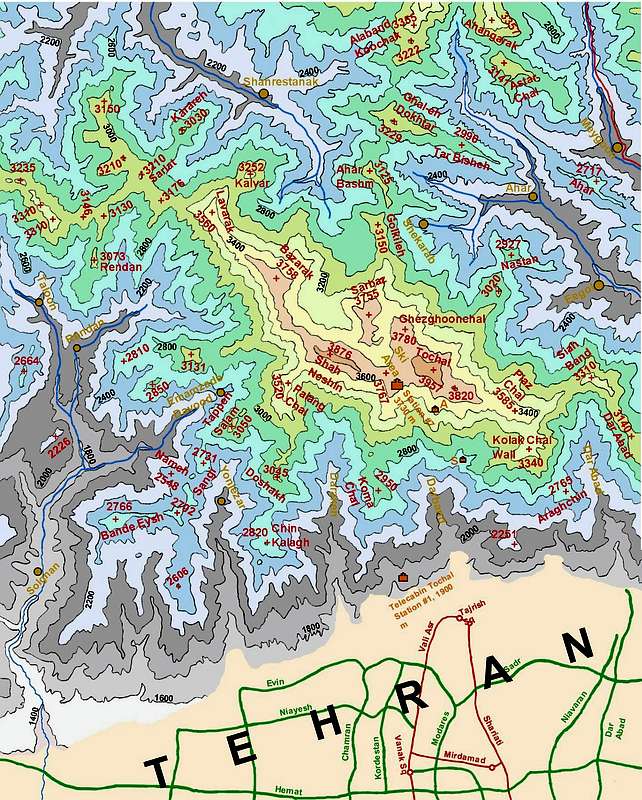
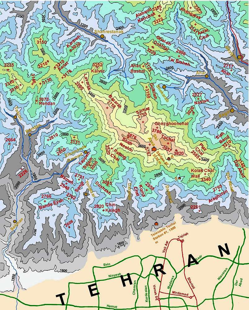
Map of Mt. Tochal and northern Tehran created by me based on the 1:50 000 maps. This map is to scale and covers an area 22.5 Km East-West by 27 Km North-South. The red lines are some of the major streets in Tehran and the green lines are the freeways. The icons show the location of the lowest and the highest stations of the gondola line (Telecabin). The locations of Amiri (A Icon) and Shir Pala (S Icon) shelters are also shown. In the interest of not crowding the map, many other shelters, including the one on the summit, have not been shown. All elevations in meters. Contour lines 200 meters.


