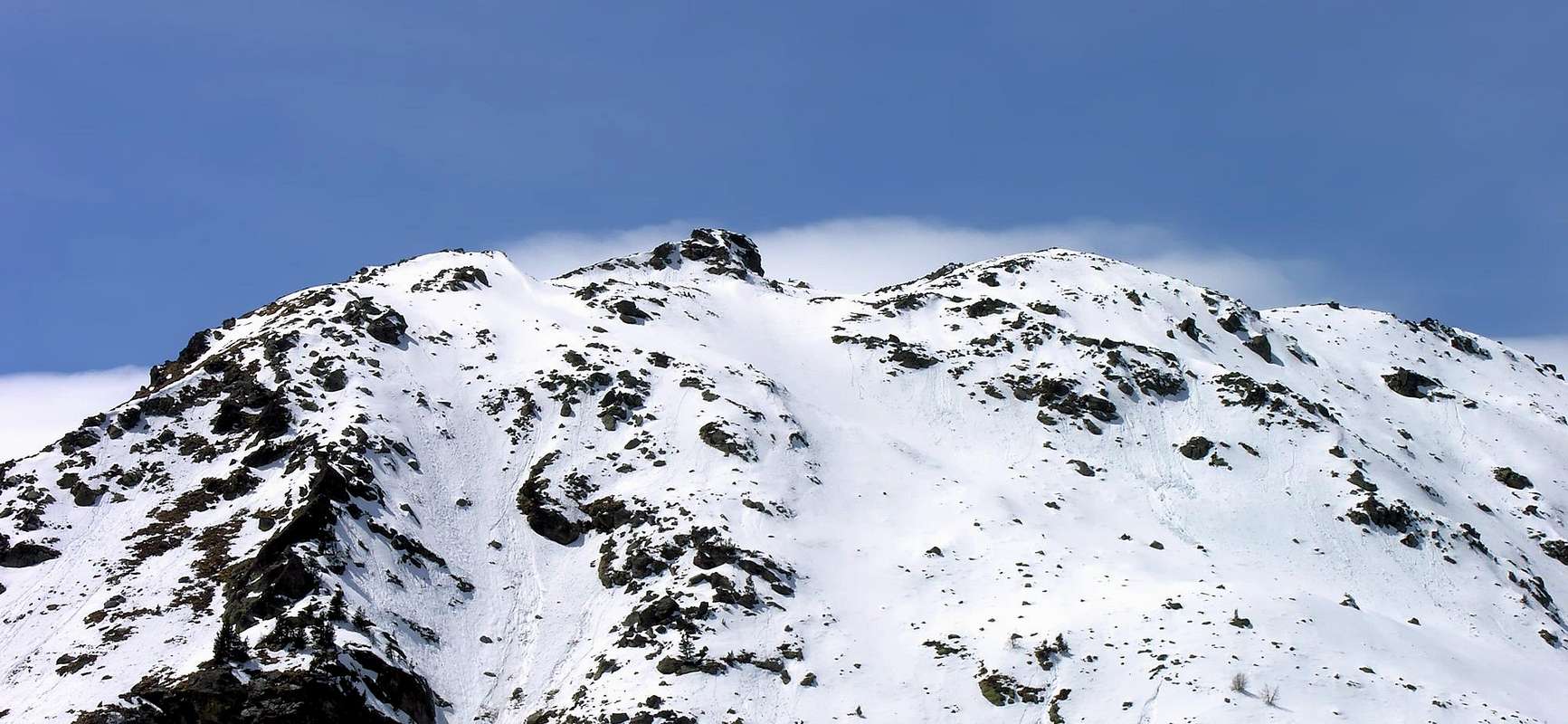
Rounded mountain with numerous turrets on top. Frequented mainly hunters, gives beautiful views of Monte Bianco Group, Monte Paramont, the Rutor, Aiguille de la Grande Sassiere and Gran Paradiso Group.
Montagna a forma di castello tondeggiante con numerose torrette sulla sommità. Frequentata principalmente da cacciatori, concede viste stupende sul Monte Bianco, Paramont, Rutor, Grande Sassiere e Gran Paradiso.
First Ascents
First on the summit: Unknown.
In winter: Unknown.
Crossing from Baulen - Torre Tonda - Tighet Pass - Thighet Tower - to Taillà Pass and Bec Taillà: Osvaldo Cardellina, Marco Cossard, Gigi Gadin, and Giuseppe Lamazzi, (Oct 27th, 1985).
Getting There
BY CAR:
From Torino, Milano, etc: Motorway A5. Exit at Aosta Ovest.
From Switzerland: through the Grand Saint Bernard Tunnel or the namesake Pass.
From France: through the Mont Blanc Tunnel or Petit Saint Bernard Pass: It is not necessary to take Motorway A5: you can drive on SS.26, in the direction of Leverogne.
BY PLANE:
Aeroporto "Corrado Gex" Saint Christophe (Aosta).
Itinerary
From the City of Aosta (583m) follow SS.26 toward Mont Blanc. Once close to the Village of Leverogne (780m), turn left on the Regional Route for Valgrisenche. Pass many small Villages, including Rochefort, La Ravoire and, after some 10 km turn to the right toward Planaval (1.580m).
Dalla città di Aosta (583 m) si percorre la SS.26 per il Monte Bianco e, giunti nei pressi dell'abitato di Leverogne (780 m), si imbocca sulla sinistra la strada regionale per la Valgrisenche, dopo aver superato le Frazioni di Rochefort, La Ravoire, e percorso una decina di chilometri svoltare a destra verso la Frazione di Planaval (1.580 m).
Route
From Planaval to the Village of La Clusaz (1.628m); to the first curve after the inhabited area to take the path n° 21(Alta Via n° 2) that it passes for the Alpe of Benevy (1.954m) and it reaches the Alpage du Glacier (2.162m). Or reaching from Baulen (1.775m), at the end of the road, with a taller parallel path to north. Before the bridge the Alpage to take the path n° 20b that it climbs to the Tighet Pass(2.533m). To follow the path and on pietraie to reach the Hill and for the easy crest W in peak. Or to the alternative (2.440m) to continue verse going up again without difficulty Of it the slope S-SW (2h'30/3h'00). Descent: from the same routes.
Da Planaval al Villaggio di La Clusaz (1.628 m); al primo tornante dopo l'abitato prendere il sentiero n° 21(Alta via n° 2) che passa per l'Alpe di Benevy (1.954 m) e raggiungere l'Alpage du Glacier (2.162 m). Oppure raggiungendolo da Baulen (1.775 m), al termine della carrozzabile, con un sentiero parallelo più alto a nord. Prima del ponticello dell'Alpage prendere il sentiero n° 20b che sale al Colle del Tighet (2.533 m). Seguirlo e su pietraie raggiungere il Colle e per la facile cresta W in vetta. Oppure al bivio (2.440 m) continuare verso NE risalendo senza difficoltà il versante S-SW (2h'30/3h'00). Discesa: per la via di salita.
Difficulty
The routes can be rated as EE/F.
L'itinerario è classificato EE/F.
Gear
Normal hiking equipment.
Da escursionismo.
Campings
Remember that free camping is forbidden (except for emergency reasons, over 2.500m, from darkness until dawn).
Old Images
Mountain Conditions
You can get meteo information at the official site of the Regione Valle d'Aosta:
"Guida delle Alpi Occidentali" di Giovanni Bobba e Luigi Vaccarone C.A.I. Sezione di Torino Volume II (parte II) 25-05-1896.
"Guida della Regione Autonoma Valle d'Aosta" di Mario Aldrovandi; Ed. S.P.E. di Carlo Fanton Torino 1964.
"80 itinerari di Escursionismo Alpinismo e Sci Alpinismo in Valle d'Aosta", di Osvaldo Cardellina, Ed. Musumeci, Giugno 1977 (in Italian); seconda Ed. Luglio 1981; terza Ed. Luglio 1984; (in French), prima Ed. Febbraio 1978; seconda Ed. Marzo 1980.
"Guida dei Monti d'Italia Alpi Graie Centrali" di Alessandro Giorgetta - Club Alpino Italiano-Touring Club Italiano, 1985 (in Italian).
"Diari Alpinistici" di Osvaldo Cardellina e Indice Generale accompagnato da Schedario Relazioni Ascensioni 1964-2019 (unpublished).
MAPS:
Kompass "Gran Paradiso Valle d'Aosta" Sentieri e Rifugi Carta turistica 1:50.000.
Enrico Editore Ivrea-Aosta "Gruppo del Gran Paradiso" 1:50.000.
L'Escursionista "La Thuile-Piccolo San Bernardo" Carta dei sentieri (n° 2) 1:25.000.
L'Escursionista "Valgrisenche Val di Rhêmes" Carta dei sentieri (n° 3) 1:25.000.
I.G.C. Istituto Geografico Centrale Torino "Il Parco Nazionale del Gran Paradiso" (3) 1:50.000.
I.G.C. Istituto Geografico Centrale Torino "Valsavarenche Val di Rhêmes Valgrisenche P.N.G.P.", 1:25.000.
Hapax "Les Sentiers Comunità Montana Valdigne-Mont Blanc”, 1:50.000.
Parents refers to a larger category under which an object falls. For example, theAconcagua mountain page has the 'Aconcagua Group' and the 'Seven Summits' asparents and is a parent itself to many routes, photos, and Trip Reports.

 4482 Hits
 86.37% Score
 22 Votes