
-
 12244 Hits
-
 72.6% Score
-
 3 Votes
|
|
Route |
|---|---|
|
|
35.17410°N / 106.4164°W |
|
|
Hiking |
|
|
Spring, Summer, Fall |
|
|
Half a day |
|
|
Class 1 |
|
|
Facts
Distance - 3.4 miles (one-way)
Trailhead Elevation - 8480'
Summit Elevation - 9627'
Gain - 1440'
Approach
See the "Getting There" section for the Tree Springs Route on the Pt 9627 main page.
Route Description
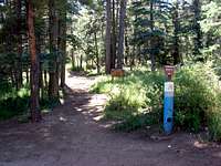
Tree Springs Trailhead
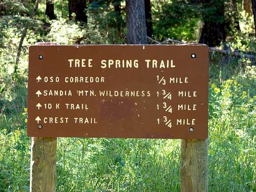
Mileage Sign
These pictures show the beginning of the Tree Springs Trail. The trail is well defined and well marked. The sign at the beginning of the trail displays fairly accurate mileages for certain trail intersections. Continue up the wide, well worn path to the first intersection with the Oso Corridor trail.
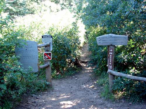
Tree Springs/Oso Trail split
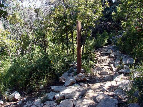
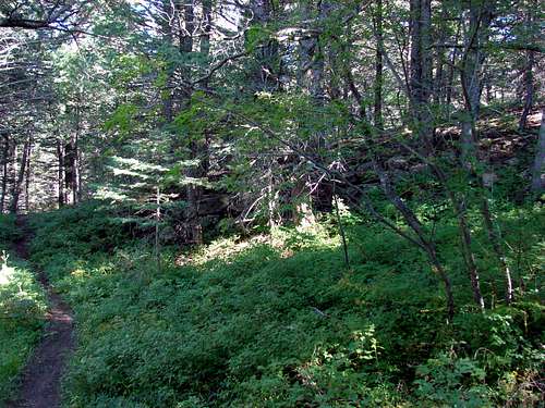
At the intersection with the Oso Corridor trail head right (southwest) uphill. The trail will continue without intersecting any other trails until you reach the Crest Trail. This trail is well shaded with a few areas with breaks in the trees offer nice views of the surrounding area. Higher up the trail switchbacks many times.
After 1.75 miles you will come to an intersection with the Crest Trail as well as the 10K trail. You will go behind the fence and go left (south). Going north will take you to the Tram. At this point the Crest Trail has some ups and downs but the majority of the climbing is done and you can enjoy an easy hike in the shade. After about a mile on the Crest Trail you will need to leave the trail and bushwhack west towards the summit. The best place to do so is after seeing this natural rock wall pictured below. The coordinates of this point are 35.1728N, 106.4122W. At this point just choose the easiest path uphill towards the summit. This is where a GPS with both coordinates would be helpful.
Tree Springs/Crest Trail intersection
Leaving the Crest Trail
Essential Gear
Typical gear for a short hike. A GPS would be helpful for the final section of route finding.
External Links
Local weather: Albuquerque
City of Albuquerque open space info: here
Local Search and Resuce Team: Cibola SAR