
-
 4712 Hits
-
 79.78% Score
-
 11 Votes
|
|
Route |
|---|---|
|
|
39.12538°N / 106.4913°W |
|
|
Download GPX » View Route on Map |
|
|
Hiking |
|
|
Spring, Summer, Fall |
|
|
A long day |
|
|
Overview
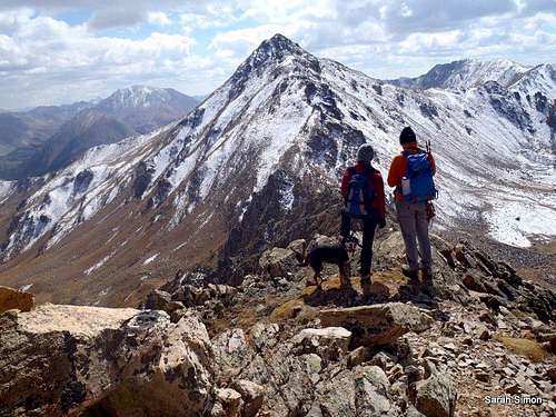
Senad & Liba chat on the descent from Frasco Benchmark (13,876 feet | 4229 meters) to Casco Peak (13,908 feet | 4239 meters).30 Sep 2012
Depending on your vehicle and your preference, this route could either be medium-short Jeep ride to the Iron Mike Mine, or a foot slog up a rough Jeep road to the mine. Once to the mine, however, the scenery is show-stopper, and the connecting ridges between the peaks are mellow enough to enjoy the scenery but a bit more interesting at points than hands-in-pockets walking. This “balloon-on-a-string” route takes in the Thirteeners: two ranked Centennials and an unranked benchmark. Go ahead - enjoy dynamite alpine scenery plus a little mining history with your 13er trio!
Note the this route would not be a good choice in unstable snow conditions due to avalanche danger from many directions.
- Roundtrip Distance: 11 miles
- Net Elevation Gain: (Cumulative quite higher)
- 3,645 feet
- YDS Class: 2+*
*During our visit, in late summer, recent snowfall ruled out the easiest passage and our line was more like Class 3 with ice.
Getting There & Maps
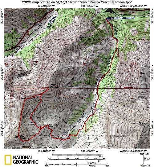
Go ahead - enjoy dynamite alpine scenery plus a little mining history with your 13er trio! | Map designed Feb 2013
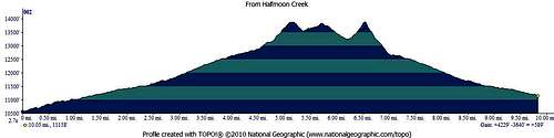
Plenty of ups and downs on this route once you leave Iron Mike Mine in the upper South Halfmoon Creek Basin.Profile designed Feb 2013
From Leadville, travel south approximately 3 miles on US Hwy 24. Turn right on Colorado 300 at the Leadville National Fish Hatchery sign. Continue about 3/4 of a mile and turn left at the Halfmoon Campground sign. Continue on Halfmoon Road (FSR 110)past the Halfmoon Campground and Elbert Creek Campground. Continue 2 miles past the Mount Massive Trailhead to a left-hand turn on FSR 110J to an unmarked (at the time of our visit) parking area. A stout 4x4 can get you across the stream crossing (in appropriate season / conditions) and could even carry you clear up the Iron
Mike Mine, if you so desire.
Notes:
- FSR 110 is not maintained in the winter.
- While 4x4 may not be strictly required in dry conditions to reach FSR 110J, it would make your life much more comfortable…in snowy or wet conditions, it would become a necessity.
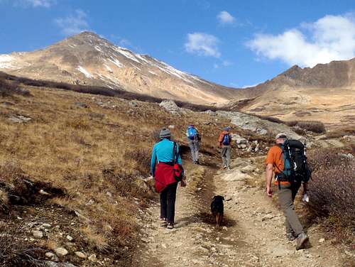 Our team makes its way up into the basin | 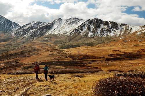 Liba hiking in the upper basin |
Route Description
Note regarding my elevation profile: Somehow, my GPS “cut off” for the last .5 miles or so of the return trip, so the ending of the route seems to cease suddenly. Obviously, this in reality the route does not
just get truncated and run into a cliff! Sorry about that!
Dutchess, Liba and Eric getting very close to the summit of French Mountain (13,940 feet | 4249 meters).30 Sep 2012
Descending French Mountain (13,940 feet | 4249 meters) toward the saddle with Frasco Benchmark (13,876 feet | 4229 meters).30 Sep 2012
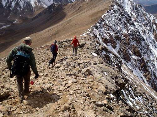
Short scramble section on the north ridge
Senad checking out the route up the North Ridge of Casco. Photo taken from the slopes of Frasco.
- From the parking area on FSR 110J just downhill from FS 110 (Halfmoon Road), head south up FSR 110J
- across a stream crossing.
- Switchback up the road through the woods first to the west, before the road trends southeast back into
- the stream bed of South Halfmoon Creek.
- About three miles from the stream crossing, the basin opens up and the road turns west to head up to
- Iron Mike Mine.
- The road then turns more steeply to the northwest to reach Iron Mike Mine.
- From here, ascend the southern slopes of French Mountain. It is possible to follow the road a bit further then run an ascending northeastern traverse across the slopes or leave the road at Iron Mike Mine and ascend the slopes directly.
- Near the saddle between Frasco and French, a use trail may appear. Follow this to the top of French Mountain.
- From French, it’s an easy approximately half-mile to Frasco Benchmark on gentle alpine tundra and rocks.
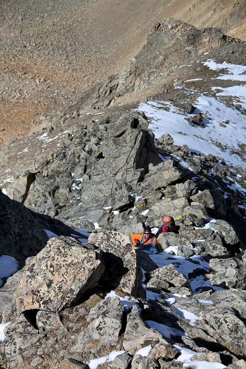
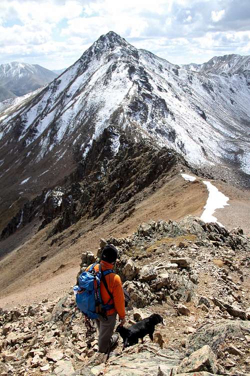
- From Frasco Benchmark to Casco Peak is less than 1 mile, but the terrain gets a bid more interesting. Both the descent down the south ridge of Frasco into the saddle and the ascent of the north ridge of Casco out of the saddle involve some loose scree and talus and navigating around small rock towers.
- The summit of Casco Peak is the rockiest, most rugged and most dramatic of the three peaks on this route – savor the time spent up there!
- From the top of Casco Peak, descend the southeast ridge roughly ¼ mile or less, then choose a reasonable spot to descend back into the upper basin toward Iron Mike Mine.
- From the Mine, regain the road and simply retrace your steps to your vehicle!
Essential Gear
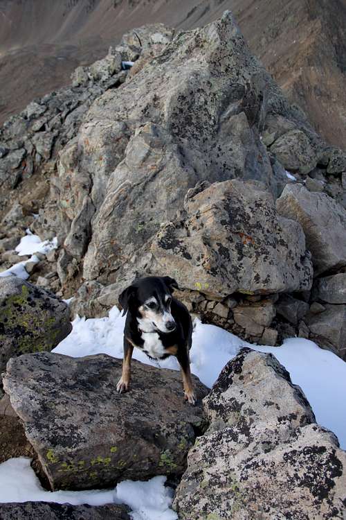
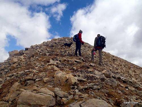
Duchess on the rocky summit of Casco Peak.
- Map & compass
- Comfortable hiking boots or shoes appropriate to
the season
- Outerwear appropriate to the season
- Snowshoes or skis for flotation in snow season,
plus an ice ax
- Water and snacks
- Wind-blocking clothing
- Sunscreen
- A camera to save memories of the high country
views
- First aid kit
- Other standard backcountry essentials
External Links
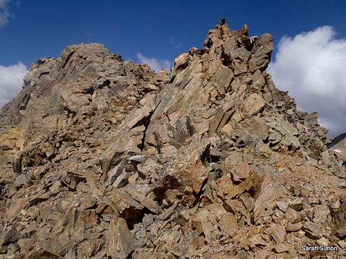
Bold and rugged outcrops along the ridge between Frasco Benchmark (13,876 feet | 4229 meters) and Casco Peak (13,908 feet feet | 4239 meters).30 Sep 2012
If you have any external links, information or trip reports you would like for me to add to this page, please let me know via Additions & Corrections. Thanks!