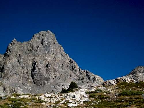
Banner Peak
So I was thumbing through a few of my Sierra Nevada routebooks looking for something fun and casual, and I came across the description for the East Corner on Banner Peak. In Secor’s book, not noted for its accuracy, the route is listed as Class 4, and was first climbed way back in 1931 by Jules Eichorn and Robert Underhill, in canvas tennis shoes, with hip belays and hemp ropes. Jules Eichorn , on route grading, wrote: “We had a kind of simplified version of a rating system. If we did not have a rope – it was class 3. If we had a rope, but did not have the right pitons – it was class 4. If we had a rope and pitons (and used them) – it was class 5.” Sounded fun and interesting, I do enjoy steep scrambling.
![]()
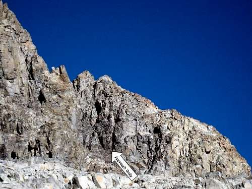
The route follows the right-hand skyline for multiple pitches
Further reading, this time in Moynier and Fiddler’s Climbing California’s High Sierra, second edition, gave a bit different picture. The route is listed there as III 5.7, and they write: “…this route has come to be respected as at least as difficult as their (Eichorn and Underhill’s) later route up the east face of Mt. Whitney.” and “This old-style ‘Class 4’ in reality offers multiple pitches of fifth class with mandatory 5.7 climbing on the overhanging headwall pitch. There are lots of fixed pieces where parties have obviously backed off. It is considerably harder and longer than something like the north ridge of Lone Pine Peak or the west ridge of Mt. Conness.” Well, I had thought that the west ridge of Conness was pretty long, but pretty casual, and easily done as a dayhike. So if this route was longer and more difficult, but still no harder than 5.7, well, it was sounding pretty good.
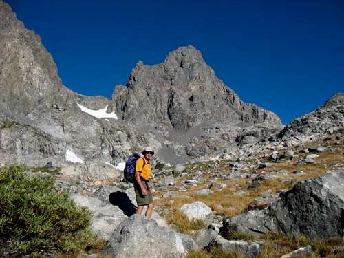
Now, I’m basically pretty lazy, and I don’t like to carry a heavy backpack out to make expeditions out of backcountry climbs, so I knew I wanted to do the route as a dayhike. I found one trip report, but they definitely hiked in and camped, and on top of that, they bivied on the route due to thunderstorms interrupting their climbing. I started asking around for a partner, but everyone I asked, when I mentioned the out-and-back in a day, well, there wasn’t a lot of interest. What I needed was someone who didn’t know any better, so I asked my co-worker David. I sent him a couple of links with info, and he thought it sounded pretty good. David is pretty much fit, but he doesn’t have a lot of climbing experience, nor a lot of cross-country travel experience, but I figured that’s the reason he agreed in the first place, so I could live with that. Plus, I’d get to lead all of the pitches, which is definitely a bonus.
We agreed to meet just outside Mammoth Lakes, we’re both Eastside locals, David lives in Paradise, between Bishop and Crowley, and I live in beautiful metropolitan Bridgeport, home of outrageous fuel prices. Please don’t ever buy fuel here, both fuel stations are owned by the same shyster, and I hate to have his gouging supported.
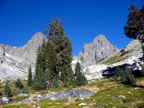
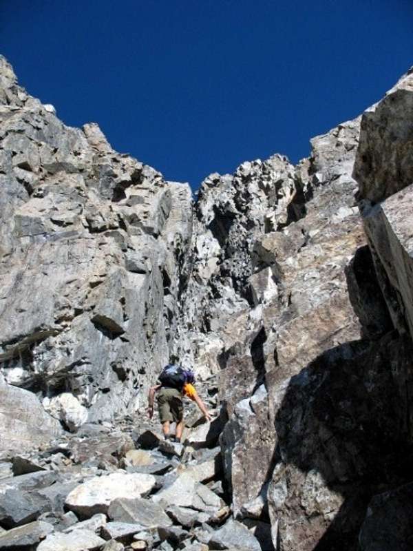
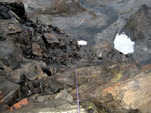
The outing started inauspiciously when I set my alarm incorrectly, and woke up 15 minutes before I was supposed to be there, but I jumped up, piled in the truck, and headed south. Even though I may have exceeded the legal speed limit by a fair margin, I was still 45 minutes late, and we didn’t leave the Agnew Meadows trailhead until 0615. We made good time up the trail, hitting Ediza Lake about 2 hours into it, and catching the use trail up toward the Ritter-Banner Saddle shortly thereafter. We left the use trail just past Nydiver Lakes,
![]()
Cross-country travel to the base of the route
![]()
The author enroute to the approach gully
and scrambled up slabs in an attempt to avoid a bunch of crappy loose talus.
![]()
We kept to the slabs as much as possible to avoid talus scrambling
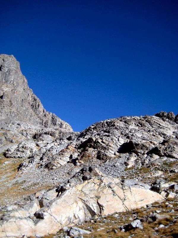
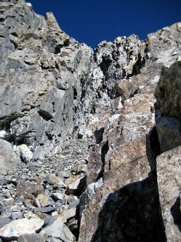
The route description says to scramble up a steep chute
![]()
between Banner and Peak 11,440 to gain the ridge. The chute was steep, and about halfway up there is a chimney with a big chockstone lodged in it.
![]()
Entering the chute/gully
![]()
David heading up into the approach gully
![]()
Checking out the approach gully
The moves around it looked fairly easy, but the start is in an exposed and precarious position, so being the soft climber that I am, I elected to rope up for the moves. The moves were easy, and I didn’t fall, and so didn’t need to get the rope out, but I just don’t free-solo much, and rarely on unknown terrain, so I guess it was worth it. And besides, I had to watch out for David, he’ll try almost anything, and his wife would be really mad at me if I let him get killed. After those few moves, we put the rope back in the pack and continued up.
![]()
Almost to the start of the route.
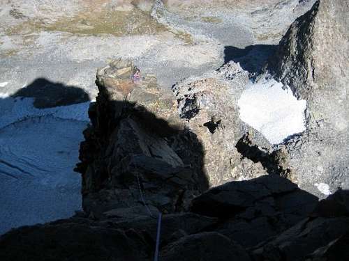
The rest of the chute was loose and steep, and third class, even by Eichorn’s standards. We gained the shoulder of the ridge, and roped up for the pitch to mount the ridge itself. There was a fixed pin at a steep section on this pitch, and I clipped it even though it was of doubtful quality.
![]()
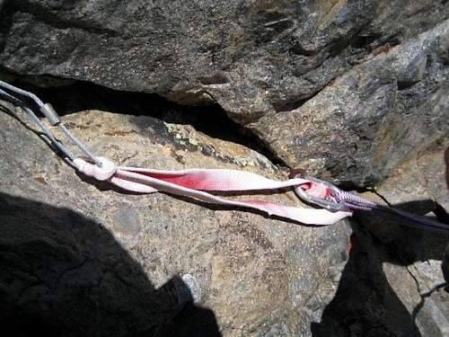
The old fixed pan and other tat. Who is so enamored of a $5 ‘biner that they girth hitch a wire with a sling?
![]()
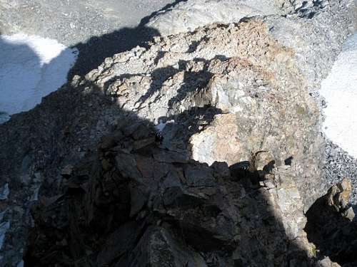
Looking down from partway up the first ‘formal’ pitch
![]()
David following the first pitch
Once on the ridge, it was more similar to the Sunshine-Peewee (East Buttress) route than the East Face that it was compared to.
![]()
Following the ridgeline up
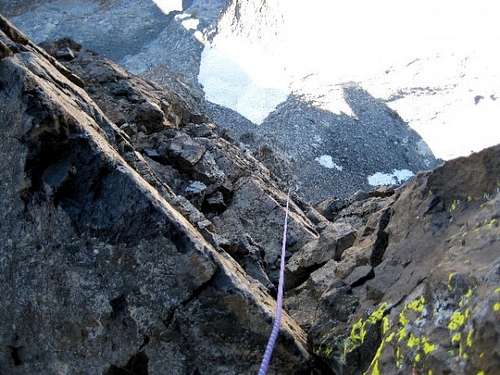
The ‘corner’ is actually a narrow ridge or arête with lots of flat spots where the ridge top had toppled off, interspersed with steep towers along the ridgeline that we mostly clambered over.
![]()
And up
Some of the towers were so steep that the first ascentionists found it necessary to traverse out and around. There were three notable spots for these traverses. When we arrived at the first (I didn’t realize right away where the route went), I looked over to the right and saw a very old and tattered sling hanging and flapping in the breeze, and I first thought that it must be a bail anchor. But after looking around a bit more, I saw a piece of old cord hanging out of a crack, but disbelief suspended logic for me. You see, if I went right, I would be stepping out into a situation of tremendous exposure, and I’m deathly afraid of heights.
You’re probably wondering why would I be climbing if I’m afraid of heights, but climbing is actually my therapy, I’m way better about heights and exposure than I used to be. But I still didn’t like the look of the traverse. So I went left, where it didn’t look so scary. I messed around for a while, until I determined that my variation wasn’t going to go with my skill level, and I backtracked and reconsidered the traverse right. I could see the moves, after all they couldn’t be any harder than 5.7, there and no sandbag routes in the Sierra, particularly none that are rated class 4 (a very common rating for the ‘old-skool’ climbers, who were so far ahead of me that I couldn’t even carry their lunchboxes).
I eased out over the abyss, and it was a really a scary spot for me as the moves are on a section of rock that is undercut, so if you fall, you will be hanging below the rock, suspended in midair. I know, a nice safe fall, but in addition to not liking heights, I don’t like to fall either. So I plugged in gear about every 2 feet along the traverse, as well as clipping the rusty old fixed pin (you know, I was looking after my second), and slimed over to the last lateral move, a long reach out to the edge of the arête over a whole bunch of air. It took me 3 or 4 aborted efforts before I committed, and it didn’t turn out to be really all that bad.
![]()
And up some more
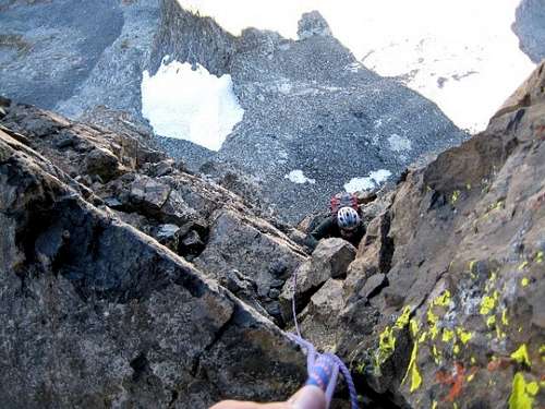
We plugged along up the narrow spine, and the climbing was mostly fun and casual until the next traverse, also to the right, also exposed, and again protected with an old fixed pin (which really wasn’t fixed too well, it wiggled like a rotten tooth). The holds were more positive here, but the wall above the traverse was way steep, but with nice positive holds. Once past the right traverse, the route traverses up and left back to the crest of the ridge.
![]()
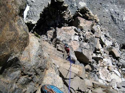
There were lots of steep sections
It was getting to be late afternoon, and D-Rod was asking if the route was ever going to end.
![]()
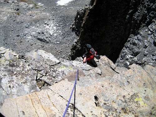
David following some of the steep stuff
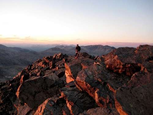
We were in the shade, it was chilly, and we were watching Banner’s shadow grow longer and longer, covering Garnet Lake, then the Nydiver Lakes, then the Long Valley Caldera, and finally the shadow reached all the way to the Whites. I was definitely hoping to get to the top and then down below the Ritter-Banner Saddle before dark so we could negotiate the steep snow gully off of the saddle.
![]()
The sun is getting low as we approach the summit
We expedited our progress as the angle and difficulty eased off (eased off? You mean it got even easier than 5.7?), and we climbed back into the sunlight just before it went away for the night.
![]()
The sun was going away quickly as we summited
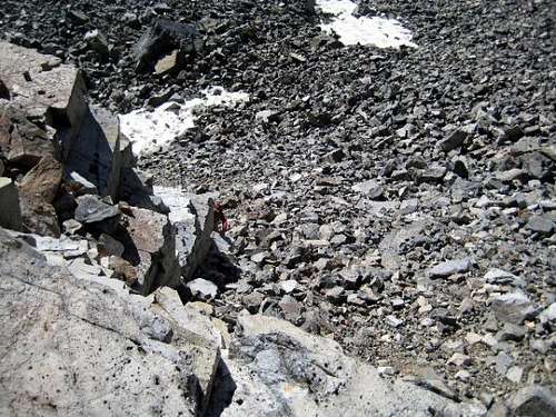
We hurried down to the saddle, and the snow in the descent chute was rock-hard and steep. I would say that we neglected to bring axe and crampons, but it was a conscious decision not to. We were hoping that between the afternoon sun softening the snow for step-kicking, and the fact that it was such a low-snow year that we would be able to find a way to scramble down without ice stuff. No such luck. By now we were a bit tired, and so made the fateful decision to go down the other side of the saddle to Lake Catherine, and hopefully over the pass down to Thousand Island Lake to catch the PCT near the outlet of the lake. We did descend down to the lake, and tried to navigate over to the pass, but we kept cliffing out in the dark. We had headlamps, because if I bring a headlamp, I usually don’t need it, sort of like dayhike insurance, but tonight we needed them. Even so, the route was not well illuminated by the 2 feeble beams.
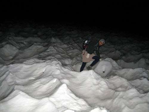
While sitting and considering our options, we had an epiphany, one that we should have had before we descended those extra thousand feet of vertical. You know, we’ve got a rope with us, maybe we should have considered rapping that snow gully? Yeah, maybe so. We regained that thousand feet, climbed into the moat on the skier’s left, and started a new descent. Pretty quickly the moat became impassable, and we set our first rap off a rock horn, and rapped down 30 meters to a stance. There was a block frozen in the ice, and the tip was sticking out for a pretty good sling anchor, so we slung it and rapped another half-rope. The stance there had a perfect rock horn to sling, but the next stance wasn’t so nice. We searched around for a bit but could only find one stopper placement. It seemed secure, and it retrospect it was. We made one more rap off of a single stopper, and finally the angle eased up enough to venture out into the frozen sun cups.
![]()
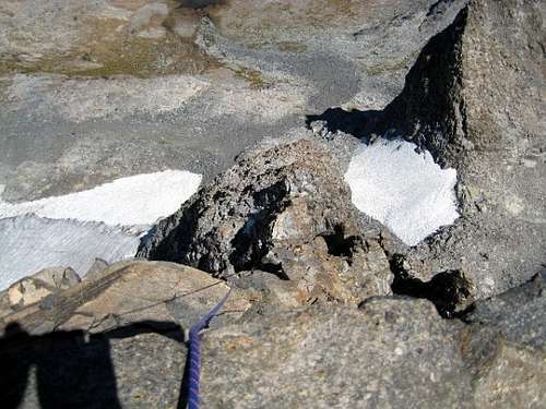
Navigating the rock-hard frozen suncups @ 2 am
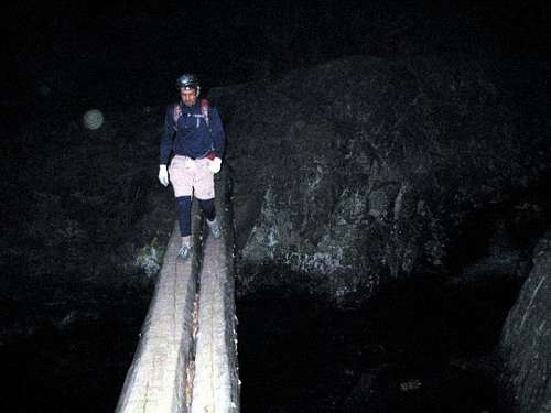
We were soon off the snow, and stumbling down a seemingly endless gully/field of loose, junky, talus by ever weakening headlamp beams. Finally got to the tarn at the base of the Southeast Face of Ritter, and joined the use trail to Ediza Lake. One more bit of talus getting around the lake to the stream crossing, and we were on the trail.
![]()
Finally on the trail!
It was about 0430 by now, and all we had left was the slog out, which seemed endless, but wasn’t really all too bad. Next time, we’ll leave earlier!


Comments
Post a Comment