Rain was lashing against the windscreen. It was not supposed to be like that, yesterday’s forecast was not that bad.
I was driving west in a rented Suzuki Jimny along the main Cretan coastal road, having left Hersonissos half an hour before. It was 4am. Weather and time permitting, I was planning to climb the two highest mountains of the island in a day. Their altitude difference is only 3 metres but they sit in two different ranges, separated by a few hours’ drive. In both cases I wanted to drive as high up the rough mountain roads as possible to save time, that’s why I rented a 4x4. With good visibility I could descend from
Psiloritis in the dark with my headlamp, it was a well-maintained, marked trail after all. Weather and time permitting. The reason of all this madness was that I wanted to spend the rest of our short holiday with my girlfriend who is not very fond of mountains. She did not want me to go, rightly saying that was too much, that I should not go alone into this back of beyond etc. But one can't discuss with a cretin.
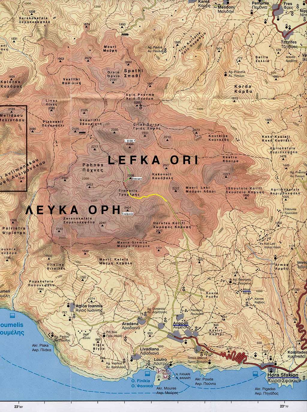
Behind Hania I turned south into the winding road leading to Hora Sfakion at the south coast. Occassional showers were still passing and higher up the mountain I drove into clouds. Until now a reader who knows Crete a bit and has a map at hand will know that my first goal was Pachnes (2453 m) – the second highest point of Crete, in
Lefka Ori, the White Mountains.
It was still pitch dark when I came to the Anopoli village, 600 m up from Hora Sfakion. At this time of year there was still about an hour left before daylight. I stopped to pick a local shepherd who was going somewhere up the road.
Polonia, good! – that were the only non-Greek words he knew, when I said the name of my country, pointing at myself. With me speaking no Greek at all, our conversation was limited to the words ‘Pachnes’, ‘Lefka Ori’ and ‘Mouri’, the latter being the hamlet where he was going, a bit to the right from my direction. He led me through two or three forks in the road, which became unsurfaced soon. A few km further up he asked me to pull in at the fork where a road to Mouri was turning right. We waited inside the car a couple minutes until the heavy rain was over. Pachnes? – once again I pointed up the other road. He confirmed. By that time I learned that
ne, against all my Slavic intuition, means ‘yes’. He also tried to explain something to me about my further way up but I had no clue what he was on about. He was waiting for someone to pick him in a car, as far as I understood. Or maybe he wanted to walk, I had no idea.
Efcharisto! – he thanked me before he left. It was 7am and the first light of day was breaking shyly through dense clouds.
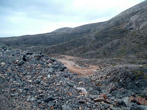
So here I was in the middle of nowhere, at the most remote place of Crete, alone with my own thoughts. The road was rough, it was a good choice to rent a 4x4. In an ordinary car, if passable at all, that 19 km of gravel would take most of the day. In places it was perhaps worse than
the road in Albanian mountains that I negotiated in my Škoda Felicia a year before. Still, behind the wheel of a 4x4 for the first time in my life, I was driving very slowly. The weather was gradually improving and the clouds went up quite a lot.
![]()
So here I was… |
| ![]()
…in the middle of nowhere… |
| ![]()
End of the road |
|
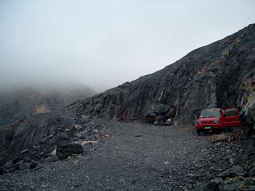
At 8.45am I reached a place with a wire net across the road, but it was open just enough to let a car through, so I drove on. Just a bit higher up, however, the road ended. According to my maps I was somewhere between 2000 and 2100 m a.s.l.
My maps... they were a whole different ball game. I had found one quite detailed 1:79000 on the Internet but then I bought two different 1:100000s that seemed to have similar details so I did not bother to print that first one. Those two maps had differences in showing the course of the gravel road and its position towards the mountains around. I relied more on the one that seemed more accurate.
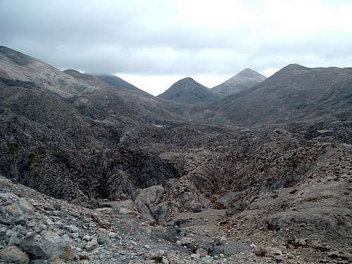
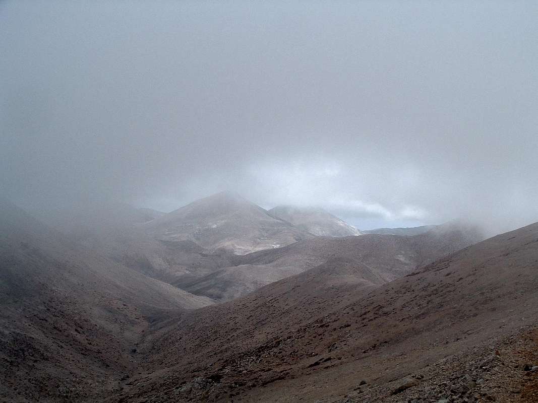
![]()
Lefka Ori moonscape |
| The landscape or rather moonscape around was quite impressive. Even with clouds beginning just above me and hiding all the peaks. I had a big breakfast, packed up and left the car. The air was cold but at least it was not raining.
At the beginning there was hardly any path visible, although according to the map the path should be a natural extension of the road. By the same map, the two summits of Troharis (2402 m) should be to my right. Maybe try that one later, now the destination was Pachnes. I scrambled the black rocks slightly to my right and saw a patch of red paint on a stone. So it was marked! That made my task a lot easier in that fog, although the marks were sometimes far apart and needed a good look around to find them. After a while I reached a col. There was a battered metal arrow pointing left, with ‘Pachnes’ scratched on it. One path was leading further north, while the other was going in the direction shown by the arrow. The latter was not marked on my map. | ![]()
Into the fog… |
|
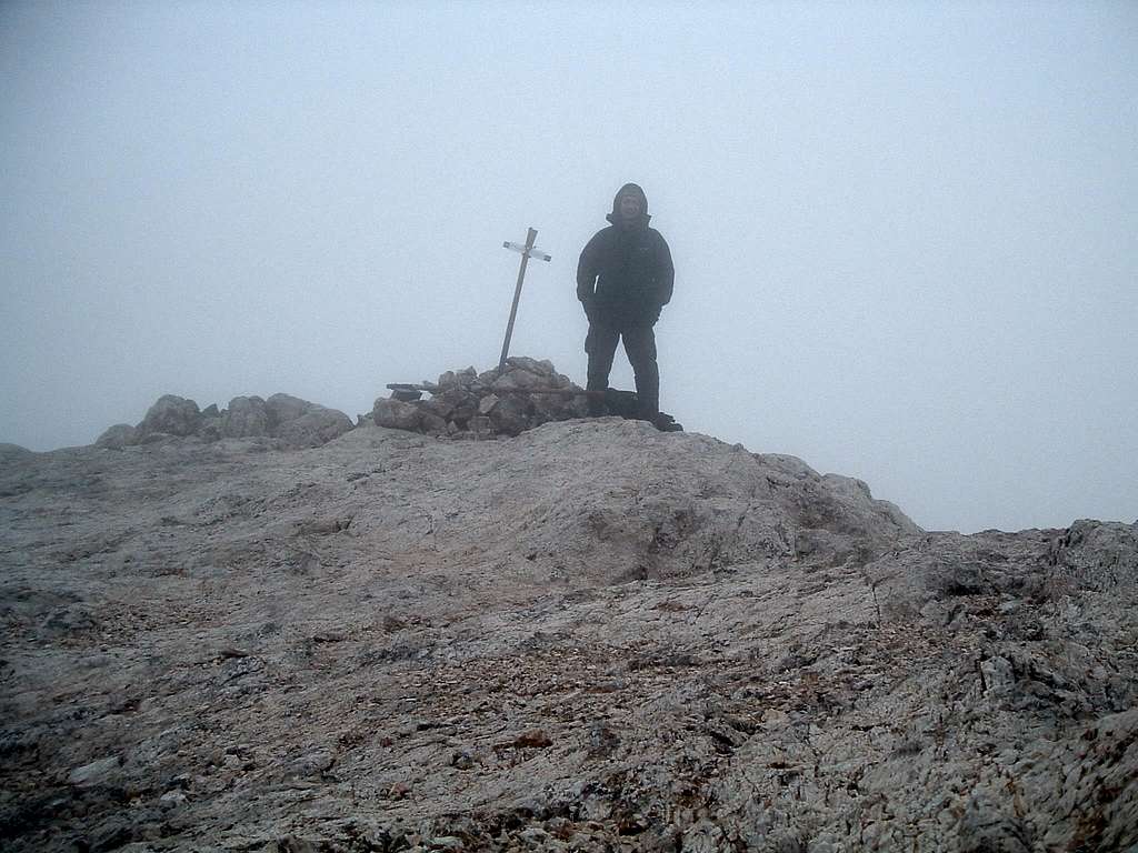
Soon I entered a cloud and could see no further than 10-15 m ahead. There were no red marks anymore but the path was well visible and sometimes marked with cairns. It was winding up and down the hills for a longer time than I expected from the map. By my feeling and my compass it seemed to be circling the mountain from the north. There were a few steeper thresholds, otherwise it was just an easy walk. Once or twice I was tempted to climb left up the ridge, thinking the path may be bypassing the summit. But I decided to stick to the cairned path and was rewarded. After the last steeper climb, at 10.30am through the fog I saw the summit cairn with a cross. The scenery was like from a ghost story.
![]()
Ghost of the White Mountains |
The strong wind made me put all my warm clothes on. I had some chocolate and water with fizzy tablets. With a self-timer I took a few shots of myself, hoping at least one would be decent. There was a steel box with a summit register in. There were not too many entries from recent weeks. I wrote my entry, saying hi to the whole Summitpost.
Half an hour later I started retracing my steps down the path. Once the clouds broke, showing an odd patch of blue sky, but not for long. When I was back at the col with an arrow, all the mountains were again hidden in an even thicker fog. I decided to go to the peak that should be Troharis. At that point I knew it probably did not make much sense to push myself to drive to Psiloritis, not to mention climbing its top, if the weather remained like that.
![]()
…the clouds broke… |
Going straight up the steep slope, after less than half an hour I was on top of what should be the Troharis lower summit, with a small cairn. Visibility was close to zero. I followed a ridge more or less to the north where the higher summit should be less than 1 km away. But the ridge was going only down for a long time so I returned. On the other side the slopes looked identical in all directions so I used the compass to find my way back to the col.
Only a few days later, when I bought a better 1:25000 map in Matala, I realised I had climbed Sternes (2336 m) instead, which is 2 km north from Troharis. The ‘more accurate’ of my two maps was just showing the end of the road to be in a completely different place!
![]()
I did it my way :) |
According to that new map, from the summit of Sternes I unknowingly roamed towards what is described as ‘Probably the most eerie and forbidding area in the whole massif. A ‘moonscape’ of black, gray and red rocks heavily eroded and impassable.’ Only the clouds did not let me see any of it...
I walked down the red-marked path and left it where I thought I should reach the car. When the fog broke a little, I realised I went too far down when I saw my red car a bit higher up. A few days later I would know the end of the road was at 2050 m a.s.l.
It started raining. I chowed down two bananas and some chocolate and started my long drive back. Soon I saw three blokes walking up the road, looking quite miserable in the rain. They were from Hania and were going to climb Pachnes. All spoke good English. They already thought of backing off and my question ‘Shall I give you a lift?’ only helped them make a right decision. It was too late, the weather was minging and they had a hangover from drinking
raki until 3am. The time when I woke up to start my trip, as we noticed, laughing.
Their car was parked a few km below. So they made an effort to drive an ordinary car up that rough gravel, a bit at least. My previous year’s Albania sprang to my mind again.
When I was driving down to Anopoli and then Hora Sfakion, the showers got heavier. Yeah, it would take not just an ordinary cretin but an utter fool to go to Psiloritis in this rain, especially with the prospect of walking down after dark. I texted Agnieszka to ask if it was raining in Hersonissos too. ‘Just started to drizzle a little’ was her answer.
Having plenty of time I decided to take a more scenic road via Asi Gonia. When I was already on that road, the wet hell broke loose. For several hours I was driving up and down a winding road into a never-ending, dense curtain of water. It was good to have the 4-wheel drive in those conditions. The next day we would see in the evening news that a massive wave of downpour and thunderstorms left significant damage all across Greece. When I finally hit the coastal road I was so knackered that I had to stop at a lean-to for a half an hour’s kip.
I still had more than 100 km to Hersonissos along the coastal road. Soon it got dark and the rain became even heavier. The traffic was heavy and the locals were driving like crazy. Back in the hotel I only managed to grab a quick beer and I went to sleep.
The cretin’s plan worked only halfway. A glass can be half-empty or half-full, depending on the point of view. I was well jammy to climb one mountain before the rain.
Efcharisto, Pachnes!


Comments
Post a Comment