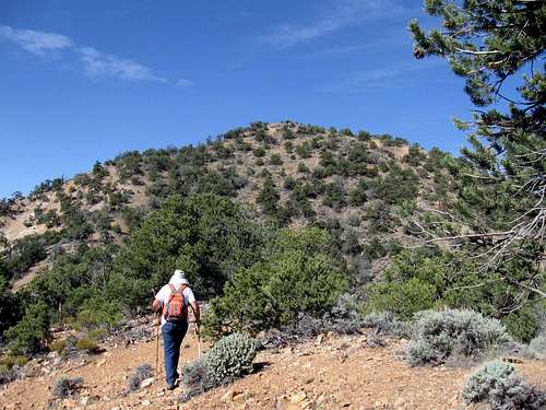
![End of the road]() Start of the hike
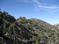
Start of the hike![Viewscape]() View north during hike
View north during hikeDay Three of our peakbagging week
With Mount Hillers done and Mt. Holmes put to rest the day before, we had plans to go hike Mount Ellsworth to make it three days in a row in the Henry Mountain range. We needed to get an early start as Andy and I also planned to make the day a twofer which would require a fairly long drive to get to Lands End, another prominence peak located in Canyonlands National Park. I had been out to Lands End before but Andy had not so for once on the trip, I could lead the way but more on that in a bit. First, we had Mount Ellsworth to deal with. I had read descriptions of how to summit this mountain in
Mike Kelsey's fine book that is centered on the Henry Mountains and would recommend it to
those who are curious about this area or intent to explore it. However, the best help I found was a trip report posted by another summitpost member, Eric Willhite, on his website that provides information about many of Utah's peaks, along with photos and maps. A link to Eric's trip report is provided in the section below
Mt. Ellsworth
After another fine night in the Starr Spring Campground, our third, we left at first light to find our way to the trailhead of Mt. Ellsworth. In following the directions we had, we overshot the 4WD road located off of highway 276 but found it when we turned around and headed back north. The 4WD road isn't real distinct at where it begins off of the highway but it is quite obvious as it ascends up from the road a bit. For those without high clearance and 4WD, they would do well to park just off the highway as the 4WD road gets rough and rocky in a hurry. Eric Willhite had described it well in
his nice page for Mt. Ellsworth:
"Follow Hwy 276 to milepost 20 where a 4WD road takes a left. This road is just after a road cut and is very hard to see traveling southbound. The first few sections of uphill are the worst as it climbs above the roadway but you can drive it for 1.5 miles to its end. "
I managed to drive right to the very end of this rocky track in my Tacoma
but I did so carefully. Just before where the jeep track ends, there is a place where you can turn around and find parking. I also noted a fire ring
indicating that others have camped at this spot.
Once we parked, Andy and I pulled out the sheet of info that I had copied from Eric's trip report page which read as follows:
"From the end of the road, follow a faint trail (on the left side) down to the lowest point. A climbers trail crosses a few bumps and then begins the climb up. Not too far up is probably the hardest part of the climb as a few slabs of rock must be climbed around. The first I found a fairly easy route around the right side, than traversed above it on a east/west ridge. This ridge goes east several hundred feet before you begin climbing again. Not far above here is the second slab that most climbers cross (based on cairns and the climbers trail). Once over, it’s a scramble to the summit ridge below some big cliffs.
Although this route is fairly straightforward going up, one should take note of landmarks because the way down could confuse you if you are not paying attention. On the summit ridge, you’ll climb up and over several bumps before the final climb comes into view. In most places, a trail will help lead you. The final climb is easy enough before you are on a summit with a small radio facility."
Eric's info was really helpful although we found a few cairns that helped us on our way upward. The key was paying attention so that we would hit the same route on our way down and I placed a few cairns myself to aid in that effort as well as keep my GPS on full time to provide a "bread crumb" trail
on the route down which was also helpful. Andy and I found it important to go as high on the ridgeline as we could before crossing a talus field that led us to the final ridge that went up to the summit area.
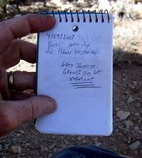
On reaching the top, we found the small radio facility that Eric mentioned and a register nearby. One entry indicated that the radio facility is serviced by helicopter and provides communication capability for much of this area of Utah, with emphasis on the Lake Powell area. We found a couple witness benchmarks but not the main central one. It is probable that the little building was built on top of the central benchmark. A large metal boxlike container was also nearby but what really made our visit worthwhile were the views. Despite the haze, we had nice views of Lake Powell, Navajo Mountain to the south and Mt. Holmes and the rest of the Henry mountains to the north.
After our leisurely lunch on the summit and picture taking, it was time for Andy and I to head down. Both Andy and I had paid attention to our route up and found that we had no problems on our route down. Back at the truck,
we were amazed to realize that the round trip to the summit and back was right around three miles. However, we gained close to 2000 feet and for some reason, it seemed longer. We had used up about five hours for the round trip and had spent 45 minutes on the summit. I'm sure that faster hikers could easily cut an hour off of our time if they were so inclined.
I know that most likely I'll be making a return trip to this mountain since I have a son in law that is keenly interested in visiting the summit of Mt. Ellsworth. I also believe that Kadee is another one who would like to join with us when we do make that effort since Mt. Ellsworth is the only one of the five major peaks of the Henry's that she hasn't visited.
On to Land's End
Lands End
Our next objective was to visit Land's End. This was a good drive away and here it is, the
Land's End trip report.
Our hiking agenda
Day one -
Mt. Hillers
Day two -
Mt. Holmes
Day three -
Lands End (as well as Mt. Ellsworth)
Day four -
San Rafael Knob
Day five -Mt. Elliot
Could you combine Mt. Hillers and Mt. Ellsworth on the same day? My answer to that would be yes. Start early on Hillers and you could get both in the same
day. Could you combine Mt. Hillers and Mt. Holmes? I wouldn't but faster hikers most likely could. Could you combine Mt. Holmes and Mt. Ellsworth? I would answer yes to that one but again, you'd need to start early. I think my choice would be to do Mt. Ellsworth first since you could conceivably camp at the end of the jeep road
as others have done. But, personally, I'd recommend a day for each and the campground at Starr Springs as your basecamp. You could also include Mt. Pennell and Mt. Ellen by allowing a week to thoroughly enjoy the Henry mountain range.
For more pics of this hike, see the images at the left.


Comments
Post a Comment