
-
 12138 Hits
-
 89.01% Score
-
 28 Votes
|
|
Route |
|---|---|
|
|
34.46498°N / 119.71259°W |
|
|
Hiking |
|
|
Spring, Summer, Fall, Winter |
|
|
Half a day |
|
|
class 1 |
|
|
Overview
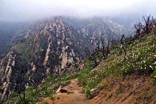 Section of the trail with Arlington Peak in the background.
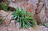
 Canyon Sunflowers
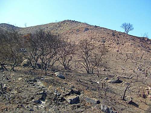 Charred Hillsides after the wildfires of 2009
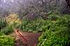
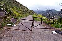 Start of the hike
There are a number of trails that connect the city of Santa Barbara to Camino Cielo Road. Tunnel Trail, more or less, follows Mission Canyon, one of the several canyons in the Santa Ynez mountains. Other canyons in this range include Romero Canyon, Cold Springs Canyon, San Ysidro Canyon and Rattlesnake Canyon. Mission Canyon is the westernmost major canyon of the group.
Although Tunnel Trail is not one of the most enjoyable trails in Santa Barbara, never the less, it's one of the most popular. Except for the start of the hike when you cross over Mission Creek, there are no more creek crossings. The trail used to stay in the shade of the trees and heavy brush for the good part of the morning hours. After massive fires of 2009 in which all of the vegetation was burnt, the trail now is entirely in the sun. This may make the trail a desirable one for the cooler winter months, but it's easy to imagine that it will be scorching hot during the summer months.
For several months after the fires that burnt this section of the Santa Ynez mountains from bottom to top, the trail was closed to the public. Several small volunteer groups were allowed to enter the area to deal with the ash and improve the trail. More professional work was done to sure up the hillsides and natural drainages. My wife and I had hiked Tunnel Trail countless times before the wildfires but had never seen what the surrounding area really looked like. Before the fires it was like hiking in a tunnel of vegetation. But now, April of 2010, the entire hillside is open to the view and it's brimming with wildflowers. The hiking experience on Tunnel Trail has become something to behold.
Route Description

 End of the paved road
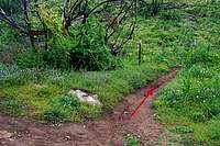 Start of Tunnel Trail proper
 Service Road/ Power Lines
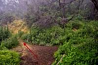 Hairpin Turn/Connector trail to Rattlesnake Canyon
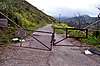
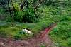
Start your hike at the very end of Tunnel Road by a locked gate. You need to park your car a few hundred yards before this gate. Pass the gate on the left and walk about three quarter of a mile on paved road and cross Mission Creek on a bridge. There are no more creek crossings from this point on. Continue to the end of paved road to where it turns into dirt and intersects a service road from the right. Stay on the left fork as indicated by a green Forest Service sign. In about two hundred yards you come to the actual start of Tunnel trail marked by an old rusty trail sign. This is a narrow trail to your right and it may be easy to miss.
Your next landmark on Tunnel Trail is in about one and a quarter of mile from the locked gate. This is where you are next to some power lines and a service road. Go straight up the hill crossing the service road. After two and a half miles you will come to the Connector Trail to Rattlesnake Canyon. The are two wooden signs here. To reach Camino Cielo Road you need to stay on the main trail that veers to the left. Continue for another one half of a mile to a dry waterfall. This waterfall is very impressive after a long and hard rain, but it's barely wet for the rest of the year. Shortly before reaching the waterfall the trail makes a sharp turn to the right following the creek bed for a short time. It's only another mile to Camino Cielo Road.
How to get there:
From US Highway 101 in Santa Barbara take the Mission Street off ramp and turn right at the light. Continue on Mission street passing in front of the mission building to a stop sign at the intersection with Foothill Road. Turn right onto Foothill Road and left onto Tunnel Road. You will come to a fork. Take the left fork and drive all the way to the end. You can park on the right hand side of the road within the white lines. Additional parking may be found before the end of the road. Please do not park in the side streets. They are all private roads.
Trail details
| Benchmark | Tunnel Trail to Camino Cielo coordinates | elevation | Distance from trailhead |
 Trailhead Trailhead | N 34.46498--------W 119.71259 | 1002 ft | 0 |
 Tunnel Trail Tunnel Trail | N 34.47059-------- W 119.70688 | 1280 ft | .85 mile |
 Take the left fork Take the left fork | N 34.47242--------W119.70295 | 1650 ft | 1.5 miles |
 Rattlesnake Canyon connector trail Rattlesnake Canyon connector trail | N 34.47828--------W119.6972 | 2494ft | 2.5 miles |
 Dry Waterfall Dry Waterfall | N 34.48463--------W119.70001 | 2670 ft | 3 miles |
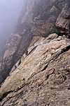
| Camino Cielo Road/ Too Foggy for a photo | N 34.49382--------W119.70557 | 3450ft | 4.5 miles |
Essential Gear
A good pair of hiking boots. During the summer months take plenty of water.Fees, permits, camping
 Looking west from the top of Camino Cielo.
Fortunately there are no fees or permit requirements to hike in the hills of Santa Barbara.
Unfortunately, there are no campgrounds close and convenient to Santa Barbara.
There is, however, one very large and well developed campground at Cachuma Lake, and a few less developed ones along Paradise Road off Highway 154. There are also a few campgrounds along Highway 101 at El Capitan State Park and Refugio State Park.
El Capitan Beach Camping
Refugio State Beach Camping
Cachuma Lake