Page Type Page Type: Mountain/Rock
Location Lat/Lon: 47.90284°N / 123.1486°W
Additional Information County: Clallam
Additional Information Elevation: 6364 ft / 1940 m
Sign the Climber's Log

Overview

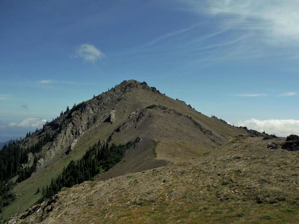
The final summit ridge to Tyler Peak


Tyler Peak located in the Northeast tip of the Olympics is great starter peak for anyone interest in hiking and climbing summits in the Olympics. It is an official summit in that the peak does have 443 feet of prominence. Unlike many of the Olympic Mountains this peak is a relatively easy summit to do in a half day and it is mostly just a hiking summit. In terms of popularity Tyler Peak is often overshadowed by other mountains in the region such as Hurricane Hill, Mount Angeles and even it neighbor Baldy 1 3/4 a mile to the south of Tyler. The direct trail to the summit actually completely disappears once above timberline, though it is not very hard to navigate to the summit trail which goes directly to the summit with some minor scrambling through the last set of rocks to summit (low Class 2). 


Grey Wolf, and Baldy
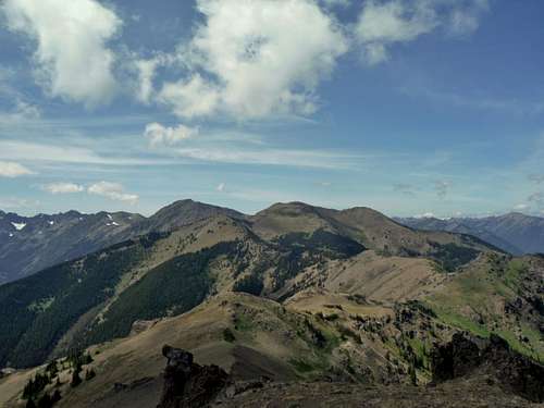
Gray Wolf Ridge and Baldy from Tyler Peak
The view toward Maynard from the summit of Tyler Peak
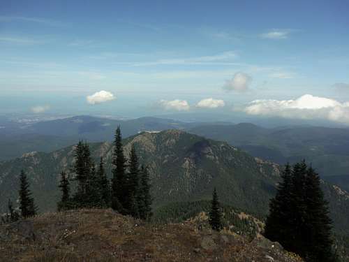
Maynard from Tyler Peak


Don't let the lack of popularity deter you. Tyler Peak is right on the northeastern side of the Olympics. This means that the peak is on the lee side of the wind and is located right in the rain shadow. Snow hear melts much quicker than other parts of the Olympics and Tyler along with neighboring Baldy tend to be free of snow by July when many other peaks carry snow clear into August and September. In July and August the slopes of this mountain above timberline are covered in wildflowers adding to scenery even when it is cloudy on the summit. The only drwback to this mountain is that if there is a north wind off of the Straight of Juca de Fuca fog can form on this high peak. JordanH and I hit this summit in perfect sunshine and had every goal of hitting closeby Peak B on the way back but a whiteout prevented us from combining the two on this trip. 


JordanH hanging on the rock
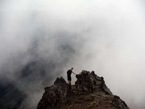
JordanH as the fog was rolling in on the summit
Looking west toward Mount Angeles and Unicorn
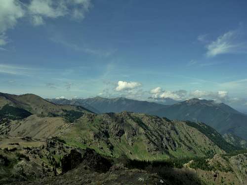
Looking west from the summit of Tyler


View from the summit are panoramic and very beautiful. Many of the northeastern Olympic Mountains including, Baldy, Grey Wolf Ridge, Maynard, Townsend, Deception and Constance along with the city of Sequim and Port Angeles can be seen from Tyler Peak making it a great destination. Tyler Peak is often combined with Peak B and Baldy to make a full day trip. Some even add Grey Wolf and other peaks to make this a multiple day summit trip. The beauty of this region cannot be denied. 

Tyler Peak from Sequim
Tyler Peak from Sequim in Spring (photo from OlympicMtnBoy)

Getting There

VIA THE TYLER AND BALDY TRAILHEAD: From US 101 head south on Louella Road located 3 miles southeast of the town of Sequim. Make a left on Palo Alto Road and proceed for another 6 miles. Make a right at the junction at the sign pointing to Forest road 28 to the left. The road heads down steeply and crosses Dungeness River. One mile past the bring merge left onto FR 2870 and continue to follow signs for 2870, bearing right at the next fork in 2.6 miles. Stay on the road for 5 miles then on another V intersection with a sign marking 2870 to the left make a right. The road is not marked and is rough in places. This will take you in 1.5 miles an overgrown parking area and a dirt barrier. At the dirt barrier pick the trail that goes directly uphill if you are trying to summit Tyler Mountain.

Route

Tyler Peak Trail
8 miles 
3000 feet of elevation gain. 

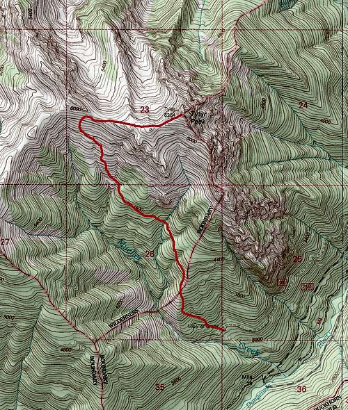
Map of the direct route up Tyler Peak


The trail from the parking area up to Tyler Peak is a primitive one. It is very steep in places and footing on section of the trail can be quiet tough. The trail itself is known to be an unofficial trail. All the way up to timberline this trail is very easy to follow. Once beyond timberline though the slowly disappears and one must travel through the alpine field up to the ridge in order to reconnect with another trail. Once on that trail make a right and follow this trail all the way to the summit. The final section to the summit does have some minor scrambling but most can walk it to the summit. 

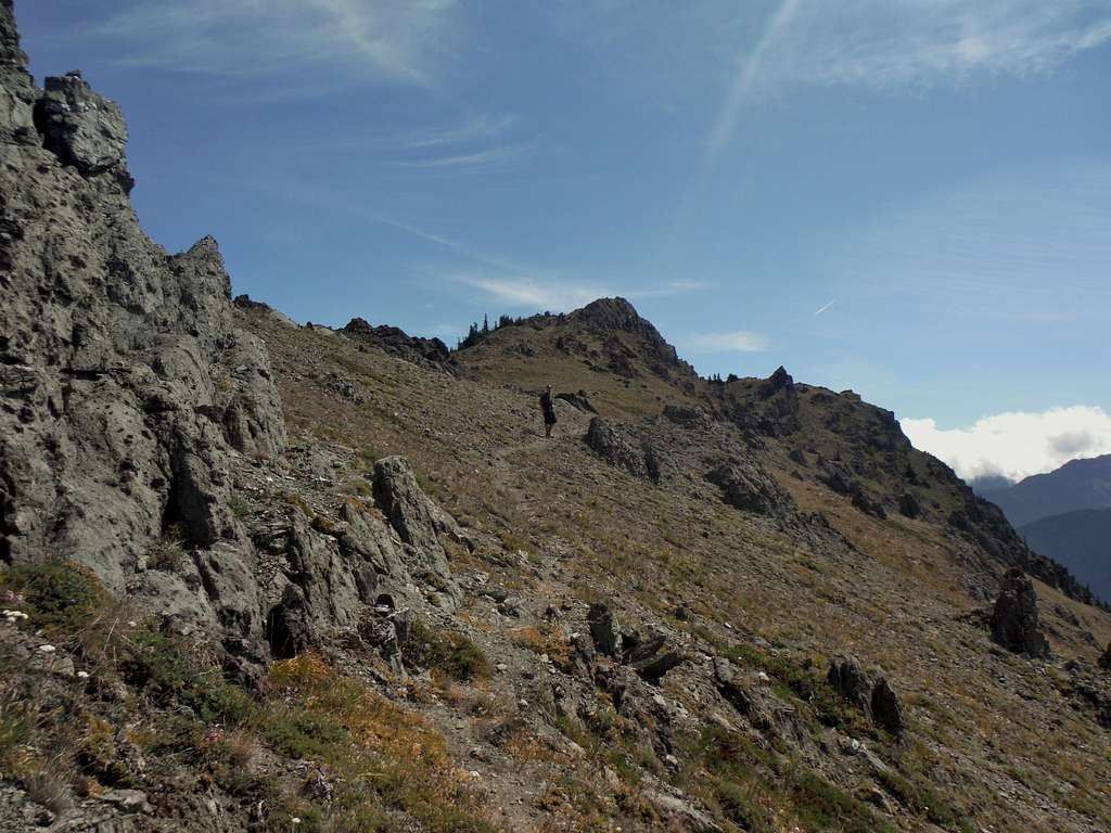
Heading across the ridge

Red Tape

This peak has no red tape. The trailhead is primitive and the road though doable in a passenger vehicle is quiet rough in places. 

When to Climb

Summer is the ideal time to knock off this mountain. It can be done with snow but with a higher trailhead (3600 feet) this peak would not be advisable in winter unless one was really interested in going long distance on the trail. The snow usually clears this mountain by July and does not become an issue again until October or November. 

Camping

Camping on Tyler Mountain is leave no trace. There is an excellent place to camp just below the summit of Tyler Mountain. There are other great places to camp once one breaks on the ridge and a couple just above timberline. Just note that the Tyler Peak Trail has poor footing and is not very backpacker friendly. The last water supply on the Tyler Mountain trail is 4800 foot level when the trail crosses over a creek so one would have to bring the water up if someone were to camp near the summit of Tyler Mountain. 

External Links