
-
 5180 Hits
-
 79.78% Score
-
 11 Votes
|
|
Area/Range |
|---|---|
|
|
46.47206°N / 10.95703°E |
|
|
Hiking, Mountaineering, Skiing |
|
|
Summer, Fall, Winter |
|
|
9701 ft / 2957 m |
|
|
1 - Overview
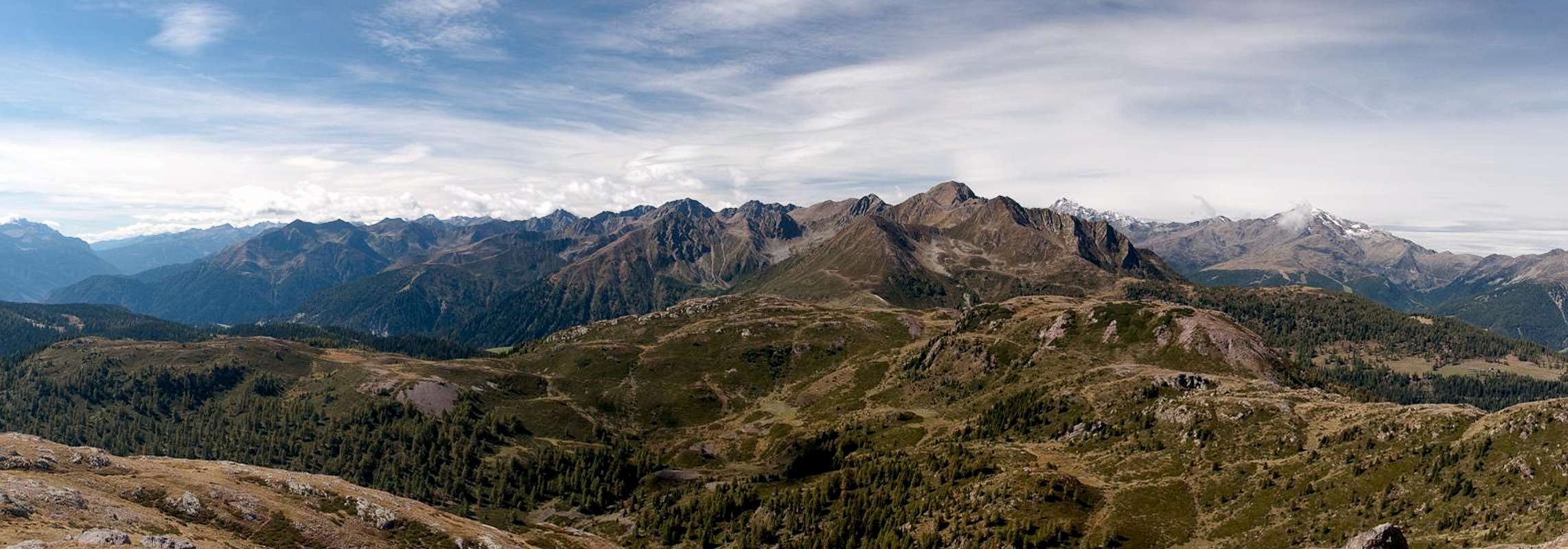
 Ultentalkamm / Cresta Val d'Ultimo from Gleckspitze / Collecchio Ultentalkamm / Cresta Val d'Ultimo from Gleckspitze / Collecchio |
Ultental / Val d'Ultimo stretches deep into inside the Ortler / Ortles Group from the east. It starts at Lana near Meran / Maerano and ends in several branches near the central part of the greater Group. The most important of these branches is Kirchbergtal / Val Montechiesa, which ends in Passo di Rabbi. Ultental / Val d'Ultimo is accompanied by two long ridges, which are both considered subgroups of the Ortler / Ortles Group: Marteller Hauptkamm / Cresta Principale di Martello in the north and west and Ultentalkamm / Cresta Val d'Ultimo in the south.
In fact, there is no real naming convention for this latter subgroup. The Guidebook of the German Alpine Club (see Maps & Books Section) calls it "der das Ultental nach Süden begrenzende Kamm", which translates into "The Crest which bounds Ultental / Val d'Ultimo to the south", a clumsy name for a group. Therefore I'll use the abbreviation defined in the title.
Ultentalkamm / Cresta Val d'Ultimo, much like its northern counterpart, starts in the south-east, close to the centre of the Ortler / Ortles Group. It is separated from Marteller Hauptkamm / Cresta Principale di Martello by Schwarzer Joch / Giogo Nero, an only slightly pronounced saddle at 2822m. Right to the south of the saddle you can find the highest mountain of the group, Gleckspitze / Collechio (2957m). Unlike the northern subgroup, however, it is composed of several ridges, all separated by the important passes of the group. The northern boundary, quite obviously, is Ultental / Val d'Ultimo, the southern boundaries are Valle di Rabbi and Val di Sole while the eastern boundary is composed by Val Pescara and Marauntal / Val Marano. These latter valleys separate the Ortler / Ortles Group from the Nonsberg Group and it is here that the Peradriatic Fault separates the North-African from the Eurasian tectonic plate.
Speaking of boundaries: the language border between the German speaking Südtirol / Alto Adige and Italian speaking Trentino runs across these mountains. While most of them carry names in both languages those to the south there are only Italian names. This is also true for any other names, like villages, valleys or passes.
Ultentalkamm / Cresta Val d'Ultimo is a good and popular hiking (and ski touring) destination. Many of its summits can be reached by multiple hiking trails. The most popular mountains are Ultener Hochwart / Vedetta Alta, Ilmenspitze / Cima d'Olmi and Gleckspitze / Collecchio. All three are wonderful lookout summit but to reach them, however, you have to scale huge elevation differences. Rock quality in the area is poor, erosion is pronounced so that you can find interesting cirques with lots of old glacier lakes. The glaciers themselves have retreated a long time ago.
2 - Ultentalkamm / Cresta Val d'Ultimo on SP
  |
- Ultentalkamm / Cresta Val d'Ultimo
3 - The Summits
|
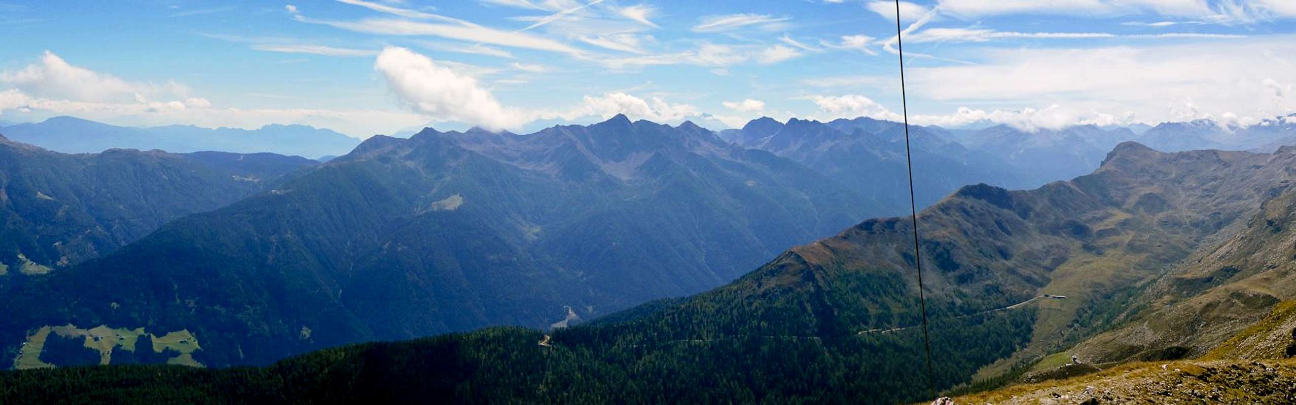
Ultentalkamm / Cresta Val d'Ultimo consists of several ridges. There is a short northern ridge, Gammerwandkamm, which is separated from the remainder of the group by Passo di Rabbi. Eastward two ridges, one to the south-east, the other to the north-east turn off from Karspitze / Punta di Quaira: Kachelstubenkamm and Cresta Pagano, only here, separated by Klapfbergjoch / Passo Val Clapa starts the main ridge, which runs all the way to the east, to Hofmahdjoch.
- Schrummspitze / Cima Binazia (2645m)
- Monte Pin (2420m)
- Stübele (2671m)
- Breitbühel / Monte Foggiola (2578m)
- Seefeldspitze / Cima della Siromba (2539m)
- Ilmenspitze / Cima d’Olmi (2656m)
- Seekopf / Monte Lavazze (2415m)
- Samerberg (2568m)
- Manndlspitze (2425m)
![]()
- Korb / Monte Ometto (2395m)
- Ultener Hochwart / Vedetta Alta (2627m)
![]()
- Schöngrubspitze (2459m)
![]()
- Spitzer Kornigl / Monte Cornicoletto (2418m)
- Kornigl / Monte Cornicolo (2311m)
![]()
3.2 - Gammerwandkamm
- Gleck / Collechio (2957m)
![]()
- Sass Fora (2808m)
![]()
- Gammerwand / Le Crode (2763m)
![]()
- Nagelstein / Monte Chiodo (2469m)
- Klunke (2287m)
3.3 - Kachelstubenkamm
- Karspitze / Punta di Quaira (2752m)
![]()
- Nebelspitze / Cima Tuatti (2701m)
- Äußere Seefeldspitze (2615m)
- Kachelstubspitze ( Welscher Berg) / Cima Trenta (2636m)
- Klapfberger Kachelstube / Monte Mattorna (2660m)
- Kachelstubschneid / Monte Stanga (2644m)
- Breitbühel / Colle Largo (2287m)
3.4 - Cresta Pagano
- Castel Pagano (2609m)
- Cima Zoccolo (2561m)
- Le Mandrie (2583m)
- Cima Lainert (2462m)
- Cima Lac (2439m)
- Cima Vese (2400m)
- Cima Candei (2190m)
3.1 - Main Ridge


4 - Getting There
 |
Ultentalkamm / Cresta Val d'Ultimo can be most easily reached either from Ultental / Val d'Ultimo in the north, Val di Bresimo or Val di Rabbi in the south and Proveis / Proves in the east.
- Ultental / Val d'Ultimo and Proveis / Proves
- Take Brenner Motorway A22 to the exit Bozen Süd / Bolzano Sud
- Switch to SS38 towards Meran / Merano.
- Take the exit Lana and drive through the town
- For the Ultental / Val d'Ultimo trailheads follow the signs into the valley
- For Proveis / Proves leave Ultental south at St. Pankraz / San Pankrazio
- Val di Bresimo and Val di Rabbi
- Take Brenner Motorway A22 to the exit San Michela all'Adige
- Take SS43 to Tasullo
- For Bresimo take SP57 to Livo, then switch to SP68 to Bresimo
- For Rabbi take SS42 to Male, then switch to SP86 to Rabbi
5 - Accommodation
6 - Red Tape
The western and highest part of Ultentalkamm / Cresta Val d'Ultimo belongs to Nationalpark Stilfser Joch / Parco Nazionale dello Stelvio. See the following link for more information:Elsewhere there is no red tape.
7 - Weather Conditions
8 - Maps & Books
8.1 - Maps
- Ortler / Ortles - Cevedale
Kompass Map WK072
1:50000
ISBN: 3-85491-081-9
- Meran / Merano
Kompass Map WK53
1:50000
ISBN: 978-3-85491-059-2
- VAL D´ULTIMO / ULTENTAL
Tabacco Map 042
1:25000
ISBN: 978-8883150562
- MERANO E DITORNI / MERAN UND UMGEBUNG
Tabacco Map 011
1:25000
ISBN: 978-8883150111
8.2 - Books
- Rund um Meran
H. Klier
Rother Wanderführer
Rother Verlag
ISBN: 978-3-7633-4290-7
- Meran / Burggrafenamt
Kompass Wanderbuch 951
Kompass Verlag
ISBN: 3-87051-386-1
- Ortleralpen
P. Holl
Alpenvereinsführer
Rother Verlag
ISBN: 3-7633-1313-3