
|
|
Mountain/Rock |
|---|---|
|
|
39.68310°N / 106.2936°W |
|
|
12362 ft / 3768 m |
|
|
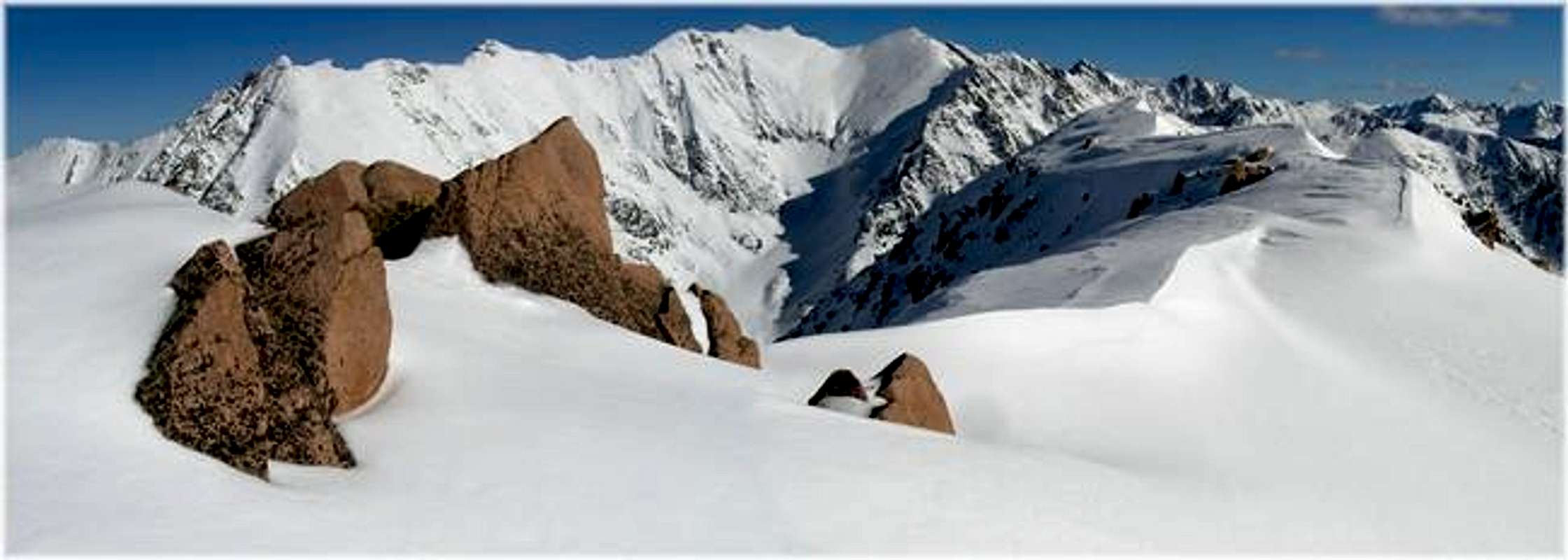
Gore Range Overview
”In my opinion, the two most rugged mountain ranges in Colorado are the Gore Range northwest of Dillon Reservoir and the Needles Range in the remote San Juan Mountains.” -John Fielder-famous Colorado Landscape photographer.
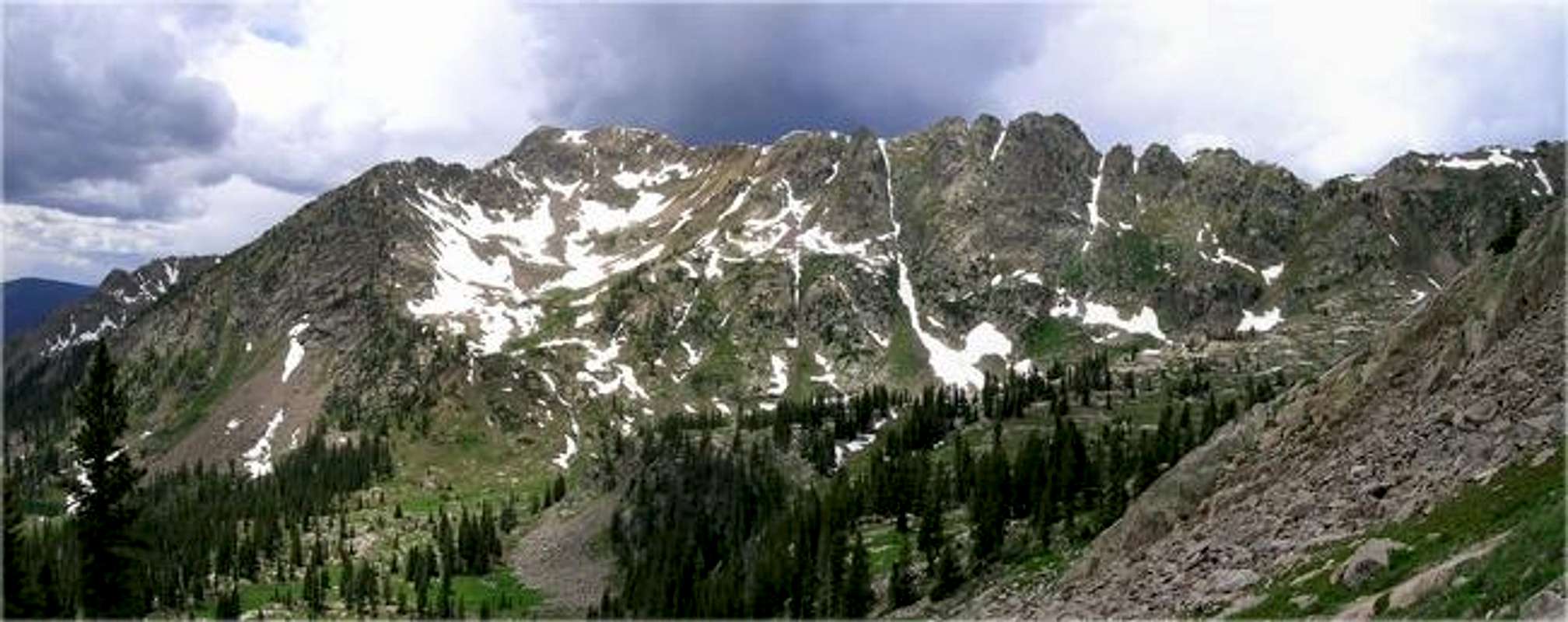
The Gores are more of a range consisting of 12-13,000-ft ridges, rather than separated peaks. A few of the more prominent ridges actually have names like, Zodiac Spires, Rockinghorse Ridge, Ripsaw Ridge and the Grand Traverse. With 50 peaks over 12,000-ft, none attain the magic 14,000-ft mark, which is the primary reason for the Gores obscurity. This is one of Colorado’ most rugged mountain ranges and the rock quality is generally good.
Only 60 miles from Denver, Colorado the Gore Range as a whole is relatively inaccessible due to the lack of mining roads that normally criss-cross other Colorado mountain ranges. The Gores also have a rep for a lot of trailhead access red tape, due in large part to private property. Hikers and climbers not interested in long approaches and heavy vertical might want to look elsewhere for their adventure. Overall, the west side of the Gore Range is more accessible than the east. Approaches that start from the east are few because of private property, in return, expect even longer approaches and expect a poor network of trail systems. Precise planning and execution are of paramount importance when selecting routes in this range. Armed with a loaded backpack and good maps, many of these quiet summits can be climbed without a rope. Major faces and long jagged ridges provide unlimited technical climbing opportunities as well. An ice axe is highly recommended on any early season climbs.
Officially named peaks in the Gore Range are hard to come by, only a few of the Gore highpoints have official names. Differentiating the highpoints on a map or while hiking has challenged all of us at some point. Thankfully we have the CMC to make sense of all of that rugged terrain. In 1932, CMC members Carl Erickson and Edmund Cooper used letters to assign summits in the obscure Black Creek Basin and the CMC subsequently tended and expanded the system (Jacobs & Ormes- Guide to Colorado Mountains.) The lettering system for naming peaks has frustrated many casual visitors over the years, however Gore Range enthusiasts seem embrace the system. It won’t be going away anytime soon.
"Outpost Peak" Overview
Inspired by an in your face view of the northeast face of “Outpost Peak” from the lower slopes of “East Partner Peak” it is safe to assume I’ve had a little problem getting this mountain out of my head for at least a year. Not that I was losing sleep over it; well… maybe a little. Easy winter access and the potential for big views of some of the Gores most beautiful mountains may have been the real reason for my obsession.
UN12,362 or unofficially named “Outpost Peak” separates two beautiful drainages, the Booth Lake Drainage and the Pitkin Lake Drainage. “Outpost” has a very rugged north ridge, which connects to “West Partners” south ridge, in addition to very steep east and west faces and a short but direct south ridge that terminates at I-70 and the Pitkin Lake Trailhead at 8,470-ft.
South Ridge Route
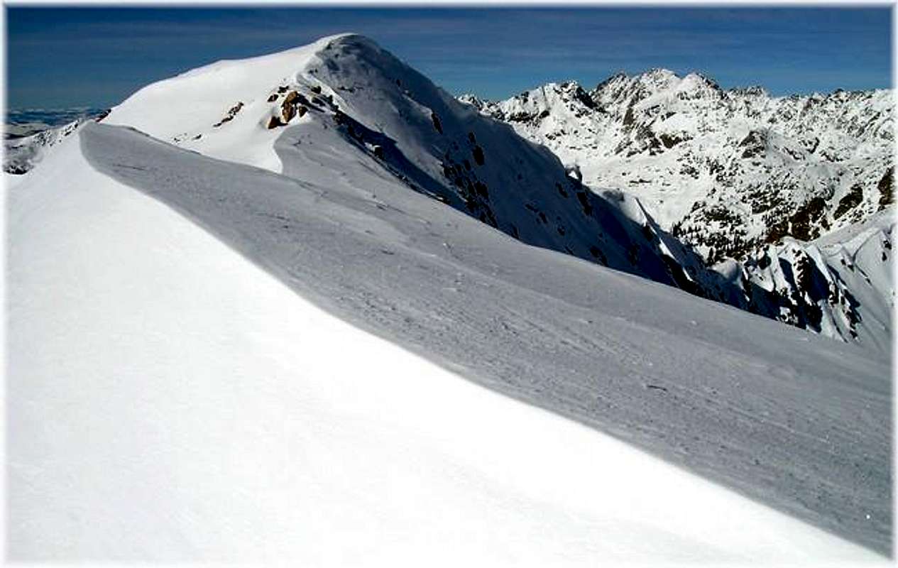
Outpost Peak” makes for a safe winter climb. Located across the I-70 corridor from the mega ski resort of Vail, “Outpost Peak’s” direct south ridge gets all the southern exposure that makes Vail a ski area. While the northerly aspect of Vail keeps the snow from melting quickly, “Outpost’s” south ridge definitely gets sun, thus creating sun crust and snow consolidation, which helps expedite climbing while minimizing the post holing that so many of us fear when hiking in the winter. Sun-crust is also the stuff that creates the dangerous layers that trigger avalanches. Consecutive sunny days, followed by a heavy snow makes for dangerous avalanche conditions, but in Outpost’s case, shallow snow depths and thousands of aspen trees help anchor any steep snow that may be considered too steep for safely traveling during the winter months.
In an effort to spy a winter safe route up “Outpost Peak” a climb up the neighboring Bald Mountain was in order three weeks prior. Armed with revealing photos from Bald Mountain and first hand knowledge of the immediate area snow conditions, Jon Bradford and I experienced a route with uncanny snow similarities of Bald Mountain’s southwest ridge. A potent combination of strong teamwork, solid route finding and perfect weather made our ascent successful. “Outpost Peak’s” winter route is shorter in total distance than Bald Mountajn’s southwest ridge, however it is much steeper and potential avalanche danger lurks anywhere away from the direct south ridge route on “Outpost Peak.”
The route can be sectioned into three benchmarks. First, the lower slopes are steep and laden with trees, which anchor any steep snow: no avalanche danger. The middle slopes are gentle. Lastly, prevailing winds that scour most of the south, southwesterly ridges in the Gores, blast the upper slopes above tree line. Thus, the upper portion of this route is safe from avalanche danger as well.
Pitkin Lake Trailhead
Locating the Pitkin Lake Trailhead (8,470-ft) is easy. From Denver, take I-70 west, past the Eisenhower Tunnel and on to the popular ski towns of Dillon and Silverthorne. Continue past Copper Mountain Ski Resort and on to Vail Pass. From Vail Pass, descend down to the city of Vail, Colorado and take exit 180, your first Vail exit on the right. Turn right and quickly make another right and drive about .2 mile east. Look for the trailhead on the left next to some private condos.Current weather for Pitkin Lake area
Click image to enlarge
Click here to view a 7-day forecast for Pitkin Lake Basin at 11,400-ft

Eagles Nest Wilderness-Red Tape
“Red Tape” per attmNo permits or fees are required. Like all wilderness areas no mechanized or motorized vehicles are permitted within the Eagles Nest boundaries.
Wilderness is land set aside as part of wild America, where man can be a visitor. The natural environment has not been disturbed. Travel is restricted to foot or horseback. No mechanized equipment is allowed.
For more information, contact the U.S. Forest Service at the # below:
Additional Resources:
Eastern Portion of the Wilderness:
Dillon Ranger District
680 River Parkway
Silverthorne, CO 80498
970-468-5400
or
Western Portion of the Wilderness:
Holy Cross Ranger District
P.O. Box 190, 24747 US HWY 24
Minturn, CO, 81645, Phone: 970-827-5715