


lcarreau - Jan 4, 2008 2:01 pm - Voted 10/10
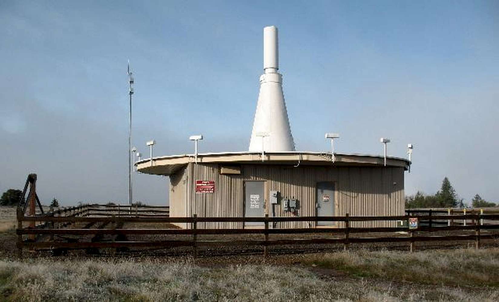
What is it ?A beacon to direct aircraft away from the mountain in foggy or overcast conditions???
Just curious. They apparently don't want people going in there. Great FAA facility!!!

Dennis Poulin - Jan 11, 2008 1:14 pm - Hasn't voted
Re: What is it ?Actually, I think the beacon allows the aircraft to line up for final approach to the landing strip. Several planes passed just west of the summit on their landing approach. They are only about 3,000 ft in elevation when they pass by.
lcarreau - Jan 11, 2008 1:32 pm - Voted 10/10
Re: What is itWhat a great place to have an airport!
Reminds me of a flat-topped landform here
in central Arizona, called Mingus Mountain.
Has several "unique gadgets and towers" on
its summit. An airport is down below. In
an act of uncertain rebellion, a "hang-gliding" group placed a "runway" on top for their gliders. The airplanes had to change their flight paths, to keep from hitting the
gliders. Its lonely at the top!!!

ppergande - Feb 10, 2008 5:57 pm - Hasn't voted
YepThat’s exactly what it is. It is called a VOR (VHF Omni-directional Radio Range) the Rouge Valley VORTAC to be exact. It is used by pilots for approaches to runway 14 and 32 at Medford Jackson County Airport. The airplanes you see are crossing the VOR at 1400 ft over head and descending southeast bound for runway 14, 5.8 miles away. More info than you probably wanted. Cheers.


Comments
Post a Comment