
-
 17322 Hits
-
 89.21% Score
-
 29 Votes
|
|
Route |
|---|---|
|
|
Hiking |
|
|
Spring, Summer, Fall, Winter |
|
|
Half a day |
|
|
Overview
Ute trail to the bottom of Gunnison River Gorge.
There are several hiking trails leading into the gorge to Gunnison River.
Visitors must register at the trailhead and pay a user fee. For one day, the fee is 3$ (there is a self pay station). For camping at the primitive marked campsites by Gunnison River there is 10$ fee for one night and 15$ fee for two nights. There are no reservations (first come first serve basis). You can buy an annual pass for 15$.
The trail is ideal for cross country running and is dog friendly (dogs must be under visual or audible control).
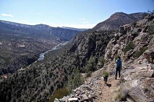
Ute Trail is one of the most scenic hikes in the area. It feels like descending into a smaller version of Grand Canyon. The views are spectacular! The trail is well marked and easy to follow.
Elevation Gain: 1,200 feet down and then up (366 meters)
Round Trip Distance: 9 miles (14.5 miles)
Time: depending on your fitness, the trail is good for trail running with many switchbacks, anywhere from 3 hrs to 6 hrs
| Trail | Miles | Elevation | Trail Description |
| Chukar | 1.1 one way 2.2 total | 560 feet drop (5960'-5400') | Moderate. Adobe clay with sand/rock outcrops. Very heavy foot, horse and boater use. Limited hiker camping spots & river access. |
| Bobcat | 1.5 one way 3.0 total | 840 feet drop (6100'-5300') | Difficult. Undeveloped, hard to follow with steep descent in the last 0.5 miles on rocky face. Good river access. There are 2 spots for camping. |
| Duncan | 1.5 one way 3.0 total | 840 feet drop (6100'-5300') | Difficult. More commonly used that above Bobcat. Last 0.5 miles very steep with loose scree (stay on the north side). Good river access. 3 spots for camping. |
| Ute | 4.5 one way 9 total | 1,200 feet drop (6500'-5300') | Moderate trail, the longest one. Very well developed and easy to follow. Gradual slope with steeper section at the lower section. Great views. Good river access, 4 campsites. |
Getting There
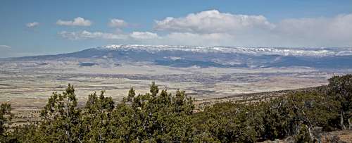
Grand Mesa as seen from the top/start of Ute Trail.
From Montrose, go north on US 50 and turn right onto Falcon Road, about 1 mile before the Olathe traffic light. There is a brown Gunnison Gorge NCA sign just after your turn off. The pavement eventually turns into gravel, you enter Peach Valley area (although not peaches). Continue on a dirt road through the adobe badlands heading north. You will pass several signs of trails in the area - Chukar trail, Bobcat, and Duncan. Head north until you see sign indicating Ute Trail. It is 14 miles from the NCA sign to the trailhead. Again, the last 2.5 miles are better with a 4WD vehicle, but in dry conditions passable by 2 WD vehicle.
Route Description
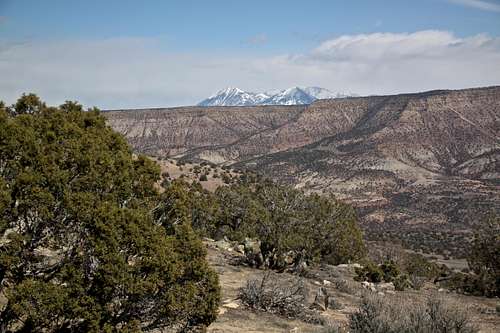
Start at the Ute Trail TH - well marked, nice spot for a picnic located on the top of the gorge with amazing views towards western Elks, Grand Mesa, Uncompahgre Plateau. There is a sign in register at the start of the hike, and an outhouse. Several trails start here, Ute trail is located between the kiosk and the fee box. The trail starts immediately descending into the canyon. It winds down with many switchbacks, which are not very steep. The trail passes through the open area, do not expect much shade.There are several beautiful overlooks with views of the Gunnison River. You will pass a rock bench and some small hoodoos, from here the trail follows the river upstream for about 1/2 mile and ends at small sandy beach and camping areas by the river. The river access is nice here, and the scenery is great for taking a rest. There are a few trees by the river providing rest.
There are 4 camping sites - primitive sites, only marked with signs.

Click for weather forecast
 Western Elks as seen from the TH Western Elks as seen from the TH | 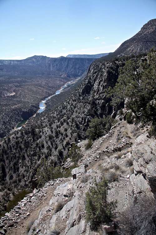 Many switchbacks Many switchbacks |
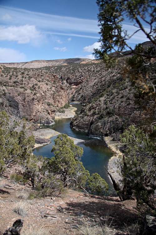 Along Gunnison River Along Gunnison River | 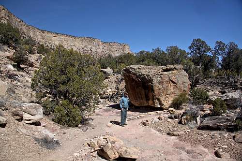 Large boulder about 1/2 day down Large boulder about 1/2 day down |
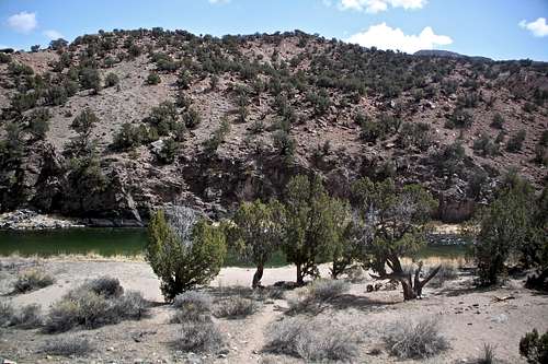 Camping area Camping area | 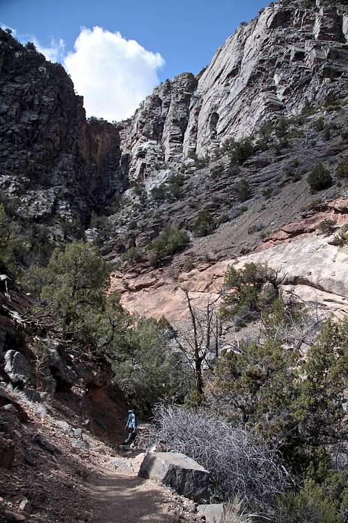 Ute Trail Ute Trail |
Essential Gear
Hiking shoes, possibly hiking poles. Plenty of water. Sunscreen - there is not much shade on the trail.Click for weather forecast