
-
 8198 Hits
-
 71.73% Score
-
 2 Votes
|
|
Route |
|---|---|
|
|
50.75520°N / 6.01730°E |
|
|
Hike |
|
|
Less than two hours |
|
|
Walk-up |
|
|
Approach
You will probably start from the main street in Vaals where most of the bus stops are (and most of the parking places are close by). From there take any road up towards the town (while in town you might want to have a quick look around as it has some nice architecture and little stores and cafes).
 |
Route Description
As is the case with most Dutch towns, everything is very well signalled and soon you will find indications that show the way to the "drielandenpunt". Follow these indications until you come to the main road climbing the hill. After following this road for a couple of minutes, you will pass a big apartment building on your left, just after this and also to your left, there is a walking path between two houses (a small green sign says Wandelpad). Follow this path, and after a while you’ll come up to a sightseeing tower (Willeminha tower), continue past the tower and on towards the south for a couple of hundred meters more and you will come up to the main area of the mountain.
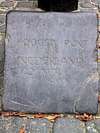
Here you will not only find the “summit” (very well marked with a big bronze monument and a carved stone sign) but also you will find the “drielandendpunt”- the point where the Netherlands, Germany and Belgium come together one of the biggest tourist attractions in the area.
 |  |
Essential Gear
Just take some confortable shoes and a map of the additional walking paths in the area.
 |
Miscellaneous Info
If you have information about this route that doesn't pertain to any of the other sections, please add it here.