La montagna chiama i suoi figli, ed essi rispondono fedelmente al suo appello…
Osvaldo Cardellina, Diario alpinistico, 1964-65
Page texts: @ OsvaldoCardellina"Osva", passed away on May 2, 2022. Page owners: Christian Cardellina e Osvaldo Cardellina. Any updates from September 12, 2022: Antonio Giani, page administrator, friend and climbing companion.
Testi della pagina: @ OsvaldoCardellina "Osva", scomparso il 2 maggio 2022. Proprietari pagina:Christian Cardellina e Osvaldo Cardellina. Eventuali aggiornamenti dal 12 settembre 2022: Antonio Giani, amministratore della pagina, amico e compagno di salite.
Savara Overview
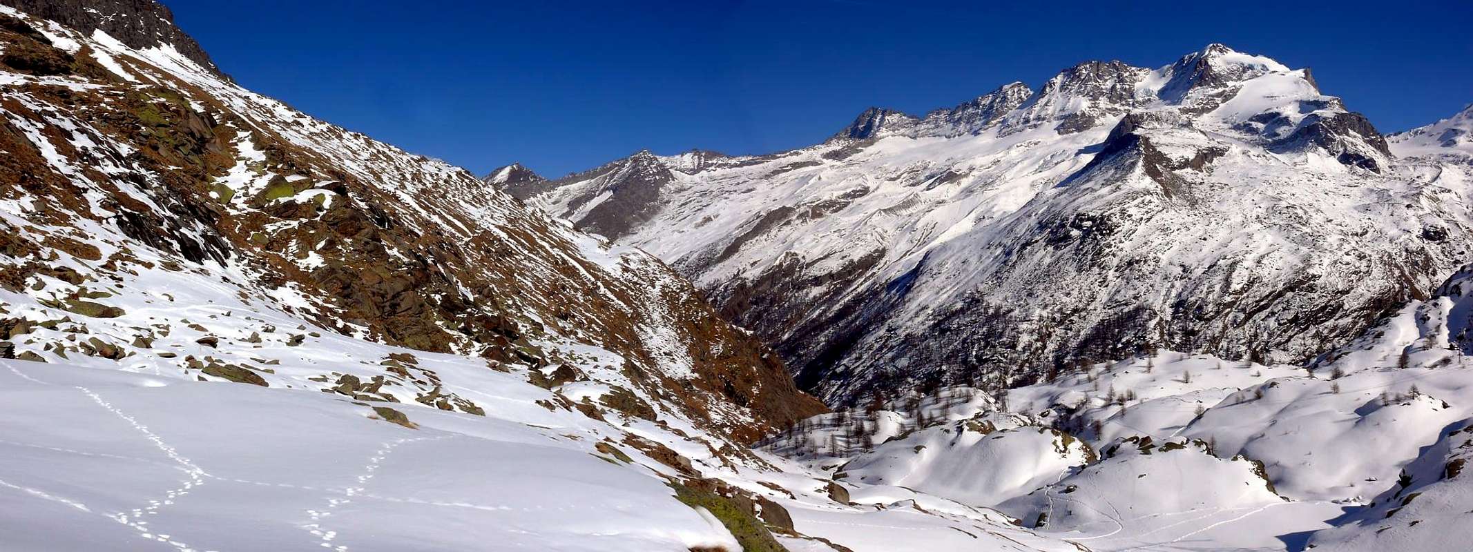
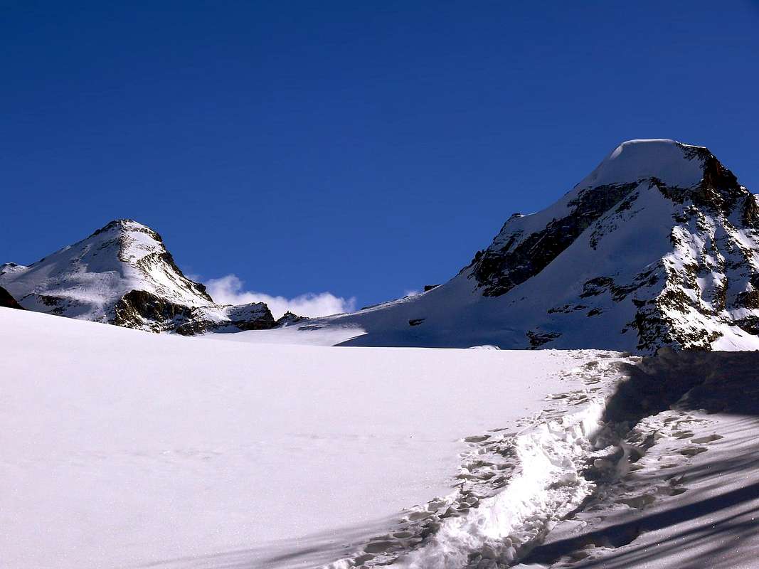
Located on the Southern slope than the Dora Baltea, or the Valsavarenche Valley Torrent Savara, is located immediately in parallel to that of Cogne, and before that of Rhêmes, analyzing so topographical layout of the valleys in Aosta Valley from East to West. Having beginning above the small Communes of Villeneuve and Introd, right at its entrance, stretches toward South for over 26 Kilometres after reaching 15 from the main town of Villeneuve-Dégioz Valsavarenche, at the foot of the Grand Nomenon and Grivola (3.969m) to the East and the length of chain that reaches from Mount Roletta Punta Bioula (3.413m) on the opposite side. These top, famous in the two previous centuries, have fallen somewhat into oblivion, although it is still the charm of their joint mountaineering history that goes with the life of the people of this beautiful valley. Once the rivalry with neighboring Cogne for the conquest of the Grivola interest is gradually shifted toward the more "high" of the valley turning more and more so to the Gran Paradiso and its satellites. They ended the times, to be able to go up, they saw as the Mountaineers even from the valley floor at Villeneuve Municipality. The old muletrack who traveled to the East high above the Savara to reach the old Refuge Vittorio Emanuele II° has been completely abandoned and now only prove a distant memory. Today a road asphalt along the entirety reaching Pont (1.980m), where the adventure begins. But just before the same another trail reaches a new shelter dedicated to the two famous brothers climbers Federico and Renato Chabod, great Sons of Val Savarenche. But this is also, par excellence, since 1922 the Valley of P.N.G.P. (National Park of Gran Paradiso) that coinvole, but not so complete like this, the nearby Valleys of Cogne, Rhêmes and Soana-Ceresole Reale, this last in Piedmont.
Situata sul Versante Meridionale rispetto alla Dora Baltea, la Valsavarenche o Valle del Torrente Savara, é situata subito appresso a quella parallela di Cogne e prima di quella di Rhêmes, analizzando in modo topografico la disposizione delle valli in Valle di Aosta da Oriente ad Occidente. Avendo inizio sopra i Comuni di Villeneuve e di Introd, proprio al suo imbocco, si distende verso Sud per oltre 26 Kilometri raggiungendo dopo 15 da Villeneuve il Capoluogo di Dégioz-Valsavarenche, ai piedi del Grand Nomenon e della Grivola (3.969 m) ad Est e dal tratto di catena che dal Monte Roletta raggiunge la Punta Bioula (3.413 m) sul lato opposto. Queste sommità, famose nei due secoli precedenti, sono cadute un poco nel dimenticatoio, anche se rimane sempre il fascino della loro storia alpinistica che và congiunto con la vita delle popolazioni di questa splendida vallata. Terminate le rivalità con la vicina Cogne per la conquista della Grivola l'interesse si é gradualmente spostato verso la parte più "alta" della vallata rivolgendosi sempre in modo maggiore al Gran Paradiso ed ai suoi satelliti.
Son terminati i tempi che, per poterlo salire, vedevano partire gli Alpinisti addirittura dal fondo valle presso Villeneuve. La vecchia mulattiera che percorrevano alta ad Est sopra la Savara per raggiungere il vecchio Rifugio Vittorio Emanuele II° é rimasta completamente abbandonata ed ormai testimonia soltanto un lontano ricordo. Oggi una strada in asfalto la percorre integralmente raggiungendo Pont (1.980 m), dove inizia questa avventura. Ma subito prima del medesimo un altro sentiero raggiunge un nuovo rifugio dedicato ai due celebri fratelli alpinisti Federico e Renato Chabod, grandi Figli della Val Savarenche. Ma questa è anche, per eccellenza, dal 1922 la Valle del P.N.G.P. (Parco Nazionale del Gran Paradiso) che coinvolge, ma non in modo completo come questa, le viciniori Valli di Cogne, Rhêmes e Soana-Ceresole Reale in Piemonte.
Toponomastic Note: Valsavarenche also called Savaranche ie with a instead of e (in Aosta Valley is left with the Valtournanche) was once called as the Val Savarre named after its Torrent; but it seems that this name is the result of an imperfect transcription, as a result of erroneous information, the Cartographers State of Piedmont-Sardinian. In "patois" or the local dialect of the name is "Giuire", so at least they called the creek. Regarding the Grivola its name, which comes from "Grivaé or Grivaèsa" mean girl. Virgin girl as the Jungfrau in the Oberland Bernese. But it also has other names like "Horn of Cogne, Grivolet, Pic de Cogne, Aiguille de Grivola". Other hypotheses lean towards the name "Grivolé" or mountain waves spots highlight the two ice walls and interspersed with steep rocky bends. However, much to the disappointment for "Cogneins" was climbing the mountain for the first time August 23th, 1859 by the Slope Valsavarenche. From Dayné Mountain Guide Valsavara. To the inhabitants of Cogne has remained the satisfaction that, fall in total oblivion this way, the Normal is located in their valley. Regarding instead the name of Gran Paradiso is a pure invention of the '800, because prior show only those Iseran, Soana, generically designed to qualify and indicate the vast area beyond the edge of Val d'Isere in France and the Soana-Ceresole or also known as of the Valle dell'Orco (Orc Valley from the name of its Torrent) with Piedmont. Other names, such as Becca Montandayné, indicated a land ownership, that by Dayné; some names are clearly root of Piedmont such as Becca's Monciair where Becca is then a repeat of Mont or vice versa.
Nota Toponomastica: la Valsavarenche detta pure Savaranche cioé con la a al posto della e (in Valle di Aosta é rimasta la sola Valtournanche) anticamente era chiamata come la Val Savarre dal nome del suo Torrent; ma sembra che anche questo toponimo sia frutto d'una imperfetta trascrizione, a seguito di indicazioni erronee, dei Cartografi dello Stato Piemontese-Sardo. Nel "patois" o dialetto locale il nome é di "Giuire", così almeno chiamavan il torrente. Per quanto concerne la Grivola il suo nome, che par derivi da "Grivaé o Grivaèsa" significa ragazza. Ragazza vergine come la Jungfrau nell'Oberland. Ma possiede anche altri nomi come "Corno di Cogne, Grivolet, Pic de Cogne, Aiguille de Grivola". Altre ipotesi propendono per il toponimo "Grivolé", ovvero montagna a macchie onde evidenziare le due pareti ghiacciate ed inframmezzate da ripide fasce rocciose. Comunque, con grande disappunto per i "Cogneins" la montagna venne salita per la prima volta il 23 Agosto 1859 tramite il Versante Valsavarenche. Da Dayné Guida della Valsavara. Agli abitanti di Cogne é rimasta la soddisfazione che, caduta nello oblio totale questa via, la Normale é situata nella loro vallata. Per quanto concerne invece il toponimo di Gran Paradiso é una pura invenzione dello '800, poiché antecedentemente si riscontrano soltanto quelli di Iseran o Soana, genericamente intesi a qualificare ed indicare quella vasta area oltre il confine con la Val d'Isère in Francia e quella di Soana-Ceresole o detta anche dell'Orco, dal nome del suo Torrente, con il Piemonte. Altri nomi, come Becca di Montandayné, indicavano una proprietà terriera, ovvero quella di Daynè; alcuni toponimi sono invece chiaramente di radice piemontese come ad esempio Becca di Monciair, dove Becca poi risulta una ripetizione di Mont o viceversa.
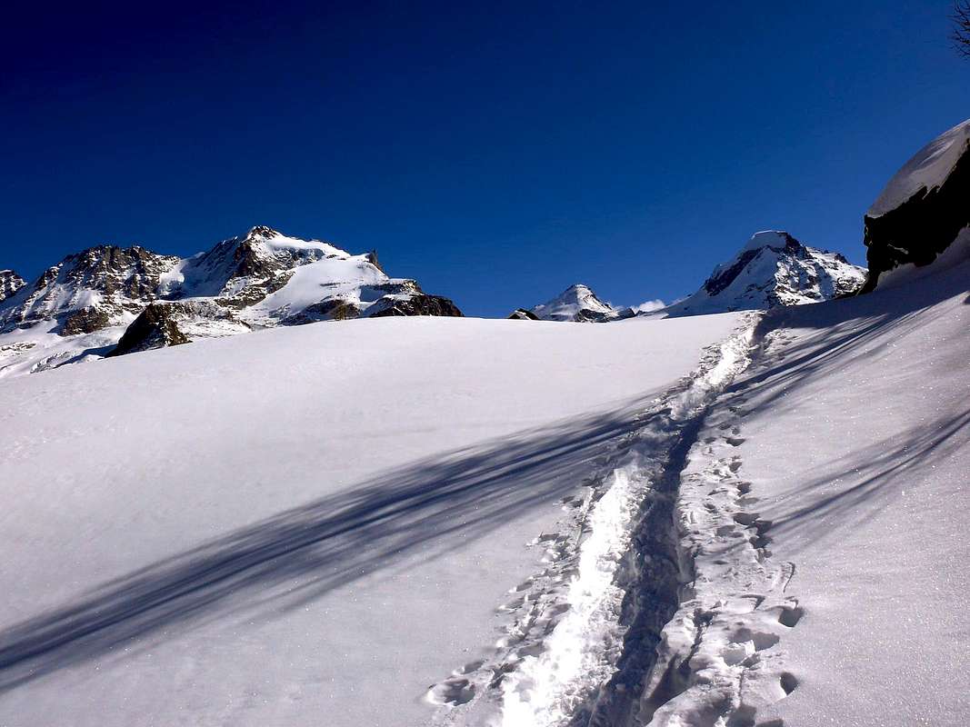
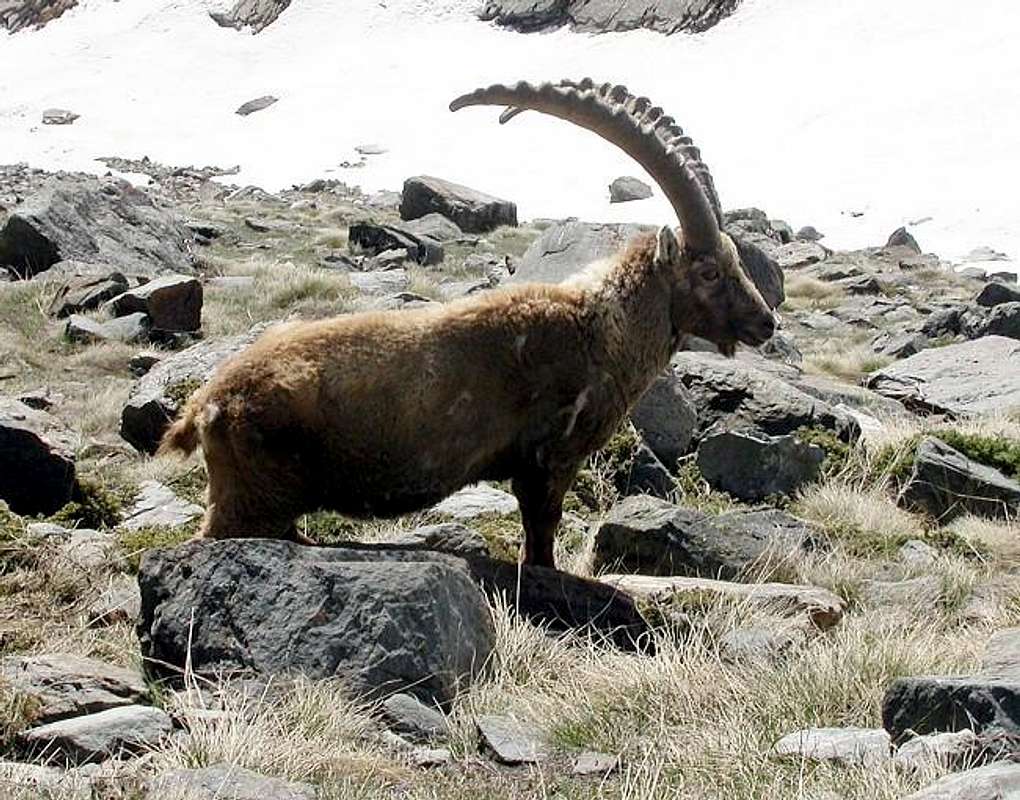
Valsavarenche: offers walking, hiking and some beautiful routes of glacial North Walls of Gran Paradiso, Ciarforon and Becca Monciair; interesting rock in the South Wall of Becca Moncorvé (various routes) and on renowned South Crest Herbetet, while the other climbs, although not always easy, have gone completely out of fashion. In general, the attendance of this valley is donated to climb along the Normal, the Gran Paradiso (recently more and more fashionable ski-mountaineering), starting from the two Shelters Vittorio Emanuele and the Chabod; fairly easy climb and close Tresenta, while the more distant Teeth Broglio have fallen into total oblivion, as incidentally for Grivola along the old via that ran through this side or the Southwest. Regarding the walks, very often is reached Croix de la Roley (1h from Pont Valsavara) at the beginning of the long Nivolé Tableland; excursions between a classical (long and a little boring) is the achievement of the Col Lauzon or Lauzon starting from Eaux Rousses. The ancient Bioula is instead going by the wayside and the trail of "Re Toio" is going more and more into decay. Then there are ascents "rare" because it made a one time or up to one or two repetitions type the Fourquin de Biola and Clocher de Djuan, but things are sought only by "connoisseurs", while the Punta Basei, departing from one of two Refuges Savoia or Città di Chivasso or even in a day from Pont of Valsavarenche, ascents are among the most popular.
The area immediately to the North is rather rich in lakes (Leytà, Rosset, Trebecchi, Chavaney) that lend themselves to easy walks-hikes, while that at the next Lago Nero requires a little more experience; and close to the East than in the two shelters are the two Lakes Nivolé while to the South, just after the eponymous hill and now in Piedmont, we find the Lakes Agnel and Serrù overlying the famous Dam-Lake Artificial Ceresole, almost at the end of Orco's Valley. But there are still places to "explore" maybe passing on the trail of more than old now almost ancient ascents, or transiting where once passed almost exclusively hunters chamois and ibex; all you need is a willingness to go outside of the slopes usually frequented by mass. If you go to Dégioz a path East takes you to the Casotto P.N.G.P., located between the Alps Boconnere Dèsott and Damon; continuing in that direction can reach the Belleface Pass (3.095m) located between the bold spiers of the Grand Nomenon (3.488m) and the elegant Northwest Ridge of Grivola, looking out you over the wild Walloon of Nomenon. Or, if you have smaller ambitions and want to make only a nice walk, from Damon (2.276m) turn the South reaching the Maison de Chasse (2.569m) and then down again to the bottom of the valley coming to Casotto Levionaz Dèsott and to Camping Grivola at the Village of Tignet, on Regional Road.
Otherwise, on the opposite side, always starting from Dégioz or Maisonnasse Rouges-Eaux (1.652m, 1.666m) can go up to the "Pavillon Royal de Chasse" of Orvieille (2168m) at the Casotto and the Alps of Djouan; from this camp neo King of Italy was holding contacts via telegraph to the Capital of Turin. Already this turns out to be a beautiful and historic walk, but if you want to lengthen the course, go wild in the Northwest Walloon of Fourquins towards Punta Bioula; or the Southwest reaching with the Alta Via No. 2 Entrelor Hill (3.007m) and then maybe go down to Rhêmes-Notre-Dame. Also from this side is waiting for the classic Kki-touring trip to Punta Entrelor (3.426m), starting from the Pont du Grand Clapier (1.726m) or more forward from the large parking lot in Pont (1.994m). But now here you are "immersed" completely by the tide of the mass that is to go to columnates Emanuele Shelters in revelry or the Gran Paradiso. Someone is content of the Restaurant "Gran Paradiso" by the friend Jacaccia to eat a good polenta with fontina, but is still the realm of great confusion to say the least. But we want to get out of this track and go south along the opposite bank of the Stream Savara. A small path to Unnamed Alp 1.991 meters; if you go to the right climbs to that of Seyvaz then continue on an ancient path that, among herds of ibex, leading to the Grand Collet (2.832m) and then down on the other side on the floor on the Nivolé Tableland. If instead go straight to reach the South Alpage Grand Etret (2.178m) and, if you're a "hard men", the above Glacier below the Hill (3.139m). But these are things for OSA (Good Mountaineers Skiers) and not all are.
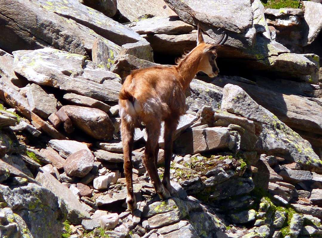
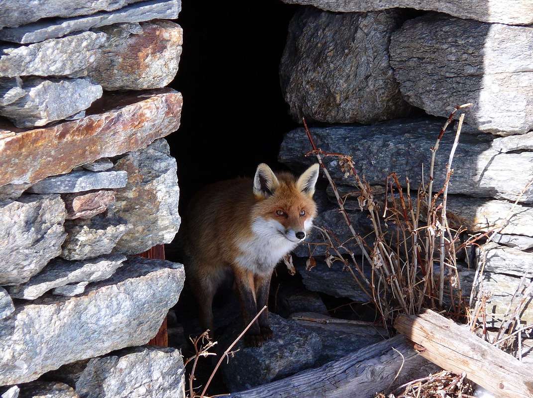
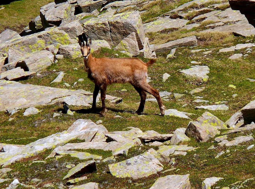
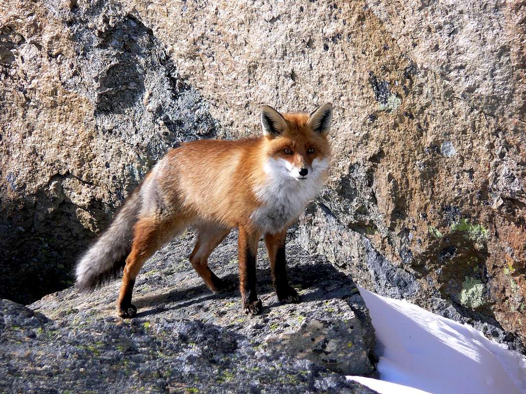
We are content going right to the Cross de l'Arollay (2.322m), which offers a great view of the whole "Granpa" or just above the Alp Turin or Teureun, where you will find surely the Red Fox. However, if you are a tireless "Scramblers", let there Tourists at the tables and benches (they have already done a wonderful Walk) and climb upwards scree "unclean" at the Cima of Rolay (2.995m), then traverses the watershed to the South reaching progression Grand Collet, Mont Giansana (3.051m), the two Tops of Seyvaz (3.074m, 3.207m) to conclude in Colle and Punta Fourà (3.441m). Re-enter the Nivolé because we are down to Pont deliver to You Diploma of "Great of the Gran Paradiso". From this moment all the Summit are within your reach. Seriously, we hope to have given you some good suggestions. You can come and check by visiting the Val Savarenche not regret it. I hope just to have done to make You a nice "Valsavarenche Tour" ...
Valsavarenche: offre passeggiate, escursioni ed alcune belle vie glaciali su Pareti Nord di Gran Paradiso, Ciarforon e Becca di Monciair; in roccia interessante la Parete Sud della Becca di Moncorvé (varie vie) nonché sulla famosa Cresta Sud dell'Herbetet, mentre altre ascensioni, anche se non sempre facili, sono passate completamente di moda. In genere la frequentazione di questa valle é devoluta alla salita, lungo la Normale, del Gran Paradiso (recentemente sempre più di moda lo sci-alpinismo) con partenza dai due Rifugi del Vittorio Emanuele II° e dello Chabod; abbastanza salita la facile e vicina Tresenta, mentre i più lontani Denti del Broglio sono caduti nel totale oblio, come daltronde per la Grivola lungo la vecchia via che percorreva questo versante o Sudovest. Per quanto concerne le passeggiate, molto spesso viene raggiunta la Croix de la Roley (1h da Pont Valsavara) all'inizio del lungo Piano del Nivolé; tra le escursioni una classica (lunga ed un poco noiosa) é il raggiungimento del Col Loson o Lauzon partendo da Eaux Rousses. L'antica Bioula é invece andata nel dimenticatoio e la mulattiera del "Re Toio" sta andando sempre più in disfacimento. Poi esistono ascensioni "rare" poiché effettuate una unica volta o con al massimo una o due ripetizioni tipo il Fourquin de Biola ed il Clocher de Djuan, ma sono cose ricercate esclusivamente dagli "intenditori", mentre la Punta Basei, con partenza da uno dei due Rifugi Savoia o Città di Chivasso se non addirittura in giornata da Pont di valsavarenche, sono salite tra le più frequentate.
L'area subito a Settentrione é invece ricca di laghi (Leytà, Rosset, Trebecchi, Chavaney) che si prestano a facili passeggiate-escursioni, mentre quella al successivo Lago Nero richiede un pò più d'esperienza; vicino e verso Oriente rispetto ai due rifugi vi sono i due Laghi del Nivolé mentre a Sud, subito dopo l'omonimo colle ed ormai in territorio piemontese, troviamo i Laghi dell'Agnel e del Serrù soprastanti la famosa Diga-Lago Artificiale di Ceresole, quasi al termine della Valle dell'Orco. Ma esistono ancora posti da "esplorare" magari passando sulle tracce di più che vecchie orami quasi antiche ascensioni, oppure transitando dove una volta passavano quasi esclusivamente i cacciatori di camosci e stambecchi; basta avere la volontà di uscire al di fuori delle piste usualmente frequentate dalla massa. Se andate a Dègioz un sentiero verso est vi porta al Casotto del P.N.G.P., sito tra le due Alpi Boconnere Dèsott e Damon; continuando in quella direzione potete raggiungere il Colle di Belleface (3.095 m) posto tra le ardite Guglie del Grand Nomenon (3.488 m) e l'elegante Cresta Nordovest della Grivola, affanciando voi sopra il selvaggio Vallone di Nomenon. Oppure, se avete ambizioni più ridotte e volete compiere esclusivamente una bella passeggiata, dal Damon (2.276 m) voltate a Mezzogiorno raggiungendo la Maison de Chasse (2.569 m) per poi scendere nuovamente sul fondo valle arrivando al Casotto di Levionaz Dèsott ed al Camping Grivola presso il Villaggio di Tignet, sulla Strada Regionale.
Altrimenti sul versante opposto, sempre partendo da Dégioz o da Maisonnasse-Eaux Rouges (1.652 m, 1.666 m) potete salire al "Pavillon Royal de Chasse" di Orvieille (2.168 m) presso il Casotto e le Alpi di Djouan; da questo accampamento il neo Re d'Italia teneva i contatti tramite telegrafo con la Capitale di Torino. Già questa risulta essere bella e storica passeggiata ma, se volete allungar percorso, andate a Nordovest nel selvaggio Vallone dei Fourquins verso la Bioula; oppure a Sudovest raggiungendo con l'Alta Via n° 2 il Colle dell'Entrelor (3.007 m) e poi magari scendere a Rhêmes-Notre-Dame. Sempre da questo lato v'aspetta la classica gita di Sci-alpinismo alla Cima di Entrelor (3.426 m), partendo dal Pont du Grand Clapier (1.726 m) o più in avanti dal grande parcheggio di Pont (1.994 m). Ma qui ormai siete "immersi" completamente dalla marea della massa, che s'incolonna per andare all'Emanuele a far baldoria o al Gran Paradiso. Qualcuno s'accontenta del Ristorante "Gran Paradiso" dell'amico Jacaccia per mangiar una buona polenta e fontina, ma é pur sempre regno di gran confusione per non dir altro. Noi invece vogliamo uscire da questa traccia ed andiamo a Sud lungo la sponda opposta del Torrente Savara. Un sentierino arriva all'Alpe Innominata 1.991 metri; se andate a destra salite a quella della Seyvaz per poi continuare su d'un antico sentiero che, tra branchi di stambecchi, conduce al Grand Collet (2.832 m) e quindi scendere sul versante opposto al Pian del Nivolé. Se invece proseguite diritto a Sud raggiungete l'Alpe del Grand Etret (2.178 m) e, se siete dei "duri", il soprastante Ghiacciaio ed il Colle (3.139 m). Ma queste son cose per OSA (Buoni Sciatori Alpinisti) e non tutti lo sono.
Accontentiamoci andando a destra alla Croce de l'Arollay (2.322 m), dove si gode d'un gran panorama su tutto il "Granpa" od appen sopra all'Alpe Turin o Teureun, dove verrà a trovarvi sicuramente la Volpe Rossa. Però, se siete degli infaticabili "Scarpinatori", lasciate lì i Turisti presso tavole e panchine (han già fatto una splendida Passeggiata) e salite sù per pietraie immonde" alla Cima della Rolay (2995 m), poi traversate sullo spartiacque verso Sud raggiungendo in progressione il Grand Collet, il Mont Giansana (3.051 m), le due Punte della Seyvaz (3.074 m, 3.207) per concludere a Colle e Punta Fourà (3.411 m). Rientrate pel Nivolé perché noi siam giù a Pont per consegnarvi il Diploma di "Grandi del Gran Paradiso". Da questo momento tutte le Sommità sono alla vostra portata. Scherzi a parte, speriamo di averVi dato qualche buon suggerimento. Potete venire a controllare visitando la Val Savarenche: non ve ne pentirete. Spero proprio di averVi fatto fare un bel "Valsavarenche Tour" ...
Getting There
BY CAR:
From France, through the Mont Blanc Tunnel or the Col du Petit Saint Bernard: you can drive on SS.26, following directions for Aosta and, before arriving in Villeneuve, turn right towards Introd. Alternatively, you can take Motorway A5 (at Courmayeur or Morgex) and exit at Aosta Ovest.
From all the other directions: get to the Aosta Ovest exit of Motorway A5. Then drive on SS.26 Aosta, in the direction of Courmayeur; just after Villeneuve turn left towards Introd.
BY PLANE:
Aeroporto "Corrado Gex" Saint Christophe (Aosta).
Shortly after Introd, you arrive at a junction: turn left, entering Valsavarenche, and passing through many Villages (Degioz, Eaux Rousses, etc.) you can arrive at Pont (1.960m) where the road ends.
Mountains & Summits
MOUNTAIN CHAINS & SUMMITS Succession from Gran Paradiso to the Northern, Southwestern & North-northwestern watersheds
^^^^^^^
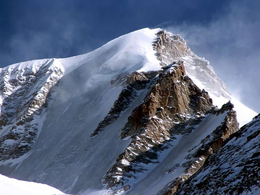
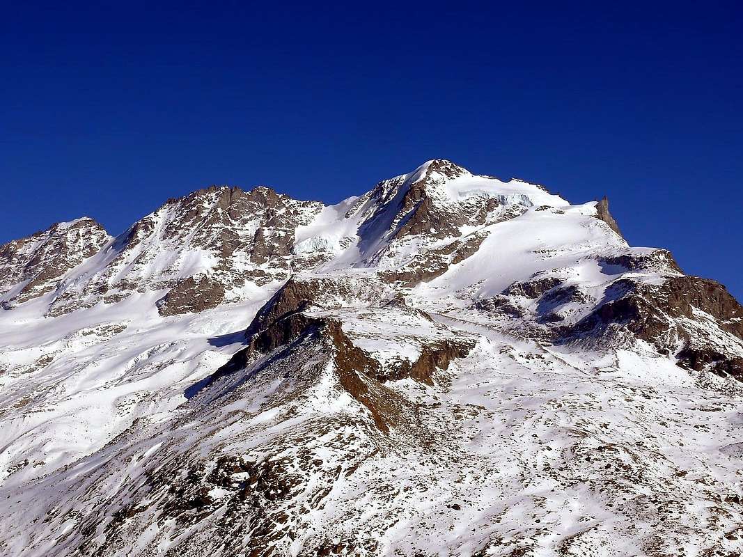
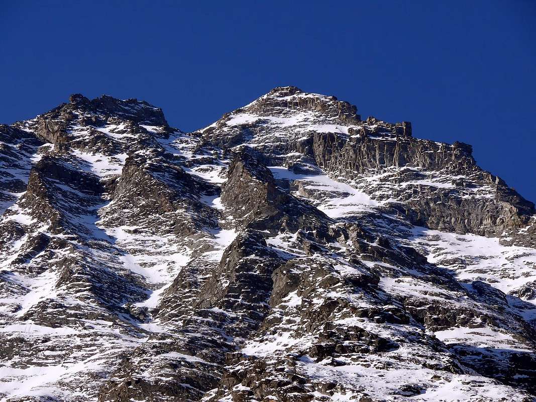
NORTHERN APPENDAGES of GRAN PARADISO: To North Piccolo Paradiso (South Points: Southern, Northern or Frassy; Mont Petit Paradis: Central also Farrar, North or Vaccarone Points) - Becca di Montandayné - Punta Budden - HERBETET(3.778m)- Pointes de l'Herbetet (Petites Pointes Meridional, Septentrional) - Gran Sertz or Serra - Punta di Leviona Subgroup.
To West Costa del Timorion-Punta del Timorion small Subgroup. To North-northwest Punta dell'Inferno - Costa del Tuf - Punta del Tuf - Becca di Vermiana - Punta Nera - Punta Bianca - Punta Tuckett - LA GRIVOLA(3.969m)Group. To Northeast Grivoletta - Cresta Giacosa-Becca Crevasse - Punta del Trajo - Pointe Lavincusse - Becca d'Eytava also Dentavù - Cote Lavincusse Subgroup. To North-northwest Grand Nomenon - Mont Favret - Pointe Valletta - Becca Piana Subgroup.
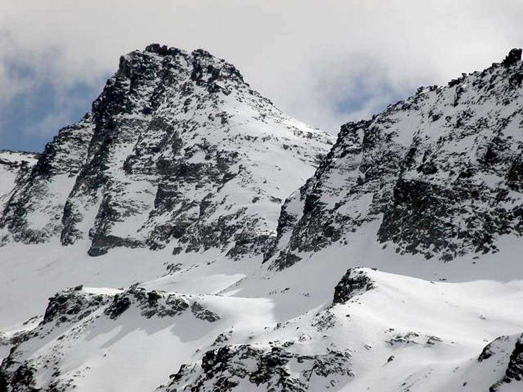
SOUTHWESTERN SATELLITES on WATERSHED: Becca di Mon(t)corvé - Punta Marco - La Tresenta - CIARFORON(3.642m)- Becca di Monciair - Denti del Broglio also Breuil - Testa del Grand Etret - Mare Percia Subgroup. NORTH - NORTHWEST APPENDIX: PUNTA FOURA'(3.411m)- Mont de la Seyvaz Meridional and Septentrional - Monte Giansana - Punta dell'Arolley or Pointe de la Roley Subgroup. WATERSHED & NORTHERN APPENDAGES amongst Savarenche/Rhêmes Valleys: Punta Violetta or Nivolé(t) - Crête de Menthe - Roccia del Nivolé - PUNTA BASEI (3.338m)Group. NORTH-NORTHWESTRN WATERSHED between Savara/Rhêmes Valleys:
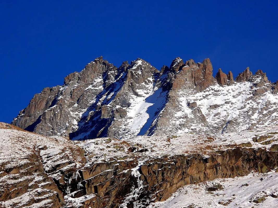
Cime di Nivoletta(z) (South and North) - Petite Vaudala - GRANDE VAUDALA(Z)(3.270m)- Punte Paletta (Sud and North) - Pointe de Lavassey Subgroup. Punta del Rosset - Punta del Leynir - Mont Taou also Tout Blanc - L'AOUILLE'(3.445m)- Cima d'Entrelor - Testa d'Entrelor - Becca Tsambeina - La Treutse Subgroup. Punte di Percià or Pertcha South and North - Cime di Gollien (South, Central, North)-Mont Roletta(z) - Clocher de Djouan - PUNTA BIANCA(3.427m)also Truc Blanc Subgroup. To East Fourquin de Bioula (West, Central and East); on watershed South/North Tour de Notre Dame - PUNTA BIOULA(3.413m)- Pointe du Ran-Pointe Chamoussière - Mont Paillasse - Mont Blanc Subgroup.
The vallons
^^^^^^^
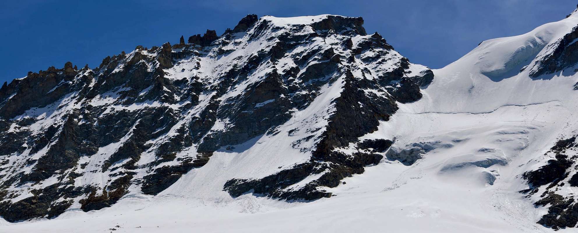
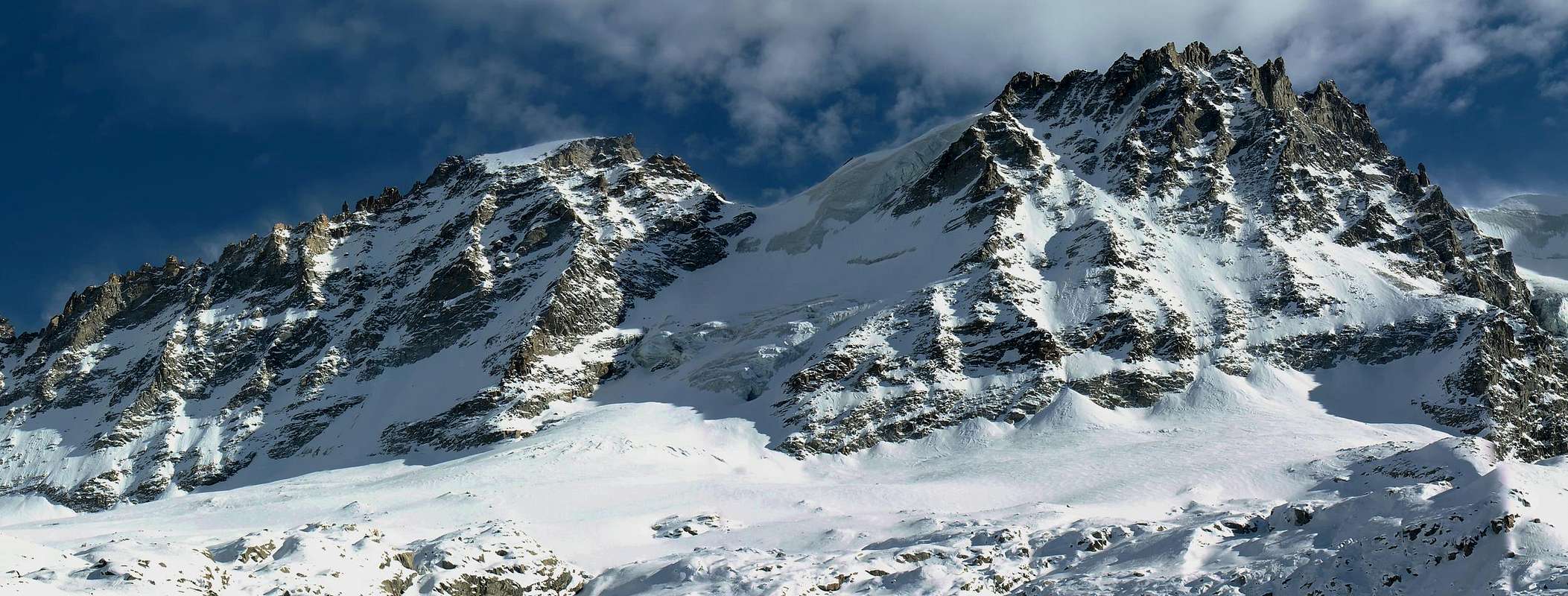
From the Gran Paradiso, only peak in Aosta Valley completely Italian above 4.000 meters, the ridge dividing the Piedmont turns to the Southwest with the summits of Becca Moncorvé, Tresenta, Ciarforon, Becca Monciair and Denti (Jags) of Broglio also Breuil, then falls above the Grand Etret Pass, large glacial window between Pont Valsavarenche and Pont Canavese, and rises again to Mare Percia and the adjacent Point Fourà. From this a long buttress divides the Walloon of Seyva from Nivolé(t) Tableland, the plateau largest in Europe with its eleven Kilometers of grasslands, to finish the eponymous hill near the Refuges Savoia and Chivasso. Here comes Ceresole Reale from a paved road that would have to reach inside the Pont Savara P.N.G.P., but was interrupted and there remain only the dismal track to deface the environment. They say that the inhabitants of this area are all from Pont Canavese, through these hills and vallons. In fact they are a bit special in Aosta Valley ...
^^^^^^^
VALLEYS & VALLONS In order to deploy clockwise into Valsavarenche from "Granpa" towards Northern, Southwestern & North-northwestern watersheds
^^^^^^^
Valsavarenche Valley & surroundings Maisoncle Vallon: from the alternative before Rovenaud (1.462m), Cabine P.N.G.P. near Maisoncle (1.861m) to Charbonnière Pass (2.916m).
Bocconere Vallon: from Valsavarenche-Dégioz, Bocconere near Cabine P.N.G.P. (2.104m), Bocconere Upper (2.276m) to Belleface Hill (3.095m).
Leviona(z) Vallon:
1) - from Dégioz-Nex (1.665m) road, Low Leviona(z) near Cabin P.N.G.P. (2.285m), Middle and Upper Leviona (2.646m) Alps to
2) - Lauson or Loson also Lozon Hill (3.296m);
3) - to Western and Eastern Grand Neyron (3.252m) Passes, small paths-traces on moraines;
4) - from this last in East on Montayndainé Vallon to Bivouac Renzo and Sebastiano Sberna (3.401m), through moraines on Herbetet West Crest.
Enfer Vallon: from Upper Levionaz Alp in East to Leviona also Enfer Pass (3.323m), through traces on moraines near Leviona Northern Torrent.
Timorion Vallon: from Upper Alp in Southeast to Grand Serra or Sertz Pass (3.368m), through traces on moraine along Souhtern Leviona Torrent.
Money Vallon: from parking near Low Praviou (1.829m), Lavassey Pastures (2.194m) to
1) - Montandayné Alp (2.463m) Passage du Grand Neyron, traces on moraine;
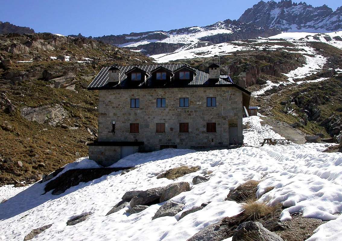
2) - Refuge Federico and Renato Chabod (2.710m) with crossing to South at Refuges Vittorio Emanuele II° (2.734m), good path.
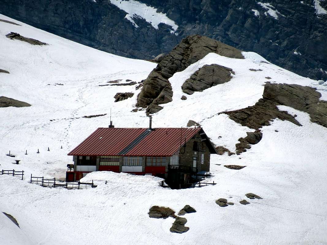
Laveciàu Vallon: from bridge nearby camping-parking Pont-Breuil (1.994m), Chanté Alp (2.372m) to V. Emanuele two Refuges, muletrack. From these to
1) - Grand Paradis Pass (3.335m);
2) - Montcorvé Pass (3.299m);
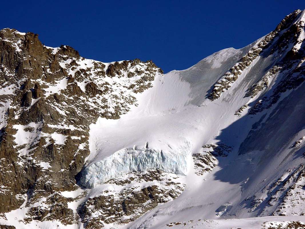
3) - Ciarforon Pass (3.317m), through traces on moraines, glaciers.
Montcorvé Vallon: from Pont-Breuil to Dzé Alp (2.424m), unnamed lake 2.830 meters to Ciarforon or Monciair Pass (3.298m), moraines, glacier.
Sei(y)va Vallon: from camping in West of Savara Torrent to Grand Etret Pasture (2.178m), Glacier, Western, Eastern Passes (3.172m, 3.139m).
Grand Collet Vallon: from alternative near alp (1.991m) before to South to Seyvaz Alp (2.364m), after in Southwest to Gran Collet Hill (2.832m).
Nivolé Tableland:
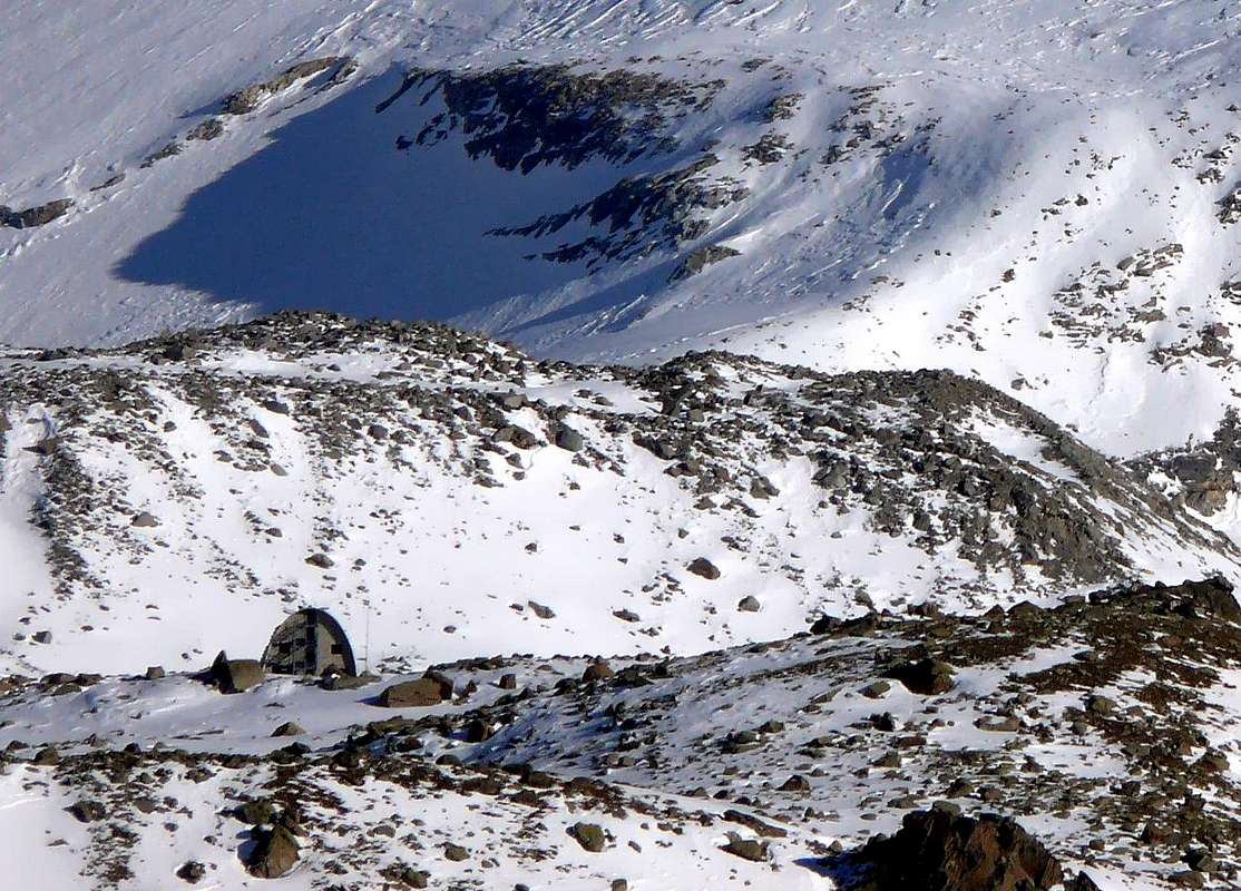
1) - from Pont-camping to la Roley Cross (2.313m), Nivolé Tableland and Alp (2.407m), Refuges Savoia (2.610m) and Chivasso (2.600m) nearby Nivolé Lochs, Hill (2.600/12m). From two Refuges in Northwest Basei Hill (3.160m), with path; from this
2) - in South Basei Point (3.383m), through easy North Crest and small rocky castle in final part (I°+/II°-; exposed to South and delicate with snow; rope required).
3) - in North on edge Nivoletta(z) Pass (3.130m) and possibility of easy traverse to Nivolettaz South and North Points (3.163m, 3.209m), Little and Great Vaudala (3.250m, 3.272m), Rosset Point and Hill, Leynir South and North Points (3.100m, 3.023m, 3.225m, 3.238m) and return to Southeast amongst various Chavaney, Rosset, Leità Lakes (2.846m, 2.703m, 2.701m) on splendid Rosset Tableland. Beautiful ridge hike for experienced hikers (EE/A).
Loch Noir Vallon: from Rosset Lake
1) - in North near Trebecchi three Lochs, Leynir Pass, Taou or Tout Blanc (3.084m, 3.438m), with path and traces easily on Southwest Slope;
2) - descent to Rhêmes Valley, through Glacier, Vaudaletta Vallon. Beautiful Ski-Mountaineering crossings.
Aouillé Vallon:
1) - from Pont Roley Cross and in Northwest Teureun or Turin Alp (2.396m), Plan Borgno(z) Pasture and Lake (2.672m) on Borgno Tableland, with paths; from this in West Aouillé Glacier and Pass (3.314m), without, through moraine and glacier.
2) - Delicate descent in West by a small and steep icy gully (trail exposed to falling stones from L'Aouillé West-southwest Wall and South Crest), snowfields and moraine to Vaudaletta(z) Vallon. Hike in an untamed poorly attended; prior to the establishment of P.N.G.P. frequented by hunters and climbers rare.
Mèyes Vallon: from Pont in North Roley Cross, small bridge up Nivolé Torrent, Teureun, Aouillé Pastures (2.313m, 2.322m, 2.396, 2.514m) to
1) - North Manteau Pass (2.789m) with path;
2) - in West from fork 2.590 meters to Pertcha Pass (3.148/52m), with path-traces, moraines below Meyes Glacier.
3) - From pass Entrelor Antesummit, Summit and short easy crossing to L'Aouillé Point (3.391m, 3.426m, 3.445m), with traces, small rocks.
Entrelor Eastern Vallon:
1) - from Eaux Rousses Hotel-parking in Northwest to Rondzegou, Ploriond, Djouan Pastures (1.974m, 2.126m, 2.226m); from this in Southwest to
2) - three Djouan Lochs (2.507m, 2.516m) between Low/Upper Alps, Lake Noir (2.670m) to Entrelor Hill (3.007m), with path Haute Route n°2. From this
3) - to South easily on ridge Northern and Southern Percià Points, with traces, debris and small rocks at terminal;
4) - descent in Northwest to Western Entrelor Vallon-Rhêmes Valley, path. A classic Ski-Mountaineering trip, where dispute the Trophy Rollandoz.
Sort Eastern Vallon:
1) - from Low Lacs Alp (2.535m) with path-moraine to Sort Pass (2.970m);
2) - to Western Vallon-Rhemes Valley. Bioula Vallon: from Valsavarenche-Dégioz Chef Lieu (parking 1.525m) to Fontaines, Woods Crottes and Flotta de Payel, Pavillon Royal Chasse near P.N.G.P. Cabine (2.168m); from this in Northwest through old muletrack to Lorguibet/Fourquin de Bioula Saddle to Bioula Point (3.413m).
Néquede-Ran Vallon: from regional road in altitude about 1.530 meters to Perrere and Grotta di Ran Alps (1.720m); from this to connection of Ran two Torrents (1.960m), after along Southern branch without path to Néquede Pass, better Carving (3.022m). Would not recommend crossing.
Chamoussière-Pontes Vallon: from Bois de Clin Village (1.392m) into very wild vallon not easily to Chamoussière Point (2.944m), without path.
Vou-Brenvey Vallons: from Molère Village (1.192m; Church 1.232m) or Fenille Village (1.304m) to West along the two torrents. Same remarks.
Arpilles-Mont Blanc Vallon: from Bioley (1.042m) in Rhemes Valley to South to Arpilles Alp-Gite d'étape E. Dayné (1.809m) in Savara Valley, in South, P.N.G.P. Cabine near Mont Blanc Hill (2.171m); from thys to North Mount Blanc (2.201m), to South Mount Paillasse (2.414 m) with good paths.
^^^^^^^
Dal Gran Paradiso, unica cima in Valle di Aosta completamente italiana sopra i 4.000 metri, la cresta spartiacque con il Piemonte volge verso Sudovest con le vette della Becca di Moncorvé, Tresenta, Ciarforon, Becca di Monciair ed i Denti del Broglio oppure Breuil; quindi scende sopra al Colle del Grand Etret, larga finestra glaciale tra Pont Valsavarenche e Pont Canavese, rialzandosi al Mare Percia ed alla contigua Punta Fourà. Da questa un lungo contrafforte divide il Vallone della Seyva dal Pian del Nivolé, l'altipiano più esteso d'Europa coi suoi undici Kilometri di praterie, per terminare all'omonimo colle presso i Rifugi Savoia e Chivasso. Qui arriva da Ceresole Reale una strada asfaltata che avrebbe dovuto raggiungere Pont Savara all'interno del PNGP, ma è stata interrotta e ne rimangono soltanto le lugubri tracce a deturpare l'ambiente. Dicono che gli abitanti di questa zone provengono tutti da Pont Canavese, attraversando questi colli e valloni. In effetti sono dei Valdostani un poco particolari ...
"I Rifugi della Valle d'Aosta" di Stefano Ardito, Ed. Guide iter, Febbraio 2003.
"Parco Nazionale del Gran Paradiso" di Stefano Ardito, Ed. Guide iter, Novembre 2001.
"Guida delle Alpi Occidentali", di Giovanni Bobba e Luigi Vaccarone C.A.I. Sezione di Torino Volume II (parte II), 25 Maggio 1896.
"Gran Paradiso", A. Gegenfurtner, G. Klotz, F. Müller, Ed. Bergverlag Rudolf Rother, Monaco 1980 (in tedesco).
"Gran Paradiso", G. Klotz, Ed. Bergverlag GmbH Rother, Monaco 2005 (in tedesco).
"Rifugi e bivacchi in Valle d'Aosta", di Cosimo Zappelli aggiornata da Pietro Giglio, Musumeci Editore, Luglio 2002.
"Guida della Regione Autonoma Valle d'Aosta" di Mario Aldrovandi,Ed. S.P.E. di Carlo Fanton, Torino 31 Dicembre 1964.
"Guida dei Monti d'Italia-Gran Paradiso Parco Nazionale" E. Andreis, R. Chabod, M. C. Santis, Club Alpino Italiano/Touring Club Italiano, prima Ed. 1939; seconda Ed. 1963; terza Ed. 1980.
MAPS:
Kompass "Gran Paradiso Valle d'Aosta Sentieri e Rifugi" Carta Turistica 1:50.000.
L'Escursionista "Valsavarenche Gran Paradiso Carta dei Sentieri" (n° 9) 1:25.000.
Meridiani Montagne "Gran Paradiso" 1:25.000.
Enrico Editore Ivrea-Aosta "Gruppo del Gran Paradiso" 1:50.000.
L'Escursionista "Valle di Cogne Carta dei Sentieri" 1:25.000.
L'Escursionista "Tour de la Vallée de Cogne Grand Paradis" 1:25.000.
I.G.C. Istituto Geografico Centrale "Parco Nazionale del Gran Paradiso" 1:50.000.
Studio F.M.B. "Gran Paradiso" Bologna 1:50.000.
I.G.C. Istituto Geografico Centrale Torino "Valsavarenche Val di Rhêmes Valgrisenche P.N.G.P.", 1:25.000.
Parents refers to a larger category under which an object falls. For example, theAconcagua mountain page has the 'Aconcagua Group' and the 'Seven Summits' asparents and is a parent itself to many routes, photos, and Trip Reports.


 5262 Hits
 81.84% Score
 14 Votes