
-
 5518 Hits
-
 74.01% Score
-
 4 Votes
|
|
Route |
|---|---|
|
|
46.38223°N / 14.48891°E |
|
|
Mountaineering |
|
|
Spring, Summer, Fall, Winter |
|
|
Half a day |
|
|
Walk-up |
|
|
Overview
The character
Veliki vrh, 1742 m, is the last high and still rocky elevation in the NW ridge of Kočna. Its short west wall hosts a dozen of climbing routes, from Jezersko resort also a marked path reaches it. By the forrest road we can drive quite high below the summit so it's a nice, short hike on a quite panoramic summit. To the ridge and then steeply along it, we first walk up through dense woods, then a short rocky summit section comes.
Basic tour data
0. General: From 1150 m (945 m) to 1742 m, slopes exposition N and NW, steep, marked path through a forrest and over the rocky and grassy summit part. Gear: Good shoes, poles.
1. Effort: 600 m (800 m), 1 h 30 min (2 h).
2. Power: 1 - no difficulties, just walk up.
3. Psyche: 2 - easy (take care in steep woods in winter if icy).
4. Orientation: 1 - no difficulties, well marked. Overall difficulty would be by the Swiss Hiking Scale graded T3.
Approach
You start the tour either on Jezersko, or on the forrest road, ascending high arount the Veliki and Mali vrh. From the Jezersko village you can drive some 1500 m into the valley of Makekova Kočna. There you can park on the crossroads 945 m, where one road goes left to the Makek farm and the other one continues towards the valley end. If you continue driving straight, you'll soon reach the plate, informing you (only in Slovenian language), that the continuation of drive is only on your own responsibility (2017). If lumberjacks are not performing jobs, occupying the road, you can continue. The road first reaches its southern point in this valley, where the path towards Čedca waterfall deters left. There the road makes a big right turn and continues ascending the valley slopes towards Veliki and Mali vrh. You drive to below the saddle between these two elevations, where you can park on 1150 m. There the marked path deters left (south-westwards). Otherwise the forrest road encircles the slopes of Mali and Veliki vrh and on the other side (above the valley of Kokra) continues far towards the south. It can be used for a biking approach to some meadows there or to drive there by car and then continue hiking.
Route Description
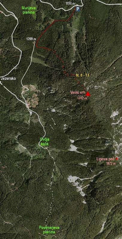
If you start the tour already on Jezersko, then you walk by the road into makekova Kočna only till on the right you see the Muri farm. there the marked path deters right and you follow it up until you reach the forrest road again. If you park on the crossroads by Makek farm, then you either go all the time up by the forrest road, or soon deter right from the road and continue ascencing by a non-marked path over a clearing. Higher it brings you on the forrest road again. In any case we reached the point 1150 m on the forrest road, where the marked path deters left, in the SW direction. You can also drive till here by car, on the road there's also the plate 'Veliki vrh'. Now we follow first a weak cart-road and then a comfortable marked path which ascends through the woods gently. In some 15 minutes we reach a small clearing with a hut, 1289 m. There the marked path for Veliki vrh turns left (well marked). From the hut the path goes more and more steeply through the woods. The direction is SE. We first follow the ridge, later the path leads us right into the western slopes, and finally again steeply up on the summit ridge and the highest point. We descend by the same route.
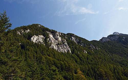 Veliki vrh and the ridge towards Kočna
Another possibility?
I wonder if one could find a safe and comfortable possibility of Veliki vrh ascent from Ovčja koča. That would enable a nice round tour or combination with the tour described in the chapter below.
Veliki Vrh Summit Views
From Veliki vrh you have some nice views on Kočna massif, further along the northern walls of Kamnik & Savinja Alps, on the Karawanks above the Jezersko resort and on the mountain group of Storžič.
 Towards Baba, Rinke and Skuta Towards Baba, Rinke and Skuta |
 Over Jezersko Over Jezersko |
 On Storžič On Storžič |
Alternative: The SW meadows
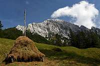 Below Kočna
Nice is also the hike on which you even don't ascend the summit of Veliki vrh, but visit a few alpine pastures below it. The best logistic woul be the following one: Drive up to the parking place 1270 m and leave bike(s) there. Then drive down again, to Jezersko and further down into the Kokra valley, where you start the tour on 600 m, by the bridge over Kokra river, near the confluence of Lobnica creek and Kokra.
 Povšnarjeva planina
You cross the river Kokra and pass the Povšnar farm, then you ascend by the cart road to the Stara Povšna meadow. That's the place where once a big farm stood, but was during the World War II burnt by Nazis. From the farm ruins you continue up by the cart-road and non-marked paths towards the NE, until you reach the deep ravine named Strah graben (the upper end is called V Kladju). You carefully descend by an old, decayed ladder into the ravine, cross water stream and then continue ascending by a path till the picturesque Povšnarjeva planina (pasture), 1315 m. The last section of the path is quite lost, but you hit the forrest road and you can continue by it.
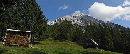
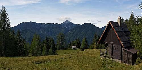 At Ovčja koča (hut, meadow)
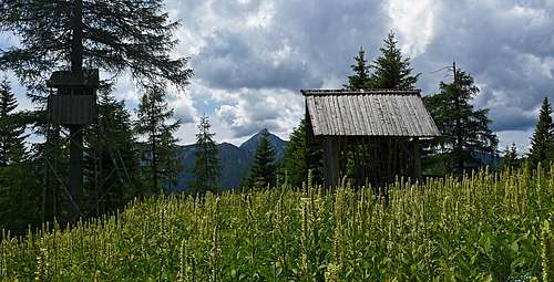 Near the Ovčja koča
From the meadow you continue northwards, all the time horizontally across the forrest slopes. First you have a cart-road, then a good trail, but not marked. On some 1340 m you reach a clearing and then continue in the same direction (cart-road again). So you reach the meadow of Ovčja koča (Sheep hut), some 1320 m. From there the cart-road descends somo 50 m of altitude and you reach a big parking place (some 1270 m) on the forrest road, which joins us from the left. From the big parking place you can continue towards Jezersko either all the time by the forrest road, or, much shorter, by a shortcut over the ridge. For the second option you leave the road left and continue by a cart-road right up. In two turns you gain some altitude, then you continue straight towards the north and so reach a small clearing in the woods with a big hut, 1289 m. There you hit the marked path, coming down from Veliki vrh on the right. Now you can ascend the summit of Veliki vrh and return, or you can simply continue descending towards the NE. The marked path soon brings you down on the road, on point 1150 m, where bikes are waiting. Then just ride down into the valley of Kokra.