

|
|
Mountain/Rock |
|---|---|
|
|
49.15337°N / 19.34193°E |
|
|
Hiking |
|
|
5285 ft / 1611 m |
|
|
Overview
|
||||
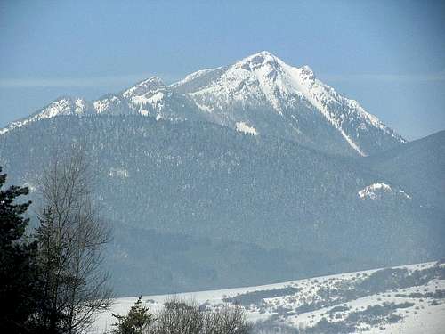
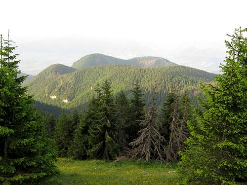
| The massif of Choč is the mightiest, highest and westernmost massif in the Choč Mountains, which are the western extension of the Western Tatras. The summit of Velký Choč (Great Choč), which reaches an elevation of 1611 m (or 1608 m according to some sources), is one of the most prominent in Slovakia. It has 788 m of prominence and over 19 km of topographic isolation. The second highest massif in the Choč Mountains is nearly 240m lower than Velký Choč, which – seen from afar – dominates the landscapes of the western chunks of the Orava and Liptov regions, appearing to be higher than it really is. | ||||
|
||||
|
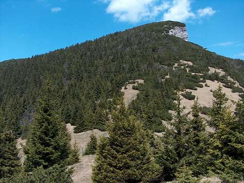
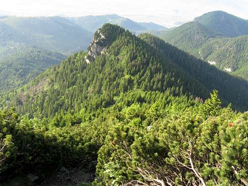
The limestone-and-dolomite massif has a characteristic shape of an asymmetric pyramid. Its second highest summit is Malý Choč (Little Choč) at 1465 m atop a short spur, around half a mile south of Velký Choč, beyond Vráca Saddle at 1422 m. Both Great and Little Choč have cliffy eastern faces. The same goes for Predný (Front) Choč at 1249 m, which lies further south, halfway between the summit of Velký Choč and the town of Ružomberok. |
||||
|
||||
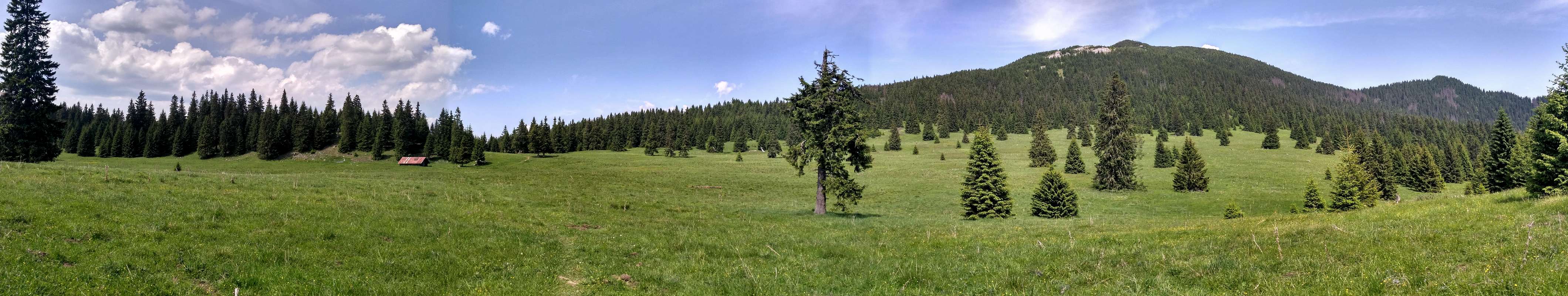
| Generally the western slopes of Choč are pretty gentle. Cliffs do occur in the west of the massif too, but further away from what can be called the main ridge (Velký Choč-Stredná poľana-Zadný Choč-Kopa-Predný Choč) and at lower elevations, mostly less than 1100 m. They largest of them form the southern sides of the western spurs - that of Zadný (Rear) Choč (the stretch with a few summits topping out at around 1300 m between Stredná poľana and Kopa at 1217 m) and below the summits of Sokol (1134 m) and Soliská (1107 m) near the village of Valaská Dubová. Most of the massif is covered by spruce-dominated forest. The highest parts of Velký Choč belong in the dwarf pine zone. The area supports a thriving brown bear population. The mountain meadows, the largest being Stredná poľana (Middle Glade) to the west of the main summit, are a testimony to a few centuries of pastoralism. | ||||
|
||||
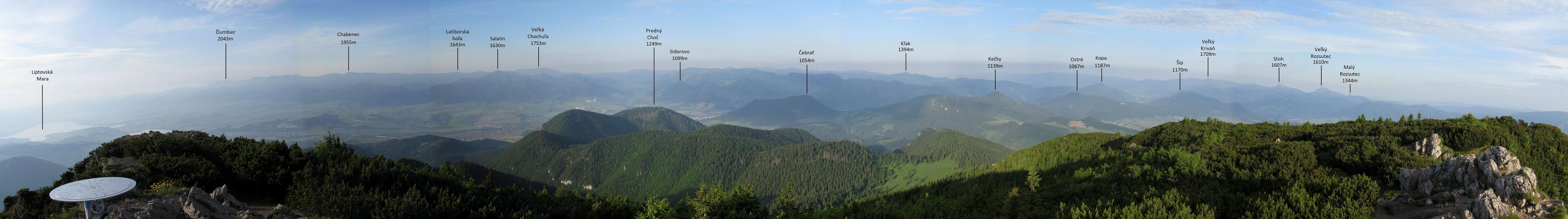
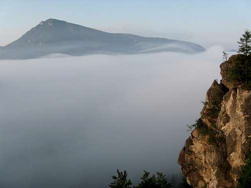
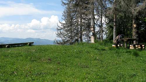
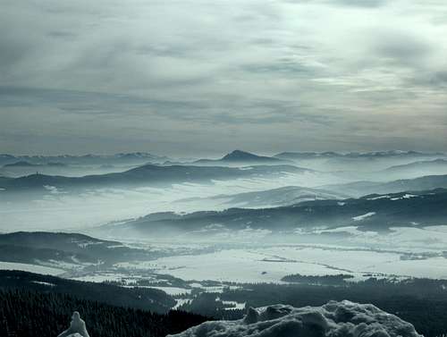
| Not only is Velký Choč regarded as one of the most beautiful Slovak mountains (it was pictured on the reverse side of a ten-crown banknote released in Czechoslovakia in 1986), but also as one of the best viewpoints in all of Slovakia. It affords spectacular vistas, especially to the south, west and east – toward the Low Tatras, Great Fatra, Little Fatra and Western Tatras. On the summit is a metal box with a summit log, a compass rose with the names of the surrounding mountains and a memorial. | ||||
|
||||
|
Getting There & Trails
 Valaská Dubová Valaská Dubová |
 On trail from Lúčky On trail from Lúčky |
 Likava Castle Likava Castle |
 |
 |
 |
| Trailhead at | Marks (stripes against white background) | Times of walk up (hr:min) | Approx. net elevation gain (m) |
| Valaská Dubová | blue+green | 2:50 | 960 |

|

|
Maps & Guidebook
Paper map 1:50 000 by VKU Harmanec
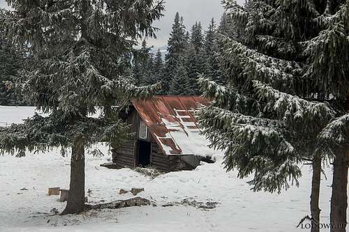
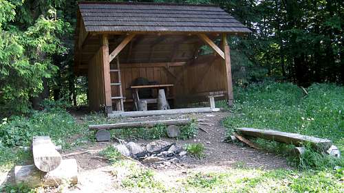
Shelters
There are two unmanned refuges on the mountain.
| Refuge | Elevation (meters) | Photo | Nearest source of water | Capacity (persons) | Location/Access |
|
|||||
|
*Once Hviezdoslavova útulňa situated about 1 km SSE of Stredná poľana was the only mountain hut in the Choč Mountains, but it was burned by German troops in 1944. It had been opened in 1924 and had three rooms with 20 beds.
Red Tape & Camping


Since 1995 Velký Choč is part of a Site of Community Importance and National Nature Reserve named Choč, with the highest level of protection. There are no fees, no seasonal closures, but you are supposed to stick to waymarked trails, which means you are not allowed to climb Malý Choč or the very summit of Predný Choč. Where an unmarked path leading to the latter summit branches off from the red stripe trail is (or rather was in 2018) a yellow cross painted on a tree and a little sign that reads 'Ku Krížu,' meaning 'To the Cross', as there is a sizable metal cross on the main summit of Predný Choč. That path is neither official nor well-trodden though. The red marks do not lead to the cross, but to another good outlook, with wooden benches, table, small cross and summit register.

Weather, Rescue & Warnings

Warnings
- In Slovakia those who do not carry commercial insurance have to pay for any rescue services rendered by Mountain Rescue Service (HZS)
- Most of the area is covered by dense needleleaf woodland inhabited by brown bears (Ursus arctos arctos), which can be run into when least expected. More about the bears and whether they can make trouble can be found for example here. Make sure you follow at least the basic safety techniques.
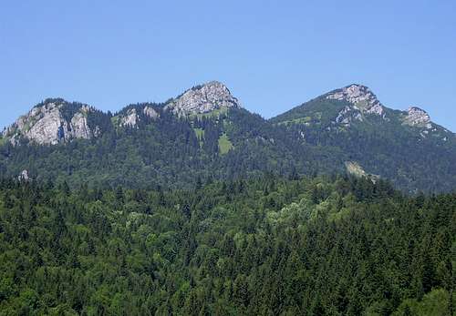
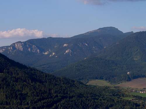
 Velký Choč dominating the landscape as seen from Babia Mountain - by HansG