
|
|
Mountain/Rock |
|---|---|
|
|
45.92841°N / 115.13663°W |
|
|
Idaho |
|
|
Hiking |
|
|
7575 ft / 2309 m |
|
|
Overview
 A view of Vermilion Peak from the east.
 Northwest side
 Near the top
 False summit
 True summit
Vermillion Peak is the southernmost of several high peaks along and extending into the north perimeter of the vast, 300 square mile Meadow Creek drainage, which after Moose Creek is the largest tributary to the Selway River. Though it’s not the highest in its group of the central Clearwater Mountains it’s well formed summit cone that is separated from its neighbors gives in an impressive profile from all directions. It is located just south of the designated wilderness boundary, but still is one of the more remote and difficult places to reach in north central Idaho. Some routes to the mountain enter the wilderness boundary, while some do not, but regardless of the route taken it’s a long haul to get into this summit. The higher peaks in this area are formed of unusually decomposed granite that gives the ground a white powder texture with very little soil development. The upper elevations of Vermilion Peak are somewhat of an exception to this as the rock seems to be fairly solid and mixed with other finer textured materials. But the subalpine beach feel is still well developed on the connecting ridges and some lower slopes. The 7,575 foot mountain has 515 feet of prominence.
The summit area is formed by an elongate point with a broad slope to the south, two steep basins to the north and the broad head of Vermilion Creek to the southeast. The main ridge runs to the west and descends more than 3,100 feet down to Buck Lake Creek. The north basins fall 1,800 feet into the upper No Business Basin. The southeast aspect rises 3,000 feet above the confluence of Vermilion Creek and Schwar Creek. The extended south and southwest ridges fall approximately 4,100 to 4,800 feet over four to five miles from the summit. The southwest and especially the north aspects are very steep, being made up of many cliffs. The other slopes are relatively gentle up high, but the lower two thirds of the canyons are quite precipitous, though the main ridge connecting to Disgrace Butte is fairly gentle. The actual summit is formed by a rounded, slightly elongated hump of black rock behind a false summit on the southeast side. Debris litters the summit from an old lookout that was built in 1924 and abandoned in 1939.
The mountain forms a large promontory at the south end of a ridge that extends south into the large Meadow Creek basin. From this vantage point the views from the southeast around to the northwest are dominated by the seemingly endless waves of a huge maze formed by the many ridges and feeders of the overall drainage. Beyond these the Gospels and other distant southern points along the Salmon/Clearwater divide can be seen on clear days. Other views are dominated by closer peaks such as Indian, Rocky and the Copper Buttes in the northerly directions.
The primitive road into this area passes between the Selway Bitterroot Wilderness and the large Meadow Creek roadless area. Meadow Creek is managed much as a wilderness area, but some motorized vehicle access is allowed on some trails. The area is becoming controversial as different factions argue for their interest in the area. Many would like to see it designated wilderness, however it was excluded from designation as part of the compromise to create the massive Frank Church River of No Return Wilderness to the south. Some would like to see it managed for timber and other resources as intended when it was excluded from designation. Despite its planning history, it is doubtful the Forest Service would enter the basin for timber purposes, but it will likely never be managed fully as wilderness. In the fall, hunters are common in the area with many four-wheelers on the road and stockmen on the trails; however Vermilion Peak is remote enough that few if any hunters will be seen during hunting season. Still use caution during this time and wear orange. There are a lot of wolves in the area so seriously consider leaving the dogs home if you don’t want to lose them.
Getting There
Via the South Fork Clearwater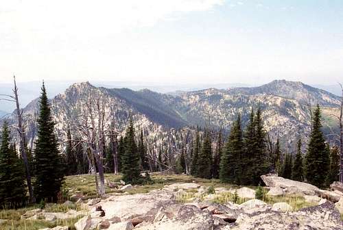 There are choices to reach Vermilion (distant right) from the east.
 Eastern Meadow Creek
 Middle section of hike
 From Indian Peak
 Looking northeast
 South Ridge
 Drake Saddle/Fire
From Highway 95, turn east into Grangeville and continue on main street (Highway 13) for a long mile to the east edge of town. Town ends abruptly at the intersection of Highway 13 and the Mt. Idaho Grade road. From this intersection turn south (right) on the Mt. Idaho Grade road. After driving approximately 0.7 miles take the curve to the left at the drive-in theater (the curve is the main road). Continue on through the cluster of houses known as Mt. Idaho and soon the road will descend into the deep canyon of the South Fork of the Clearwater River. The road hits the canyon bottom and Highway 14 joins from the left, 9 miles after the theater curve.
At the bottom of the grade continue straight for 38 miles to the Red River Road. Turn right and continue up Red River for about 14 more miles to Red River Ranger Station. Turn right (keeping on the pavement) and go through the Ranger Station for 0.4 mile to the Montana Road, Forest Service Road 468 (also known as the Magruder Road or the Nez Perce Trail Road). Turn left off the pavement on this road and continue 19 miles to the junction of road 285 to Green Mountain. Turn left on road 285 and continue 15 miles to the trailhead just south of Elk Mountain.
From the trailhead take trail 517 north over Elk and Bilk mountains and continue west across the Schwar/Marten divide to Grave Meadow. This is a distance of about seven miles. Next get onto the high ridge to the west. There are many ways to do this. It is possible to go straight up the steep slope west of the meadow or follow the trail north from of the meadow and get onto the ridge at the saddle. Hike out the ridge to the south and pass over the rounded high point of Indian Peak. From the summit of Indian Peak there are two options, a descent into Slowslide Creek or ring that basin on its east and south sides, which requires going over Rocky Peak. The first option is longer, requires more elevation loss and gain and gives the possibility of getting lost in a very remote place. The second is shorter, more level, but getting over Rocky Peak is a chore.
For the first option hike cross country west on down the broad ridge of Indian Peak that divides Snowslide Creek and Buck Lake Creek for nearly two miles. The slope is gentle to flat. When a trail is found crossing the ridge, turn left or south on it and continue for nearly a mile to the bottom of Snowslide basin. Thus far the hike forms a big hairpin with wasted miles and time. This can be cut off by dropping of the west ridge of Indian Peak and picking up the trail below. Just use caution as the slopes are steep with loose soil. Study a good topographical map beforehand to pick a good way. The bottom of Snowslide is where one can get lost. The trail completely disappears in a cold spruce swamp. There is not much to say to help here except to work to the south side and work the slopes until the trail is found. Once found the trail is in good condition, being maintained in 2006 or 2007 and is an easy hike up the divide between upper No Business and Snowslide creeks to the main east ridge of Vermilion. From Indian Peak this is between a four and five and a half mile hike depending on how much if any is cut off dropping of the west ridge of Indian.
To continue on the high elevation route, hike down the south ridge of Indian towards Rocky Peak. Getting over Rocky Peak takes some route finding and serious scrambling. Refer to the Rocky Peak page for the specifics. From the summit of Rocky Peak it’s an easy hike on the broad ridge south and then west for approximately 1.75 miles until a trail is found where the divide between No Business Creek and Slowslide Creek meets the main ridge. From here it is only about a 0.75 mile hike on a relatively level trail to the summit. The last few minutes will be steep. It’s a little more than three and a half miles from Indian Peak by this route.
There likely is another route on the 517 trail that drops into Spook Creek just before the Elk Mountain trailhead. This trail ties in with the 513 trail in lower Schwar Creek about four miles in. It may be possible to leave the trail here and climb one of the ridges up the south side of Vermilion Peak. This could well be the best way to Vermilion Peak and could likely be done with a day hike. But no first hand information of such a route is given here. While studying a map, it may be tempting to leave the trail in the Elk Mountain area and drop down into Schwar Creek and go up the ridge south of Rocky Peak. Schwar Creek is wide, deep and brushy and a cross country crossing is not recommended.
Caution should be taken on much of driving portion of this approach. For several miles on Highway 14 just east of the base of Mount Idaho Grade, the road is very narrow and twisted. Watch the speed and stay on the right side of the road and hope the oncoming traffic (largely composed of RVs and logging trucks) does as well. The shoulder is falling into the river on this already narrow road and in some places even the white strip is going, leaving absolutely no space between you and the river. On the mountainous portion, the 285 road is very narrow and will take some time to navigate safely. Road use can be high some weekends and during hunting season so anticipate other vehicles on the corners.
Part of the adventure of going into this part of Idaho is driving along the South Fork Clearwater River. This small, but beautiful river has a steep grade over endless boulders of class III, IV, and V whitewater in the spring. About 10-15 miles upstream the canyon tightens into a spectacular gorge with miles of technical climbing that is never climbed. Low elevation mountain goats are not an uncommon site here on large granite walls. All is especially beautiful in the fall when the larch and broadleaf trees lining the rocky stream turn gold. The river also supports good runs of steelhead and Chinook salmon, which can be seen jumping some of the small waterfalls during the appropriate season.
Via the Selway River
 Approaching Vermilion from the west.
 Copper Creek
 Prospect turnoff
 Above Buck Lake Creek
 West acess
From Kooskia follow Highway 12 east for about 20 minutes to Lowell at the confluence of the Lochsa and Selway Rivers. Turn right onto the Selway Road and continue for about 14 miles to the right turn across the river and go up Meadow Creek. After crossing the bridge it is about two miles to the left turn over Meadow Creek. Cross the creek and turn left and continue about 12 miles up the road to the trailhead on the south end of the Indian Hill summit area. There are many parking places and open sites to camp if desired.
From the trailhead take the 602 trail east toward the Copper Buttes. There is a trail junction visible from the trailhead; keep to the right. Off the 602 trail there are a handful of different options to get to Vermilion Peak; all of which are extended hikes that probably can’t be done in a day hike.
One option is to follow this trail for about nine miles to Drake Saddle. Through much of the way the trail passes through severely burned forest that was cooked by the 17,000 acre Drake Fire of 2007. From Drake Saddle turn right on the 628 and drop into Drake Creek. After a long mile take a left on the 609 and go up Buck Lake Creek. After about a mile this trail will climb for about another mile up to the ridge coming off the west side of Indian Peak. From here drop down into Snowslide Creek and then up the Snowslide/No Business divide to the main east ridge of Vermilion Peak. The trail will be lost in the swampy bottom and could take some time to relocate up the south side. Be sure to have a good map just in case. This route is about 15 miles from the trailhead.
Another option is to hike four miles from the trailhead to the well marked 632 trail that turns south from the saddle between Cooper Butte and Little Cooper Butte and continues south for three miles to Prospector Point. From there it drops a mile to the east to Buck Lake Creek. From here one can climb a very steep 3,300 feet over nearly two miles up the west side of Vermilion or continue south a short distance on the trail down Buck Lake Creek to the 628 trail. The 628 trail climbs 2,300 feet over two miles to the south ridge of Vermilion Peak, reaching the ridge top just northeast of Disgrace Butte. Turn left on the 609 trail and continue northeast for about three miles to Vermillion Peak. This route is about fourteen miles from the trailhead. Hiking out over Prospector Point and them up the west side of the peak and back for a day hike may be possible for an extreme power hiker on a long day, but this would not be possible for most people.
Disclaimer: I have seen the trail as far as Little Copper Butte and have been told its good to Drake Saddle. I have also seen the trail in the vicinity of the ridge coming off the west side of Indian Peak. But I have no other firsthand information of the trails from the west. If coming from this direction be sure to check current maps and don’t trust the USGS quads as many trails have been moved or no longer exist. Contact the Forest Service offices below for information.
A note on the roads from the west: the Selway River Road is paved for the first few miles and then it becomes gravel and is much narrower. Traffic can be heavy and some corners are tight so drive this road with caution. The road up Indian Hill is especially narrow and steep in places and isn’t suitable for the family sedan. Many people like to drive this road up to the lookout on the summit so proceed with caution. The fire that burned the forest on Indian Hill was the Slims Fire in 2003, which burned about 12,500 acres.
Red Tape
None, other than standard wilderness regulations when within the Selway Bitterroot Wilderness boundary. Given the overall remoteness and connectivity of the roadless areas, it all is generally managed and treated as a wilderness area whether a specific area is formally designated or not.Camping
 Lower Buck Lake Creek provides access and camping
There are not a lot of good camping opportunities near Vermilion Peak. It is possible to camp near the trailhead on Elk Mountain or basins on Bilk Mountain, but these do not get one close to the peak. Grave Meadow at the north end of Indian Ridge is about a seven mile hike from the trailhead and is five miles, mostly cross country to Vermilion Peak. About a mile further north of Grave Meadow, Red Lake is also a camping option. If coming in from the Indian Hill trailhead to the west, there are probably camping options in the stream bottoms or the lakes near Drake Saddle. This is a longer hike and Vermilion Peak is still an indirect hike of several miles. Also some of the trails in this area may be suspect and do not occur as indicated on the map (or not at all). There are also many camping options along Meadow Creek to the south and west of the mountain, but reaching them requires long term hikes followed by other long hikes to reach the mountain. To reach this mountain it may necessary to camp at the trailheads or other campgrounds along the Montana Road or Selway River and plan at least one or probably more likely two nights out.
When To Climb
Obviously the summer is the best time to reach this summit. Winter access into this area would be extremely difficult due to terrain, lack of a workable route and deep snows. At this high elevation come prepared for any kind of weather regardless of the time of year, even on days that seem warm in the morning. Storms can and often do blow up out of nowhere and can drop temperatures dramatically and bring rain or snow. It may be possible to snowmobile along the 285 road toward Elk Mountain, but it’s a long way to that trailhead from the accessible ends of the road and it doesn’t really get one near Vermilion Peak or its neighbors. The low elevations of Meadow Creek or Buck Lake Creek would enable a long range hiker to get into the area much of the year, but then getting on the steep ridges in the snow would be very difficult, but possible for a hard core, crazy person.More Information and Current Conditions
 Vermilion Peak from near its northern base.
Go to the mountain prepared for variable conditions. Vermilion Peak and its neighbors are not easily accessible, which adds a degree of difficulty to any trip into such remote country. The ability to communicate with the outside world or summon assistance if needed is greatly impaired. Any trip in this area should involve caution and good planning.
Before traveling the 468 or 285 roads or for more information and current conditions in the Vermilion Peak vicinity, contact the Nez Perce National Forest or the Red River (Elk City) Ranger Station. If coming in on the trails from the north or west contact the Moose Creek Ranger District at the Fenn Ranger Station.
Nez Perce National Forest
104 Airport Road
Grangeville, ID 83530
208-983-1950
Red River Ranger District:
Elk City Ranger Station
300 American River Road
Elk City, ID 83525
208-842-2245
Moose Creek Ranger District
831 Selway Road
Kooskia, ID 83539
(208)926-4258
FAX:(208)926-8925
TDD: 208-926-7725
NOAA Forecast