
-
 5520 Hits
-
 83.09% Score
-
 16 Votes
|
|
Mountain/Rock |
|---|---|
|
|
37.97856°N / 107.42627°W |
|
|
Hinsdale |
|
|
Hiking, Mountaineering |
|
|
Spring, Summer, Fall, Winter |
|
|
13691 ft / 4173 m |
|
|
Overview
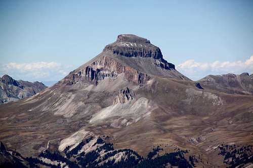
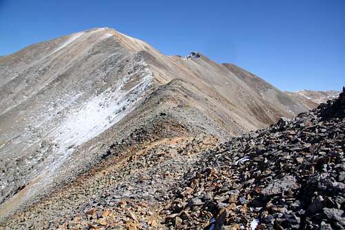 West Ridge Every Mountain
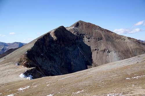 Every Mountain from the east
Guide to Colorado Mountains with Robert Ormes (sort of a bible of Colorado Mountains) briefly mentions the peak, but it does not use name "Every Mountain" only Peak 13691. "Ormes was fond of calling Peak 13688 (Cooper Creek Peak) "Three Faces Mountain", apparently as seen from Alpine Gulch to the east. Though easy to climb from this side, a more common approach is by Cooper Creek to the west. Peak 13691 (Every Mountain) is climbed by hiking 1.5 miles northeast from Peak 13688. To descend, go west a mile along the ridge to pick up the trail that drops into Cooper Creek".
Colorado Rank: 151
Parent Lineage: Line Parent: 13832 Proximate Parent: Redcloud
Class: 2
Nearby Mountains:
- “Cooper Creek Peak” 1.08 miles
- “Gudy Peak” 1.89 miles
- Unnamed 13180 A 2.08 miles
- “C.T. Peak” 2.54 miles
- Unnamed 13832 2.66 miles
- Unnamed 13811 3.10 miles
- “Sundog” 3.29 miles
- Unnamed 13540 A 3.95 miles
- Redcloud Peak 2.62 miles
- Sunshine Peak 3.87 miles
Getting There
 Cooper Creek TH
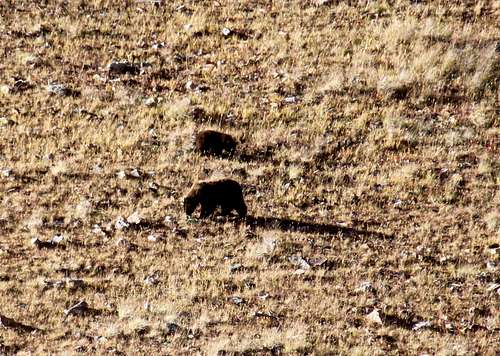 Bears in Cooper Creek basin
From Lake City take Hwy. 149 south, 2.5 miles. Turn right on the road to Lake San Cristobal. Follow the paved road about 4 miles, then continue on dirt road for another 8.3 miles. Bear right at the fork - well signed road up Cinnamon Pass; and travel another 4.2 miles to the Silver Creek Trail. The Cooper Creek Trail is located approximately .8 miles further on the right. Obviously, you can access this trailhead also if coming over Cinnamon Pass from the west - Silverton area. You do need a 4WD high clearance vehicle to reach this trailhead.
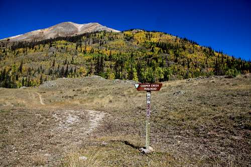
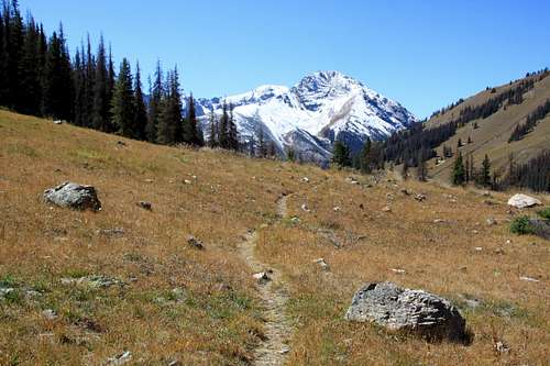
The road is open year round up to Sherman townsite (only a ghost town currently with very few buildings left), the road up towards Cinnamon Pass is closed from November (conditions dependent, could be earlier) til late May.![Cooper Creek Trail]() Cooper Creek Trail - Whitecross and Handies Peaks in the backround
Cooper Creek Trail - Whitecross and Handies Peaks in the backround![Gudy Peak]() Gudy Peak and Cooper lake
Gudy Peak and Cooper lake![Every Mountain summit]() Every Mountain summit
Every Mountain summit![Climber on the summit of Every Mountain]() Climber on the summit of Every MountainThe Cooper Creek trail is well marked and easy to follow. It does ascend through forested area, passes through open meadows, crosses the creek, and finally starts to ascend towards a basin below the Cooper lake. You will see "Every Mountain" right ahead and slighty to the east as you ascend up the valley.
Climber on the summit of Every MountainThe Cooper Creek trail is well marked and easy to follow. It does ascend through forested area, passes through open meadows, crosses the creek, and finally starts to ascend towards a basin below the Cooper lake. You will see "Every Mountain" right ahead and slighty to the east as you ascend up the valley.
Route
 Cooper Creek Trail - Whitecross and Handies Peaks in the backround
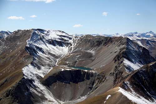 Gudy Peak and Cooper lake
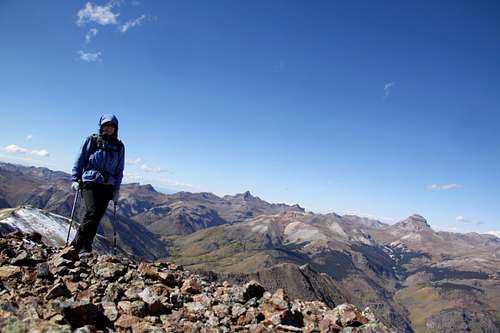 Every Mountain summit
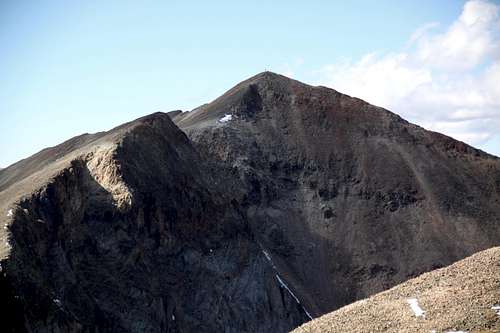 Climber on the summit of Every Mountain
I chose to hike up the easier slopes west of "Every Mountain", so I left the trail before it started to ascend up towards Cooper lake. Cooper lake is nicely placed below Gudy Peak. You have to get pretty high on the west ridge of "Every Mountain" to be able to see its waters. Once I reached the saddle, the going on the west ridge was easy. There is a false summit and some section of the ridge have a pretty obvious trail.
The summit had a cairn. I did not find any summit register. The views are spectacular in all directions.
I continued eastwards and had to drop into a saddle between "Every Mountain" and "Cooper Creek Mountain". This east facing ridge is steeper and you are on scree, but nothing is too technical (see photo with climber on the summit). Every Mountain appears more dramatic when one is examining it from the east. I continued onto the easy ridge walk towards the summit of Cooper Creek, returned back to the saddle and dropped into the Cooper Creek drainage. I tried to join the trail, but ran into bears: mom and bear cub. What a nice way to finish the hike!
 Uncompahgre Peak
 | 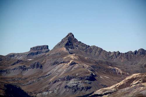 Wetterhorn and Coxcomb
 |