The page was successfully edited.

-
 2556 Hits
-
 84.27% Score
-
 18 Votes
|
|
Mountain/Rock |
|---|---|
|
|
37.78408°N / 107.83279°W |
|
|
San Juan&San Miguel |
|
|
Hiking, Mountaineering |
|
|
Spring, Summer, Fall, Winter |
|
|
13300 ft / 4054 m |
|
|
Overview
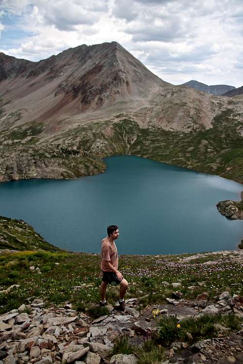 Unnamed 13300 and Hope Lake
Unnamed 13300 (some sites call it V 8, but per more resources: San Juan Mountaineers - V 8 is West Turkshead Peak). Colorado has so many high peaks and many do not bear a name, therefore another ranked, but unnamed peak. UN 13300 raises nicely above Hope Lake and combines really well with Beattie peak along a narrow exposed traverse with some class 2+/3 moves.
The peak is accessible either from the west via popular Hope Lake trail, or from the east via South Mineral trail.![Nice columbines]() Nice columbines - Hope Lake
Nice columbines - Hope Lake![UN 13000]() UN 13000
UN 13000
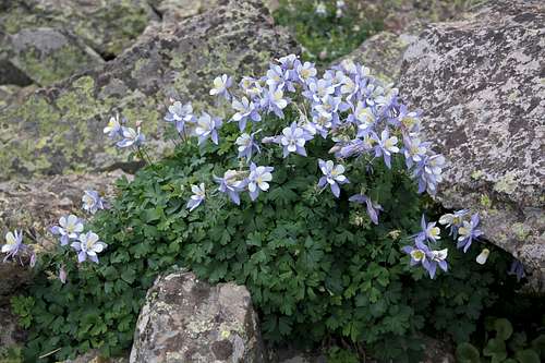 Nice columbines - Hope Lake
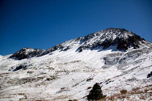 UN 13000
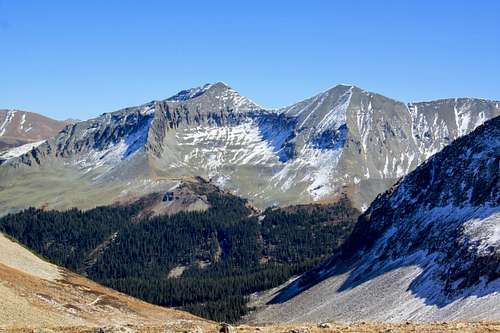
Motivated climbers seeking multiple summit can add other nearby 13ers with the summit of UN 13300, e.g. V 9, Rolling Mountain, or if continuing onto Beattie, you can add Fuller Peak and Vermillion (centennial and the highest point in the area).
Colorado Rank: 403
Class: 2 (the easier route, the traverse to Beattie may have some class 3 moves, very exposed and loose)
Parent Lineage: Beattie Peak 13342 feet
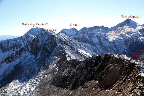
Nearby Peaks: * Beattie Peak 0.61 miles
* V 9 0.82 miles
* Fuller Peak 1.03 miles
* Vermilion Peak 1.08 miles
* Rolling Mountain 1.31 miles
* Golden Horn 1.49 miles
* San Miguel 1.76 miles
* Pilot Knob 1.91 miles
* Grizzly Peak B 2.51 miles
* Twin Sisters West 2.53 miles
* Twin Sisters East 2.70 miles
 Along the Hope Lake
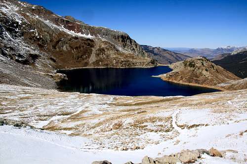 Lake Hope from the trail up Hope Lake Pass
The trail is well used and really easy to follow. It is 2.5 miles to the Lake, and another 0.3 miles to reach the pass. Trailhead elevation is 10,750 feet, Lake Hope is 11,880 feet and the Pass is 12,445 feet. The views are spectacular!
Bandora Mine Trail via South Mineral Campground: nice if coming from the east (Silverton area). Drive north of Silverton for a couple of miles towards Ouray on Million Dollar Highway. At the sign for the South Mineral Campgroung, turn left onto a good dirt road. In 4.3 miles, pass the Ice Lake Trailhead. The next two miles require high clearance 4WD vehicle. Park in a turn out at 6.6 miles at the Bandora Mine. The road splits here - the left branch goes down to the South Fork of Mineral Creek (good access point for Twin Sister Peaks and Rolling Mountain), and the right branch is closed to vehicles and goes up Lake Hope Pass.
As mentioned in an Overview section - basically, it does not matter which approach you choose. The goal is to reach Hope Lake Pass and here both approaches meet and you climb the south ridge of UN 13000. I chose Hope Lake approach because we got fresh snow and I expected the drive to Hope Lake Trailhead easier. Hope Lake trailhead is passable for 2 VD vehicles. If coming from the east via Bandora Mine and South Mineral, you do need a 4WD (ok for 2 WD to South Mineral campground, then the next 2 miles are rough).
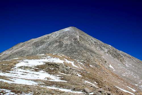
The easiest way up is via Hope Lake Pass - a nice trail bring you to the top of the pass and from here the route finding is obvious. Zig zag your way up the south ridge on loose rocks and talus. There is no trail higher up (I thought there was something reminiscent of a trail lower down) and no cairns. It may appear steep, but the going was actually pretty easy. I did traverse a little to the east on the ridge and then west, technically not difficult and relatively short. Once you reach the top of the steep section, you will go over a false summit on much easier terrain. The summit is decorated with a cairn. I did not find a summit register, but did not search too much (did not want to dig through the snow too much).
NNE ridge = traverse onto Beattie (harder than south ridge). The initial descent starts easy, then steepens, I used a snow filled couloir to reach again easier terrain. The route finding is again obvious and tried to stay on the ridge proper as much as I could, but occasionally bypassed some rock formation and used both west and east sides of the ridge. There is not much escape from this ridge, so watch your weather. Once you reach Beattie Peak, it is an easy descent into Beattie - Fueller Peak saddle.
 UN 13300 from Hope Lake Pass UN 13300 from Hope Lake Pass | 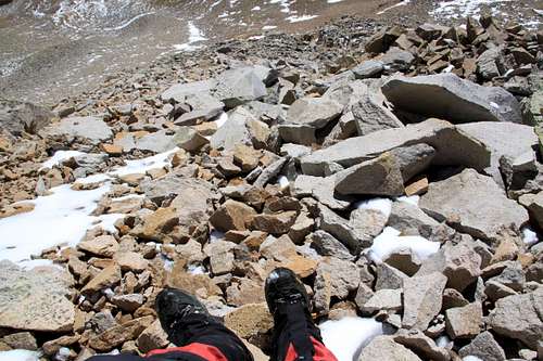 Nasty terrain - UN 13300 Nasty terrain - UN 13300 |
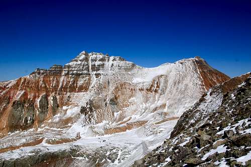 Vermilion and Fuller peaks from south ridge of 13300 Vermilion and Fuller peaks from south ridge of 13300 | 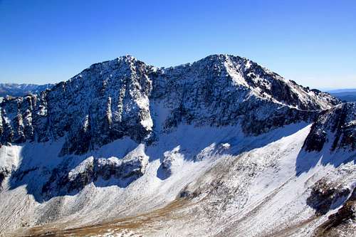 Rolling Mountain Rolling Mountain |
 Twin Sisters Twin Sisters | 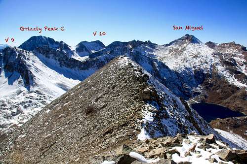 South Ridge of 13300 South Ridge of 13300 |
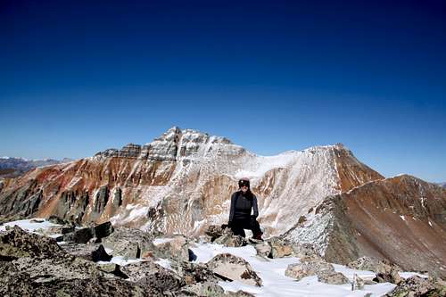 Summit of UN 13300 Summit of UN 13300 | 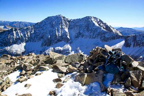 13300 summit cairn 13300 summit cairn |
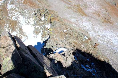 Traverse from 13300 to Beattie Traverse from 13300 to Beattie | 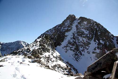 UN 13300 from the traverse to Beattie Peak UN 13300 from the traverse to Beattie Peak |
 UN 13300 to Beattie Peak traverse UN 13300 to Beattie Peak traverse | 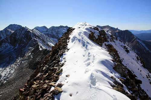 UN 13300 traverse to Beattie UN 13300 traverse to Beattie |
Red Tape
Driving 4 WD roads, hiking and climbing are free.When to Climb
Summer is the easiest with a relative short access. Winter is easier from Lake Hope since the approach will be shorter. Check for avalanche reports prior venturing out in the winter. Lake Hope area is a very popular hiking destination, especially during the summer expect crowds, beautiful blue waters of the lake and tons of wildflowers.Camping
You can sleep in the car at the Lake Hope trailhead (there is an overflow parking also). The road to the trailhead has several pull out parking areas with nice camping (primitive, flat, fire rings built out of rocks).South Mineral campground is open seasonally and paid camping area with vault toilets. You can also sleep in a car around Bandora Mine or set up a campsite at the south fork of Mineral Creek (primitive, but beautiful and free).