California 14ers Solo Female FKT
This trip report below is a summary from https://reneeelsdon.wordpress.com/2019/09/22/ca-14ers-fkt-trip-report/
September 2nd, 2019 | Leg 1: Thuderbolt (T-bolt), Starlight, North Palisade, Polemonium, Sill, and Split |South Lake (Bishop Pass) trail head to Red Lake trail head| 35.82 miles | 31 hours, 30 minutes| 11,191 feet of climbing
"You saw my email about weather?" my husband had texted. I was in Mammoth Lakes the day before my attempt was to begin, doing last-minute planning / organization and acclimatization (I had slept at Minaret Vista). Checking the weather was on my list for the day... 5 days ago a chance of rain had shown up in the forecast for Tuesday the 3rd. Now the chance of rain/thunder varied 20-30% on Monday, 30-40% on Tuesday, 30-60% on Wednesday, and a "slight chance" on Thursday, throughout the 14ers in the Sierra. CRAP! Not only would I need to be working around sleep, driving, and daylight, I now had T-storms to work around. We began thinking about strategies for managing this. "Shasta is in the the clear," my husband mentioned. "I know you don't want to tack on an extra 7 hours of driving but if the weather looks really ugly, you could hit Shasta and come back." I hadn't considered doing Shasta in the middle, but it seemed the best option...
 Bishop Pass trail head
2:15am start at Bishop Pass trail head. I've been here before, heading up/down Bishop Pass by headlamp. Most recently, for my 1st attempt earlier this month on the 15th, which I ended after a 34-hour leg 1. I had succumbed to germs my toddler had shared with me. But this time I was feeling good (last time it was pretty obvious from the start that something was wrong). So I focused on my breath, heart rate (I was wearing my chest strap monitor), and perceived effort, making sure I didn't let myself go out too hard at the start.
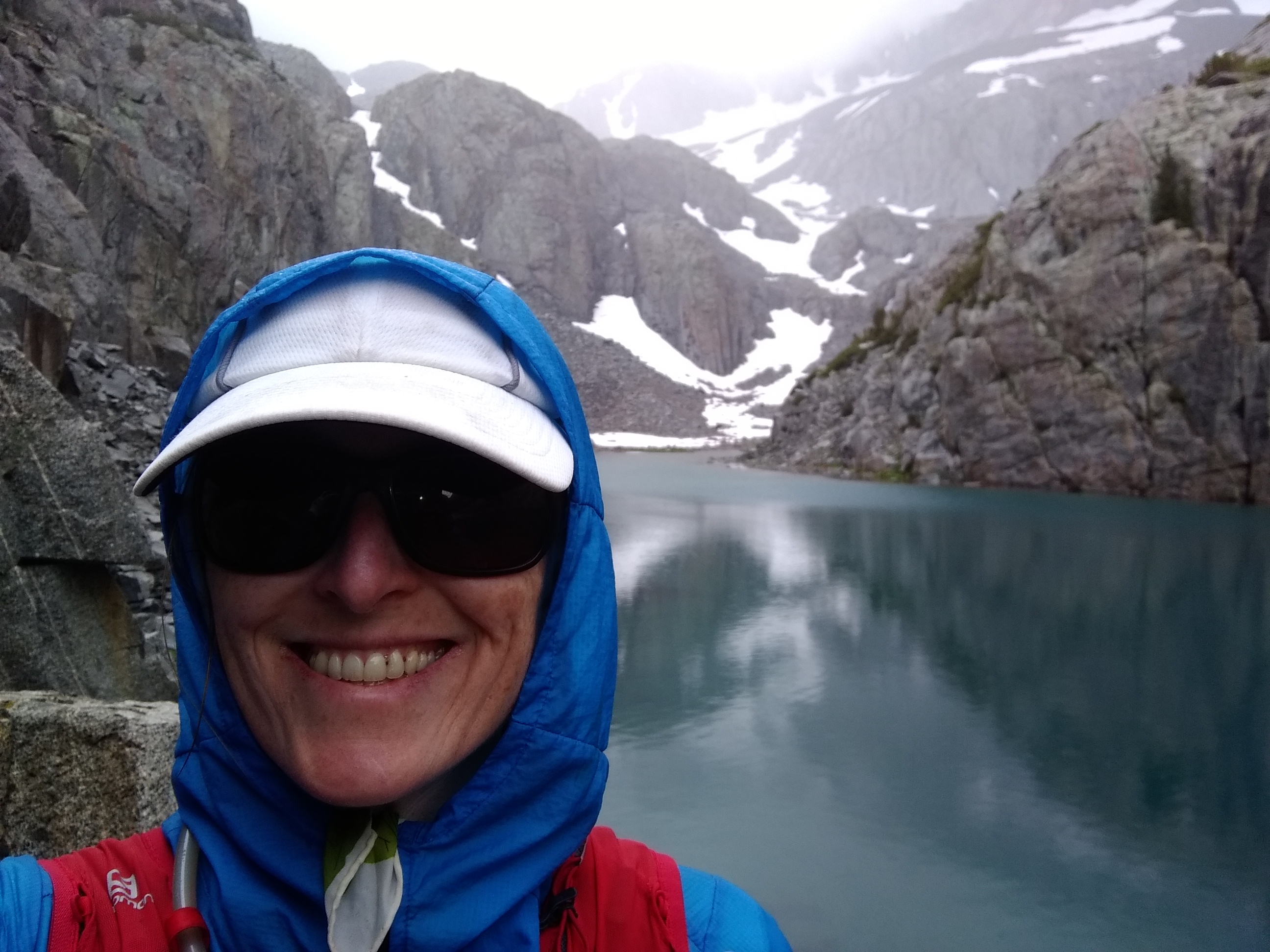
 Making light of a very bad omen - rain at dawn
I was able to turn off my headlamp around Thunderbolt Pass, and was dismayed to see a lot of clouds in the sky already, some of which were already producing rain. This is not a good sign. The internal dialogue started. "Should I turn around?" "Is this going to be my second failed attempt?" "Do I stand a chance to pull together a third attempt this year?" I decided to push on...
 On the top of the T-bolt summit block (7:35am)
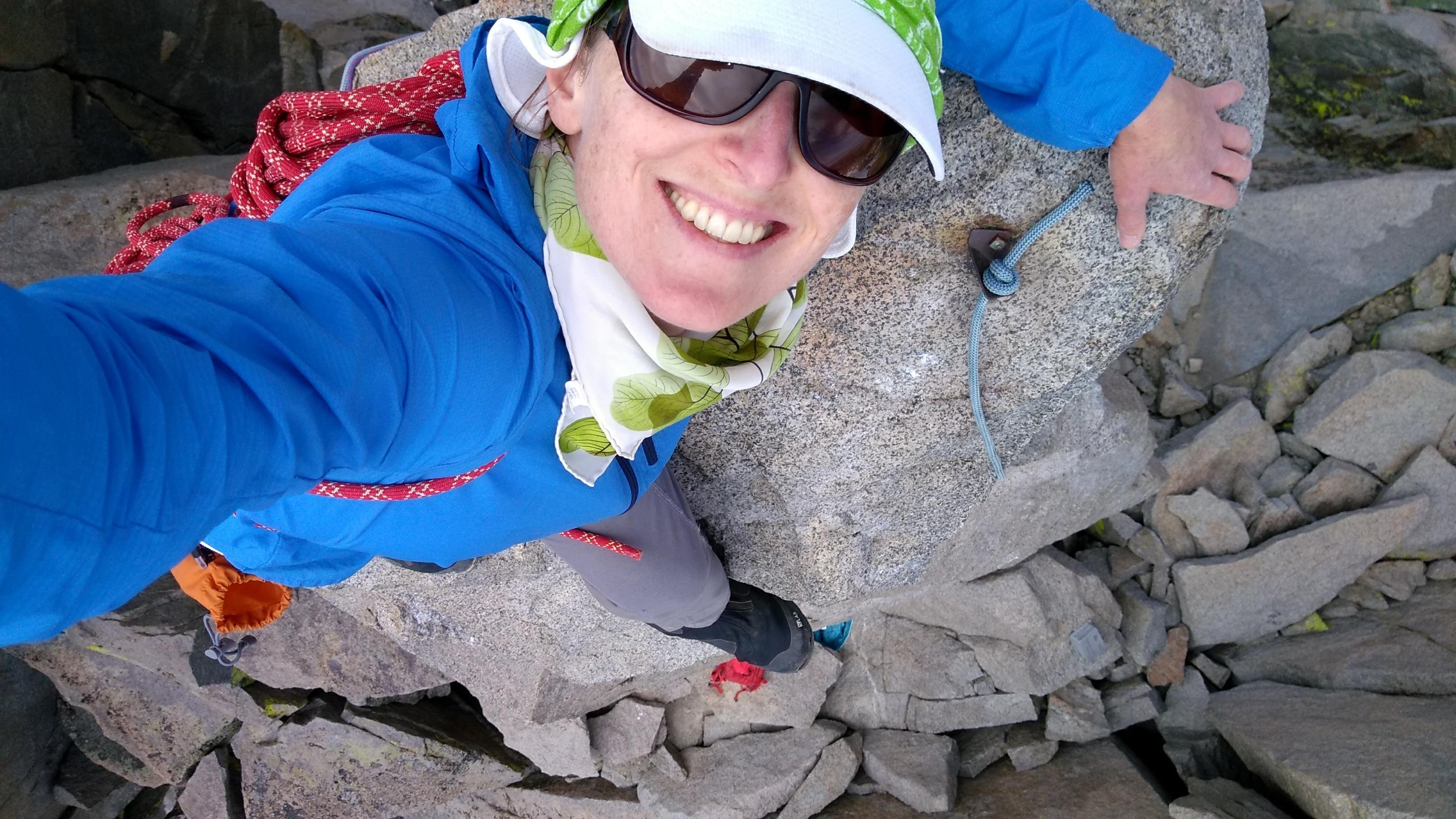
 My handline on the T-bolt summit block from my first FKT attempt (Aug 15 2019). The summitblock is rated 5.9 and is very exposed on most of it's sides, so I prefer to aid it rather than free-solo. On the second attempt, I skipped tying the knots for a handline and prusiked up the rope.
The lack of snow in Southwest Chute #1 on the way to T-bolt gave me some stoke (the snow had been very obnoxious a couple of weeks ago). So did my relatively quick time lassoing and prusiking up the T-bolt summit block (it took a lot longer a couple of weeks ago). But traversing the Palisades has a way of depleting stoke relatively quickly, particularly if you are trying to go fast... I had compiled and nearly memorized route beta from Secor's The High Sierra, Sean O'Rourke's Hikes to Climbs, and SummitPost.org in addition to having done the traverse two times already. Despite all of this, the traverse to Starlight was not flawless... I should have taken the obvious chimney/corner system near the summit down to the ledges and "easy slabs" that I used a couple of weeks ago rather than trying to stick to the ridge to find the "5.6 section"/"chimney" in the beta photo. I ended up smearing, sliding, and jumping down a rather blank but short face for the sake of avoiding backtracking. But oh well, several small mis-steps later and I found myself at the base of Starlight. Just as the last two times, I free solo'd the summit block (the only tricky move I've found is the first one, getting onto the block), wearing my harness and a rope backpack so I could rap down off the fixed slings and double 'biners rather than downclimb. This time I did bring my cell phone to take a picture from the top!
 The tippidy top of Starlight (5.6, according to some...) at 11am
The traverse to North Palisade was one section where the beta paid off - it went relatively smoothly (it helps that it's a short distance between Starlight and North Palisade). I rapped into the "gap with a flake" (since I already had my harness on and I was standing right next to the rap station, why not?) and tried to maintain my cool while spider-crawling the "outward sloping slabs" before hitting the chimney. I avoided the "tricky mantle" right below the summit block by climbing the crack and blocks climbers right of the mantle problem.
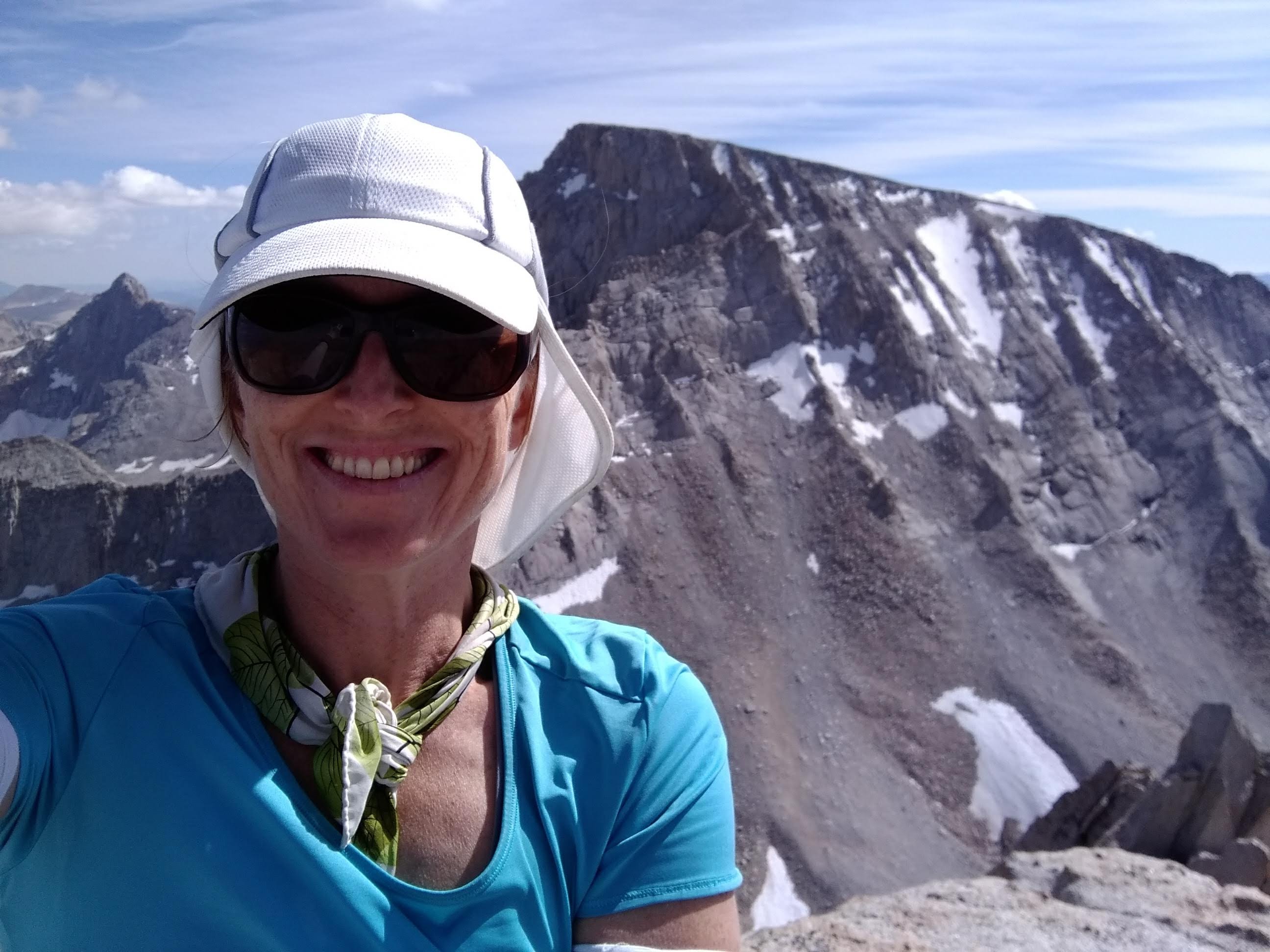
 Smiles despite clouds, on the summit of North Palisade (12:35pm)
The traverse to Polemonium started off well (I quickly found the entrance to the Clyde variation down to the U-notch this time!) but exactly how far to descend the "3rd class chute" was one area where beta differed. In hindsight, descending "at least two pitches" was far too much and took me below an obvious "ledge around the arete" and had to reverse my tracks. I ended up exiting the ledge system about 50 feet below the U-notch via blocks and ledges just below and south of the "ledge" and "the big crack" that Secor mentions. It appeared that one could descend even farther than I did and manage to get to the U-notch OK, but it would require a lot of unnecessary elevation loss. One big lesson from the Palisades is that many routes are perfectly viable and sometimes trying to diligently follow the beta is not the fastest way to go about things.
After the U-notch, I decided to experiment with going to the far side of the Polemonium southwest ridge after climbing to the notch just above the “prominent gendarme," rather than try to find the "5.2 crux" in the beta photo from Summitpost, because that did not go well last time (it led to a lot of wasted time and obnoxious climbing). I found a relatively easy, obvious path up blocks to the summit and was there at 2:30pm.
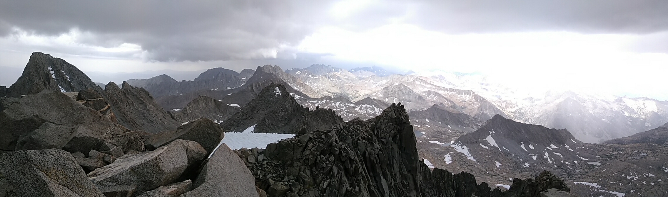 The state of affairs from the Polemonium summit
I don't recall exactly when the thunder started, but by this point, it had been rumbling for quite some time and it had changed in quality from distant, low drumming to louder, crackling, signaling that the strikes were getting closer. The weather also turned - it got windier and colder, and it started sprinkling, then raining. By the time I had finished the dramatic, exposed knife edge ridge beyond the Polemonium summit on my way to Sill, graupel started pouring down on me. I kept my husband informed of the situation via my InReach messages and internally acknowledged that I was possibly making a very bad decision by continuing to Sill. I rationalized to myself that the wind was coming from the southwest while the thunder was clearly to my north, and it seemed as though I could see some clearing in the clouds to the southwest, so it was likely that this would pass without causing any real harm. If it weren't for the FKT attempt, I would have descended now, as fast as possible. Instead, I took a low traverse line to Sill to stay off the ridge and occasionally hid beneath a massive overhanging boulder for protection from the downpour and to reconsider my decision. I realized that I was very lucky to have made it through the exposed technical sections, as everything was now wet and/or covered in graupel and extremely hazardous - even the boulder hopping to Sill was sketchy at times. I had to move relatively slowly/cautiously and had a couple of slips. My windbreaker was soaked through and I was cold...
 Mount Sill, 4:00pm. Sunshine in the distance...
As I approached the summit of Sill, I was elated as the downpour slowed then stopped and the lighting became less frequent. I pulled out my puffy jacket, had a snack, and let my husband know the weather was getting better. This was also decision time... I had determined that if I was at Sill around this time or later, it might be faster/better to bail back to South Lake and do both Middle Pal and Split as separate legs, mostly because of the time it took to recover from a 30-hour push. I was certainly not going to do the Farquhar Death Chute on Middle Palisade at this point - not only would the 4th class route be loose and chossy, but dripping wet, with hazardous graupel on all of the ledges, and I would not make it to the route before dark. Perhaps my optimism got the better of me, but I decided to go on to Split.
The descent from Sill was tedious and slow because of the wet rock, graupel, and patches of snow, at least until I hill the scree lanes lower down. After this point, the terrain (relatively flat, large boulders and patches of vegetated dirt) is absolutely joyous and I was able to jog a lot of it. This was also my first opportunity for water since the tarn and seasonal creeks just after Bishop Pass (about 15 hours ago!). The snowmelt tasted so very sweet.
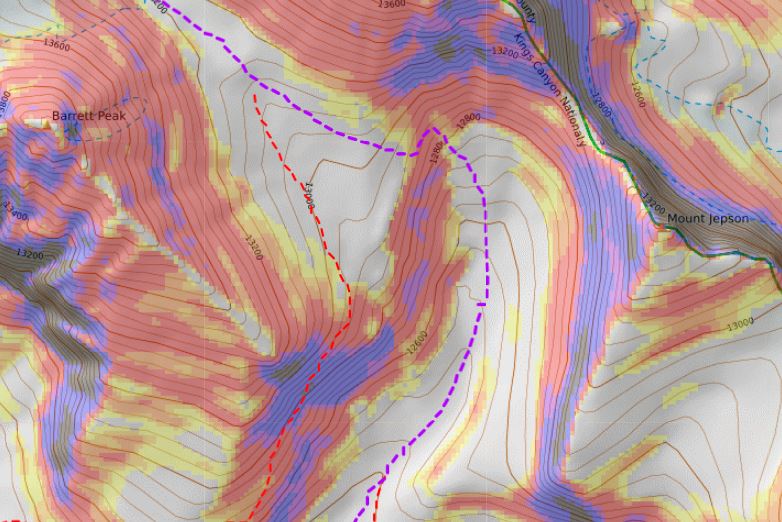 Cliff band west of Mt Jepson. My route is purple. The red line is the route back to South Lake (which looks sketchy but goes - I went this way with Sean O'Rourke many years ago)
There is a cliff band on the east-facing slopes due West of Mt Jepson that had caused me significant delays when I attempted to navigate it in the dark during my last attempt. This time, I knew exactly where to go, which saved me a lot of time. The snow and boulders after the cliff section also seemed easier and faster than last time. It's amazing what a bit less snow and little daylight can do.
My shoes were soaked and my feet started talking to me. Unfortunately, I did not bring a spare set of socks with me and I regretted the decision. I decided to stop and apply some Squirrel's Nut Butter to my feet, which helps repel water and reduce irritation from friction. In the cold temps the coconut oil-based anti-chaffing salve was rock hard and required first scraping with fingernails then brisk, extensive rubbing between my hands and feet. This improved things but dry socks would have been even better!
It was still light as I traversed the bowl at the head of Glacier Creek. This is another area where daylight helped a lot. By dark, I continually had to zig-zag around to maneuver around slabs that ended in steep drop-offs, but now I could clearly see a path that prevented such hi-jinks, making the terrain fun rather than frustrating.
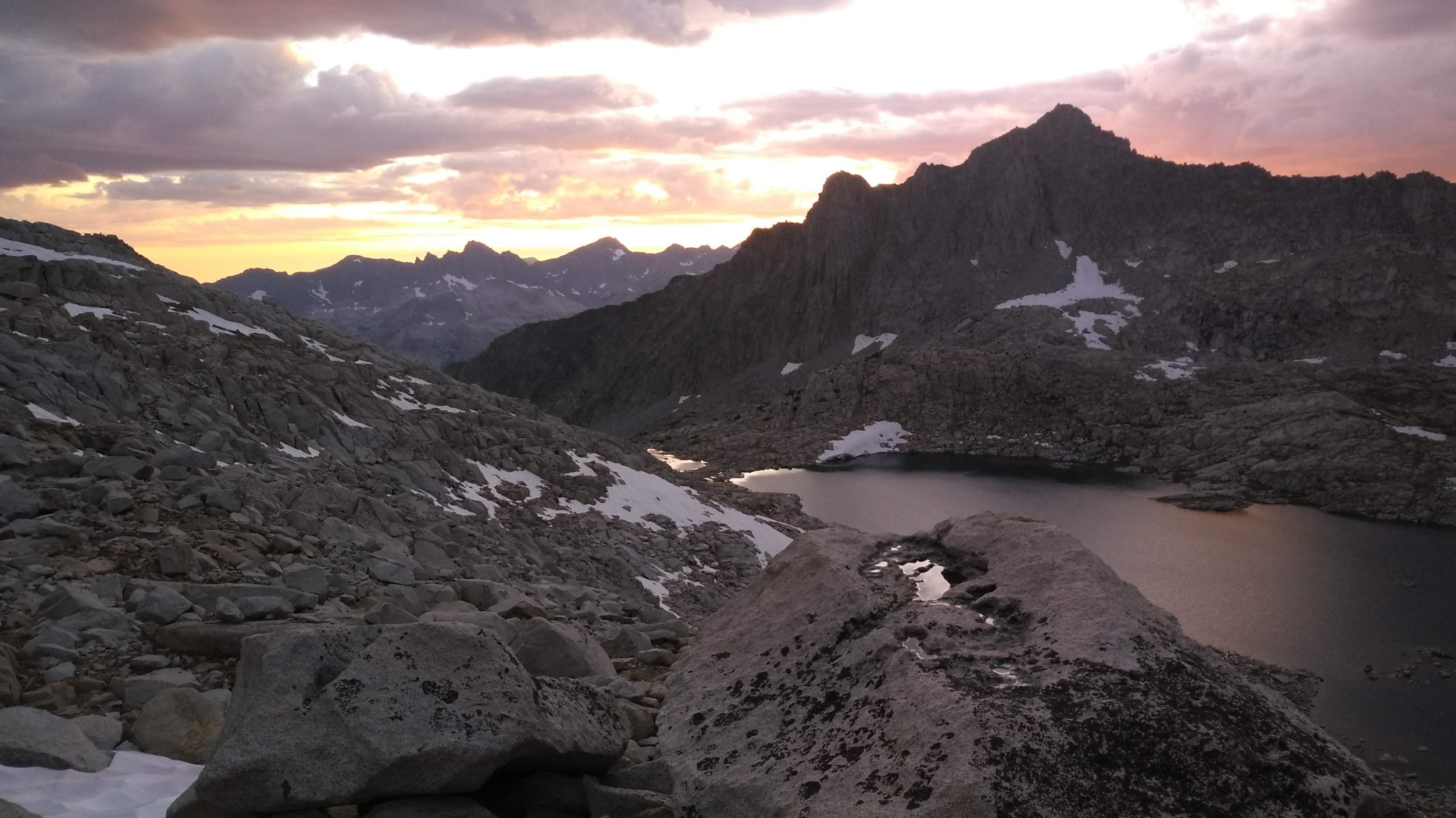
 Sunset just beyond the lake at the head of Glacier Creek
 Snow conditions at Chimney Pass during my attempt
Chimney Pass was just ahead. I fantasized about making it up the pass before it became completely dark, to be able to see the terrain on the other side. This was yet another area that was incredibly slow and frustrating during my last attempt - I kept getting delayed by small cliffs/drop-offs that needed to be navigated around ("This is supposed to be class 2?" I kept thinking), but also at that time there was a lot more snow on these steep slopes, necessitating countless microspikes+ice axe transitions. This time, the new "Weekly High Res" satellite layer on Caltopo.com made me confident that I leave this gear in the car (yay, less weight!). Having some daylight certainly helped and to my surprise, I made it to the top and I could see into the basin on the other side before total darkness hit. I cannot tell you how stoked I was! The bail path to the John Muir Trail (JMT) that I planned on using (because I was bypassing Middle Palisade) was created entirely from analyzing satellite imagery and slope angle shading on Caltopo.com and did go through some steep slab sections that could cause some issues. Seeing at least a part of my route made me feel amazing.
 Sunset just before Vacation Pass
It was 7:30pm when I hit Vacation Pass and 10:15 when I made it to the JMT right around upper Palisade Lake. Hitting a trail after many hours of technical scrambling, boulder hopping, etc. always lifts my spirits! I broke out into a jog, passing some campers that must have wondered what the hell I was up to. Their headlamps were the only signs of human existence I had seen all day.
I don't know whether my legs or my brain (or both?) were to blame, but as I started climbing up Mather Pass, all I could think about was my fatigue and I had to become my own cheerleader. I had to bring out all the stops - I was listening to music for a distraction and telling myself things like "You can do this!" "We're almost to the top of the pass!" "You can have a cookie when we get to the pass!" As soon as I made it over the pass and was descending again, my legs/brain stopped complaining and instead of focusing on convincing myself to continue, I could enjoy the stars and my music.
I found more fantastic jogging terrain between Mather Pass and the last push to Split - sandy vegetated slopes, mellow slabs, and later, relatively pleasant talus. But as the slope steepened and I started up the last 2,000+ ft climb up to Split, I found myself in a loose boulder and talus field, the kind that shifts and slides with almost every step, draining your energy and challenging your mental toughness. It's hard enough to deal with such terrain fresh and in daylight, but at 2 or 3am after having been awake and moving for 26 or so hours? I couldn't keep it together... Oh and it was cold (I was wearing all of my layers while climbing uphill). Oh and my stomach was upset (nothing in my pack sounded appetizing). Oh and my cough had started again (so I got to fret about whether or not toddler germs were going to undermine yet another attempt). I checked the elevation on a relatively frequent basis and was repeatedly dismayed by the lack of progress ("I've only climbed 100 feet?!"). I found myself going slower and slower, succumbing to my negative talk and absolutely despising this evil mountain. I had been using caffeinated gel to reduce perceived effort, but it didn't seem to be doing anything anymore. What kept me going? I didn't give myself the option to quit. I only considered stopping to take a "dirt nap" for a bit (an idea quickly dismissed because of how inadequate a space blanket would be in these temperatues) or continue, however slowly I needed to, taking it step-by-step, knowing that eventually the summit would come. Luckily, my misery did not last forever. At some point a patch of soil with some Sky Pilot flowers showed up. This meant solid ground and an excuse for some positive thoughts to leak into my system! There were more soil patches and fewer large, loose boulders/talus as I went up. Finally, at 4am I hit the summit. I cannot remember anything. I am pretty sure I found a summit register and signed it. I might have forced down some food and water. I sent a message to my husband and my shuttler (Tom Grundy) and started the descent...
The advice to check your gps to make sure you are taking the correct gully off the Split-Prater saddle cannot be emphasized enough. Even though I had a very accurate and reliable gps track to follow, and I had been here a couple of weeks ago, it was hard to find the right spot in the dark. This was all made more difficult by the fact that I was using my backup headlamp (both of the batteries for my primary headlamp were drained) and my gps watch was dead. Thankfully, my phone still had plenty of battery life and at least one of the geospatial pdfs I created for this area was working (others were mysteriously refusing to open in the Avenza app...). I found the loose and steep descent trails difficult to follow by my dim headlamp and I kept loosing my footing and landing on my butt. The small sections of snow that I had to navigate across were rock hard. Luckily they were not too steep and I managed to get through all of them in my running shoes and trekking poles by stepping in the shallow sun cups and using careful foot placements. Usually, sunrise is depressing after being up all night, especially when you've been up since before sunrise the day before, but I was rather elated when the sky lightened and eventually I could stop using my headlamp. I yearned for the warm sun rays.
Although the use trails from the summit of Split and the trail below Red Lake are significantly better than they used to be, neither can be described as well-maintained - they are rather difficult to follow and quite rugged at times. The last 4 miles or so to the trail head were arduous and slow, particularly because of my fatigue. For example, at one point I was crawling through the alders that were invading the trail, trying to avoid the creek that was running along the trail, and slipped on a wet root, covering my back-side in mud and soaking my feet. In another section, I completely lost the trail and despite having a gps track from the last time I was here, only found the trail again after a significant amount of backtracking and bushwhacking. It was absolute agony. But when the terrain eased I managed to break out into a jog (for the sake of getting to the car faster!) and when I got to the last 1/2 mile or so and could see my Sprinter van at the trail head, I was elated.
Tom greeted me in the parking lot (9:45am) with a hug and a smile and asked what he could do for me. What an angel! I showed him how to make my foot soak (hot water with 1/2 cup epsom salt, 1/4 cup listerine, and 1/4 cup baking soda) and dinner (bone broth, chicken, veggies, and pasta), downed my recovery drink (Vitargo and Tart Cherry Juice concentrate) and we discussed weather / plans. Although it would add time to my attempt, because there wasn't any bad weather at Shasta, it became the next objective. As Tom drove, I rolled my muscles with my tiger tail and attempted to sleep in the car...
September 4th, 2019 | Leg 2: Shasta via Clear Creek| 12.38 miles | 7 hours 26 minutes | 7,159 ft climbing
Rangers were officially deterring people from using Avalanche Gulch now, because of late season rockfall hazard (both natural and man-made). The ranger's conditions report also warned of obnoxious, loose scree slopes where snow had melted and in the snow that remained, nasty sun cups. All of this made me opt for the Clear Creek route, which was almost snow-free. This decision meant that I would not have to carry a helmet, ice axe, or crampons. I took microspikes and trekking poles.
Despite resorting to a 1/2 dose of Ambien, I did not sleep well in the car and decided to give myself another 4 hours of rest at the trail head without the car moving. Tom was going to join me for this one, since he had never climbed Shasta, it would be his last 14er in the Continental US (the last one was on private land and he did not intend to deal with the hassle to climb it), and since it was a short/easy/non-technical route, I did not feel that his presence would be of notable benefit, so it would not compromise my intentions for doing the 14ers solo.
We started at a 3:05am and I was stoked to be feeling great and moving at a reasonable pace. we hit snow around 10,500 feet and it was only about 800 feet wide. The snow was in perfect microspike condition so I continued on snow for as long as it made sense. The trail became intermittently loose and obnoxious shortly after the snow patch, which persisted and worsened around 12,000 feet, but you could generally find slightly more stable ground if you looked for it. Having trekking poles certainly helped. I fantasized about how wonderful this would be on the descent...
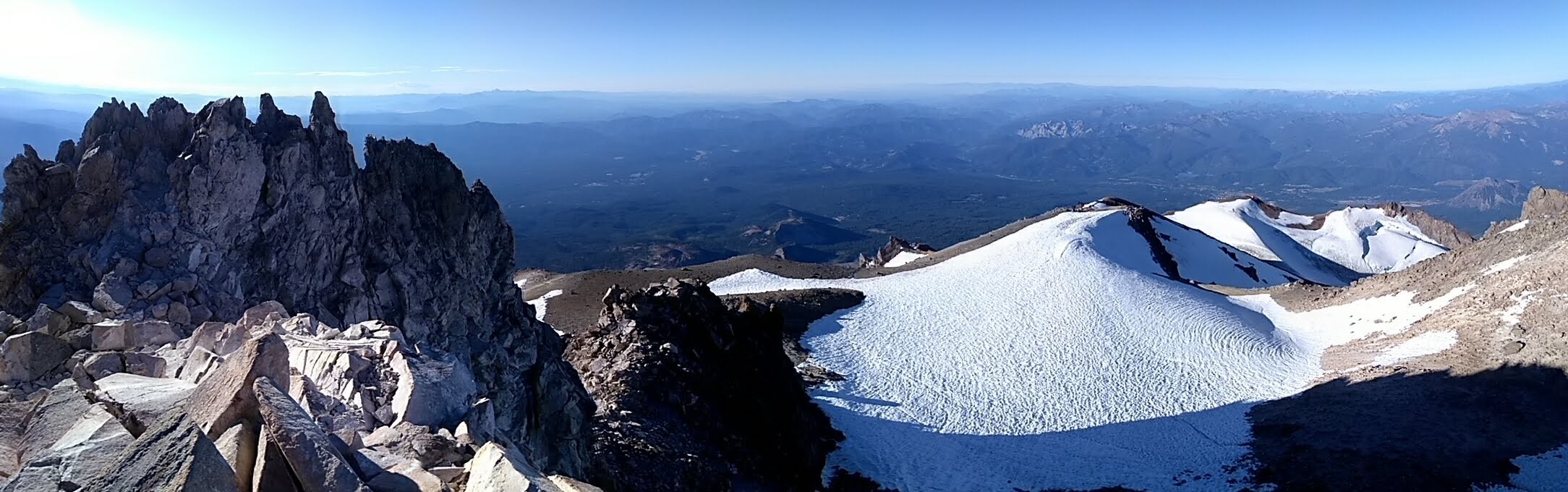
Panoramic view from the summit of Mt Shasta
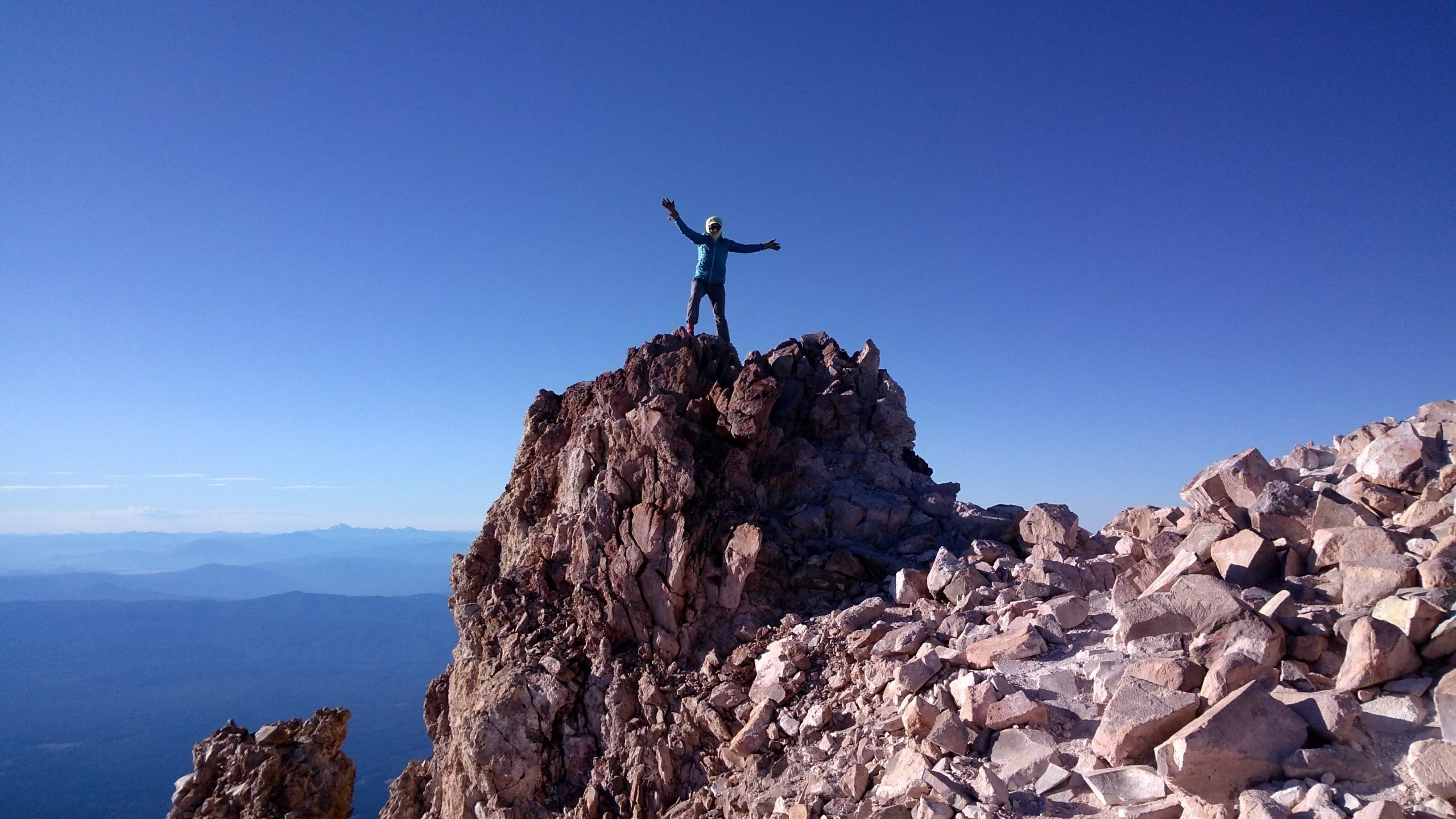 The one time I didn't have to resort to a selfie to be in the picture!
Unlike on Split, on Shasta the miles/elevation flew by and we were on the summit (8:15am) before any fatigue set in. It was cold and windy, but on the summit we could find a sunny and somewhat protected spot to enjoy the view. We spent almost 30 minutes there, which was by far the most luxurious summit experience of the entire FKT!
As I expected, the scree on the descent was dreamy - we dropped about 3,000 feet per hour. Unfortunately, the temps kept the snow patch from softening enough to provide the good boot (running shoe) ski conditions I would have appreciated, but the microspikes and trekking poles were good enough and I made it across without too much drama. Tom, in his boots and trekking poles, provided me with some impressive dancing entertainment - the sort of thing where you find yourself laughing one second and gripped with fear the next. I was getting flashbacks to seeing my friend JD loose his balance while skinning across a firm and steep patch of snow on Shasta then sliding and unable to self-arrest (no ice axe/whippet) for at least 500 feet...
When we hit the firm trail, I broke out into a jog and Tom decided he would join in the running. We were back at the car around 10:50am. After a foot soak and "dinner," we were on the road again heading back to the stormy Sierra. This time I took the first shift of driving so Tom could get some sleep. The fast descent left my knees and surrounding muscles talking to me, so I used my e-Stim/tens machine while driving on my calves, knees, and quads. It's a fabulous gizmo, I must say.
I saw a lot of rain and lighting during the drive south. My husband and I had a phone conversation about the weather. To my dismay, things had gotten a bit worse. Essentially throughout the Sierra, the forecast was for 20% rain starting at 5am, 70% rain and T-storms starting at 11am, until 5pm. I decided to do the two shortest legs, Middle Palisade in the morning and White in the evening, with the goal of being off the summit and/or driving during the worse of the weather.
While Tom was driving on 395 south of Reno, we saw two fires, the second of which was the Taboose fire which ended up devastating the Red lake trail head (my exit from Split yesterday morning!), requiring helicopter evacuations for hikers/climbers, and closed the trail head (it remains closed as I write this). If I had waited for the weather to clear, I would not have been able to complete the FKT because of this fire...
September 5th, 2019 | Leg 3: Middle Palisade Northeast Face via South Fork Big Pine Creek | 17.2 miles | 10 hours 36 minutes | 6,699 ft climbing
I set my alarm for 1am but somehow managed to accidentally turn it off and sleep in 2 hours! In hindsight I probably really needed it and it was for the best, but it certainly filled me with fear of lighting on the route... 3:54am start. The body felt great again this morning. That plus some good route research, reliable gps tracks from JD, and well-cairned use trails kept me moving quickly and efficiently on the approach, after departing the trail after a pond just shy of 10,200 feet, past Finger Lake, and through the snow/boulders/slabs up to the base of the route. I had planned on doing all of this by headlamp, but sleeping in meant that I could see and enjoy the scenery! I found myself smiling and paused to take pictures. Sprinkles and a cloud-filled sky reminded me of the T-storm threat and kept me from dawdling too much...
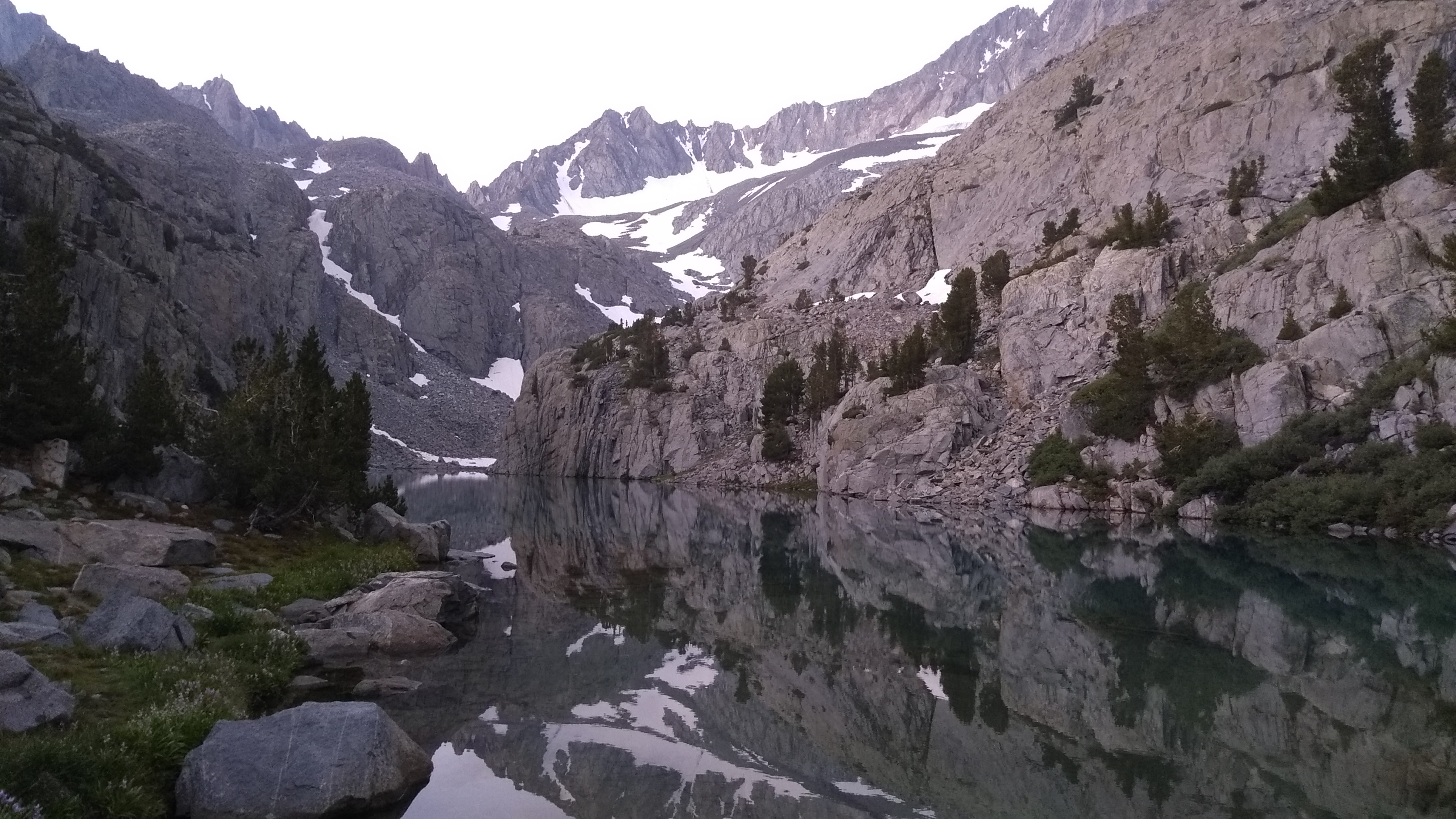 Finger Lake in the Morning
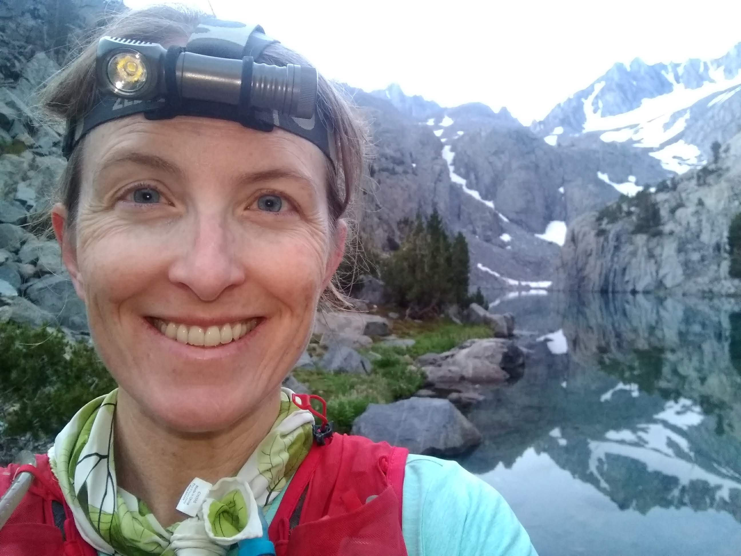 I was enjoying the morning (it hadn't started raining yet....)
Because the Middle Palisade glacier has receded so much, finding the route to "Secor's Chute" is not exactly obvious and requires some class 4 or 5 scrambling. I thought I found it and started climbing but then started questioning myself... Thoughts of wasted time being off route with T-storms looming made me reverse my tracks and head to the very obvious ramp marked by white and red stone (the red line in the beta photo). This ramp is loose and chossy, particularly near the top, which did not bother me much on the ascent, but did necessitate a more cautious, slow descent. This section does not last long, and I was soon on the very solid class 3 ledge system that makes up the "Main Chute" to the summit. It was about 9:30am and frequent bouts of thunder and heavy rain had started at this point (much earlier than expected). Just as on Sill, I managed to convince myself that the thunder was far enough away to warrant continuing, while acknowledging that this was possibly a very bad decision. Both me and the rock was dripping wet. I climbed as fast as possible while trying to be safe on the slippery rock, occasionally looking up to make sure I was going approximately in the right direction. I was definitely not taking the easiest path, but I didn't care. I told myself "you have to get up so you can get down." To my surprise, the rain and thunder started diminishing as I neared the summit. I even got brief glimpses of sunshine! I topped out at 10:20am and relaxed a little but started the descent ASAP after signing the register and sending a message to my husband via the InReach. My stomach would have to wait...
 The clouds on Middle Palisade reminded my of being in the Pacific Northwest or the Canadian Rockies
The timing of the rain ended up being perfect. The rock actually started to dry out a bit on the descent, which I preferred over having dry rock on the ascent and wet rock on the descent. If I hadn't slept through my alarm or the rain happened when the forecast said it would, it would have been the other way around! I paused for some pictures, a summit cookie, and other snacks at the base of the 3rd class route, after the thunder had stopped for a while.
 Finger Lake on the descent. Still smiling, but really wet...
Except for the clouds, cold, and sporadic drizzle, the descent was perfect. I had fantastic boot skiing conditions on the snow, found some scree lanes on the way to finger lake, and could jog some sections of the use trail. Unfortunately, if it wasn't raining, the wet plants I had to bushwhack through were soaking me, so I never got a chance to dry out and my feet weren't doing so well. I had mis-calculated and put my spare socks on too early. Now both socks were wet and my feet were pruned and swimming in what felt like lakes in my footbed. I stopped to attempt to empty water out of my shoes and ring out my socks. Nothing could be done. Thank goodness there were not too many miles left to go! I ran what I could (some sections were too technical/overgrown for me to run) and got back to the car just shy of my low estimate! I was stoked and started thinking of success on White Mountain that evening. After the car rituals (recovery drink and foot soak, but no "dinner" yet), we started the drive to the Barcoft gate. I attempted to sleep, but the windy and/or rough dirt roads prevented it from happening.
September 5th, 2019 | Leg 4: White Mountain | 14.39 miles | 3 hours 51 minutes | 3,255 ft climbing
The plan was to mountain bike White Mountain, as there is a road to the summit and it is legal to do so. This would also be faster, and give my running/hiking muscles a change of pace (most importantly, save my body from some downhill pounding). I started the ride at 5:15pm, which was after the ris k of T-storms has diminished. We saw some signs of rain and the summit was essentially shrouded in clouds nearly the entire time, but no sign of T-storms! Tom helped me rig up my lights - my Zebra headlamp on the handlebars and my Fenix headlamp on me helmet, which could have provided me with over 2,000 lumens when they were both in their brightest beam mode. I hoped to make the summit around sunset and expected the entire descent to be in the dark. It was below 50 degrees and quite windy at the trailhead, so I brought essentially every layer I had, plus Tom's clean pair of thick wool socks and balaclava, to make the cold descent manageable.
 Just about to start the MTB leg on White Mountain
 A brief moment of blue skies above White Mountain
I had never done White before. People who have told me what to expect, but their description did not entirely prepare me. Perhaps it was my tired legs or my gearing on my bike (a modern, light 11-gear set-up), but some sections of the road felt really steep (hike-a-bike time!) and some of the rocks were bigger than I was expecting. I also managed to find some sandy sections, making some of the descents a little sketchy at times. There are a couple of places where you loose some elevation on the climb, so the descent was not going to be entirely downhill... My now persistent cough started getting quite bad in the cold wind. I found myself dwelling on all of these negatives a lot more than I should have, so the ride was not as pleasant as it could have been! It seemed like it took forever for the summit to come, but eventually I was on the last set of steep switchbacks and it was getting dark. Rather than attempt to bike these last few switchbacks, I got off my bike and hiked straight line to the summit through the loose talus. It was windy, cold, and dark on the summit at 7:50pm. I dropped my pack and threw on all my layers, sent the required InReach messages, then signed the summit register and started the descent, all while chewing some snacks and shivering.
 Tom captures me biking back to the car
On some level, I actually appreciated that the descent was a bit more technical than I expected and that there were some climbs on the way back to the car - they both helped me stay warm. Once again, I got to revel in finishing a bit below my low estimate and I thoroughly enjoyed the hot dinner that was waiting for me and tried not to think about the little sleep I would be getting that night...
September 6th, 2019 | Leg 5: Williamson and Tyndall | 32.2 miles | 16 hours 13 minutes | 11,460 ft climbing
I had given up on doing Langley, Muir, Whitney, Russell, Williamson, and Tyndall all in one push like Sean had done during his FKT. He shared horror stories of difficult route finding, misery, and delirium during this leg, and he was a lot faster than me. I expected that I would have to bring bivy gear and get some real rest, I would need a lot of food, and I would be carrying an ice axe/crampons/microspikes the whole time if I did them all in one leg, which all added up to a descent amount of weight, which would slow me down further... So, despite adding mileage and elevation gain to the overall attempt, I surmised that breaking this up into two legs (Williamson, and Tyndall as one, the remaining four as another) could actually be done faster, given all of those factors plus how badly I routinely broke down after about the 24-hour mark on all my previous long outings. Williamson and Tyndall is the short outing and would come first.
I don't remember what time I had set my alarm for, but I do remember waking up before my alarm with a coughing fit that wouldn't quit (my cough had been getting worse every day). I had only gotten around 3 hours of sleep. I made hot tea and took cough drops to address the cough then decided I might as well start my day rather than try to get a measly 30 minutes or whatever of additional sleep. I was moving slowly and not looking forward to getting out of the Sprinter. Tom asked me how long I thought it would take. I had been hoping for 16 hours (or possibly even 15 if I felt really good!) but expected it to take 18 given how I felt. 5:34am start. My muscles weren't bothering me but thoughts of how tired I felt were essentially constant. At least there weren't thunderstorms and rain in the forecast!
I started the day with The Coffee Song on infinite repeat in my head for probably an hour until I realized I could purge it with my headphones. The Enormocast podcasts that I downloaded before starting the FKT were exactly what I needed and helped drown out my thoughts of fatigue. My headphones turned out to be possibly the most important piece of gear during this leg.
I had to consciously and continuously push myself to maintain a decent pace. I was wearing my heart rate monitor and I was baffled that my perception of effort was high but my heart rate was quite low, just as I had seen on Split (it didn't occur to me that my heart rate monitor was giving erroneous output because it hadn't been cleaned in a while). I ate my homemade caffeinated gel throughout the day to help this. Since I had done Williamson as a training weekend, I was quite familiar with this route, and I tackled it incrementally and tried to derive satisfaction in the variation: "focus on getting through these creek crossings," "switchbacks are next," "the saddle is coming up," now we get some descent," "we're almost at Anvil Camp," and so on. After days of seeing essentially no one all day, I passed a number of parties on the trail (at least I was not going slower than the backpackers, I thought) and campsites. It wasn't quite the weekend, but it seemed I was now sharing the mountains with all the weekend warriors.
The next increment was surmounting Shepherd's Pass. The microspikes and ice axe that I brought to ensure that the steep snow at the head of Sheperds Pass would not cause any issues were a waste of weight - the boot track was well established and the traverse was brief and horizontal, the snow firm but not slippery. I stashed them in the rocks just beyond the pass, about 4.5 hours after leaving the car, about 10 miles and 5,700 feet below. Somehow, I was not doing too bad at all...
 Tyndall, from the north end of the Williamson Bowl
 Williamson, from the north end of the Williamson Bowl
And then, it was time to tackle the Williamson bowl, which seems to last forever... At least the obnoxious snow that I had to deal with the last time I was here was mostly gone, so it felt faster. I wasn't postholing to my waste or swimming in foot-plus deep suncups this time. The snow that remained was sparse, easy to navigate, and in good shape. I managed to find good use trails and solid ground in the boulder fields. Even the talus and scree near the "black stain" at the base of the West Face Gully route on Williamson was not as bad as I expected - I could find bits of slab and more stable rocks to aid the ascent. Ditto inside the gully. I was still listening to music and incredibly tired and moving slowly on the steep terrain, but not as miserable as I feared.
 Summit cookie on Mt Williamson
When I got to the 3rd class chimney at the top of the gully, I found it to be dripping wet. The graupel that had fallen during the recent storms was still piled up on all of the ledges. My floppy Altra running shoes didn't handle it well, but there wasn't too much face climbing and inside the chimney it was relatively secure, with not too much exposure, or so I managed to convince myself. I hit the summit at 1:35pm. It had taken approximately the same amount of time as last time, during my training - apparently the snow conditions which slowed me then equaled the fatigue that I felt this time. No matter, this was reason to celebrate, so I gave myself a good food break and took pictures, in addition the the usual chores (signing the register and sending InReach status messages). Instead of signing "Renee Elsdon Jacobs CA 14ers FKT attempt" in the register, I signed "Renee Elsdon Jacobs CA 14ers FKT #10/15."
The descent was uneventful, other than deciding to boot ski on a patch of snow that ended up being too steep/firm, leading to an unplanned glissade that I could not control, which abruptly ended at the termination of the snow in some large rocks (not one of the short cliffs, thankfully). I had jammed my leg and arm and scraped up my hand but I was OK and told myself "that was stupid, lets stick to the rocks, OK?"
Just below the "black stain," I crossed paths with a party of two heading up. They wondered how long it would take to reach the summit and mentioned that they wanted to get below the snow below Shepherd's Pass before dark. It's always so hard to give advice/suggestions in situations like this... They ended up continuing and I thought of and looked for them multiple times as the day progressed to see if they were on target, but I didn't see them again.
I made a B-line to the base of the North Rib route on Tyndall and was there about 2 hours after leaving the Williamson summit. This filled me with stoke, as did the route. It looked lovely! I saw lots of solid rock, slabs, and ledges. It turned out to be exactly that and I enjoyed every bit of it. It did not feel like 3rd class - my Altra running shoes felt perfectly adequate. I was further stoked to see numerous scree lanes to my right as I ascended the solid rock on the rib. It looked like they would make for a fast, fun descent.
There was a party of two descending Tyndall as I climbed. The first recognized me from earlier that day and I felt bad that I didn't recognize him. He remembered that I told him I was heading to Williamson and was impressed that I was now climbing Tyndall. "You're an animal." At that time, I didn't quite feel like a sloth anymore, but I was no hummingbird, that's for sure. I wondered why they were not taking the scree lanes but didn't mention it...
 Looking west from the summit of Tyndall during a brief break in the clouds
 Another summit cookie, from Tyndall, looking at Williamson
 On the Tyndall summit block, surrounded by clouds
My friend JD had climbed Tyndall about a month before. He mentioned to me that there were at least a couple of options at the top of the rib for gaining the ridge to the summit. As I neared the top of the rib, I eyed the two that were the most obvious - one to the left of the termination of the north rib that summitpost.org beta suggests, and another about perhaps 200 feet to the right, which JD suggested I try. I could see an obvious ledge system leading to JD's variation, so I went for it. It was super mellow and I wondered why all of the summitpost.org beta implied that there was only one correct chute to take. I reached the ridge, made a cairn to mark my descent, and navigated through the large boulders that led to the summit, passing the well-cairned summitpost chute on the way. I hit the cloud-shrouded summit at 5:15pm, only a bit over an hour since starting the route over a thousand feet below. Once again, I felt I had reason to celebrate and gave myself a real summit break, including photos, food, summit cookie, InReach messages, and signing the register ("Renee Elsdon Jacobs CA 14ers FKT #11/15), before starting the descent.
 The state of my feet at the base of Tyndall
As expected, the intermittent scree lanes helped on the descent and I was back at the base of the route in about 40 minutes. I stopped to empty the sand and scree from my shoes and check in with my feet. This was the first time I had looked at my feet since the Red Lake trail after Split. Other than a couple of slips in creek crossings in the morning, some short sections on snow, and the wet chute on Williamson, today day had been relatively dry and kind to my feet, but the days prior had not and my feet looked horrible. Thankfully, they felt better than they looked. I decided to cut off the largest flaps with the small scissors on my utility knife, apply some nut butter, and swap into my dry socks before continuing.
 Cool clouds at sunset, from the Shepherd's Pass trail
When I hit the Shepherd's Pass trail, I noticed a pair of hikers wearing large packs off-trail just ahead, wandering towards the cliffs east of Shepherd's Pass. They were just out of shouting range. Almost every interaction I had with humans that day was a bit surreal and left me wondering about their choices/activities.
I collected my hidden ice axe and crampons and crossed the patch of snow with ease, then stashed everything inside my pack to prepare to run. I was stoked to be on-trail, before dark, and I paused to send a couple InReach status messages. It was 6:40 and I expected to be back at the car in 2.5-3 hours. Woot! With my music and caffeinated gels pumping energy into my system, I now felt like a deer and practically pranced down the trail. When FloriDada by Animal Collective started playing, I broke out into a skip. Flow state was in full effect! Even the 400 feet of climbing to the saddle to exit the Sheperd's Creek draining and enter the Symmes Creek drainage did not dismay me as much as it had a bit over a month ago. Everything felt great except for my knees (to be expected after running down over 5,000 feet). I slipped on some of the slippery branches and rocks in a couple of the four Symmes Creek crossings (same as in the morning), but I didn't care - I was close to the car. I finished right around 10pm, which meant that once again I finished with a smile and got to revel in finishing faster than expected, despite my battle with exhaustion.
Tom mentioned that he had set out the solar shower that day. It was still warm. So while he worked on preparing my foot soak and dinner, I hung the shower from the tree that the Sprinter was parked next to and enjoyed a warm shower. I even used soap. It felt good. This was a perfect shower tree - strong branches at the perfect height to hang the shower, your clothes, and a towel. There were even a few flat rocks at the base to stand on so your feet did not get muddy. There were many serendipitous moments while training for and now executing my 14ers FKT attempt that made me feel like I was somehow resonating with the universe and this was one of those moments.
I had been working on a sleeping strategy for the last two hours or more. I even dictated notes on my phone so I wouldn't forget a step. I decided that getting a good night of sleep was more important than a proper alpine start. We needed to get Nyquil to help me sleep and cough drops for my throat. We made hot water before bed and put it into a good thermos so I could have hot tea for instant throat calming in the middle of the night if I woke up with a coughing fit again. My throat was really irritated so I would bring cough drops with me for the next, final leg. Tom would prepare my pack as much as possible: clean out all the trash, charge all batteries and devices, assemble my food, ready the clothes and gear.
September 7th, 2019 | Leg 6: Russell, Whitney, Muir, and Langley | 35 miles | 21 hours 35 minutes | 13,228 ft climbing
I crawled into the bed at the back of the Sprinter as soon as possible on the drive to Army Pass trail head. I am pretty sure I wasn't sleeping, but if I was, I awoke with a start and asked Tom, "Should I be starting at Whitney Portal?" I had chosen to start at Langley for the same reasons as Sean during his 14ers FKT, but now that I was not doing Langley to Tyndall in one continuous push, and I was not getting an alpine start, I had not reconsidered my starting trail head. Whitney Portal was a bit lower than Army Pass trail head, but the terrain between Muir and Army Pass was not technical, which would be easier to do by headlamp. Tom noted that being in the Whitney Zone during daylight, without a permit, ascending rather than descending, would be riskier - I might get caught and forced to turned around. I decided it was worth the risk, so he flipped a U and headed back towards Whitney Portal. I did not set an alarm.
I woke up with a smile. I felt refreshed and energetic. No part of my body was complaining. I think I did wake up with a coughing fit, but it was solved with hot honey tea and cough drops, and I quickly went back to sleep. Start time 8:44am, which is incredibly late, but I didn't care. Shortly after starting the trail, I got an idea after seeing multiple hikers heading back to the trail head with permits hanging off their packs. "Excuse me, are you done with your permit?" The kind man stopped and responded "Do you want it?" and soon his permit was dangling off my pack and my steps became even lighter. This would not have happened with an alpine start!
To my error, I had not even looked at the map/route since creating it many months ago. I had taken the Boy Scout Lake trail once, many years before, and forgot how obscure the trail junction was and exactly how close it was to Whitney Portal. I was feeling spunky and mindlessly blasted up the trail. I came to a dead halt when I saw the "You are now entering the Whitney Zone" sign around 10,200 feet. "I am not supposed to be in the Whitney Zone before Boy Scout Lake" I thought to myself and suddenly all of my morning stoke went down in flames as I started cussing to myself and calling myself all sorts of bad names and retreated down the trail to get this error behind me as fast as possible. I reached the North Fork of Lone Pine Creek 90 minutes after having passed it earlier this morning. I was expecting this leg to take 20 hours or more and the last thing I needed was to make it even longer. I also really wanted to be done with Muir before it got dark, and I now feared that was in jeopardy. I tried not to look at the cars at the trail head as I searched for the trail (even with a gps device, it is easy to miss).
 Enjoying the East Ridge of Russell
It took some time for me to stop talking badly to myself. I knew that it was not productive and tried to convince myself to stop. This was a huge mental hurdle and I was failing. It didn't help that the Boy Scout Lake trail is relatively challenging (including some easy scrambling, bushwhacking, route finding, boulder fields, difficult creek crossings...), so rather than the miles flying by as they had on the Whitney Trail, the day dragged on. I was actually excited when I got to the infamous scree and boulder field that led to the Russell-Carillon saddle - I finally felt like I was making progress and I might actually get somewhere today! The route that I had drawn at home was quite different than where my instincts led me, but cairns and footsteps made me confident in following my instincts. Without too much pain, I was at the saddle and got a good view of the East Ridge route. It looked fun. And I was finally done talking bad to myself.
My only concern was being able to find my descent chute, so I kept an eye on the terrain and made mental notes to myself for the descent. I made it to the summit at 3:20pm and signed "Renee Elsdon Jacobs CA 14ers FKT #12/15." I took some time to study the North Face of Whitney, which was my next objective. It's a steep face covered in class 3 ribs and sheer class 4 and 5 slabs. There are some really good beta photos on summitpost.org that I used in conjunction with satellite imagery on Caltopo and google earth to set my route prior to setting off. It looked like I was right on...
 Looking towards Williamson from the Summit of Russell. This is the terrain that I would have been navigating, probably entirely by headlamp, if I did Langley to Tyndall in one push
 On the Summit of Russell, with the North Face of Whitney behind me
It turns out, the South Face Gully route that I used for my descent is well-cairned and in what I thought to be an obvious location. The chimney at the top of the gully was one of those magical Sierra alpine chimneys - it was steep and intimidating from the top but obvious big holds and ledges would appear where you needed them once you were in it. I had been hoping that the gully below the chimney would offer some fantastic scree but it was not as good as I envisioned. There were also a great deal of boulders to deal with as I neared the north face of Whitney, but it was manageable and not too discouraging. Once I was on the rib I intended to us (exactly where my watch said I should be), it became truly fantastic terrain. At times I felt like I was on Tenaya Peak in Yosemite. There was even some water, so I didn't have to ration and could skip Crabtree Lake if I wanted.
 Looking towards Muir and Langley from Whitney
 Whitney Summit
I've been on the summit of Whitney multiple times before and it was really cold and windy, so I did not dawdle. It was 5:45 and daylight was waning. "Renee Elsdon Jacobs CA 14ers FKT #13/15" was signed in the register. I was now hopeful I could finish Muir by sunlight.
The Whitney Crest trail seemed to go on forever. "This must be awful on the way up," I thought. Eventually, I made it to Muir. I appreciated that it was so close to the trail and it was such a short climb. Armed with good beta photos from Sean's book and summitpost.org, the scramble to the top was brief and I basked in the last rays of sunlight from the summit. This time, in the register I got to write "Renee Elsdon Jacobs CA 14ers FKT #14/15." I started getting optimistic that perhaps I could get a view of Crabtree/Miter Pass from Discovery Pinnacle before it got dark so I moved on quickly.
 On Muir!
Sean had warned me of cliffs on the north side of Crabtree/Miter Pass. During his FKT, he came over the pass from the south, at dark, and elected to drop down to Crabtree Lake rather than deal with said cliffs in order to maintain a high traverse line. When I got my eyes on the terrain, it did look a little intimidating, despite having found a route that looked reasonable using the slope angle shading overlay on Caltopo.com. I've learned that slope angle shading can be misleading - cliffs aren't always properly represented by contours/elevation data. I had flashbacks to previous nights and all the time lost navigating various cliff sections by headlamp. I decided to take the safe route and drop down to the lake. As I neared upper Crabtree Lake, the slope steepened and I found myself driven to my left to avoid some cliffs. I checked the map and realized that I was approximately at the elevation of the pass and heading towards the high traverse route I had found at home. I was in easily-navigable terrain. Suddenly, I was lured by the idea of avoiding unnecessary climbing and I made a B-line for the pass. I did encounter a couple cliff bands, but each time I happened to be at the right location and an obvious line appeared before me every time, aided by the ultra bright mode on my headlamp. Soon I was at the pass (8:30pm) and I was incredibly stoked to have avoided the 500-foot climb!
 The last photo taken - a view towards Langley from Discovery Pinnacle. The top of Crabtree/Miter pass is visible and you can get a hint of the terrain just out of sight. You can also see the cliffs at the base of Langley that intimidated me by headlamp.
The MapBuilder Topo later on Caltopo.com (which comes from Open Street Maps open source data) indicated that there was a use trail between the pass and Sky Blue Lake, but I never found any indication of a use trail except for the occasional cairn. I followed the route on my watch diligently and it never led me astray - it was a good route. I was going through some very confusing terrain and I am certain that I would have gotten horribly lost and/or wasted a lot of time navigating short cliffs if it were not for having this route on gps device(s). These two miles to Sky Blue Lake seemed to take forever (apparently it took 1.5 hours). The map indicated a better trail at Sky Blue Lake, and sure enough, a well-worn trail appeared on the shore and lifted my spirits as I broke into a jog (sometimes it is so nice to mindlessly follow a trail!), however it did not last long. I spent a lot of time trying to find the trail again at some point and then gave up, deciding that this was probably not a widely-used/well-maintained trail and I went back to navigating by gps. It seemed to take forever to get to the point that I was planning to depart the trail for my ascent of Langley (apparently it took another 1.5 hours, approximately). I was now past my pumpkin hour (reliably sometime between 11 or 12) and feeling it. I started thinking about how painful this ascent was going to be, particularly because of the loose scree on Langley. It was also cold and windy - I was wearing all of my layers, including my spare socks on my hands like mittens. Even as I started going uphill, I did not generate enough warm enough to remove any of my layers.
Shortly after leaving the trail, I froze when I saw on the horizon, by the light of the moon well beyond my headlamp range, a jagged, sawtooth profile that looked an awful lot like cliffs. I turned off my headlamp to let my eyes adjust and confirmed that was exactly what I was looking at. I hadn't noticed the cliff section when I was looking towards Langley earlier that day from Discovery Pinnacle, and I forgot that the slope angle shading indicated a possible cliff section while I was doing the route planning. When I checked my map with the slope angle shading, it all became obvious. I had no beta for this area. I elected to ascend through what looked like a broad gully in a break between the steeper terrain and crossed my fingers. It worked! I was elated to have lucked out with cliff navigation by headlamp multiple times but that did not last long. I now had to endure the seemingly endless loose, sandy scree slog to the summit (which was actually only a bit over a mile as the crow flies). My cough was really bad, I was cold, and I was extremely tired. I wanted so badly to be done. The wind was so strong that occasionally it would make me loose my balance. At some point I took a break in a protected spot behind a large boulder to eat and reorganize my food (I had run out of easily-accessible calories on the front pockets of my pack, so it was time to pull food out of the main compartment of my pack). I also took my hand warmers out of my first aid kit and stashed them... in the socks on my hands? I don't remember. They definitely both ended up in my sports bra but weren't doing anything ("Damnit I need to throw away expired hand warmers and buy new ones!" I thought). The break felt good until I started to loose body heat and forced myself to start moving again.
It took me over an hour and a half to travel the last 1.5 miles and 1,600 feet of climbing between the top of the cliffs and the summit at 2:30am. It felt endless an insufferable. I sent out the usual InReach status messages and was surprised to get messages of support from my stepfather and mother. I told them to go to sleep but it felt really good that there was someone out there to talk to. I got to sign "Renee Elsdon Jacobs CA 14ers FKT #15/15" in the summit register. I should have taken a picture. It might actually be worth climbing Langley again to get a picture (or perhaps if you climb Langley you can send me a picture?!) I was delirious, tired, cold, and exhausted, but so happy to be on the last summit with no more note-able climbs or navigation difficulties remaining (well, except for possibly rock-hard, steep snow on old Army Pass and no ice axe or crampons). At least I did have a fantastic scree descent to look forward to...
The snow on old Army Pass turned out to be no problem - it had either melted enough that it was no longer over the trail or there was an easy route around the remaining snow. My second FKT attempt had good timing. I surmised that a couple of weeks ago (e.g. during my prior attempt) the snow would have created some difficulties. At some point I decided to check the mileage back to the trailhead. I hadn't calculated or thought about it for some time and my recollection was that it was only about 4.5 miles or so from the bottom of the pass. My heart sank as I added up the miles. It was around 7 miles to the trail head and I was so tired that I couldn't manage to break out into a jog, so it would take even longer than usual. I swore that the terrain was flat or uphill, requiring too much energy to jog at this point, but after reviewing the profile at home, it was clearly downhill. I again relied on my headphones, moving meditation breathing techniques, and every bit of positive self-talk I could muster to cover these last miles. I tried not to look at the map too much, for the lack of progress was depressing. I occasionally found my pace slowing and I had to work at making my legs move. I definitely was seeing things. My vision would briefly blur and distort. My eye lids would close as my head bob for brief moments, while hiking. I started to fantasize about how soft a bed of pine needles might be. Thoughts of adding time to my FKT kept me going. "Are you seriously going to try to take a nap this close to the trailhead instead of pushing on to your nice, warm bed in the Sprinter?!" Luckily I did not take a wrong turn on the way to the trail head. I was in the midst of definitively the hardest push of the entire FKT attempt. Thank goodness I was not somewhere beyond Russell trying to get to Williamson right now...
The first signs of daylight were visible on the horizon. I was about 3 miles away from the trail head. "You can do 3 miles - that's easy!" I passed a few people going in the opposite direction and wondered what the hell they were up to (never mind myself) - they did not look like Langley climbers. For the first time, I actually felt a little nervous about being alone. Something about them gave me the heebie geebies.
Eventually the 3 miles became 2, then 1.5, then 0.5... I started to recognized the terrain from having been there before. I knew the trail head was coming soon. Rescue (Lost Tapes) by Royksopp started playing and suddenly I felt like I was in a movie. The music became more and more intense as I neared the trail head and everything felt choreographed (the music, the lighting, my mood, what was about to happen), except that I really needed to take a dump. That wouldn't happen in a movie. I actually considered stopping to dig a cat hole. "Where is that damn trail head?" I was considering pooping on the ground right next to the trail then and picking it up with a doggie poop bag to save time when I finally saw some cars! I eyed the pit toilet just in time and relieved myself while still wearing my pack and headphones. The soundtrack was ironic and hilarious. At least I thought to stop my gps tracker. It was 6:20am. What a way to finish!
The Sprinter was parked in an obvious spot. I didn't think to take a finish picture - food and sleep was the only thing on my mind. I was sad to discover the Sprinter Van was empty (Tom had slept in Iris' car next to the Sprinter to let me have free rein of the vehicle) so there was no one to celebrate with! I definitely did not want any of those celebration beers that Tom had stashed in the refrigerator for me. I used one stove to warm water for my foot soak, the other to heat up my dinner, while drinking my recovery beverage, then ate my dinner and went down for some glorious, well-deserved sleep. It was 6 days, 4 hours, and 5 minutes after I had started at the Bishop Pass trail head and the FKT was mine.


Comments
Post a Comment