Toggle navigation
Mountains
Routes
Images
Trip Reports
Forum
What's New
People
Areas & Ranges
Articles
Trailheads
Canyons
Huts & Campgrounds
Albums
Logistical Centers
Fact Sheets
Lists
Custom Objects
Gear
Plans & Partners
WELCOME TO SUMMITPOST
SIGN IN
REGISTER
Ötztal Alps
Additional Parents
Image
Hand drawn schematic map of...
View High-Resolution Image
Hand drawn schematic map of...
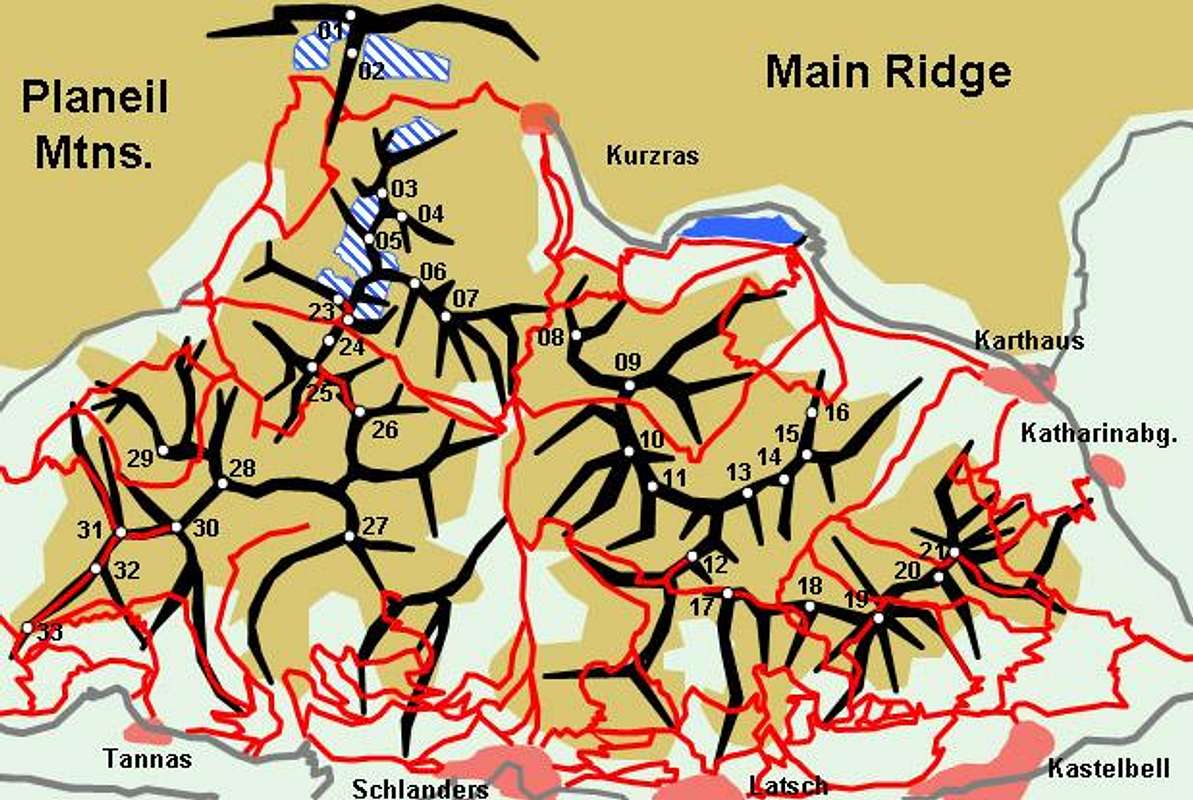
Hand drawn schematic map of the Saldurkamm Ridge of the Ötztal Alps. The red lines constitute the trails, glaciers are denoted white-and-blue. The numbers refer to the listing in the text of the main page
« PREV
NEXT »
Gangolf Haub
on
Aug 15, 2005 4:23 pm
Comments & voting
Other parents
Image ID:
120489
3414 Hits
74.92
% Score
5
Votes
Log in to vote
Comments
No comments posted yet.
to post!
Don't have an account?
Ötztal Alps
(Area/Range)
« PREV
Viewing
#131 of 310
GALLERY
NEXT »
Gangolf Haub's Image Gallery
« PREV
Viewing
#2725 of 13940
GALLERY
NEXT »
×
You need to login in order to vote!
User Name
Password
Remember me
Forgot your password?
Log me out when I close my browser.
Keep me logged in all the time.
sign in as a user
Don't have an account?
Register now for FREE
Rating available
Suggested routes for you
People who climb the same things as you
Comments Available
Create Albums
Register Here


