
|
|
Mountain/Rock |
|---|---|
|
|
33.58810°N / 49.66080°E |
|
|
13615 ft / 4150 m |
|
|
Overview
 | ||||||||||||||||||||||||||||||||||||||
| Note ! Still under construction, the pictures and information are raw, diagram maps are not included yet. | ||||||||||||||||||||||||||||||||||||||
| Oshtoran Kooh | ||||||||||||||||||||||||||||||||||||||
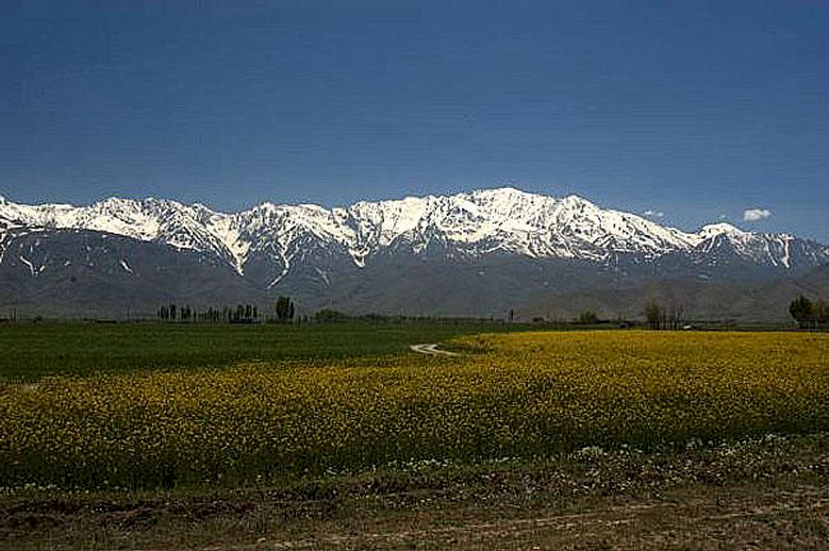
| Oshtoran Kooh, Oshtoran-Kooh, Oshtoran Kouh, Oshtoran Kuh or Oshtoran Kouh is a massive sub range of Zagros located in Lorestan province about 500Km far from Tehran, about 18Km south-west to Azna city.Oshtoran Kooh is a long straight ridge line with the natural north-west to south-east orientation of Zagros range that expands to Chagha-Gorg area at south. Unlike the Alborz range that almost all of the ridges and sub ranges stick together at a high pass with a compact form seems like Zagros range ridge lines and sub ranges like Oshtoran kooh, Zard Kooh, Dena,... have a more discrete form, each being a massive block. | ||||||||||||||||||||||||||||||||||||||
| Oshtoran Kooh Peaks | ||||||||||||||||||||||||||||||||||||||
| The Oshtoran Kooh is almost a straight long north-west oriented to south-east ridge line with the following peaks on it: north-west to south-east:
| ||||||||||||||||||||||||||||||||||||||
| Objects | ||||||||||||||||||||||||||||||||||||||
| ||||||||||||||||||||||||||||||||||||||
| About Iran and Lorestan | ||||||||||||||||||||||||||||||||||||||
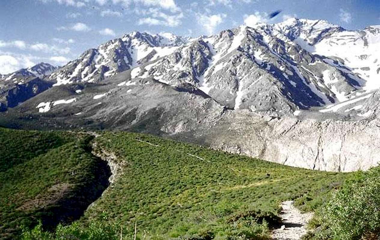
 North face | ||||||||||||||||||||||||||||||||||||||
| [I added this section to give a small glance to people who want to travel to Iran] Iran is high plane hosting two vast ranges of mountains Alborz and Zagros including hundreds of 4000+m summits. Even taught there are two big deserts in the middle of Iran still it's been said 3/4 of the plane is covered by mountains, there are still lots of 4000+m and 3000+m outside the Alborz and Zagros ranges scattered all over the Iran plane like Kerman mountains and Taftan volcano, the weather varies from dry hot to mountain conditions and to the thick green lush and humidity of the north Caspian sea coast. The behavior of Iranians is friendly and they are helpful to foreign people from Europe and America (this friendly behaves may no be applied to Arabs), you can quickly make a friend who would be glad to guide you and stay beside you and invite you to his/her home. The pipe-supplied and mineral water and food served in restaurants and supplied from stores is safe (avoid food from road sellers in downtown). Security is granted by the police, there are two kind of polices in Iran the green ones and the blue ones, blue is only for traffic control, greens are for security and criminal matters. | ||||||||||||||||||||||||||||||||||||||
 |
Getting There
North face
Travel to Do-rood the nearest city to Oshtoran Kooh (about 503Km far from Tehran)
- Railway : Tehran-Ahwaz line
- Car : Tehran-Arak-Shazand-Azna drive 36Km to Do-rood
- From Do-rood take the road south direction to Tiyoun village
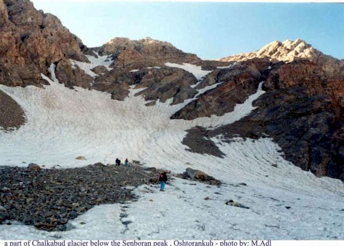
The normal route starts from Tiyoun (south/ south-west) to Chal-Kabood shelter and to the tallest San-Boran peak, Golgol, Golgahar, Kooleh-Lauyo, Chal-Boroon, Mirzaee and Fialestoon peaks.- Follow on the Do-rood road to Dareh-Takht village
The advanced technical route to Shah-Takht glacier, Shah-Takht(3900m) peak and all peaks of Oshtoran-Kooh south and north to Shah-Takht, (the routes on Oshtoran-Kooh ridge line between the peaks are hard and technical).- Follow the road to Kamandoon village
The normal route to Kool-e-Jennoo(3980m) and the blades start from this place. The route is marked normal but it is moderately hard and technical at winter for the higher points.
Reaching the peaks between Kool-e-Jennoo and Shah-Takht needs technical work.
South face
Travel to Azna
- Railway : Tehran-Ahwaz line
- Car : Tehran-Arak-Shazand-Azna drive 24Km to Aligoodarz
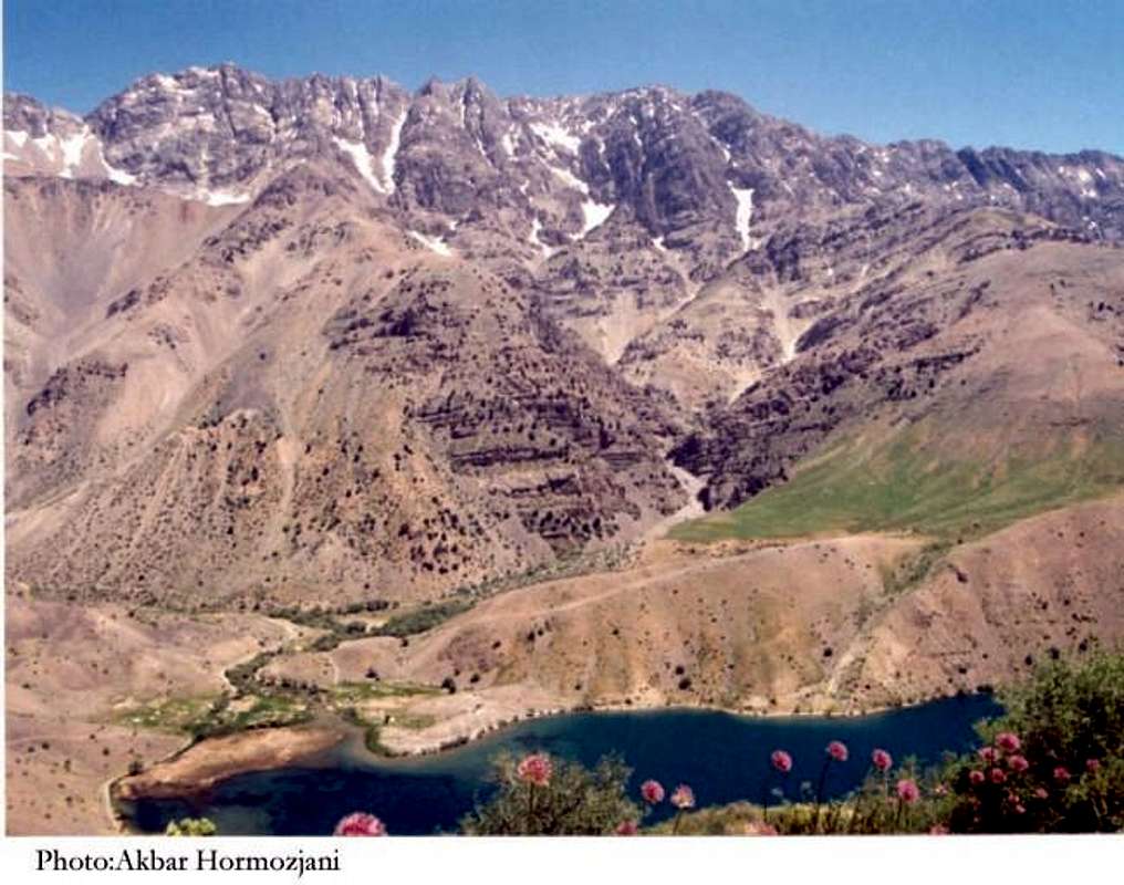
- To the south face routes and Gahar lakes
- To the south face routes and Gahar lakes
Red Tapes and Regional Hints
| Oshtoran Kooh mountain area (17800ha) is one of the protected areas of Iran, hunting is prohibited and fishing is prohibited out of season, anything harm to the nature is prohibited. Entrance to Oshtoran Kooh and Gahar lake protected area needs a permission of The Department of Environment of Iran. [See list of Iran's protected areas (Persian language)]  Oshtoran Koohsouth slopes and Gahar lake protected area
| ||||||
| No fees is required for climbing or camping but permission of The Department of Environment of Iran is required for camping and climbing on the south protected area of Oshtoran Kooh. | ||||||
| Risk of avalanches on a winter attempts. | ||||||
| Wild animals attack depending on season (brown beer, leopard, wild cat, boar, wolf ...) |
When To Climb
| Best | June and July |
| Photography | Spring and winter |
| Summer | Moderate weather, easy climb |
| Winter | A serious climb. An ice, snow and rock mixed climbing. |
Mountain Conditions
| Summer (July-October) | Weather is moderate and clear, downfalls happen rarely. |
| Winter | Heavy snow, rough cold mountain conditions, frequent snow storms and wild winds that may last for days. |
Links and Books
| Links | Aftab site, protected areas of Iran, National parks of Iran and many useful information you will need to know but the site is only in Persian language [GO] |
| About Aligoodarz, Azna, Borujerd... [GO] | |
| Zagros Mountains forest steppe [GO] | |
Report of a technical winter attempt on the blades of Kool-e-Jennoo(3980m) [GO] | |
| Books | Mountaineering in Iran (Koohnavardi dar Iran) in Persian, by Ali Moqim This book is a good guide including maps, routes, conditions... and any basic information you need for climbing mountains of Iran, also includes a list of books about mountaineering in Iran. |
| Books [GO] | |
Miscellaneous Info
External Links
- Talezang waterfall, Lorestan, Iran
You'll find a report of trip to the astonishing waterfall in Lorestan, Iran, named TALEZANG.
TALEZANG is located in Oshtrankuh region. The waterfall in the heart of mountains is 50 meter high and 70 meter wide.