Overview
![]()
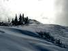
While not a particularly high mountain compared to others in the area, Dog Mountain is one of the most popular in the Columbia Gorge. It stands across the Columbia River from Mt. Defiance, the highest point in the Gorge. Views are breathtaking and the alpine meadow at the summit provides probably the best wildflower display in the Gorge. As stated, there can be a number of people hiking up Dog Mountain at any one time but there are 3 different trails to the top so you can pick your own route. Crowds are smaller in the winter and this makes for a great winter hike as you get 2820 feet of elevation gain in and usually there is not much snow on this one to worry about due to the overall low elevation. From the summit on clear days you can see Hood, Adams and St. Helens too.
Routes
There are 3 hiking trails to the top of Dog Mountain. The two most popular (and shortest) share the same first half mile then split. They are the Old Trail and the Scenic Route. Take the trail from the east end of the lot that heads up what looks like an old road. There are restrooms after a couple hundred yards and from there the trail launches up switchbacks for half a mile gaining a little over 700 feet. You'll know you are coming to the fork for the trails just after you hike through a section of the trail surrounded by shorter oak trees whose trunks are covered in moss and lichen. The junction is just two short switchbacks further.
When you reach a flat area, there will be a wooden sign. The trails divide here. Straight ahead is the Old Trail (sign designates it as "More Difficult". This trail is .2 miles shorter than the Scenic Route (1.3 miles in total) but has no views until it rejoins with the Scenic Route higher up. This trail makes for a nice workout, a little moreso than the Scenic Route.
If you take a right at the wooden post, you are then on the Scenic Route (sign designates it as "Less Difficult"). At first, it just ambles up with a few small views of the Columbia below. After about a mile, the trail opens up at a nice viewpoint in a more open area. This is known as the Lower Viewpoint and is at about 1600 feet. From here the trail switchbacks into the forest again and angles up through tall fir forests for a half a mile until it meets up with the Old Trail.
At this upper junction of the trails, head up and switchback a couple times until you emerge from the trees. Shortly after this, you will reach the higher viewpoint at an old lookout site. This is also the top of Puppy Dog Mountain. From here, you have your choice of two routes to the summit. The right fork heads into the forest and up the back side of a ridge for .6 miles to the summit. It's a bit more protected in bad weather or high winds (which there can be a lot of in the Gorge). The left fork rolls through the summit meadow for .4 miles until it meets up with the offshoot from the Augspurger Mountain Trail. From that junction it is only .1 miles to the summit. The true summit is actually a bit in the trees from the top of the meadow.
The third trail, via the Augspurger Mountain Trail, starts to the left of the main sign in the parking lot and heads northwest contouring around Dog Mountain for 2.7 miles to a junction at 2200 feet. Take the right turn there and follow 1.1 miles to that junction with the other trail and then up .1 miles to the summit. This trail is about a mile longer than the others but is easier on the knees if that is a concern.
Options
For an even better workout, consider doing both Dog Mountain and nearby
Wind Mountain the same day. Wind Mountain is the unmistakable smaller cone directly west of Dog Mountain. The trail there is 1 mile long and gains 1120 feet. Combining Dog and Wind Mountains gives you almost 4000 feet elevation gain in one day.
To get to Wind Mountain, take Highway 14 from the Dog Mountain Trailhead parking lot west just a couple of miles to Wind Mountain Road. Turn right (north) onto this road and go 1 mile and curve right, staying on Wind Mountain Road another .4 miles to Girl Scout Road. Turn right onto this road and go about a quarter of a mile to a gravel parking area. From this parking area, head further on the road (it heads down a hill here) for just about .1 mile to an unmarked trail on your right. The Wind Mountain Trail contours up the east side of the mountain before crossing over a ridge. It then angles up about half the north side before swicthbacking to the east sied again and up to the summit area.
Please note that Wind Mountain is sacred to native Americans. It has a talus field up top with vision quest pits where young males would come to fast and search for their spirit guides. Disturbing these or taking artifacts is strictly forbidden and fineable. Plus, it's just not cool to do anything like that. Please respect this area when you visit.
The Name
How did Dog Mountain get its name? Most probably think it's due to the large amount of people that take their dogs up this one. Also, there is a rather large coyote that lurks about the summit meadow, or, at least he did in 2004...................... The only thing I could find in research is that pioneers were trapped there and instead of starving, they ate their dogs. Not sure how anyone could be trapped on this smaller peak so that seems unlikely. Who knows.............................
Getting There
From Portland, the quickest way is to take I-84 east to the Cascade Locks exit (#44). Take the
Bridge of the Gods ($1 toll) across the Columbia River and turn right onto Washington Highway 14. Head east on Hwy 14 for 12 miles. Between mileposts 53 and 54, the large Dog Mountain Trailhead parking lot is on the left. The drive should take you about an hour to an hour and twenty minutes from Portland.
If you don't want to deal with the toll, just take either I5 or I-205 from Portland across the Columbia to Highway 14 and go east to the same point. It is slower and takes longer to do this though (maybe 20 minutes more).
If you are coming from the east you will either be on Highway 14 in Washington or Interstate 84 and you take it to the same place, the Bridge of the Gods in Cascade Locks, OR.
Red Tape
Northwest Forest Pass is required to park at the trailhead. If you do not already have an annual pass, you can get those at most outdoor stores in the area (Next Adventure, REI, etc). You can also purchase a day pass at the trailhead (self-service station there).
Also, beginning March 31, 2018 the great state of Washington in their infinite wisdom has decided that, because people have been illegally parking on Highway 14, the rest of us have to pay the price. So, instead of towing or ticketing those idiots, they have implemented a weekend fee and permit system that the rest of us law-abiding citizens have to pay. On weekends between March 31 and July 1 of each year (peak season for the flowers), you can either pay and ride the shuttle for $2 from the Skamania County Fairgrounds and the day use/permit is free, OR, you can pay online to get a permit for $1.50. Permits are limited to 165 per day. This is in addition to the NW Forest Pass requirement. I'm pretty sure that not too far off in the future, blood and DNA samples are going to be required to even drive past Dog Mountain. Here is a link to all the new rules that Big Brother now requires:
Click here for the Great Washington Fee Machine BS.
Please stay on the trails especially within the large summit meadow. The small flowers and alpine plants are fragile. I've seen people go trouncing through the flowers to get a picture of themselves within them and it's idiotic. If everyone did this, there would be no flowers to enjoy.
When To Climb
Year-round!
Winter hikes may require snowshoes or if it is really nasty, crampons. Doubtful you will need an ice axe though.
Camping
Camping is not allowed. This is a day hike anyway. It's doubtful anyone will drive from any distance to stay here and climb Dog Mountain but if needed, there are motels in nearby Stevenson, WA and Hood River, OR as well as Cascade Locks, OR.
Mountain Conditions
Columbia Gorge National Scenic Area
(541) 386-2333


External Links
- NWHiker by Dennis Stilwell
This site has great descriptions and photos of many hikes in the Pacific NW. This page is for Dog Mtn, complete with view photos and various trail options.
Check out
this graphic of the trails. Very cool.

 43025 Hits
 89.39% Score
 29 Votes


Grrl - Jan 22, 2007 8:54 pm - Voted 9/10
How we heard/say Dog got its nameLooking at Dog Mountain from the west, the bare peaks look like a dog lying down in the trees!