
-
 4922 Hits
-
 78.27% Score
-
 9 Votes
|
|
Mountain/Rock |
|---|---|
|
|
46.68498°N / 10.59815°E |
|
|
6398 ft / 1950 m |
|
|
Overview
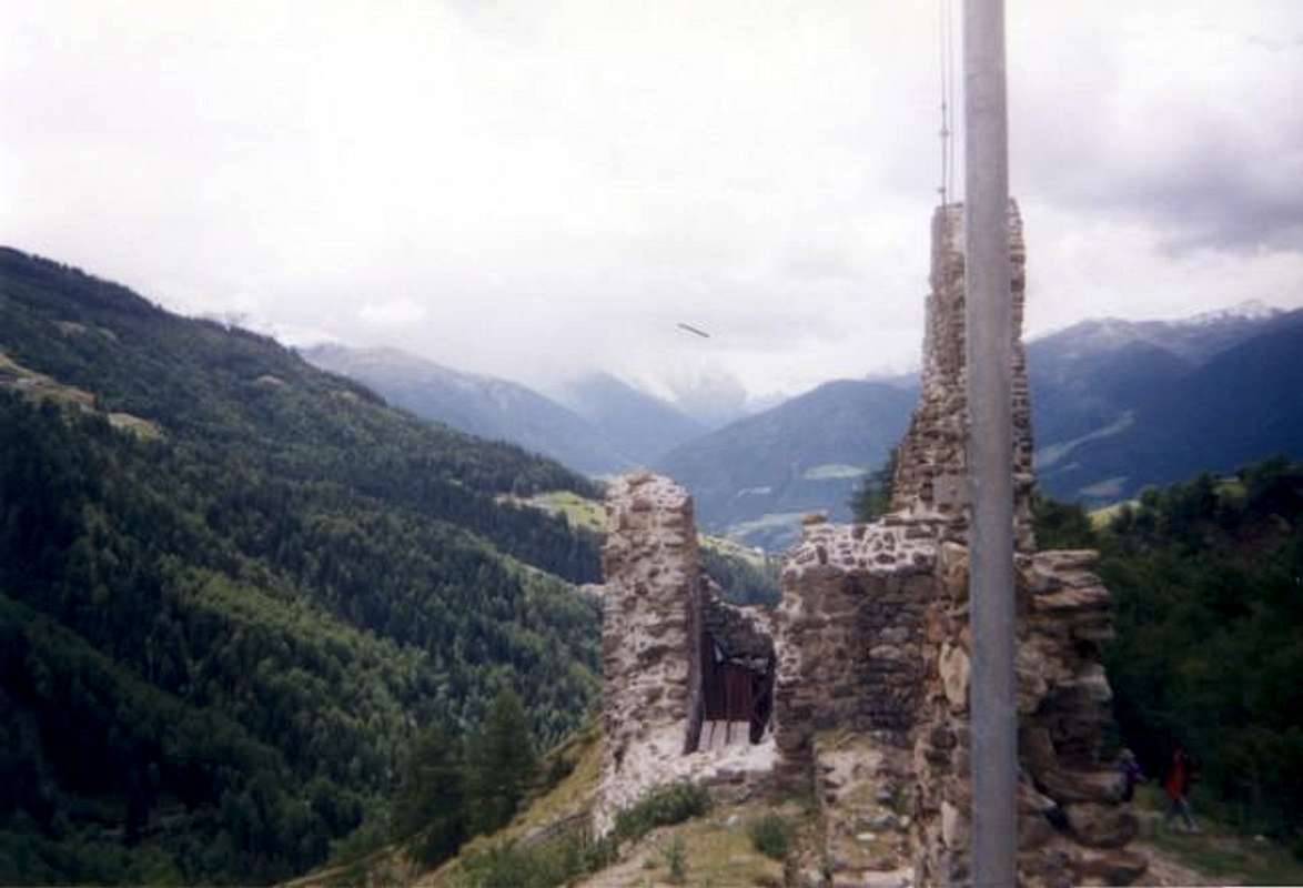
This little mountain is nestled between the prominent peaks of the Upper Vinschgau Valley. It is dwarfed by the surrounding mountains on either side, but the hiker/climber to this mountain is rewarded with wonderful views of the Schluderns Valley and Upper Vinschgau in northern Italy. The name of the mountain is just the name I was given by my family members who own a resturaunt in the area because it has no offical name. The name is translated Piz (peak)-Schluderns ( the town at the base)-kirche(church for the chapel upon its' summit). The little church or chapel on the summit was built in 1492 and is property of the land owner from which you may get the key to enter. It is a beautiful setting for a chapel and to most Americans an amazing relic of the past. Views from the summit stretch south to the Ortles Massif (3,905m/12,527ft), west to Furkelspitze (3,004m/9,637ft), and north to Valvel Spitze (3,359m/10,776ft). This area in northern Italy is one of the most beautiful places on earth and strongly recommended as a place to climb or hike. Many other summits in the area include Piz Lat, Elfer Spitze, Valvel Spitze, Ortles, Furkelspitze, Piz Sesvenna, Monte Vatles and La Lasa just to name a few. The possibilities are endless to suit all needs in this region for hiking and climbing no matter what the experience level.
 |  |  |
Getting There
From Landeck, Austria - Take highway S40 all the way south over Rechia Pass to Schluderns. In Schluderns turn off onto any road in town and go all the way east until you get to the castle (Casa Cora). The trail splits off of this path to the castle. From Bozen, Italy - Take highway S38 north to Schluderns and then get on any street and go east until you reach the castle. The trail splits off of this path to the castle. From Milano - Take highway S41to Schluderns.
 |
Red Tape
The only red tape on this hike is if you would like to enter the chapel. The owners house sits at the bottom of the spire and you may ask them for the key at anytime to enter the chapel. Otherwise the trail is open to the public.
When To Climb
The best time to climb this mountain is from June through August because of weather. The climate is perfect for climbing in the summer in this region. In all other months snow may be present and all winter gear may be needed.
Camping
There is camping in the town of Spondigna to the southwest of the mountain but no camping is permited in the immediate area of the mountain.
Mountain Conditions
Check out www.obervinschgau.it for information on weather in the region.
External Links
- www.obervinschgau.it This page has excellent information about the region with live web-cams as well as weather information.
- www.suedtirol.com This page contains information about all of South Tyrol and has weather, live cams, and tourist information.
- www.dolomites.cc This page contains information about the Dolomites region of South Tyrol.
- www.ryderwalker.com This website is for self-guided or guided tours throughout the alps by means of either hiking or riding.