
|
|
Mountain/Rock |
|---|---|
|
|
39.63600°N / 106.17°W |
|
|
13189 ft / 4020 m |
|
|
Gore Range Overview
”In my opinion, the two most rugged mountain ranges in Colorado are the Gore Range northwest of Dillon Reservoir and the Needles Range in the remote San Juan Mountains.” -John Fielder-famous Colorado Landscape photographer.
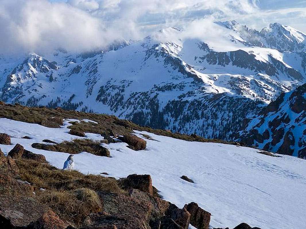
The Gores are more of a range consisting of 12-13,000-ft ridges, rather than separated peaks. A few of the more prominent ridges actually have names like, Zodiac Spires, Rockinghorse Ridge, Ripsaw Ridge and the Grand Traverse. With 50 peaks over 12,000-ft, none attain the magic 14,000-ft mark, which is the primary reason for the Gores obscurity. This is one of Colorado’ most rugged mountain ranges and the rock quality is generally good.
Only 60 miles from Denver, Colorado the Gore Range as a whole is relatively inaccessible due to the lack of mining roads that normally criss-cross other Colorado mountain ranges. The Gores also have a rep for a lot of trailhead access red tape, due in large part to private property. Hikers and climbers not interested in long approaches and heavy vertical might want to look elsewhere for their adventure. Overall, the west side of the Gore Range is more accessible than the east. Approaches that start from the east are few because of private property, in return, expect even longer approaches and expect a poor network of trail systems. Precise planning and execution are of paramount importance when selecting routes in this range. Armed with a loaded backpack and good maps, many of these quiet summits can be climbed without a rope. Major faces and long jagged ridges provide unlimited technical climbing opportunities as well. An ice axe is highly recommended on any early season climbs.
Officially named peaks in the Gore Range are hard to come by, only a few of the Gore highpoints have official names. Differentiating the highpoints on a map or while hiking has challenged all of us at some point. Thankfully we have the CMC to make sense of all of that rugged terrain. In 1932, CMC members Carl Erickson and Edmund Cooper used letters to assign summits in the obscure Black Creek Basin and the CMC subsequently tended and expanded the system (Jacobs & Ormes- Guide to Colorado Mountains.) The lettering system for naming peaks has frustrated many casual visitors over the years, however Gore Range enthusiasts seem embrace the system. It won’t be going away anytime soon.
Red Peak Overview
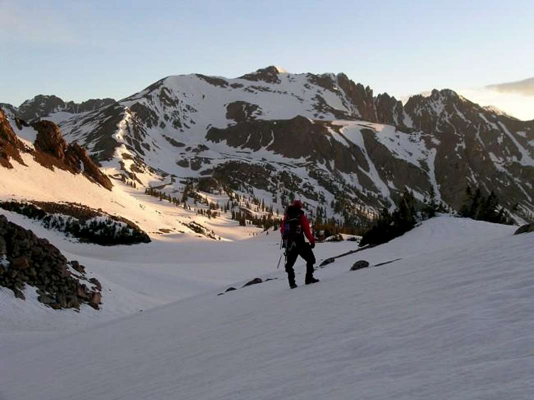
Anchoring the southern tip of the Gore Range proper is Red Peak at 13,189-ft. Red Peak is king of all visible Gore mountains from the Silverthorne, Colorado. Decending the Eisenhower Tunnel, the visible granite dome of Buffalo Mountain dominates the view west of Silverthorne. If you love beautiful, rugged mountains; you will foam at the mouth when your eyes first set on the jagged, tooth-like rock pinnacles that sore over the rounded mass of Buffalo Mountain. Those pinnacles belong to Red Peak.
Red Peak is a very large mountain. Separated by three major drainages, (South Willow Creek, Gore Creek, North Willow Creek) Red Peak's summit commands breathtaking views of nearby East Thorn, Willow Peak, Snow Peak, Hail Peak and the Zodiac Spires. Red Peak has two distinct summits. The west summit is the true summit and can be attained by a steep class 2+ hike up the south ridge. This ridge becomes a class 3 outing in May and early June, depending on snow pack conditions. The unfrequented east summit is the highpoint on the other side of the gnarled ridge.
Meadow Creek Trailhead
Locating the Meadow Creek TH is easy. From Denver, take I-70 west to the mountain towns of Dillon and Silverthorne. After passing the exit for Dillon look sharp for the exit for Frisco and Breckenridge, exit 203. After exiting 203 you will come to a roundabout. Travel halfway around the roundabout and take a gravel road that heads west. Follow this gravel road about a quarter mile to the Meadow Creek Trailhead; this is also the trailhead for an easy hike of Lily Lake. There is ample parking for early hikers. Because of the proximity of this trailhead to major mountain resort towns, these trails do see its share of traffic. I would consider an 8-mile RT hike to Eccles Pass to be the main attraction for most day hikers.
I discovered the Meadow Creek approach to Red Peak to be the easiest way to climb the South Ridge Route based on extensive topo research. Jacobs and Ormes “Colorado Mountains” suggests the standard route on Red Peak to start at Gore Range Trail at South Willow Creek or the Gore Range Trail at Gore Creek Campground off I-70, each approach is 6 miles. The Meadow Creek approach is 5.5 miles and gets southern sun exposure for faster snowmelt.
UN12,736 "West Demming" & Uneva Peak-12,522
Click image to enlarge for better detail or to vote.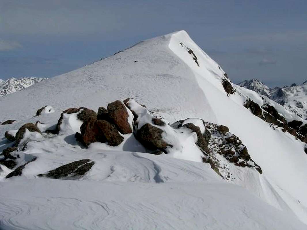
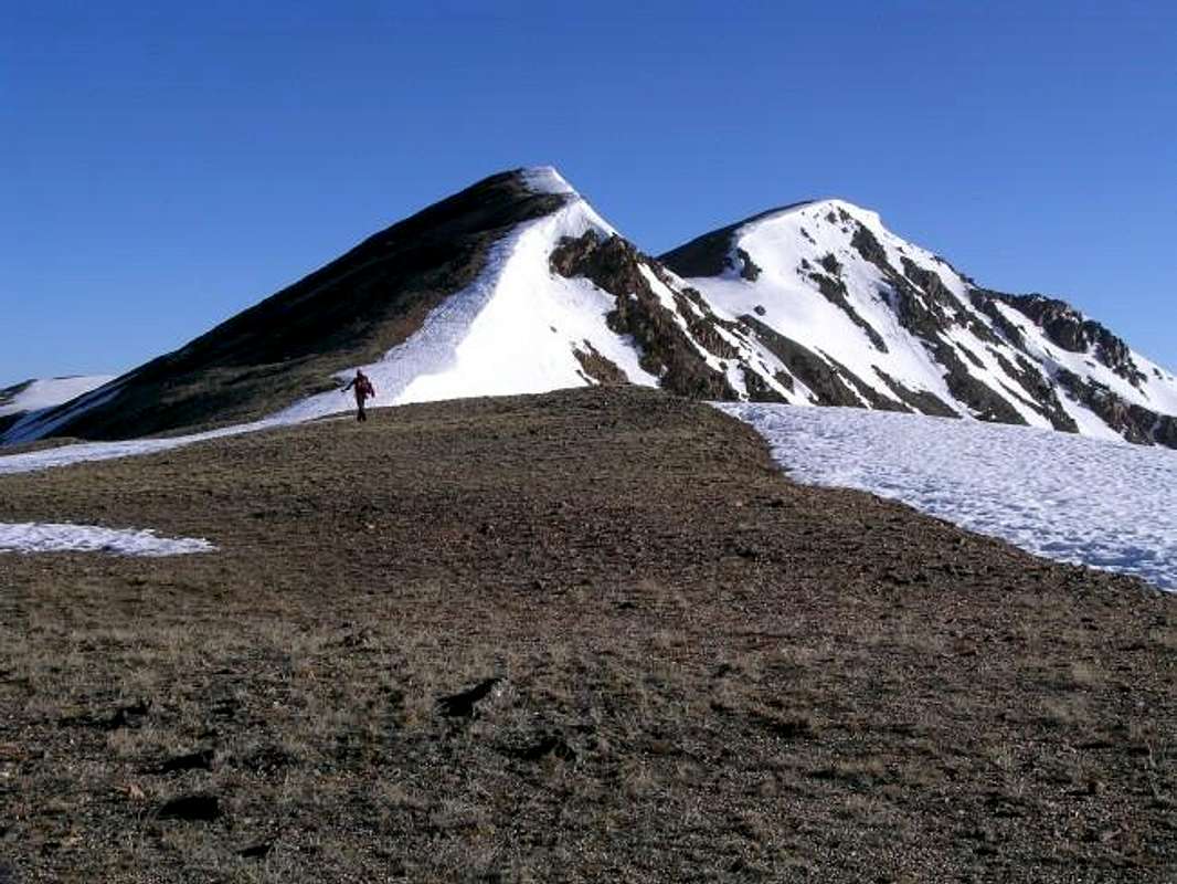
Point 12,736-ft (above left) and Uneva Peak-12,522-ft (above right) bookend a long, gentle ridge that extends 6 miles south from the Gore Creek Campground and I-70 to Copper Mountain Ski Resort. Uneva Peak is accessed from the parking area at Vail Pass and Point 12,736 is easily accessible from the runaway truck ramp about 4.5 miles west of Vail Pass.
This entire ridge is above tree line and any number of spots along this ridge will offer a perfect place to become anointed with the Gore Range. If your interested in the Gores and want to get an excellent view, showing many of the more prominent peaks, then I would highly recommend both of these points. Personally, Point 12,736 is my favorite of the two because it’s in closer proximity to the Willow Massif and the rest of the Gore Range proper.
When I first discovered Uneva Peak and the long ridge running west to Point 12,736, I realized what a great winter hiking option this could be because of the minimal avalanche danger. I would research the area before heading out, but Point 12,736 seems the best option of the two for a very safe winter accent. In the early days of spring, attaining both summits will require some glade hiking, and much more tundra hiking. This wide open hiking takes place on expansive, high alpine, moderate slopes. Also, these west-facing slopes get plenty of sun hit in March and April and can be void of snow as early as May. Conditions may vary season to season.
Route-Uneva Peak-1,930-ft & 4.68 miles-RT
Add 263-ft and 1 mile to summit-Point 12,363-ft
From I-70 and Vail Pass at 10,600-ft, hike mostly north and a little east over a treed hill into Corral Creek Meadow at 10,767-ft. Cross Corral Creek and pick spot to ascend the obvious, moderate slope to the east. I would recommend trying to attain the saddle in between Uneva Peak and Point 12,363-ft. Select your route based on snow conditions for in summer any route will work here.
After 1.67 mile and 1554-ft of hiking, you will come to the low point or saddle in between Uneva Peak and Point 12,373-ft. From here it is an easy .67 mile hike on a faint trail over a false summit and on to Uneva’s true summit.
From here you can see Point 12,736-ft about 3 miles to the north. On a nice weather day it wouldn’t be a bad idea to hike the easy ridge to Point 12,736-ft.
Route-Point12,736-ft-3,127-ft & 5.6 miles-RT
From Vail Pass, descend .5 miles west to the runaway truck ramp at 9,777-ft. Exit here and follow the easy dirt road that runs along the right side of the gravel truck ramp. At the end of a ramp is a flat, paved area that CDOT uses to store sand for Vail Pass in the winter. Locate the paved road from here and drive it another quarter mile to some obvious parking on the right. Later, when leaving, you must go back the same way you came in for the road is not open for thru traffic.
If you study a topo map of your planned route, this route description may become a moot point. The route is fairly steep but is easy. From the parking area at 9,532-ft, ascend the grassy slope directly northwest. This grassy slope will quickly become a treed slope. At about 10,400-ft, begin to veer to the right (east) to bypass some steeper, and more rugged areas. The entire slope here is a bit convoluted so the idea is to hike up along ridge crests of the abundant small drainages. At 10,900-ft the slope will relent as you come to an open area.
From 10,900-ft, continue east up through more trees and soon you will hit tree line at 10,520-ft. From here it is an open tundra hike 1 mile to the summit, which should be obvious and directly east.
Mountain Conditions
Conditions vary, depending on the time of year. We climbed Red Peak in late May. We encountered snow at about 11,000-ft. Because of the residual snow pack in early spring you must climb Red Peak in the early a.m. hours (between 5:00 & 11:00 a.m.-meaning you must start and summit and back to snow less terrain by 11:00 a.m.) to take advantage of the overnight freezing for fast snow travel. Five miles of this RT hike in late May and early June is on snow.
Mountain Conditions/Regional Weather
- Colorado Avalanche Information Center (CAIC)
- Vail Web Cam
Click image to enlarge
Click here to view a 7-day forecast for Silverthorne, Colorado
Eagles Nest Wilderness-Red Tape
“Red Tape” per attm
No permits or fees are required. Like all wilderness areas no mechanized or motorized vehicles are permitted within the Eagles Nest boundaries.
Wilderness is land set aside as part of wild America, where man can be a visitor. The natural environment has not been disturbed. Travel is restricted to foot or horseback. No mechanized equipment is allowed.
For more information, contact the U.S. Forest Service at the # below:
Additional Resources:
Eastern Portion of the Wilderness:
Dillon Ranger District
680 River Parkway
Silverthorne, CO 80498
970-468-5400
or
Western Portion of the Wilderness:
Holy Cross Ranger District
P.O. Box 190, 24747 US HWY 24
Minturn, CO, 81645, Phone: 970-827-5715
![]()

John Prater - May 26, 2004 12:21 pm - Hasn't voted
Untitled CommentStan Wagon has done a bunch of stuff in the Gore Range. On this page, he calls the ridge between Red's summits "Red Diamond Ridge" (5.6) and mentions that he's done it 3 times.