
|
|
Mountain/Rock |
|---|---|
|
|
45.89600°N / 110.968°W |
|
|
9665 ft / 2946 m |
|
|
Overview
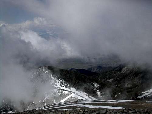
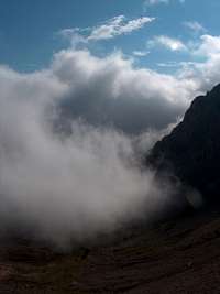
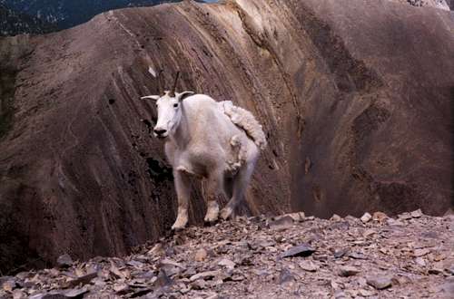
Sacagawea Peak is located just outside of Bozeman, Montana. It's in an absolutely beautiful area of snow capped mountains in the Bridger Mountain Range. This whole ridge line is known for it's sitings of Mountain Goats. Just south of Sacagawea Peak is the Bridger Bowl ski area. The peak is located in Gallatin National Forest. Access to the mountain summit can be had from either the east or the west. From the summit of Sacagawea Peak, you can see for miles to the east with great views of the Crazy Mountains, to the west with great views of the Spanish Peaks and the Tobacco Root Mountains.
From the east side of the mountain, there is a road which leads to the base of the mountain. This is fairly well traveled as locals hike to Fairy Lake, also at the base of the mountain.
Getting There
Starting from Main Street in Bozeman, Montana, head north out of town on Rouse Avenue. Stay on Rouse Avenue and eventually it will become Bridger Canyon Drive. Follow this out of town through some of the most beautiful country around. Not only is it beautiful scenery, but it's a (70) mph speed limit through the mountains. Anyhow, at mile 21.5, make a left hand turn on Fairy Lake Road. This is approximately (1) mile past Battle Ridge Campground. Follow Fairy Lake Road (a gravel / dirt road)for approximately (5) miles to the trailhead, the base of the mountain, and the campgrounds. There is adequate parking here.
I climbed Sacagawea Peak in June. At this time, the road was not opened completely. There was a gate at the creek crossing where you needed to leave your car and hike in from that point on. That was about a (2) mile hike in from the gate. This is pretty easy hiking as it is along a snow covered gravel road. Check with the park rangers (see links) prior to arriving to check on road openings.
Red Tape
Permits / parking passes were not required for climbing Sacagawea Peak.
There are seasonal closures for all of / part of Fairy Lake Road. Check with the rangers for closures (see links).
When To Climb
Sacagawea Peak is normally climbed from June through October. Beyond that heavy snows would blanket the mountain and make travel near impossible.
Camping
Fairy Lake Campground is located at the end of Fairy Lake Road and at the base of the mountain. They offer (9) campsites with handicapped toilets, picnic tables, & water. Fairy Lake is located right next to the campgrounds. Fishing is available here.
Battle Ridge Campground, at 6,500', is located along the main road, approximately (1) mile before the Fairy Lake Road turn-off. They offer (13) campsites with toilets, picnic tables, & water.
Mountain Conditions
Check with Gallatin National Forest in Bozeman, Montana at 406-522-2520 or check their website at www.fs.fed.us/r1/gallatin (or go to links on this page).
If you are interested in a USGS map for this hike, purchase the "Sacagawea Peak" map.
I also purchased a map from one of the local climbing shops which was useful. It's a "Bozeman, Big Sky, West Yellowstone" trail map. It identifies (18) mountain bike trails and (10) hiking trails. The route to Sacagawea Peak is one of the (10) hiking trails.
External Links
- Gallatin National Forest
Park information. - Fairy Lake Campground
Campground information.