
-
 14433 Hits
-
 74.92% Score
-
 5 Votes
|
|
Route |
|---|---|
|
|
32.27330°N / 111.146°W |
|
|
Hike |
|
|
Most of a day |
|
|
All are walk-ups |
|
|
Introduction
 View from the Wasson Peak summit
Photo by Dave K
Please note: I am indebted to the original page owner, esteemed SP contributor Dave K for all of his hard work laying the foundation for this page.
There are several options for reaching the top of Wasson Peak. These trails are detailed here on this page. Please note that if you wish to submit a Route Page detailing a specific route covered in a general fashion on this page, I encourage you to do so!
Profile image courtesy of Outdooraholic.
Approaches & Getting There
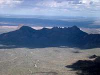
 Wasson Peak and the King Canyon Trail
Photo by RyanS
Below are the primary approaches to to Wasson Peak:
Gould Hill Mine-King Canyon Trailhead. This trailhead is just outside the south entrance of the park along Kinney Road. Head north along Kinney Road, passing the turnout to the Arizona-Sonora Desert Museum and proceeding another 0.2 mile. The trailhead is on the right.
Or, if coming from the visitor center, head south along Kinney Road for about 2 miles. The trailhead will be on the left, 0.2 mile before reaching the turnout to the Arizona-Sonora Desert Museum.
Hugh Norris Trailhead. From the visitor center, head north on Kinney Road for 1.5 miles until reaching Hohokam Road. The road is unpaved, although easily passable for most vehicles, and one-way. Proceed up Hohokam Road for about 0.8 mile. The trailhead is on the right.
Return trip: continue up Hohokam Road for about 1.5 miles until it intersects Golden Gate Road. Turn left (northwest) on two-way Golden Gate Road for about 2 miles until it intersects Sandario Road. Turn left (south) on Sandario road and proceed for 0.3 mile, then turn left (southeast) on Kinney Road and proceed for 1.7 miles until reaching the visitor center on the left.
Sendero Esperanza Trailhead. From the visitor center, head north on Kinney Road for 1.7 miles until reaching Sandario Road. Turn right (north) on Sandario Road for 0.3 mile. Then, turn right (northeast) onto Golden Gate Road. The road is unpaved, although easily passable for most vehicles. Proceed up Golden Gate Road for about 3.6 miles. The trailhead is on the right.
Sweetwater Trailhead. From Tucson, take Ruthrauff Road west. Ruthrauff Road turns into El Camino del Cerro. Continue on El Camino del Cerro west until the road ends.
Route Descriptions
 Sweetwater Trail signage
Image by Outdooraholic
 Ledges in King Canyon's wash
Photo by RyanS
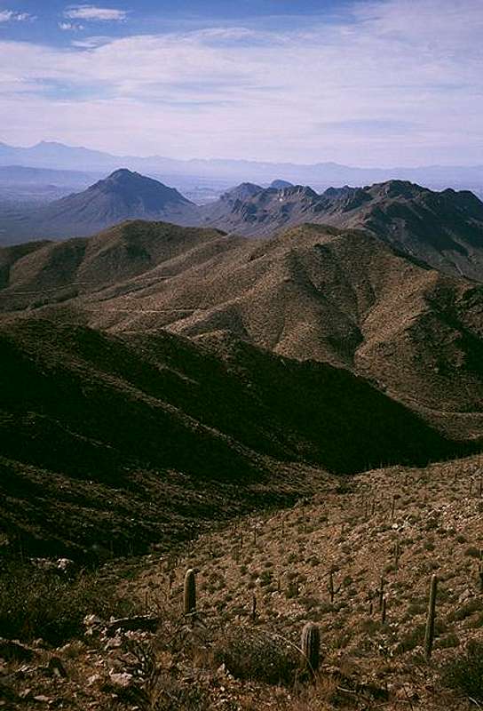
 Looking north from the summit
Photo by Andinistaloco
Wasson Peak is most commonly climbed via four trails:
Gould Hill Mine-Esperanza Trail. Hike the Gould Hill Mine Trail 1.1 miles, following a drainage most of the way. Turn left (northwest) at the Esperanza Trail and hike another mile until reaching the Hugh Norris Trail. Turn Right (east) and hike for 2.2 miles until reaching the summit. 8.6 miles round trip, 1850 feet elevation gain.
A semi-loop is possible by hiking the King Canyon Trail instead of the Gould Hill Mine Trail to the Esperanza trail. This route is 0.2 mile longer.
Hugh Norris Trail. This trail mostly follows a ridge, providing an excellent view of the park. Hike the ridge east for 4.9 miles to the summit. 9.8 miles round trip, 2100 feet elevation gain.
During the fall and winter full moons, rangers lead monthly hikes up the Hugh Norris Trail to the summit of Wasson Peak. This is a great way to experience the sights, sounds, and smells of the desert at night. Inquire at the visitor center.
Sendero Esperanza Trail. Hike along an old mining road south. After one mile, the road becomes a trail and begins climbing uphill until reaching the Hugh Norris Trail, 1.7 miles from the trailhead. Go left (east) for 2.2 miles until reaching the summit. 7.8 miles round trip, 1800 feet elevation gain.
Sweetwater Trail. From the trailhead, hike left (south) up the Sweetwater Trail for 3.4 miles until reaching a saddle and the trail junction with the Hugh Norris Trail. Turn right (northeast) and hike another 0.3 mile until reaching the summit. 7.4 miles round trip, 1900 feet elevation gain.
Outdooraholic - Aug 19, 2008 2:19 am - Hasn't voted
Sweetwater TrailThe Sweetwater Trail from the Camino Del Cerro TH is 4.6 miles each way, 9.2 miles round trip.