
-
 107651 Hits
-
 99.84% Score
-
 147 Votes
|
|
Area/Range |
|---|---|
|
|
40.59392°N / 111.72084°W |
|
|
Hiking, Mountaineering, Trad Climbing, Sport Climbing, Bouldering, Ice Climbing, Mixed, Scrambling, Skiing |
|
|
Spring, Summer, Fall, Winter |
|
|
11489 ft / 3502 m |
|
|
Overview
The Central Wasatch is the center of hiking and mountaineering in the Wasatch Mountains. These mountains are the rugged alpine peaks located directly above Salt Lake City. They have a commanding presence over much of the valley. The Wasatch Mountains to the east and the Great Basin and Salt Lake to the west make this is a great place for the people who live there. Whether you like snow, alpine, or rock climbing, it's all here within a short drive of the city. The area is divided by several canyons that run east to west along the Wasatch Front. The routes up these mountains vary from easy trail hiking to exposed scrambling and rock climbing. The Central Wasatch is bounded on the west by Salt Lake City and other cities along the Wasatch Front, on the north by Parleys Canyon, on the east by Park City, and on the south by American Fork Canyon.
The canyons are what make these mountains so special. Parleys Canyon has a road that connects with Park City. Millcreek Canyon is forested and green. Big Cottonwood Canyon has a lot of quartzite cliffs and buttresses. Little Cottonwood Canyon has numerous granite slabs and walls. American Fork Canyon has overhanging limestone crags. These canyons provide access to the Central Wasatch mountains and are the most popular areas around Salt Lake City. Within these main canyons are several other smaller canyons that descend from the highest mountains and passes. The Wasatch Front's water supply is provided by the snow and water of rivers and streams. With so many people you would think that the mountains would be crowded with hikers every weekend. This is true in some areas, but you'll notice that the majority of people don't hike very far. When you have a chance to get away from the most popular peaks in the Wasatch you will probably be alone. This is amazing if you consider how many people live down below.
These mountains are characterized in the topography of the Middle Rocky Mountains province. They were carved by streams, geologic faulting, volcanic activity, and glaciation. The core of the range is made of very old Precambrian rocks, some over 2.6 billion years old, that have been altered by multiple cycles of mountain building and burial. Uplift of the modern Wasatch Range only began within the past 12 to 17 million years. From 138 to 66 million years ago, compressional forces in the earth’s crust began to form these mountains by stacking or thrusting up large sheets of rock. About 38 to 24 million years ago large bodies of magma intruded parts of the mountains. These granitic intrusions, eroded thrust sheets, and the older sedimentary rocks have formed the uplifted Wasatch Range as it is seen today.
The Central Wasatch is located in Wasatch-Cache National Forest. The name Wasatch is a Ute Indian word meaning a low place in high mountains, and the name Cache is a French word meaning to hide. It was originally a term that referred to fur trappers, the first europeans to visit the land. The forest boundaries include over 2 million acres of land. The Wasatch-Cache not only includes the Central Wasatch Mountains but three major geographic areas: the northern and western slopes of the Uinta Mountains; the Wasatch Front that is north and west of Lone Peak including the Monte Cristo Range, and Bear River Range; and the Stansbury Range, in the Great Basin.
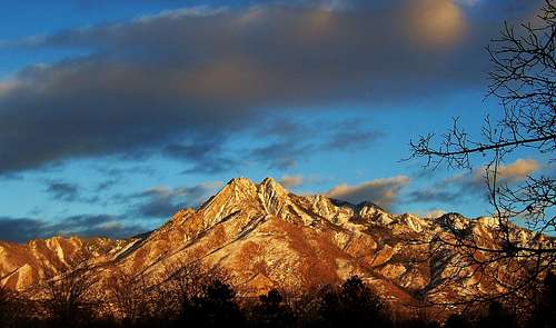
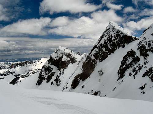
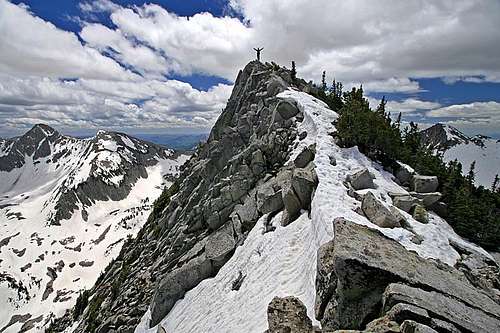
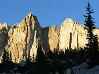
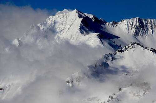 Mount Superior and another gorgeous day in the Wasatch - by Phenom
The Wasatch Range
The Wasatch Range is part of the Rocky Mountains. The Wasatch Range rises to elevations of more than 11,000 feet and stretches for over 200 miles from Soda Springs, Idaho to Nephi, Utah. It starts with the Bear River Range in southeastern Idaho and northern Utah, then the Wellsville Mountains near the city of Mendon and Sardine Canyon, the Northern Wasatch above the cities of Ogden and Bountiful, the Central Wasatch above Salt Lake Valley, and Southern Wasatch, which has the highest mountains, from Provo to Nephi. The Wasatch Range is an imposing and important geographic feature in the western United States. From a geologic perspective, the mountains are a complex mix of igneous, sedimentary, and metamorphic rocks.
From a demographic perspective, these mountains, and their western base, is known as the Wasatch Front. Over 80 percent of Utah's population lives within 15 miles of the Wasatch range. Salt Lake City lies between the Wasatch Range and the Great Salt Lake. Not only those that live in the areas around Salt Lake City but Logan, Ogden, and Provo have the Wasatch Mountains as a spectacular backdrop each morning. Hiking, rock climbing, skiing, camping, mountain biking, and fishing are a few things that the Wasatch Mountains have to offer. This mountain playground is an ideal place for all kinds of outdoor enthusiasts.
In early January 2006, Summitpost was remodeled into its second version. Area/Range pages were added to help complement Mountain pages. Now as of 2013 we have SP Version 3. The purpose of this page is to provide an overview of all of the areas in the Central Wasatch. I have focused more attention on the area south of Parleys Canyon and north of Big Cottonwood Canyon. The mountains above the Cottonwood Canyons are already covered in detail on Summitpost. For the Park City Ridge, Cottonwood Ridge, and Alpine Ridge sections, there are links to their separate pages.
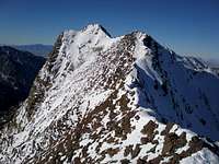
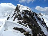
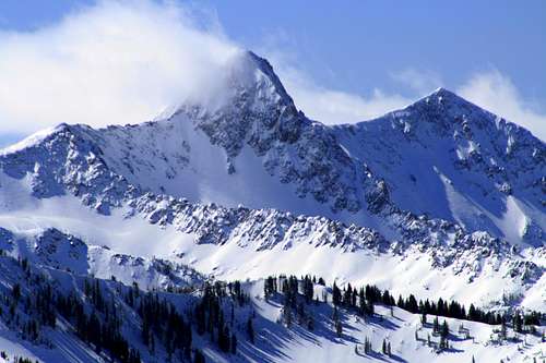 Pfeifferhorn in winter - by TyeDyeTwins
Getting There
The mountains above Salt Lake City are situated in one area so they are easy to get to for most people. Several canyons run east to west along the Wasatch and provide access to all of the peaks. You can get to almost all of these mountains by exiting off of Interstate 15 and heading east toward the mountains. This is the major highway that goes north to south all the way through Utah.
Parleys Canyon
From the West: Travel on I-15 to Salt Lake City and take the exit for I-80 East heading towards Cheyenne.
From the East: Travel from I-80 West towards Salt Lake City. If coming from Kamas take Highway 40 and exit onto I-80 West. If coming from Park City exit at Kimball Junction/Park City onto I-80 West.
This road goes all the way through Parleys Canyon and gives access to trailheads on the north side of Millcreek Ridge.
Millcreek Canyon
From I-15 take exit I-215 East. From I-215 on the east side of Salt Lake valley, take either the 3300 or 3900 South exit, and proceed east to Wasatch Boulevard. Follow Wasatch Boulevard and drive to 3800 South. Look for signs to Mill Creek Canyon and drive into the canyon towards the fee station.
This canyon gives access to trailheads on the south side of Millcreek Ridge and the north side of Olympus/Raymond Ridge.
Big Cottonwood Canyon
Big Cottonwood Canyon is located on Wasatch Boulevard at 7200 South (Fort Union Boulevard), about 12 miles southeast of downtown Salt Lake City. The best way to get there is by driving on the I-215 Belt Loop and following the signs for the Cottonwood Canyons Ski resorts.
Take the 6200 S exit- EXIT 6- toward SKI AREAS/Solitude / Brighton/Snowbird / Alta for 0.2 miles. Merge onto UT-190 E toward SKI AREAS: Solitude/Brighton / Snowbird/Alta and drive for 1.8 miles to the mouth of Big Cottonwood Canyon.
There is a Park'N Ride at the mouth of the canyon on the left side. This is a popular place for people to meet and carpool up the canyon. During winter ski buses run from the city up to the Ski Resorts.
This canyon gives access to trailheads on the south side of Olympus/Raymond Ridge and the north side of Cottonwood Ridge.
Little Cottonwood Canyon
Little Cottonwood Canyon is located at the intersection of Highway 210 and South Little Cottonwood Canyon Road. The best way to get to Little Cottonwood Canyon is to get on the I-215 Belt Loop and follow the signs for the Cottonwood Canyons Ski resorts.
Take the 6200 S exit- EXIT 6- toward SKI AREAS/Solitude / Brighton/Snowbird / Alta for 0.2 miles. Merge onto UT-190 E toward SKI AREAS: Solitude/Brighton / Snowbird/Alta and drive for 1.8 miles to the mouth of Big Cottonwood Canyon, which is at Fort Union Blvd & Wasatch Blvd. Continue straight through the stoplight and follow the road another 4 miles to the mouth of Little Cottonwood Canyon.
At the mouth of the canyon is a Park'N Ride similar to the one in Big Cottonwood Canyon. During winter ski buses go from the city up to the Ski Resorts.
This canyon gives access to the trailheads on the south side of Cottonwood Ridge and the north side of Alpine Ridge.
American Fork Canyon
From I-15 take exit 284 and head East towards the city of Alpine on SR 92 for 6 miles. Continue East on through the intersection with route 74 running North and South for another 1.8 miles to the mouth of canyon. Continue straight for another 0.5 miles to the fee station.
This canyon gives access to the trailheads on the south side of Alpine Ridge.
Check each mountain page for exact trailhead locations.
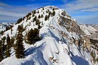
 Mount Olympus Sunset - by Joe Bullough
Wilderness Areas
The Mount Olympus Wilderness
The Mount Olympus Wilderness was established by Congress in 1984 and consist of approximately 15,800 acres. Mount Olympus Wilderness consists of narrow canyons, steep cliffs, and rugged terrain. The highest mountains include Mount Raymond and Mount Olympus. Gobblers Knob is just outside the Wilderness boundary to the east. Elevations range from approximately 5,000 feet to 10,241 feet. The highest mountains are characterized by large, alpine cirque basins and bare rocky ridges. Snow may linger into mid-summer in these places. There are various firs and aspens that grow in stands, mainly on north-facing slopes. The lower elevations are covered in dense mountain brush mixed with sagebrush and grass.
Big Cottonwood Canyon, and State Road 190, are located along its southern boundary, and the canyon separates this wilderness from Twin Peaks Wilderness to the south. Millcreek Canyon and its county road form the northern boundary. From both of these canyons, you can enter the wilderness from several trailheads. Most of the trails are well maintained and are easy to follow, but some are more strenuous than others. Crowds from the Salt Lake City area flood into here, especially on weekends. Mount Olympus Wilderness area has about 12 system trails totaling approximately 37 miles. The Big Cottonwood side of the wilderness is part of the Salt Lake City watershed and no dogs are allowed. Dogs are allowed in Millcreek Canyon.
The Twin Peaks Wilderness
The Twin Peaks Wilderness was established by Congress in 1984 and consist of approximately 11,400 acres. It is bounded on the south by Little Cottonwood Canyon, on the north by Big Cottonwood Canyon, on the west by Salt Lake Valley, and on the east by Mineral Fork in Big Cottonwood Canyon. The Twin Peaks Wilderness forms a part of the dramatic backdrop that is seen on the east side of the Salt Lake Valley. This ridge was carved by glaciation and more recently erosion. The canyons consists of steep terrain and quartzite cliffs. The highest mountains include the Triple Traverse Peaks: Broads Fork Twin Peaks, Sunrise, and Dromedary. Elevations range from just under 5,000 feet to 11,330 feet. Much of the higher terrain is alpine and is characterized by large cirque basins.
At lower elevations, dense mountain brush mixed with sagebrush and grass dominates the vegetation. On north-facing slopes are stands of firs and aspens. Large differences in temperature can occur between summer highs and lows. Snow remains in some parts of the wilderness until midsummer. Both Cottonwood Canyons have a road that goes toward the ski areas at the end and are highly scenic, and you'll find trailheads along both roads. Hiking trails vary from easy to difficult. Both Big and Little Cottonwood Canyon are part of the Salt Lake City watershed and no dogs are allowed.
The Lone Peak Wilderness
The Lone Peak Wilderness was established by Congress as part of the Endangered American Wilderness Act. In 1978, it was designated as Utah's first Wilderness Area and is the largest of the trio of wilderness areas above Salt Lake City. It consist of approximately of 30,000 acres. The Lone Peak Wilderness contains very rugged terrain and alpine peaks. It is located on both the Wasatch-Cache and Uinta National Forests. The highest peaks include the Pfeifferhorn and Lone Peak where snow often can remain until midsummer. Much of the higher elevations were carved by glaciers, with open cirque basins and lakes.
The area is geologically complex. The mountains are made of sedimentary, metamorphic, and igneous rock formations that form granite cliffs and buttresses, as well as colorful bands stretching for great distances across mountainsides. At higher elevations are douglas fir, subalpine fir, and aspens that grow in isolated patches on north-facing slopes. At the lower elevations are dense mountain brush and grass. Little Cottonwood Canyon, and State Highway 210, form the northern boundary and provide access to many trailheads on the north side of Alpine Ridge. It separates Lone Peak Wilderness from Twin Peaks Wilderness just to the north. In American Fork Canyon, State Highway 92, and a small stretch of State Highway Route 144, form the southern boundary of the wilderness.
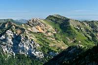
 Grandeur Peak seen from the east on Millcreek Ridge - by Phenom
Millcreek Ridge
This is the gentle ridge of the Central Wasatch. It is the main ridgeline that divides Parleys Canyon and Millcreek Canyon. You won't find any jagged peaks here but you will find great ridge running and off trail hiking. Aside from the trails, there is usually no one else on the entire ridgeline. The ridge goes in a west to east direction from Grandeur Peak to Murdock Peak. Millcreek Canyon is usually full of people on weekends. This is due to easy access and a well maintained trail system. During winter, Upper Millcreek Canyon is closed to vehicles from the gate at Terraces Trailhead.
Parleys Canyon is located on the north side of Millcreek Ridge. This is the canyon where Interstate-80 runs west to east from Salt Lake City to Park City. It was Parley Parker Pratt who made an initial exploration of the entire canyon in June 1848. He was a Mormon missionary, religious writer, poet, and an editor of the publication The Latter-day Saints' Millennial Star. He was also an original member of Quorum of the Twelve Apostles from 1835 until 1857. Parley Pratt practiced polygamy which would result in his death by Hector McLean in 1857. Parleys Canyon was named in his honor.

Mount Aire
Millcreek Canyon
When the first settlers came into the Salt Lake Valley in the 1840s they headed up into Millcreek Canyon to cut trees; this is where the name "mill" came from. It was the most heavily wooded canyon of all of the canyons above Salt Lake City. The name of the canyon can be seen spelled as either Millcreek or Mill Creek. It is a popular place for recreation. A narrow, paved road starts at 4,900 feet and goes up to 7,400 feet elevation. Decades earlier, the canyon was being overused and the watershed had been affected causing erosion problems.
The Forest Service made an agreement with Salt Lake City to change the canyon into a fee area. Today, you can purchase a daily fee all the way to an annual fee depending on how much you visit the canyon. There are a few restrictions. Dogs are allowed in the canyon but must be leashed on even-numbered days.
People can ride their mountain bikes on even-numbered days in upper Millcreek Canyon. I have never seen any of these restrictions enforced so don’t be surprised if they are broken. Millcreek Canyon has the most picnic sites of any of the canyons above Salt Lake City. The best thing about Millcreek Canyon is the trail system. There are many to choose from that vary from easy hikes to mountain summits on both sides of the canyon. Even though this area is lower in elevation than the Cottonwood Canyons, it is a great place to go skiing and snowshoeing in winter.

Millvue Peak
Millcreek Ridge Traverse

Mount Aire
Millcreek Ridge is not sought after like other ridge traverses in the Wasatch. This could be because the mountains are rounded and less interesting to some climbers. Although it is not technically difficult it would take a long day to hike the entire ridgeline so it is considered a challenge. Most people just climb one mountain or only parts of the ridge at a time. This ridge can also be traversed in winter which offers solitude and beautiful scenery. In summer, expect some bushwhacking and warm temperatures since it is lower in elevation.
The hike starts by climbing up Grandeur Peak. The Church Fork trail from Millcreek Canyon is the easiest route but the West Slopes provides the most direct way to start the traverse. From the summit of Grandeur Peak continue to the saddle to the east. Then the route follows the ridge over to Church Fork Peak. You may be able to find a less maintained trail that goes toward the summit. From here, hike to the head of Burch Hollow. Follow the ridge over Point 8,244 and Point 8,194. Hike northeast toward the saddle which intersects the Elbow Fork trail. Now you can follow the switchbacks to the summit of Mount Aire.
From Mount Aire, the route goes down to a saddle. The ridge ahead involves a little scrambling. You'll reach Lambs Canyon Pass where you can follow a trail in summer. In winter, just follow the ridge to Millvue Peak which has two summits. Now the ridge continues over Point 9,074 and Peak 8,939 plus several unnamed points. Murdock Peak is the last summit and is located on the Park City Ridge. The Millcreek Ridge traverse is usually done in a west to east direction from Grandeur Peak to Murdock Peak. It can be done in the opposite direction which starts at a higher elevation. You’ll need two cars or someone to pick you up at the end of the day to complete this route.

Grandeur Peak
Grandeur Peak - (8,299 feet)
Grandeur Peak is probably the most climbed peak on Millcreek Ridge along with Mount Aire to the east. It is on the western end of the ridge and is located northeast of Mount Olympus. The trail from Church Fork trailhead is the most used route to the summit. The trail is well maintained the entire way. This is also a nice mountain to hike in winter. The west slopes route is much steeper and has more elevation gain so it is climbed less often. The Dragon's Tail route is an alternative to the West Slopes route and follows a series of limestone cliffbands that curve up the mountain. The route from Pharoahs Glen was once a hidden oasis but there is some private property on the lower slopes of the route.

Church Fork Peak
Church Fork Peak - (8,306 feet)
Church Fork Peak is located on the ridge between Grandeur Peak and Mount Aire. It can be climbed from the Church Fork trailhead by hiking up the same trail as Grandeur Peak. The route takes off from the seventh swithback near the ridge. This is where there is a long curve in the trail heading west toward Grandeur Peak. Walk off-trail toward the meadow on the east face of Church Fork Peak. From the meadow the route goes northeast through trees and bushes to the summit. The shortest route up Church Fork Peak is from Burch Hollow. It follows the pipeline trail at the beginning. The turn off to Burch Hollow is easy to miss but there is usually a signed junction on the trail. The trail ascends switchbacks up the drainage. You will reach a saddle where Church Fork Peak is directly west and the ridge can be followed to the top.

Mount Aire
Mount Aire - (8,621 feet)
Mount Aire is a popular mountain to climb in the area. It is considered one of those mountains that has the best view for the least amount of effort. It also makes a good mountain to climb when there is still snow on the ground. The most common way to climb Mount Aire is from the Elbow Fork trailhead. It gains a little under 2,000 feet in 1.75 miles. The trail is in good condition but may be muddy in spring. Mount Aire can also be climbed from Burch Fork. It branches off trom the 8,120 foot saddle in between Church Fork Peak and Mount Aire. It heads east making a long curve along the ridgeline and then back up north to a trail junction with Elbow Fork below the south face. There are several swithbacks up to the summit.

Millvue Peak
Millvue Peak - (8,926 feet)
Millvue Peak is located southeast of Lambs Canyon Pass on the Millcreek Ridge. It can be climbed from the Elbow Fork trailhead. This is also the trailhead for Mount Aire. You'll want to turn right at the first junction on the trail that goes east. There is a sign marking the turnoff. The trail eventually meets up with Lambs Canyon Pass. From here, the trail heads toward Millvue Peak. The other alternative trail starts from the Lambs Canyon trail in Parleys Canyon. The trailhead is reached by driving up a narrow paved road for 1.6 miles to a small parking area on the left. Hiking this in winter will add a couple extra miles. It is a 1.75 hike to Lambs Canyon Pass from the trailhead. From the pass follow a trail up the west ridge to the summit of Millvue Peak. East Millvue Peak, which is on the same ridge, is also worth a visit.
 Mount Olympus seen from Salt Lake Valley - by gjagiels
Big Cottonwood Divide
This is the ridge that divides Big Cottonwood Canyon and Millcreek Canyon. It doesn't have an official name so I decided to call it the Big Cottonwood & Millcreek Ridge after the two canyons it is located above. It starts with Mount Olympus and goes east towards the Park City Ridge. There are several smaller ridges that branch off from the main ridge. Hiking in this type of terrain is very enjoyable for people who like to explore. There are routes leading to mountains from both sides of the canyons but there are more trails on the eastern half of the ridge. The western half of the ridge is known as Wildcat Ridge.

Wildcat Ridge
Wildcat Ridge Traverse

Wildcat Ridge
Wildcat Ridge is the rugged ridgeline located between Mount Olympus and Mount Raymond. Many people also add Gobblers Knob to the list. It is one of the wildest scrambling traverses in the Central Wasatch. Expect 3rd and 4th class scrambling with exposure and some bushwhacking. This ridge is below timberline and you’ll be making your way through bushes, trees, and cliff bands. The route starts by following the standard trail up Mount Olympus.
There are not many places to bail from the ridge so make sure that the weather is good and you have enough strength and energy to continue. On a warm day you will have to watch out for rattlesnakes. They are common in this area. From the summit of Olympus, the next point on the ridge is Triangle Peak. The summit provides a great view of the valley and surrounding mountains. Hobbs Peak is located farther east along the ridge and is higher in elevation. You’ll be hiking over other peaks on the ridge which are unnamed that are over 9,000 feet high. Snow usually remains on the ridge into June especially on the shaded faces.
Mount Raymond will come into view later in the hike and is easily noticeable by its distinct appearance. The hike up the west face of Mount Raymond is sometimes referred to as heartbreak hill. This is because most people will be quite tired by the time they make it here. From the summit, you’ll descend down to the saddle between Mount Raymond and Gobblers Knob. There are a number of trails to take down from here. To the north is the Alexander Basin trail and the Bowman Fork trailhead. To the south is the Desolation Trail which leads to Butler Fork trailhead. This hike requires a car shuttle to complete. It will take most people a long day to do this traverse.
Mount Olympus
Mount Olympus - (9,026 feet)
Mount Olympus is the most famous mountain north of the Cottonwood Canyons in the Central Wasatch. There are several mountain ranges that have a mountain named Olympus and the Wasatch is no exception. In Greek mythology, Olympus was the home of the gods. On summer weekends the trail is packed with hikers while other routes on the mountain are visited less. The mountain is prominent and just over 9,000 feet. The Mount Olympus trail gains over 4,000 feet in a few miles. There is a little scrambling for the last 400 feet. There are many rock climbing routes that go up the tilted quartzite slabs on the mountain. They include the West Slabs, Guerts Ridge, Kamps Ridge, and the Great Chimney. Several other scrambling routes exist including a few 3rd and 4th class routes on the North Face. There are even a few couloir climbs. Neffs Canyon is the only maintained trail on the north side of Mount Olympus. With so many routes, its popularity is well deserved.

Thayne Peak
Thayne Peak - (8,656 feet)
Thayne Peak is located below Mount Olympus to the northeast. It is usually climbed from the Desolation trailhead in Millcreek Canyon. The Thayne Canyon trail is the most straight forward way to climb the mountain. The trail follows the canyon bottom and meets up with the Desolation trail higher up. The other trail branches off from the Thayne Canyon trail and goes up a long series of switchbacks to the Salt Lake Overlook. This overlook is a popular hike. The Desolation trail was originally constructed as a motorcycle trail so many of the switchbacks are unnessary for hiking. This makes the ascent very gradual until it meets up the the Thayne Canyon trail. At the junction, the trail makes one long switchback to another junction. The trail divides and the Desolation trail goes east towards a saddle on the south side of Thayne Peak. It is a short scramble to the top from here. The view includes Mount Olympus, Wildcat Ridge, and Millcreek Ridge.

Triangle Peak
Triangle Peak - (9,410 feet)
This is the most striking mountain you will climb on the Wildcat Ridge traverse. The most common way to climb the mountain is by climbing Mount Olympus and then traversing over. Interestingly, the peaks that are located just east of Triangle Peak are higher. The mountain is shaped like a triangle, just like its name suggests, and there is a cliff down the north face of the mountain looking down into Neffs Canyon. You must continue east along the ridge in order to finish the Wildcat Ridge traverse. Hobbs Peak is the next major mountain you will get to. It is a rounded peak and more hiker friendly. Mount Raymond is the last major peak that you must climb in order to get to Baker Pass. Climbing up the west side of Mount Raymond is steep but not difficult. From Baker Pass, you can hike down into Millcreek Canyon or Big Cottonwood Canyon.

Mount Raymond
Mount Raymond - (10,241 feet)
Mount Raymond is the pointed summit located at the eastern end of Wildcat Ridge. Mount Raymond has several routes to choose from but the trail from Butler Fork is used the most. It starts in Big Cottonwood Canyon and goes up the drainage to the east of Circle-All Peak. It then heads north towards the base of Gobblers Knob. The trail eventually goes into Mill A Basin and makes one last switchback up toward Baker Pass. The climbers trail from the pass is straight forward and there is minor scrambling along the ridge. The summit is knob shaped with a narrow ridgeline that extends towards the southeast. Another route starts from Big Cottonwood Canyon goes up Mill B North Fork above the S-Curve trailhead. There is a nice viewpoint located about 1.2 miles up the trail that looks toward Cottonwood Ridge. This route goes around the south side of Mount Raymond and meets up with the Butler Fork trail. Trails from Millcreek Canyon include Porter Fork and Bowman Trail.

Gobblers Knob
Gobblers Knob - (10,246 feet)
This is the highest mountain on the Big Cottonwood & Millcreek Ridge. The name of the mountain is odd but it is another good peak to climb in the area. It is only 5 feet higher than its neighbor Mount Raymond. They are seperated from each other by Baker Pass which is the normal route up the mountain. It is less than a mile to the summit from here and a climbers trail can be followed up the west ridge. The trail is steep but there is no scrambling. The first highpoint that you can see from the pass is not the actual summit. It is the next summit on the ridge that is only a few feet higher. You can descend the ridge to the east in order to meet up with the route from Alexander Basin. This basin is in an alpine cirque and is less traveled than the route from Butler Fork. Porter Fork above Millcreek Canyon is another good route.
Circle-All Peak
Circle-All Peak - (8,707 feet)
This isn't really a mountain by definition but I thought I should mention it because it is a good peak to climb in early season. It's actually a bump at the end of the ridge below the south side of Gobblers Knob. The mountain is climbed from the Butler Fork trail. There is a junction at 0.5 miles and there will be a sign pointing left toward Circle-All Peak. A series of switchbacks climbs up the mountainside to a flat area on the trail directly north of the peak. A smaller trail branches off towards the south and is a short walk to the top. The view includes Mount Raymond and Gobblers Knob, and the Cottonwood Ridge Peaks. Circle-All Peak was named after an avalanche slide area located below the mountain.

Reynolds Peak
Reynolds Peak - (9,422 feet)
Reynolds Peak is an easy mountain to climb in the summer. It is also a good peak to climb in the winter because of the short approach and great views. There are two trails from Big Cottonwood Canyon that go to the base of Reynolds Peak. The Mill D North Fork trail goes to a junction with the Desolation Lake trail. Take the left fork to Dog Lake. The trail is short and steep. From Dog Lake the route goes to the saddle located north of Reynolds Peak. It gains about 2,200 feet in feet in 2.3 miles. Reynolds Peak can also be climbed from Butler Fork. The trail goes right at the first junction and ascends the canyon west of Reynolds Peak. The same trail on the north ridge can be followed to the summit. The shortest route to the top starts from Millcreek Canyon and goes up the Big Water trail.

Little Water Peak
Little Water Peak - (9,605 feet)
Little Water Peak is located northeast of Reynolds Peak. They are in close proximity to each other and can be combined for a nice day of hiking. It uses the same trail up Mill D North Fork to Dog Lake. From the north side of the lake, there will be a smaller trail heading up the hillside. The trail follows the ridge northeast through the trees and bushes. It goes through an aspen forest to a false summit below the real summit. Descend down from here and climb back up toward the top. The summit is rounded flat pile of rocks. You'll be able to see Reynolds Peak which will look much smaller because it is almost 200 feet lower than Little Water Peak. Reynolds Peak is climbed more often because of its location directly above Dog Lake. Another route up Little Water Peak starts at the end of Millcreek Canyon and goes up the Big Water trail.
 View from Silver Peak on Park City Ridge - by ZeeJay
Park City Ridge
This ridge goes in a north to south direction instead of a west to east direction like the other main ridges in the Central Wasatch. It is also commonly known as the Wasatch Crest Ridge. The Park City Ridge is located on the eastern side of the Central Wasatch. It forms a chain of peaks that are at the end of Millcreek Canyon and Big Cottonwood Canyon. There are many mountains to climb but most of them are unnamed. There are a few peaks that reach over 10,000 feet in elevation and many others that are over 9,000 feet.
The Park City Ridge is full of rolling hills and rounded mountains just like the Northern Wasatch and Millcreek Ridge. For this reason, the area is more popular with hikers than climbers. There are several trails and ridges that runners and mountain bikers use during the summer. In the winter, skiers and snow boarders come here to play. An interesting thing to note is that there is a Red Pine Canyon and Lake, White Pine Canyon, and Thaynes Canyon located on the east side of Park City Ridge. Sometimes the Wasatch Mountains have similiar names for canyons, lakes, and mountains.
You're probably wondering if it is possible to traverse the Park City Ridge. Yes, and it's done a lot more than you think. A series of different trails can be used to hike the whole ridge. The Great Western Trail (GWT) traverses almost the entire length of the ridge and it is also used as the route of Wasatch 100 ultramarathon. The Mid Mountain Trail crosses the bowls on the east side of the ridge. This section of the Great Western Trail starts near Lambs Canyon and follows trails in Millcreek and Upper Millcreek Canyon. This ridgeline trail travels on the divide between Salt Lake County and Summit County. Then the route heads south and intersects the triple divide with Wasatch County.

Summit Park Peak
Summit Park Peak - (8,618 feet)
Summit Park Peak is located in the northern section of the central Wasatch. It is on the ridge south of Parleys Summit. Lambs Canyon separates Summit Park Peak from Murdock Peak on Park City Ridge. It is an easy hike during summer. Most people ski or snowshoe to the summit during winter. It is a more interesting peak with snow. There are great views from the top of the Wasatch Mountains and farther to the Uinta Mountains.

Murdock Peak
Murdock Peak - (9,602 feet)
Murdock Peak is located on the Park City Ridge and the eastern side of the Millcreek Ridge. The peak can be hiked as part of the Millcreek Ridge traverse. It's more easily approached from the trailhead at the end of Millcreek Canyon. Follow this trail east as it goes along the south side of the bottom of the canyon. It reaches a meadow where the trail divides. Go left and take the north fork. This leads to a pass just southeast of Murdock Peak. The mountain is easily hiked by its south slopes. Murdock Peak can also be approached from Lambs Canyon. This is a nice area in winter for skiers and snowshoers. Some of land on the Park City side of Murdock Peak is privately owned.

Desolation Peak
Desolation Peak - (9,990 feet)
This mountain is also known as Peak 9,990. Desolation Peak is an easy mountain to climb because the Great Western Trail passes near the top of the mountain. It is located on the Park City Ridge southeast of Desolation Lake. It can be reached from Beartrap Fork. Another route is from the Mill D North Fork trail. This trail branches off with the junction to Dog Lake. You can also start from the top of Millcreek Canyon and hike up to the ridge and follow the Great Western Trail south toward Desolation Peak. The eastern side is home to the Canyons' ski lift on 9,990.

Silver Peak
Silver Peak - (10,006 feet)
Silver Peak is the lowest mountain over 10,000 feet in Salt Lake County, but elevation doesn't measure difficulty. It is a relatively easy peak to reach. It is located to the southeast of Desolation Peak and the two can be climbed together. The Great Western Trail passes just below the summit of Silver Peak on its south face. The most popular routes are Beartrap Fork and the Mill D North Fork trail to Desolation Lake. Another route is the Great Western Trail from Scott Hill.

Scott Hill
Scott Hill - (10,116 feet)
Scott Hill is north of Guardsman Peak and overlooks the Park City Ski Resort. It is also accessible from Big Cottonwood Canyon. There is a building with a fence just below the summit with an old mining shack on its south face. The route from Scotts Pass is the easiest way to get there. It begins near the second hairpin curve or past the winter gate on the Guardsman Pass road. From the pass, two trails head northwest. The one further uphill leads to the summit.

Tri-County Peak
Tri-County Peak - (10,026 feet)
Tri-County Peak is also known as Guardsman Peak. The mountain is unofficially named and located west of Jupiter Hill. The road to Guardsman Pass can be reached from Big Cottonwood Canyon or Park City. The route follows the road that leads north up toward the ridge. It's a short hike from here along the trail to the top. Mount Majestic (Clayton Peak) is located on the opposite side of Guardsman Pass south of Tri-County Peak.

Jupiter Hill
Jupiter Hill - (9,998 feet)
Jupiter Hill is located south across the deep canyon of Scotts Pass. Guardsman Peak, Scott Peak, and Jupiter Hill are also good winter hikes on snowshoes or skis. Jupiter mine is located west of the peak. The route to the mountain starts from the end of the Guardsman Pass road. Jupiter Hill will be directly east of Guardsman Peak. Both of these peaks are located near the triple divide of Salt Lake County, Summit County, and Wasatch County and can be climbed together.

Flagstaff Mountain
Flagstaff Mountain - (9,213 feet)
Flagstaff Mountain is located east of Jupiter Hill and south of Bald Mountain on Park City Ridge. This peak shouldn’t be confused with the more well known Flagstaff Mountain which is above Alta on Cottonwood Ridge. Its name comes from nearby Flagstaff Mine. The mountain is just south of the boundaries of Deer Valley Resort. There is a ski lift that is nearby and the mountain is actually half a mile southeast from the lift. You can get there from Highway 224 from the pass that separates Park City Mountain Resort with Deer Valley Resort. It is a short hike from here to the summit.

Park Benchmark
Park Benchmark - (9,363 feet)
Park Benchmark is located southeast of Flagstaff Mountain and south of Bald Mountain on Park City Ridge. A ski lift above Deer Valley Resort is located below the peak. The first route starts from the pass on Highway 224 that divides Park City Mountain Resort with Deer Valley Resort. Hike to Flagstaff Peak and simply follow the ridge to Park Benchmark. From Deer Valley there are two routes. They are the Ontario Trail and the Silver Lakes Trail. Both of these trails are about two and a half miles to the top of Bald Moutain. The summit has a triangular metal platform.

Bald Mountain
Bald Mountain - (9,346 feet)
Bald Mountain is located north of Park Mountain and east of Flagstaff Mountain. One route starts from the pass on Highway 224 that divides Park City Mountain Resort with Deer Valley Resort. Hike to Flagstaff Peak and continue to Park Mountain and then hike north to Bald Mountain. There are two hiking trails near Deer Valley Resort that include the Silver Lake Trail on the east face and Ontario Canyon Trail on the west face. Both start at Silver Lake Village and are over two miles to the top of Bald Mountain. On the summit are some microwave reflectors similar to the ones on Big Beacon.

Bonanza Benchmark
Bonanza Benchmark - (8,708 feet)
Bonanza Benchmark is part of Park City Ridge. It is above Heber Valley in Wasatch Mountain State Park. Bonanza Benchmark is south of Bald Mountain and Park Benchmark. A narrow 4wd road goes close to the summit so most people will want to hike up. There is a creek crossing that is easy to navigate when the water level is low. Highway 224 is gated in winter down lower. This peak is usually hiked to after the gate is open and the snow melts. The trail does not go all the way to the top so you’ll have to bushwhack your way up the final part to the summit.

Iron Mountain
Iron Mountain - (9,018 feet)
Iron Mountain is located between the Park City Resort and The Canyons Ski Resort. It is on Park City Ridge south of Quarry Mountain, northeast of Brighton, and southeast of Little Water Peak and Murdock Peak. Iron Mountain is above 9,000 feet elevation north of White Pine Lake. The shortest route is from the lake. There are several lakes with that name in the Wasatch. Another trail starts south of Snyderville along the north ridge. The last route starts from the northeast. The trail ascends Iron Canyon before turning up the south ridge. Locals like to sled down this route.

Park City Hill
Park City Hill - (7,202 feet)
This hill is located exactly where you thought it would be, Park City. This is a short hike that can be done year round. There is a trail that goes to the summit and great views of the city below. The trail starts north of Treasure Mountain Middle School near the city park. The route starts by going south up to a saddle on the south side of the hill. This is where you will intersect a road. Then you can hike up that road as it goes around the summit on its north side.
 Dromedary Peak & Sunrise Peak above Broads Fork - by Joe Bullough
Cottonwood Ridge
The Cottonwood Ridge is the prominent ridgeline that divides Big Cottonwood Canyon and Little Cottonwood Canyon. These two canyons give access to the trailheads for these mountains. They are the most popular areas around Salt Lake City to go hiking and mountain climbing. Big Cottonwood Canyon has more trails that lead up to canyons, lakes, and mountains. The south side of Cottonwood Ridge ridge is very steep. There are granite buttresses on this side of the ridge that provide challenging routes. There are only few trails on the Little Cottonwood Canyon side of the ridge until you get to Cardiff Pass. At the end of the canyon is Alta Ski Resort and down lower is Snowbird Ski Resort.
The ridge runs west to east from Broads Fork Twin Peaks to Clayton Peak near the Park City Ridge. Big Cottonwood Canyon has several side canyons on the north side of the ridge with maintained trails. Notable peaks are the Triple Traverse Peaks including Broads Fork Twin Peaks which is the highest mountain on the ridge. Monte Cristo and Mount Superior are located west of Cardiff Pass. Mount Wolverine is the highest mountain above Brighton. At the end of Big Cottonwood Canyon is Brighton Ski Resort and down lower is Solitude Ski Resort. A lot of peaks are in this area along with several lakes. The canyon has many quartzite crags that are popular with rock climbers. The highest mountains are over 11,000 feet and are rugged with steep canyons and cliffs.

Triple Traverse Peaks

Tanners Gulch
The Triple Traverse
The Triple Traverse is named after the three main peaks located above Broads Fork. They are Broads Fork Twin Peaks, Sunrise Peak, and Dromedary Peak. A fun day involves traversing all three of them. Broads Fork is one of the best hikes on Cottonwood Ridge. There is a nice maintained trail that goes to the meadow located below these mountains. The terrain above features a large boulder and talus cirque. Snow doesn't melt from this area until summer and avalanches are a common sight during winter.
The highest mountain on the ridge is Broads Fork Twin Peaks. This is one of the most recognizable mountains in the Central Wasatch. It is only a little shorter than American Fork Twin Peaks on Alpine Ridge. The standard route goes up Broads Fork from the saddle between Twin Peaks and Sunrise or the Robinson Variation. In the summer, the easiest routes involve 3rd class scrambling. Sometimes a climb of Storm Mountain via Ferguson Canyon and the ridge connecting it to Twin Peaks is done as part of a longer version of the Triple Traverse.
If you are climbing Tanners Gulch then the traverse is done in the opposite direction. Tanners Gulch is one of the best spring snow climbs in the Wasatch. This route has a small time frame for safe conditions usually in late spring from the end of April to early June depending on conditions. The major issue is avalanches so try to go after the snow has consolidated. The route climbs up the prominent snow filled gully located between Dromedary and Sunrise Peak. From Tanners Saddle follow the ridge to the summit of Dromedary Peak which is the lowest peak of the traverse. From here you will get a view of the rest of the route. Sunrise Peak towers above with its distinct snow dome shape. The route follows its east ridge to the top. The down climb of Jepsen's Folly from Sunrise Peak is considered to be the crux of the route. This leads to the saddle between Sunrise and Twin Peaks. Now you can just follow the standard route up the ridge to the summit of East Twin Peak. A short walk leads to the summit of West Twin Peak. The preferred descent is down Broads Fork.
Monte Cristo

Cottonwood Ridge
Cottonwood Ridge Traverse
This part of the ridge is located between Dromedary Peak and Cardiff Pass. To traverse across the entire Cottonwood Ridge in one day would be quite a feat. So this section of the ridge is probably enough for most people. It is usually combined with the Triple Traverse. The traverse is more commonly done by going in a west to east direction. This means that the approach to Broads Fork is done earlier in the day. The traverse can also be done in the opposite direction starting in Alta which begins at a higher elevation. It’s all a matter of preference. Bring plenty of food and water for this long hike.
Dromedary Peak can be climbed from Broads Fork or Lake Blanche. Mount Superior and Monte Cristo are located on the east side of the ridge. There are several other peaks and points along the ridge but they are not named. Notable unnamed peaks include Peak 10,910 which is a half mile east of Dromedary Peak. The next major point located to the east is Peak 11,033. This is the highpoint of the long ridge that extends south from Sundial Peak. There is a small point located farther east that you hike over. Another prominent unnamed peak is the one located west of Monte Cristo. It is photographed often from people who climb the mountain. The last half mile along the ridge to Monte Cristo is steep, narrow, and fun. Follow the east ridge of Mount Superior and descend to Cardiff Pass down the trail.
The ridgeline is narrow for most of the way and a few parts are knife-edged with a lot of exposure looking down into Little Cottonwood Canyon and the basin southeast of Lake Blanche. The scrambling isn't difficult but the rock is loose in many places. The ridge has mostly 3rd class and 4th class scrambling. Most people consider the crux to be located west of Monte Cristo. You should be able to find good handholds in the rock. The ridge is a lot longer than it looks and sometimes scrambling along it can be incredibly slow. There are a few places to bail if the weather gets bad. Almost all of them are down the basin to the north on either side of Sundial Peak. The route finding is pretty straight forward but there are a few side ridges that connect with the main ridge.
Honeycomb Cliffs
Flagstaff Mountain
Cottonwood Ridge (East)
This section of the ridge is located between Cardiff Pass and Twin Lakes Pass. Some of the peaks that can be accessed from here include Flagstaff Mountain, Reed and Benson, Davenport Hill, and Honeycomb Cliffs. The nearby ski resorts allow quick access to this area. In winter, many skiers and snowshoers will be in this area especially near Silver Fork, Days Fork, Cardiff Pass, and Grizzly Gulch. In summer, fewer people hike this part of Cottonwood Ridge but you should start seeing hikers once you get to Twin Lakes Pass. A trail can actually be followed for much of the way along the ridge.
Flagstaff Mountain is located on the north side of Little Cottonwood Canyon across from Alta Ski Resort. It can be reached from the trail up Cardiff Pass. There are two ways to climb the mountain. The route from Flagstaff Mine is the most direct route and follows a steep slope to the summit. This also bypasses the more rugged lower peak to the west. The other route starts from Cardiff Pass and goes up cliff bands that are frequented by mountain goats. Reed and Benson is a long ridge located north of Flagstaff Mountain. It is seldom climbed except during winter by skiers because there are a lot of couloirs on the face. It runs north to south and has steep cliffs on its west side that overlook Mill D South Fork which is more commonly known as Cardiff Fork.
The ridge continues as it goes toward a peak that is east of Flagstaff Mountain. The trail along the ridge descends a little and then follows the ridge except to avoid trees along the way. There will be great views of the peaks above Alta across the valley. The trail travels to the head of Days Fork and then goes to Davenport Hill. This overlooks Silver Fork to the north. The route follows the south side of the ridge as it heads toward the Honeycomb Cliffs. You can climb the mountain directly up the face. It is more easily climbed from Twin Lake Pass by following a trail up the south ridge. The last option is to follow the trail to Prince of Wales Mine and then climb up the north ridge to the summit of Honeycomb Cliffs. The best descent is down Grizzly Gulch.

Mount Wolverine

Wolverine Cirque
Brighton Ridge Run
This ridge traverse is located above Brighton Ski Resort at the top of Big Cottonwood Canyon. These mountains are over 10,000 feet in elevation but are easier to climb than the higher peaks to the west. This ridge can be broken into smaller hikes because there are so many trails in the area. This ridge is for people who love peakbagging several mountains in one day. The good thing is that you don't need a car shuttle if you do this hike as a loop. Another version of the hike is called the Alta Ridge Run. This starts from Albion Basin to Point Supreme and then goes to Catherine Pass. Then the route follows the ridge over Mount Wolverine to Twin Lakes Pass and descends Grizzly Gulch.
The Brighton Ridge Run starts by going up the trail toward Snake Creek Pass. At the pass is a great view of Mount Timpanogos and other mountains in the Southern Wasatch. You also have a choice of whether to add Clayton Peak to your hike. A trail can be followed all the way to its summit. From the pass, continue west along the standard Brighton Ridge Run. The first peak you'll get to is Preston Peak. Descend down a little and then traverse over toward the next peak known as Pioneer Ridge. There are several lakes that can be seen including Dog Lake, Lake Mary, and Lake Martha. Hike up to the next peak which is named Pioneer Peak. Lake Catherine is located in a pretty cirque on the northwest side of the mountain. If you continue along the ridge, you will reach Sunset Peak. This is a popular destination and one of the easiest peaks to hike to in the Central Wasatch so you are likely to see people here.
From Sunset Peak, hike down the trail toward Catherine Pass. There is a junction at the pass and you’ll want to take the smaller trail that goes north toward Mount Tuscarora. This is the smaller peak that is southeast of Mount Wolverine. Follow the ridge over boulders and rocks to the summit. Mount Wolverine is the highest mountain above Brighton. It has a great view because of its location at the top of both Big and Little Cottonwood Canyons. From here you have a choice of which direction to go. One is to follow the ridge to the northeast down to Mount Millicent. This will take you to Twin Lakes Reservoir and back to Brighton. A longer route goes over Wolverine Cirque and Patsey Marley. This goes to Twin Lakes Pass where you can follow the trail back down to the trailhead.

Sunset Peak

Mount Millicent
Brighton and Solitude Area
Brighton was named after a family that emigrated from Scotland to Salt Lake City. They homesteaded an 80 acre plot at Brighton in 1871. The family consisted of William Stuart Brighton, his wife, Catherine, and their children, Dan and Will. One of the lakes above Brighton was named after Catherine who enjoyed fishing. She was a great cook and soon travelers discovered that Brighton was a great place to get a meal.
Catherine Brighton always had a supply of mutton, beef, and fresh trout that she caught herself, as well as butter, butter milk, and biscuits. The family soon opened a large store and later they built and operated the Brighton Hotel. This was a small hotel with seven bedrooms that were used by some of the most prominent people who lived in Salt Lake City. It would later become a popular place to stay in the canyon. The summer after the completion of the Brighton Hotel, Catherine had a sudden heart attack and died on July 19, 1894.
William Stuart Brighton carried on with the hotel for the remainder of the season. Brighton had been a popular summer destination when Salt Lake City residents came to get out of the city heat but they usually didn’t stay for the snowy winters. In the late 1800s, Dan and Will Brighton made crude skis so they could move around on the snow. About 40 years later, in the 1920s, the Wasatch Mountain Club began skiing at Brighton because it had a large amount of snow. But there were no lifts in those days. Instead, groups would travel to Park City, climb up over the ridge tops just as the early travelers had done, and ski down into Brighton where they would spend a few days skiing, eating, drinking, dancing, and playing bridge. The shortest route was a one day trip that went through Brighton. Otherwise, it took about three days to go from Park City down the canyon to Salt Lake City then up another canyon to Alta.
Some of the routes from Park City to Brighton became so popular that the Wasatch Mountain Club marked them with signposts displaying the club’s insignia. In the early years, lifts were all privately owned. In 1936, the club built the first rope tow at Brighton. The Alpine Ski Club built a J-bar, but it was a complicated contraption that didn’t work very well. In 1938, K. Smith, an avid skier with the Wasatch Mountain Club, built a 1,440 foot long T-bar lift that was very successful. Smith then traveled to Sun Valley in Idaho to learn about newly invented chair lifts. This made skiing much more accessible. Several organizations began to promote skiing in the Wasatch Mountains. Ski resort activity didn't take off until the 1940's. Resorts in Salt Lake City, Ogden, and Park City soon opened. Downhill, slalom, and combined ski championships were held at these resorts. The Wasatch Mountains became well known for ski racing.
Zane Doyle was a meat cutter at Hill Air Force Base. He bought K. Smith’s idle lift and went into the ski business. Over several years he continued to install lifts above Brighton. In the winter of 1947-48, the 4,000 foot long, 1,100 foot high Millicent chair lift was built. At the time it was one of the best constructed in the United States. Then in 1955, Doyle and his father-in-law, Willard Jensen, formed a partnership to operate Brighton and the first double chair lift in the Intermountain region, the Majestic double chair lift. In 1963, Doyle and Jensen operated all of the different lifts, equipment, and services under their ownership. Brighton continued to grow and become a favorite resort along the Wasatch Front. In 1987, Boyne USA, a family owned corporation established in 1947 by Everett Kircher, purchased the resort. Everett's son John continues to guide the resort today. The Doyle family continues to operate Brighton.
Silver miners gave the name Solitude to the geographic area now dominated by Solitude Mountain Resort. The peak of mining activity was during the 1870s and 1880s. The first production of ore was in Honeycomb and Silver Fork Canyons. At that time, the mining district was called the Mountain Lake District because of Silver Lake and Twin Lakes, which is now a reservoir. The first mine was known as Evening Star. By 1875, there were hundreds of mines located at or near Solitude with interesting names like Argenta, Davenport, Antelope, Teresa, Wondering Boy, Prince of Wales, Highland Chief, Woodlawn, and Copperking.
Robert M. Barrett made his fortune as a Moab uranium miner during the early 1950s. He moved to Salt Lake City and took up skiing. While pursuing his passion at Alta, he was denied restroom access. The ski area used sewage tanks and was responsible for transporting waste down the canyon. Restrooms were reserved for guests so he declared he would open his own ski area. Barrett bought every piece of land available in the canyon adjacent to Alta and started construction in 1956. Solitude opened in the fall of 1957 with two chair lifts providing access to the area now skied on the front of the mountain.
Solitude Mountain Resort is located 12 miles up Big Cottonwood Canyon. The area that surrounds the mountain features 1,200 acres of terrain with challenging powder bowls and tree-lined glades with a drop of 2,000 feet. New ski lifts have enabled beginner and intermediate skiers to get up onto the mountain easier than ever before. Solitude is a favorite of Salt Lake City locals due to its abundance of powder and variety of terrain. In more recent years Solitude has expanded to include a villiage for out of town skiers and several lodges. Solitude Resort is open in the summer for hiking and mountain biking.
 North Thunder Mountain summit - by marauders
Alpine Ridge
The Alpine Ridge is the ridgeline that seperates Little Cottonwood Canyon and American Fork Canyon. Its name is appropriate because much of the ridge is above timberline. The mountains have a jagged alpine appearance and rise steeply from the surrounding valley. The rock in this area is made out of granite and there are many cliffs, walls, and buttresses. Much of the granite is conglomerate with patches of dark rock with a gray colored matrix. Several of these canyons end in cirque basins and a few have alpine lakes. There are many areas that are fun to explore and don't have trails. American Fork Canyon provides access to trails on the south side of the ridge. The Alpine Ridge goes in a west to east direction and ends at Alta.
It starts with Lone Peak at its west end and goes to Devils Castle at its east end. It eventually meets up with the Cottonwood Ridge near Sunset Peak. The highest mountains are over 11,000 feet in elevation with American Fork Twin Peaks being the highest one on the ridge and in Salt Lake County. Lone Peak is one of the most well known and strenuous mountains to climb in the Wasatch. Its west face is a sheer cliff and can be seen from many miles around. Other notable peaks include the Pfeifferhorn which is also known as the Little Matterhorn. The mountain is a perfectly shaped horn on the divide. White Baldy and Red Baldy are located further east along the ridge. Devils Castle is the mountain directly above Alta with the huge cliff face that drops down into Albion Basin.
Sugarloaf Peak

Devils Castle
Alta and Snowbird Area
Alta and Snowbird are rich in skiing history. This area is also a great place to go hiking and mountain climbing. It is located at a high elevation and this allows people to climb several peaks in one day. There are many trails that are connected together through different valleys. Some of the mountains that can be accessed from this area on the Alpine Ridge include Devils Castle, Sugarloaf Peak, Mount Baldy, Hidden Peak, and American Fork Twin Peaks. A tram leads to the top of Hidden Peak.
In 1937, the U.S. Forest Service was given about 1800 acres of land for the development of a ski area. The first Collins lift was constructed in 1938 out of pieces of an old aerial mining tram. It was the second chairlift in U.S. history. Alta played a major role in the creation of the modern day ski resort model. The resort is located near the top of Little Cottonwood Canyon. It opened to skiers for the first time on January 15, 1939. This makes it one of the oldest ski resorts in the country and there still remains a "skiers-only" policy at the resort and no snowboarding is allowed. Alta is known for its deep powder and rugged terrain and is a world class destination. The area often receives around 500 inches of snow each season. A variety of terrain and snow conditions provide skiing opportunities for every level of skier from beginner to expert.
Albion Basin is located at the top of Little Cottonwood Canyon. It has the highest trailhead in the Central Wasatch at around 9,400 feet. The trailhead is at the end of an unpaved dirt road that can be driven by passenger vehicles. The basin is set in a beautiful alpine cirque above Alta. During summer, the area is full of colorful wild flowers and wildlife such as deer and moose. A popular trail goes to Secret Lake which can’t be seen until you are standing above it. So this is why the name seems to be appropriate. The lake is located below the rugged cliffs of Devils Castle and Sugarloaf Peak. A trail ascends to the pass located between both peaks. Devils Castle is a fun scramble with exposure down the north face. Sugarloaf Peak is one of the more mellow 11,000 foot peaks.
Collins Gulch is located in the next valley west of Albion Basin. In summer the area is never crowded. The trailhead is on the east side of the large Alta parking lot near the Collins and Wildcat ski lifts. The route up Collins Gulch follows an Alta ski service road that goes up several switchbacks. There is a junction at the base of Germania Lift. The trail heading right goes toward the ridge on the west and the top of Wildcat Lift. The trail heading left goes toward another ridge to the east and the top of Germania Lift. At a pass it meets up with the road and a trail that goes to Germania Pass between Sugarloaf Peak and Mount Baldy.
Peruvian Gulch is located west of Collins Gulch and east of Gad Valley. This area is above Snowbird Resort. A lot of mining activity took place in this area. Some of the land is private and some is managed by Snowbird. There are two approaches into Peruvian Gulch. The western route follows a trail up the Dick Bass Highway Ski Run and then onto Wilber Ridge. The eastern route starts by the bypass route near Cliff Lodge. It goes near the top of Peruvian Lift on a service road up to Hidden Peak. The trail up Peruvian Gulch is about 3.5 miles to the summit of Hidden Peak and takes two hours or less.
Gad Valley is located in the valley west of Peruvian Gulch above Snowbird Resort. It is a little quieter than the other valleys that are farther east. It can be accessed from the lower Snowbird parking area. The route ascends a service ski road up the valley. The main road leads to the saddle that is between Hidden Peak and American Fork Twin Peaks. Another route branches off from the main road and goes toward the Gad II Lift. It heads west toward a small saddle on the ridge. The saddle overlooks White Pine Canyon. This also provides an alternative route to Twin Peaks instead of the ridge after Hidden Peak.
The owner and chairman of Snowbird Ski & Summer Resort is Dick Bass. During a 1969 trip to the Wasatch Mountains in Utah, Dick’s life was changed forever. He caught an infectious energy and love for the mountains and later opened Snowbird Ski Resort. He has become one of the ski resort industries most dynamic and energetic leaders. Much of this attributes to his, curiosity, nonstop verbosity, and enthusiasm. April 30, 1985, he became the first person to climb the Seven Summits. He had no idea his achievement would help create a goal that many people would later chase after. At age 55, he was the oldest person to scale the world's highest peak at the time. Dick is a constant inspiration to others with lectures across the country. His story can be read in his book, “Seven Summits”, which is co-authored with the late Frank Wells and Rick Ridgeway who helped him climb Mount Everest.

AF Twin Peaks

White Baldy
The Bullion Divide
The Bullion Divide is a great ridge traverse that climbs over several peaks on the eastern half of the Alpine Ridge. It can be done in any direction but usually starts from Albion Basin. Devils Castle can be added as an extra peak at the beginning of the traverse. You can climb up Sugarloaf Peak from the saddle to the east which has a trail or from west. Mount Baldy can be climbed from the east ridge or around its south side.
Follow the ridge over to Hidden Peak and watch the tram carry people to the top. Of course, you could take the tram to the top and forget about Mount Baldy, but that's not very fun. After Hidden Peak is the ascent up the northeast ridge of American Fork Twin Peaks. The ridge is narrow and has fun scrambling. From East Twin Peak to West Twin Peak is a simple walk. This is the highest mountain in Salt Lake County. It is also the highpoint of the ridge but you still have a lot of elevation gain and loss left to go. Descend down American Fork West Twin Peak to the saddle below.
Now you will climb up the ridge to Red Top which is also known as Red Stack for obvious reasons. You'll get a great view of the Alpine Ridge and White Pine Lake which will be below. Follow the ridge down to the saddle below Red Baldy. There is a small knob that you go over and then you can either follow the ridge directly or move left and climb up scree gullies or chutes to the summit Red Baldy. From here you will notice that the rock changes from dark brown and red to a lighter color of grey. Your last mountain of the day can be seen to the southwest. The route up White Baldy goes up the east ridge while trying to avoid cliff bands along the way. The preferred descent is down the west ridge of White Baldy to saddle overlooking Red Pine Lake.

Alpine Ridge
Pfeifferhorn
The Beatout Hike
The Beatout Hike is one of the classic ridge scrambles in the Wasatch Mountains. The route starts from the White Pine Traihead and goes up Red Pine Canyon essentially where the Bullion Divide ended. Hike up the maintained trail to lower Red Pine Lake. This is where most day hikers turn around. A climbers trail continues to upper Red Pine Lake and the large boulderfield above. Ascend the headwall west of White Baldy.
From here the route goes west towards the Pfeifferhorn. It is only five feet higher than White Baldy. The ridge has 3rd class scrambling. The final part up to the summit is the steepest part. This is the highpoint of the ridge and one of the most beautiful mountains in the Wasatch. The route descends down towards Peak 11,137. It is also known as Upwop meaning Unnamed Peak west of Pfeifferhorn. It goes to the beginning of Lightning Ridge. The north side of Lightning Ridge drops into Hogum Fork. Chipman Peak is located on a short spur ridge and is a nice bonus mountain to climb. The peak stands above Lake Hardy.
Hogum Fork is located in a large glacial cirque and has no established trails. At the end of the ridge is the boulder hopping ascent of South Thunder Mountain. Its seldom climbed neighbor North Thunder Mountain can be seen above Thunder Mountain Bowl which is another glacier carved cirque. This is also the triple divide between Dry Creek, Hogum Fork, and Bells Canyon. The most common descent is down into upper Bells Canyon. You'll be descending down a steep boulderfield for most of the way. In early season it will be covered in snow. You don't have to hike to the reservoir, just in that general direction. From here, there is over five miles of hiking through Bells Canyon. This route is known as the Beatout Hike. The name probably came from the bushwhacking and hiking involved in descending down Bells Canyon. Some people say it is named after the way you feel after completing the hike.
North Thunder Mountain
Lone Peak
Hematoma Quad
The Hematoma Quad is a ridge traverse located on the west side of the Alpine Ridge. Hopefully, you won't be bleeding after you complete this traverse. The mountains on this route include North Thunder Mountain, South Thunder Mountain, Bighorn Peak aka Upper Bells Peak, and Lone Peak. The route is usually done in that order but can also be done in the opposite direction. Allow a full day to do the entire traverse.
The first mountain of the day is North Thunder Mountain which is most commonly climbed from Coalpit Gulch. There are other routes but this is the most direct. It has a 5,000 foot climb in only 2.5 miles that involves scrambling over waterfalls and other debris. Once above these obstacles the gulch enters into a large bowl that is below the headwall of two ridges. Climb up to the top of the ridge and follow it to the summit. The next part of the route traverses along the ridge between North and South Thunder Mountain. There is about a mile of fun and interesting 4th class scrambling in this section.
From the summit of South Thunder Mountain descend down to the saddle to the southwest. This will be above Bells Canyon. Continue west toward the ridge leading to the summit of Bighorn Peak. This is a fairly straight forward scramble up the ridge to the top. The route leading down from Bighorn Peak has some exposure in a few places. The west ridge can be kept at mostly 3rd class scrambling with careful route finding. From the saddle ascend to the west along the ridge that leads toward Lone Peak. The south summit is the first point you will reach. Drop down a little to the east and hike north to the actual summit. This is the last mountain of the traverse and also the highest. Several routes can be taken on the descent of Lone Peak. The Hematoma Quad requires a car shuttle.

Miller Hill

Ant Knolls
Southernmost Peaks
Miller Hill, 10,264 feet, is located at the top of American Fork Canyon and east of Mary Ellen Gulch. American Fork Twin Peaks forms a ridgeline to the west connecting it to Alpine Ridge above Mineral Basin. The mountain has two summits and is surrounded by dirt roads from old mining tracks. This includes the Silver Bell Mine, Yankee Mines, Bog Mine, Pacific Mines and Dutchman Mine. Most approaches are from Alpine Ridge or from American Fork Canyon. For the latter, you can start at Tibble Fork. A high clearance vehicle is recommended to travel beyond. A jeep road switchbacks up the south face of the mountain above Dutchman Flat. The easiest route is to go to Mineral Basin and hike to the peak from there.
Ant Knolls, 9,852 feet, extends several miles south from Sunset Peak which forms the triple divide above the Cottonwood Canyons near Brighton, Alta and American Fork Canyon. The Ant Knolls are located near Ridge Trail 157 and is popular with mountain bikers, motorcyclists and ATV riders. Hikers also use this trail while traversing the ridge between Sunset Peak, Ant Knolls and Mill Canyon Peak farther south. This is the most scenic and preferred route but requires a two car shuttle. The shortest and easiest way to Ant Knolls is from Pole Line Pass. You can get to the pass up a dirt road from the town of Midway. The pass can also be reached from the top of American Fork Canyon. A trail leads to the ridge which has two summits with the highpoint on the north end.
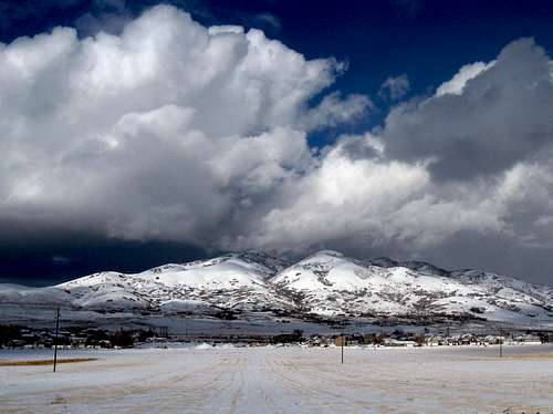 Traverse Mountains in winter - by Dean

Steep Mountain
Traverse Mountains

View Benchmark
The Traverse Mountains, aka Traverse Range, extends farther out from the west side of Lone Peak. It is the dividing point between the Central and Southern Wasatch Mountains or more commonly known as the Salt Lake City and Provo areas. The ridge stands high overlooking the valley and there are several subdivisions in and around the range. It may be a good place to live for those looking for a room with a view but sometimes the hillsides are exposed to landslides. The western ridge of the Traverse Mountains is located on the other side of highway. This area contains Camp Williams National Guard Military Reservation. That ridge becomes part of the foothills on the east side of the Oquirrh Mountains.
The two main peaks of interest in the Traverse Mountains are View Benchmark, 6,682 feet, and Steep Mountain, 6,196 feet. Steep Mountain is also known as South Mountain and is constantly being altered because Geneva Rock owns much of the mountain. These peaks are good for people who may not have a lot of time but still want to get out for a short hike. Access to hiking trails may always be subject to change because of their location so close to the community. Around the Traverse Mountains are the cities of Draper to the north, Alpine to the southeast, and Highland and Lehi to the south. Interstate-15 curves around an area known as Point of the Mountain. There is a good chance that you'll spot some paragliders and hang gliders in the sky near Steep Mountain and Point of the Mountain. It may be the most popular place in Utah for them due to ease of access and usually windy conditions.
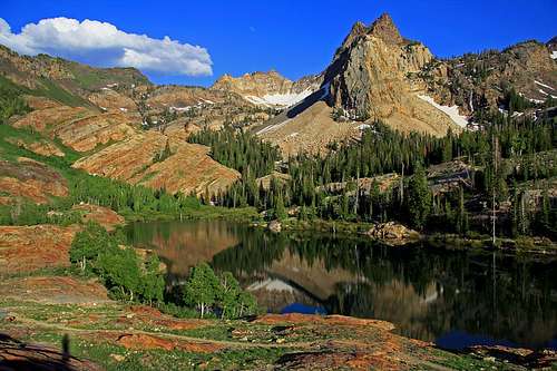 Lake Blanche and Sundial Peak - by gjagiels
Lakes & Waterfalls
The Wasatch Mountains do not have a lot of lakes compared to the Uinta Mountains but the ones that they do have are beautiful. Some are in forested areas and others are in glacial cirques. They are the most popular places to go hiking in the Central Wasatch. You'll be able to see most of these lakes on the approach hikes to the mountains. Many canyons in these mountains have streams which flow from the outlet of lakes. The snow from the highest lakes doesn't usually melt until mid summer when it is already warm in the valley. A hike to any of these lakes is enjoyable even if you don't climb any mountains. Many of them are listed below.

Dog Lake
Dog Lake
Dog Lake is located northeast of Reynolds Peak and southwest of Little Water Peak. You can get there from the Butler Fork Trail or Mill D North Fork trail in Big Cottonwood Canyon or the Big Water Trail in Millcreek Canyon. It is a small lake in a forest and has no outlet. You may have already guessed that the lake is popular with hikers who have dogs. Dogs are only allowed on the Millcreek Canyon side of the ridge.
Desolation Lake
Desolation Lake is located east of Dog Lake. Desolation Peak is above the lake to the southeast. The lake always seems to have a deep green color to it. It can be reached from Mill D North Fork by taking a right at the first junction with the Dog Lake trail. The most direct route is from Beartrap Fork in Big Cottonwood Canyon. You can also get there from Millcreek Canyon and the Great Western Trail. A trail loops around the entire lake.

Silver Lake
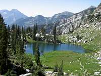
Lake Blanche
Lake Blanche is one of the classic lake hikes in the Wasatch Mountains. It is located at the end of the maintained trail in Mill B South Fork or more commonly known as the Lake Blanche Fork. The view of the surrounding mountains make the lake a popular destination. Sundial Peak is directly south of the lake and is a favorite for photographers. Dromedary Peak is to the southwest and the Cottonwood Ridge is behind. A short hike leads to Lake Florence and Lake Lillian.
Silver Lake
This is one of the easiest hikes in the Wasatch that is basically accessible to anyone. It is a short walk from the parking lot at Brighton Ski Resort. A boardwalk goes around the whole lake which makes it one of the busiest lakes in the area. The trail starts near the Brighton store and also gives access to the Twin Lakes and Lake Solitude trails.

Twin Lakes
Lake Solitude
Lake Solitude is a tiny lake located in a steep walled bowl. You can get there by hiking on the trail north of Silver Lake. It goes into the Mill F South Fork drainage and crosses beneath several ski runs. The area above the lake was used extensively during the mining era. The lake can also be reached by the Solitude Area Road. This trail branches off north of Twin Lakes Reservoir.
Twin Lakes
As the name says, this was originally two lakes that became one large lake. It is now a reservoir and there is a dam on its east side. You can hike there from Twin Lakes Pass in Alta. In Brighton, you can take the maintenance road up a series of switchbacks through many ski runs. The better way to get there is from the Silver Lake trail and turn at the junction north of the lake.
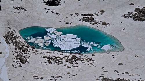 Upper Bells Canyon Ice Pond - by Phenom

Lake Mary
Lake Mary and Lake Martha
Lake Mary is a large lake set in a glacial basin above Brighton. In 1916, the lake was made into a reservoir in order to create a water supply. A dam sits on the east end of the lake. The Brighton Lakes trail can be taken to Lake Mary and it is an easy hike in the area. Lake Martha is a smaller lake located southwest of Lake Mary in the same basin.
Lake Catherine
Lake Catherine sits in a basin to the north of Sunset Peak and Pioneer Peak. You can get there from Alta or Brighton. From Alta, the route goes up Catherine Pass to the west of the lake and descends down to it. From Brighton, the trail goes passed the junctions with Lake Mary and Dog Lake and continues west towards Lake Catherine. It is one of the nicest lakes in the area.

Cecret Lake
Secret Lake (Cecret Lake)
Secret Lake is located north of Sugarloaf Peak and Devils Castle above Albion Basin. Its name can also be seen spelled as Cecret Lake. It is an easy and short hike and a popular destination with the locals. Albion Basin starts at a high elevation and is very pretty especially during summer when the wildflowers are out.
Pittsburg Lake
Pittsburg Lake is located in a small basin surrounded by forest south of Devils Castle. Most people view the lake from the summit of Devils Castle or Sugarloaf Peak. It is more easily reached by American Fork Canyon. The Pittsburg Lake trail is about a mile long hike from the trailhead. It starts off of the dirt road to Mineral Basin.
Silver Glance Lake
Silver Lake and Silver Glance Lake
These two lakes are located on the south side of White Pine Ridge in American Fork Canyon. Silver Lake is the larger of the two lakes and can be reached by trail. Silver Glance Lake is located in a high amphitheater surrounded by cliffs. The route to get there is all off-trail. This lake isn't visited very much and offers a spectacular setting below Red Baldy and White Baldy. The south face of White Baldy can be climbed from this approach along with Red Baldy.
White Pine Lake
White Pine Lake is located beneath the north face of White Baldy. It starts from the White Pine trailhead in Little Cottonwood Canyon. The route follows the east side of the creek in White Pine Canyon. This is a long hike due to the many switchbacks on the trail. It is one of the highest lakes in the Wasatch Mountains.
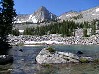
Maybird Lakes
Red Pine Lake
Red Pine Lake is one of the most popular hikes on the Alpine Ridge. It starts from the White Pine trailhead and branches off at a junction about a mile from the trailhead. The lake is located northwest of White Baldy. Upper Red Pine Lake sits in a basin just above lower Red Pine Lake. A boulderfield leads up to the ridgeline. This is also the regular route to climb the Pfeifferhorn.
Maybird Lakes
Maybird Lakes are actually more like large ponds that are located in the canyon west of Red Pine Canyon. The reward for this hike is the great view that you get of the north side of the Pfeifferhorn. The trail to Maybird Lakes is at a junction with Red Pine Canyon at about 2.6 miles up the trail. The trail climbs around the ridge and enters Maybird Gulch.

Lower Bells Reservoir
Bells Reservoirs
These two reservoirs are located in Bells Canyon. The lower reservoir is a good one to take the family to. A trail can be hiked in the canyon to the upper reservoir gaining over 4,000 feet of elevation along the way. The trail passes by the Bells Towers which have several rock climbing routes. To the east and southeast of the lake is North and South Thunder Mountain. Lone Peak can be seen above the west side of the lake.
Lake Hardy
Lake Hardy is a high alpine lake located beneath Chipman Peak, South Thunder Mountain, and Upper Bells Peak on the Alpine Ridge. There are cliffs that form a amphitheater around the lake. Lake Hardy is on the other side of the divide from Upper Bells Reservoir. The trail starts from Dry Creek which is the same trailhead for the South Face of Lone Peak. It gains over 4,500 feet of elevation to reach the lake. You can routefind your way up through the cliffbands to reach Lightning Ridge above the Lake Hardy.
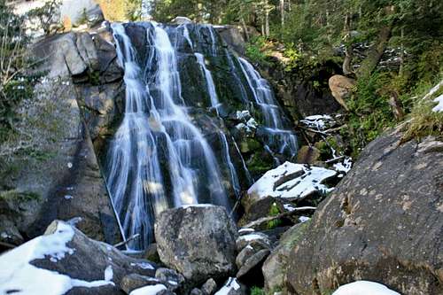 Bells Canyon Falls - by EJBean
Waterfalls of the Wasatch List - by andrew david

Donut Falls
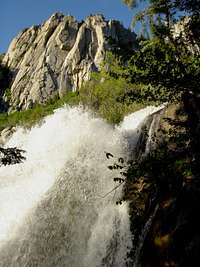
Bells Canyon Falls
Donut Falls
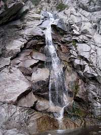
Lisa Falls

Bells Canyon Falls
Donut Falls is located in Mill D South Fork in Big Cottonwood Canyon. It's named Doughnut Falls on maps but commonly spelled as Donut Falls. This is a popular hike with families and may be crowded on summer weekends. It received its name because the falls flows down through a hole caused by erosion. The rock above the falls isn't very stable so it's advised that you do not climb there. There have been accidents in this area because of this so it's best to view the falls from below.
Lisa Falls
Lisa Falls is located on the north side of Little Cottonwood Canyon. There is a small parking pullout just off the main road where the trail starts in the forest. It's a short hike to the falls which is most impressive during spring runoff. You'll probably hear it before you see it. The Lisa Falls area is also well known to rock climbers. There are several routes around the falls which feature steep slab climbing. These routes often have a slippery texture from the waterfall.
Bells Canyon Falls
Bells Canyon is a rugged canyon on the west side of Lone Peak. It has a scenic creek flowing through it. There are several cascades that can be viewed and some larger waterfalls. The lower falls is where most people are hiking to. It is located two miles from the trailhead. Wading across the top of the falls is not recommended. The flow is strong and accidents have occured here. Fewer people hike to the upper falls so you can expect more solitude there.
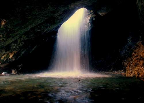 Donut Falls - by Delta9Explorer
Hidden Falls
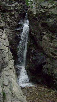
Rocky Mouth Canyon Falls
Hidden Falls is located a short distance from Big Cottonwood Road. This is probably the easiest waterfall to get to in the Wasatch Range. The trailhead starts from the S-curve parking area. Walk across the road and shortly after the trail will fork. The right trail goes to the Mill B North Fork. The left fork goes into the canyon where the creek flows and where you'll find Hidden Falls. It is surrounded by cliffs which have a few rock climbing routes.
Rocky Mouth Canyon Falls
Rocky Mouth Canyon is on the west side of Lone Peak south of Bells Canyon. The trailhead is located at 11300 South Wasatch Boulevard. The trail starts in a neighborhood traveling between two houses. Take care to respect property in the area. It's a short hike that is one mile round trip to the falls. This waterfall has formed in an interesting narrow rock slot.
Ghost Falls
Ghost Falls is below the west side of Lone Peak. It can be reached from Corner Canyon Road. There are three gates across the canyon and wherever you are able to park will determine how long the hike is. There's a restroom at the upper Ghost Falls trailhead which is located where the trail meets the Corner Canyon road and connects with the Jacobs Ladder route.
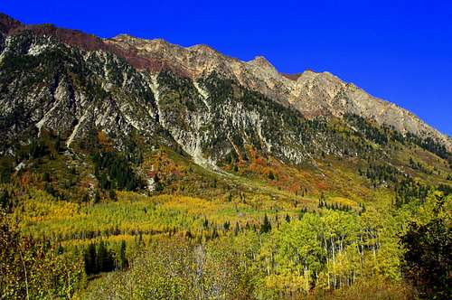 Little Cottonwood Canyon - by TyeDyeTwins
Climbing Areas
Climbers that live in Salt Lake City know how fortunate they are to be near so many quality climbing areas. The Cottonwood Canyons are a short drive from the city and have hundreds of routes. In general, Big Cottonwood Canyon sports many single-pitch climbs. There are also a number of short multi-pitch routes ranging from two to four pitches. This makes it a good canyon with more moderate routes. A few miles south of Big Cottonwood Canyon is Little Cottonwood Canyon. This canyon features friction face climbing and crack climbing on coarse and polished granite. These routes sometimes rise at a lower angle but the climbing here is more difficult. Ferguson Canyon contains granite rock outcroppings below Storm Mountain. There are other areas for those of you looking for a more alpine climbing experience. Big Willow Canyon and Bells Canyon below Lone Peak offer longer approaches at a higher elevation.

Satan's Corner
Parleys Canyon
Parleys Canyon is the connection between Salt Lake City and Park City. There are many quartzite cliffbands along the canyon but they are quite close to the highway. A couple a crags are worthwhile if you are in the area. Grandeur Peak forms the the boundary south of Parleys Canyon. Riptide Wall is located within minutes of the mouth of the canyon. It faces north and gets a lot of shade during the day. Routes here range from 5.9 - 5.11 and are well protected. Iron Curtain Wall is the larger wall that is located to the west. Most of the routes are well protected and range from 5.8 - 5.11. Grandeur Peak has a limestone hogback on its west face that is called the Reef. There are numerous routes that range from 5.8 - 5.12 in difficulty.
Millcreek Canyon
Millcreek Canyon has several limestone crags located on the south side of Grandeur Peak. There are a few walls that are down lower in the canyon. Millcreek Canyon is full of rock but most of it is poor quality. It is the type that is loose and crumbly. There are some areas that have been cleaned and have some good climbing. The Stitches Wall is 1.5 miles up the canyon. The rock is sharp and rated about 5.9. Church Fork Wall is located right next to the hiking trail up Grandeur Peak. There are many lines up the cliff but not many established routes so toproping is usually done here. Other cliffsbands include Grandeur Slander Wall and Code Blue Wall which have routes rated 5.10 - 5.11.
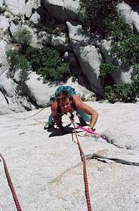
The Coffin
Big Cottonwood Canyon
This is one of the most popular places to rock climb around Salt Lake City. Big Cottonwood Canyon has quality quartzite that have both sport and trad climbing. At first the climbing areas look like huge choss piles but you'll find good climbing once you get there. Dogwood Crag is one of the first walls in the canyon. You'll always see people climbing here because the approach takes about one minute. There are several beginner routes here and topropping is easy. The Salt Lake Slips is another popular area with bolted routes ranging from 5.6 - 5.10. Storm Mountain Island is a common meeting place for climbers. Every type of climbing from cracks, slabs, and overhangs can be found here. There are also a lot of easier climbs in this area. On the other side of the road is the Dead Snag Area which several moderate multi-pitch climbing routes. The S-Curve Area has trad and sport climbing and some of the hardest routes in the canyon are located on the huge roof.
Ferguson Canyon
This is the next canyon south of Big Cottonwood Canyon. It is located on the west side of Storm Mountain. This narrow canyon has many granite crags and buttresses with good climbing routes. Almost everything here is one pitch long. The routes are steep and a lot more challenging than they look. Heart Wall and Guano Wall are the first crags you will pass by. The Watchtower is the most popular area. It has the highest amount of routes that are mainly in the 5.10 - 5.11 range with a couple of moderates thrown in. Higher up in the canyon is the Tower of Babel, The Cathedral, Goldenfingers Wall, and several others. Of course, if you feel like you need more exercise, you could always climb Storm Mountain while you're there.

The Choir Boy
Little Cottonwood Canyon
Little Cottonwood Canyon has multi-pitch climbs on granite featuring difficult slabs and cracks. Crescent Crack Buttress is one of the first climbing areas in the canyon along with the Coffin and the Egg which have classic routes. The Gate Buttress is one of the popular gathering spots in the canyon. The place is huge and is divided into the Schoolroom Area, Five Fingers Area, Prune Face, the Dihedrals Area, and Beckey's Wall. You can guess who that is named after. Lisa Falls is a nice area with several moderate routes. You can actually find three different types of rock in Little Cottonwood Canyon. It begins with the Humane Society Wall at the mouth of the canyon which is made out of quartzite, then the majority of walls which are made out of granite, and the Hellgate Cliffs which are made out of limestone. Many difficult routes with little protection were climbed in the 1960's and 1970's. The Thumb is the largest buttress in the canyon with routes that are eight pitches long.
Big Willow Canyon
Big Willow Canyon is located south of Bells Canyon on the west side of Lone Peak. It is a wild and scenic canyon with just as many granite climbing walls as Bells Canyon. The approach to this area is strenous and there are few people that hike up here. One of the lowest walls in the canyon is Twilight Buttress near the mouth of Big Willow Canyon on its north side. There are many quality climbing routes which feature steep face climbing on edges and slabs. The routes range from 5.9 - 5.12. Farther up the canyon are two other climbing walls. Jon's Hideout is in an area of many granite outcrops that have routes rated 5.9 - 5.12. The Guardian is a little farther up the canyon after Jon's Hideout. It will be on the north side of Big Willow Canyon. There are a couple routes that are in the 5.9 to 5.11 range. At the end of the canyon is Big Willow cirque which is similiar to Lone Peak cirque. This is a 500 foot wall that has several moderate routes that are 5.6 to 5.8 in difficulty. This is a very pretty cirque that doesn't see many climbers.
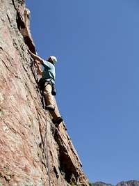
Jig's Up
Bells Canyon
Bells Canyon is the large canyon that is located northwest of Lone Peak. The canyon is full of granite buttresses. All of the towers are on the north side of the canyon and face the sun. So climbing in the area in mid-summer would be quite hot. The rock quality is good is some areas and poor in others. All of the climbing is multi-pitch trad climbing with long approaches. The first tower in the canyon is called the Far West Tower and has routes rated 5.8 to 5.10. The West Bell Tower is the next one and has several routes that are 5.8 - 5.11. Middle Bell Tower is the most beautiful tower and has routes that are five to six pitches long. They are rated 5.6 to 5.11. East Bell Tower is the easternmost tower in the area. It has the easiest moderate climb of all of the towers with the Route of All Evil which is rated 5.6. Don't let some of the low ratings fool you because the routes tend to feel more difficult.
ALPINE CLIMBING
Wasatch Alpine Climbs List
The Wasatch Mountains also have a lot of alpine routes to choose from. Many of these climbs are classic routes that shouldn't be missed. This is a good page to look at if you want to climb something more challenging than the regular route up every mountain. Difficulty and quality ratings are stated on the page. They range from rock scrambles to snow and ice climbs. Winter ascents up a lot of the higher peaks have been done by Utah SPers including Broads Fork Twin Peaks, Sunrise Peak, Dromedary, Lone Peak, Monte Cristo and Mount Superior.
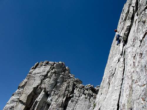 The Middle Thumb on Lone Peak South Summit - by highpeakskier
5th Class Mountains
The Wasatch Mountains have a lot of 3rd and 4th class mountains with many scrambling routes. The Cottonwood Canyons have plenty of climbing areas but there aren't any mountains in the Wasatch that require technical climbing by their regular routes. If you look around you'll see that there are mountains that have 5th class routes to their summits. I have listed a few of them below.
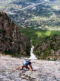
West Slabs on Mount Olympus
Mount Olympus
There are many routes up Mount Olympus. The West Slabs is probably the most climbed route. It is rated 5.5 with ten or more pitches. The climbing is not difficult but the exposure is always there because you are basically looking straight down the slabs for the entire climb. This makes it a nice beginners route for trad climbers. Geurt's Ridge is rated 5.5. It follows the west ridge of the south summit. There are a few towers along the way that and may require rappelling off the backside. There are two well known routes on the north side of the mountain. Kamp's Ridge follows the left skyline and is rated 5.6. The Great Chimney cuts a deep notch into the ridge to the right of Kamp's Ridge. It is four to six pitches long and rated 5.7. Allow at least two hours for all of these approaches. The mountain is full of other possible rock climbing routes.
Sundial Peak
The first thing you'll notice about Sundial Peak is that is has a huge cliff that drops down toward Lake Blanche. There are some rock climbing routes that go up the north face. The O'Dell Brothers and Rodell Petersen climbed Sundial Peak in the early 1940's. Then Harold Goodro and Jim Shane added a new route. In the 1970's, Larry and Steve Swanson climbed the peak and several other ascents followed. The route descriptions for this peak were not recorded very well and information is limited. This is an alpine environment and most climbs will take all day. You'll need to be able to climb with very little protection and have good route finding skills. All of the routes end at a false summit overlooking Lake Blanche. The real summit is located south along the ridgeline. The best descent is down the scramblers route on the southwest which is rated class 3. The face stays in the shade so a warm day is prefered. All routes are rated 5.6 - 5.9 and are about four pitches long.
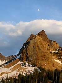
Sundial Peak
Devils Castle
Devils Castle stands high above Albion Basin at the end of Little Cottonwood Canyon. There is exposure on its regular route because there is a huge cliff on its north face. This route traverses the three summits. There is some loose rock but it has some nice scrambling. There has been at least one line that was created on the north face. It is called the Black Streak for the dark colored line that the route follows. The route is rated at 5.10b and is usually not crowded. It is six pitches long and tops out near the west summit of Devils Castle. The regular descent is either down the west ridge or the east ridge to finish the traverse.
Lone Peak
Lone Peak cirque is full of granite climbing walls and is one of the most beautiful areas to climb in the Wasatch. The views are also spectacular. The summit of Lone Peak has many routes but The Open Book is probably climbed the most. It is rated 5.7 and is five pitches long. It follows the right side of the summit wall. If you want something more challenging you could try the Triple Overhangs which is rated 5.10a. The South Summit Wall has routes that range from 5.7 - 5.11. Question Mark Wall is located further south. Below the summit is the obvious question mark for which it is named. Its routes range from 5.8 - 5.12. Big Willow Canyon is just north of the Lone Peak cirque. There are moderate routes in the canyon that are 5.6 - 5.8 in difficulty. There are so many places to climb in the Lone Peak area but not many climbers because of the long approach and substantial elevation gain required to get there.
This is a list of selected 5th class routes in the Central Wasatch Mountains. There are more routes especially in the Lone Peak area. A note about the ratings, for example the West Slabs on Mount Olympus is ten pitches or more in length. The first two pitches are the steepest while much of the route is 4th and low 5th class with a lot of exposure. Some people solo the route while others protect the whole thing. It's just a matter of preference. Local climbers already know these routes but it may be helpful for anyone not as familiar with the area.
| CENTRAL WASATCH 5TH CLASS MOUNTAINS | |||
| Route | Mountain | Rating | Length |
|---|---|---|---|
| West Slabs | Mount Olympus | 5.5 | 10 pitches |
| Geurt's Ridge | Mount Olympus | 5.5 | 10 pitches |
| Kamp's Ridge | Mount Olympus | 5.6 | 8-10 pitches |
| The Great Chimney | Mount Olympus | 5.7 | 4-6 pitches |
| The North Face | Sundial Peak | 5.6 - 5.9 | 4 pitches |
| The Eleventh Hour | Sundial Peak | 5.8 | 3-5 pitches |
| Southwest of Corner | Sundial Peak | 5.7 | 4 pitches |
| Black Streak | Devils Castle | 5.10b | 6-7 pitches |
| The Open Book | Lone Peak | 5.7 | 5 pitches |
| The Undone Book | Lone Peak | 5.9+ R | 5 pitches |
| Triple Overhangs | Lone Peak | 5.10a | 4-5 pitches |
| Vertical Smile | Lone Peak | 5.10a | 4-5 pitches |
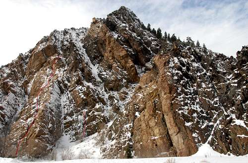 Storm Mountain Falls Area
Ice Climbing
Ice Climbers have been climbing in the Cottonwood Canyons for decades. Many of these areas contain quality ice similar to Provo Canyon. The first major ice climb was made by Ted Wilson and Rick Reese in the 1960's. They made a step-cutting ascent of the Great White Icicle in Little Cottonwood Canyon. Dave George and George Lowe made the first ice ascent of Super Slab in the late 1960's. In Big Cottonwood Canyon, Storm Mountain Falls was climbed by Dave Jenkins and Rick Wyatt in 1979. In the early 1980's, the Scottish Gully was climbed by Brett Ruckman and Gary Olsen.
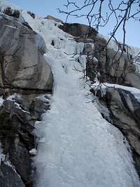 Scruffy Band Scruffy Band |
 Great White Icicle Great White Icicle |
 Great White Icicle Great White Icicle |
 Storm Mountain Falls Storm Mountain Falls |
 Storm Mountain Falls Storm Mountain Falls |
|---|
Here are a few selected ice routes in the Cottonwood Canyons of the Central Wasatch. The Great White Icicle is the most popular area. Conditions may vary depending on the type of winter it has been and the amount of snow and cold weather.
| CENTRAL WASATCH ICE CLIMBING | |||
| Route | Rating | Length | Location |
|---|---|---|---|
| Scottish Gully | I, WI4 or M4 | 260 feet | Big Cottonwood Canyon |
| Storm Mountain Falls | I, WI4-5 | 270 feet | Big Cottonwood Canyon |
| B-Pitch | I, WI4 | 180 feet | Big Cottonwood Canyon |
| Super Slab | I-II, WI2-3 | 600 feet | Little Cottonwood Canyon |
| Scruffy Band | I, WI3-4 | 200 feet | Little Cottonwood Canyon |
| The Great White Icicle | II, WI3 | 650 feet | Little Cottonwood Canyon |
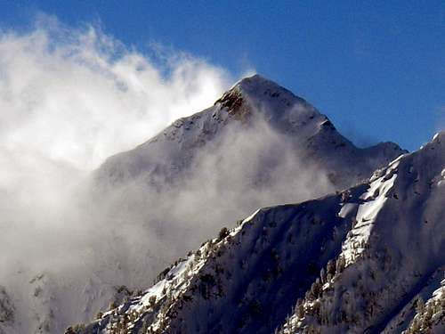 Clouds over Sunrise Peak - by TyeDyeTwins
The Weather

Central Wasatch
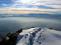
Mt. Olympus summit view
Salt Lake City has a varied weather climate. It has warm, dry, and sunny summers and a cold winter climate. It is located in a large valley separated by the Wasatch Mountains to the east and the Oquirrh Mountains to the west. The metro area below the mountains is known as the Wasatch Front. The Wasatch Faultline runs along the eastern benches of the city along the foothills near the Bonneville Shoreline Trail. This is because the valley floor was once the location of ancient Lake Bonneville.
Springtime in Salt Lake City is warm, although the weather and climate can be variable, with sudden showers occurring. During spring, temperatures start to warm up drastically and days are marked by the highest humidity and some of the wildest daily temperature swings of the year. The first summer-like weather usually comes in mid-to-late May. The last snowfall of the season usually occurs in early or mid-April, although snow was recorded as late as May 18 in 1977.
In Salt Lake City, the season of Summer last for about three months. The weather is warm and sunny from June through mid-September. The hottest months of the year are July and August, when daytime temperatures can reach around 90 °F, followed by cool nights. Summer thunderstorms can occur, with wet weather and occasional downpours. The low humidity and the altitude combine to produce a large daily range in temperatures, and rather cool nights in summer. The warmest month is July, with an average temperature of 77.0 °F.
The season of Autumn weather and climate begins in the month of September and ends in November andsettled weather can be experienced. The wet weather doesn't last long and it is usually a pleasant season with warm, sunny days and cool nights. Temperatures start to get cooler with a 50 °F maximum average temperature drop being experienced within three months. The first winter-like weather is usually experienced in early-to-mid October. The freeze-free period lasts from April 30 to October 15. Salt Lake City's average yearly temperature is about 52 °F.
Winter in Salt Lake City runs from November through the end of March and the coldest months are December and January, when daytime temperatures drop to 37 °F. Night temperatures are much colder and snowy weather occurs from December onwards, with heavy snowfalls in the mountains, but much less in the city. In winter, temperatures are moderated by the Great Salt Lake to the northwest of the city and the Rocky Mountains to the north and east of the state, which serve as barriers to the frigid arctic air. Salt Lake City temperatures will seldom fall below 0 °F for any length of time.
Why is there an inversion? One of the most significant weather events occurs in winter, when temperature inversions sometimes form. This results in cold, foggy, and hazy weather in the city while the surrounding mountains enjoy warmer temperatures and sunshine. Temperature inversions are very unhealthy and can occur weeks at a time, and are most noticable in the middle of winter, although may occur in other seasons to a lesser extent. Humidity is only high enough for fog to occur in winter, although haze and smog can be found year-round. Inversions occur when strong areas of high pressure park themselves over the Great Basin. It usually takes a strong storm or cold front to force out or break down the high pressure.
Under certain weather conditions, which occur up to roughly a dozen times a year, some of the algae dies off and decays in the Great Salt Lake. The northwest winds carry the scent of decaying algae into Salt Lake City and much of the Wasatch Front. The smell is known as "lake stink". Because of the flatness of the valley, the large amount of salt, and the lake not being a good place to fish; the lake stink is one of the few reminders people have that they live near a major body of water. The salinity of the water averages about 12% making it much saltier than the ocean. The water is so buoyant that people can easily float in it.
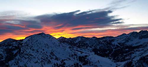 Sunrise over Mount Wolverine and Albion Basin - by seanpeckham
Mountain Conditions

Alpine Ridge
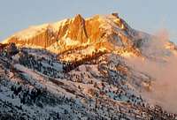
Lone Peak
Summer is the normal hiking season for these mountains. This is usually from July through mid-September. Temperatures can range from near 90 degrees in the daytime to 30 degrees at night. Occasional summer thundershowers can be expected.
Experienced climbers can climb year round. In winter, temperatures are 30-40 degrees but can be much colder in the higher elevations. Be prepared with full winter gear if you plan on climbing any mountains.
Here is the local weather forecast for Salt Lake City and the NWS website
Here is the weather forecast for Brighton and Alta and weather cams.
Red Tape
Parleys Canyon and Millcreek Canyon are located in Uinta-Wasatch-Cache National Forest.
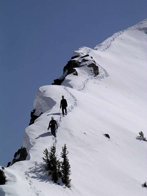
Twin Peaks Triple Traverse - by Lubos
Big Cottonwood Canyon and Little Cottonwood Canyon are also located in the Uinta-Wasatch-Cache National Forest.
American Fork Canyon is located in Uinta-Wasatch-Cache National Forest.
The following list of wilderness rules apply:
Group sizes of 10 or less people.
No short cutting a trail switchback.
No disposing of debris, garbage, or other waste.
Millcreek Canyon
Dogs are allowed off leash on odd numbered days.
Dogs must be leashed on even numbered days.
Bicycles are only allowed in Millcreek Canyon on even days.
Millcreek Canyon fee at the entrance station.
$3.00 - Daily Fee
$40.00 - Annual Pass
$20.00 - Senior Citizens Annual Pass
Big and Little Cottonwood Canyons
No fees or passes required.
No dogs are allowed in Big and Little Cottonwood Canyons.
American Fork Canyon / Alpine Loop
American Fork Canyon / Alpine Loop fee at the entrance station.
$6.00 - 3 Days
$12.00 - 7 Days
$45.00 - Annual Pass
Central Wasatch Contact Information
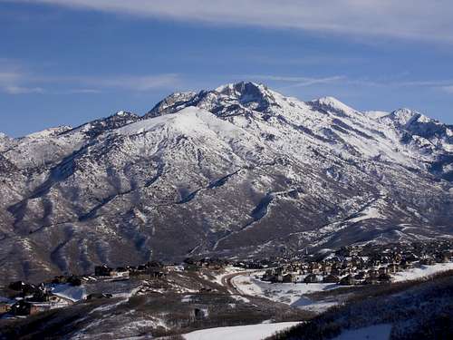
Lone Peak seen from the west - by Dean
Contact info is here
USDA Forest Service
Wasatch-Cache National Forest
8236 Federal Building
125 S. State Street
Salt Lake City, UT 84138
Phone: (801) 236-3400
Public Lands Information Center
For all your recreation questions
on the Wasatch-Cache National Forest
Phone: (801) 466-6411
Hours: Tuesday - Saturday
10:30am - 7:00pm
Salt Lake Ranger District
6944 South 3000 East
Salt Lake City, UT 84121
Phone: (801) 733-2660
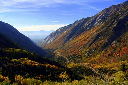 Autumn in Little Cottonwood Canyon - by TyeDyeTwins
Wasatch Autumn
Fall Aspens

Mill B South
The Wasatch Mountains are covered with gnarled juniper trees, pinion pines, and limber pines. Higher mountains have an abundance of blue spruce, ponderosa pine, lodge pole pine, Douglas fir, alpine fir, and fields of aspen. Willows grow along mountain streams, and in the valleys several species of cottonwoods line the banks of streams and canals. In the lower mountains sagebrush mixed with maple oak, chokeberry, and serviceberry can be found. Juniper and Mountain Mahogany are dominant on the south and west facing slopes.
Aspen, oak and maple trees bring fall color to the Central Wasatch Mountains. This area is among the best in Utah for beautiful scenary. Trees usually start to change color by mid-September. They cover the canyons and mountain slopes for only a few weeks. The aspen trees turn a bright yellow-gold, interspersed with red oaks and maples. The quaking aspen have thin and translucent leaves that shimmer in the breeze.
There are several scenic drives near Salt Lake City that are accessible to anyone. Both Big and Little Cottonwood Canyons are popular places to see the autumn foliage. Alta and Brighton is always pretty. The road to Guardsman Pass can be driven before the first big snow storm of the year. Millcreek Canyon to the north and American Fork Canyon to the south are also good places to visit during this time. The best views are seen by those who go hiking into the backcountry.
Wasatch Fall Colors 2010 Album - by TyeDyeTwins
 Mill D North Mill D North |
 Mount Baldy Mount Baldy |
 Mill B South Mill B South |
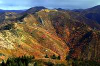 Church Fork Peak Church Fork Peak |
|---|---|---|---|
 Park City Ridge Park City Ridge |
 Lake Blanche Trail Lake Blanche Trail |
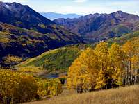 Willow Fork Willow Fork |
 Little Water Peak Little Water Peak |
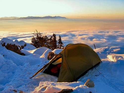 Winter camping on the summit of Mount Olympus - by Joe Bullough
Camping
Big Cottonwood Canyon
Besides having three campgrounds, there are also a number of picnic areas. The Dogwood Picnic Area is the first one in the canyon. The Dogwood crag is located nearby and many rock climbers can be seen climbing up its many routes. Ledgemere is the next picnic site and 1.4 miles up the canyon. A number of picnic tables and grills are next to the river. The Penetentiary crag is located just up the steep hill. The Birches picnic area is located 1.7 miles from the sign. This is another area that is next to the river. Storm Mountain Island is the most developed picnic area in the Big Cottonwood Canyon. It has picnic areas, a playground, and fields. There are good rock climbing walls located here. Moss Ledges is the highest of the picnic areas and 4.9 miles past the sign.
Spruces is the lowest of the campgrounds. It sits at an altitude of 7100 feet and 9.4 miles from the mouth of the canyon. It can get a little chilly even in the summertime. It's a big campground with over 90 individual sites and 9 group sites. The sites vary from being very close together to large secluded areas. The creek wanders throughout the campground. Nearby hiking trails lead off to Donut Falls in Cardiff Fork. Redman campground is located 12.7 miles from the mouth of the canyon. It is located at an altitude of 8100 feet. There are a little over 30 sites available. The reservable sites in both of these campgrounds are usually taken well in advance. You have to be there early to ensure a "first come, first served" site for the weekend. The area is popular with the locals.
Each individual site is $18.00 per vehicle, additional vehicles are $5.00.
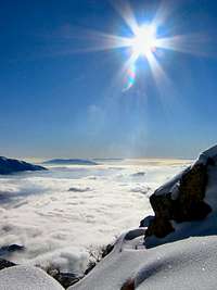
Mount Olympus Summit View
Campground reservations can be made at Jordan Pines and Spruces and Redman.
Little Cottonwood Canyon
Both of the campgrounds in Little Cottonwood Canyon can only be visited in the summer. Tanner’s Flat is located at 7200 feet. This campground is the lower of the two and can be accessible earlier in the season than Albion Basin. This campground is located in the forest below the road.. There are 36 sites available here which provide your typical campground accommodations. Albion Basin is a wonderful campground to visit in the summer. While it is still summer down in the valley you can see the flowers of blooming at Albion Basin. Devils Castle has a commanding presence over the area. There are 24 different sites and you have to get up early to get one. This campground is located on the Alta ski area. Get there by continuing up the dirt road with switchbacks.
Each individual site is $18.00 per vehicle, additional vehicles are $5.00.
Campground reservations can be made at Tanners Flat and Albion Basin.
American Fork Canyon
There are a lot of picnic areas in American Fork Canyon. Grey Cliffs picnic area is at 6,000 feet. It is near the cliffs that it is named after and is popular with rock climbers. This area has the most picnic sites in the canyon. Echo picnic area is also at 6,000 feet. Martin and Roadhouse picnic areas are both at 6,200 feet. Mile rock picnic area is located farther up in the canyon. All of these picnic areas have about 5 to 6 sites each. They are all free except for the fee at the entrance station.
The first campground in American Fork Canyon is the Little Mill campground. Little Mill is located about a mile and a half past the Timpanogos Cave visitor’s center. The campground parallels the road, as well as American Fork Creek. There are 66 campsites and numerous picnic areas. The sites are quite small and a few of them are located very close together. If you continue Northeast on 144 you’ll come to Tibble Fork Reservoir. A paved road leads from Tibble Fork to the Granite Flat camp ground. Granite Flat features 64 individual sites and several group areas. Most of the campsites are fairly spacious and well spaced. There are also three group campsites here. The individual campsites are $16.00 per night. Timpanogos Cave is always a nice side trip if you're in the area.
American Fork Canyon and Provo Canyon Campgrounds Overview.
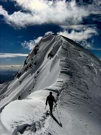
Broads Fork West Twin Peak
Campground reservations can be made for Granite Flat Campground and Little Mill Campground.
Group campsites can be reserved for North Mill Campground and Altamont Campground.
Backcountry Camping Regulations:
Camp 1/2 mile from any road, 200 feet from any water source, and 200 feet from any trail.
Camping is allowed for a period of 3 days at an individual site. Practice leave no trace techniques.
No open fires are allowed in the (Lake Blanche) Mill B South Fork drainage within the Twin Peaks Wilderness.
No open fires are allowed within Red Pine Canyon and Maybird Gulch drainages in the Lone Peak Wilderness.
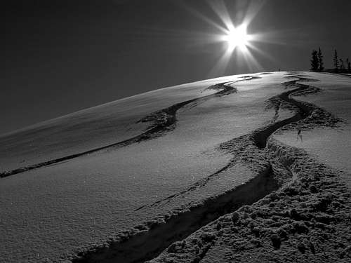 Meadow Chutes in Silver Fork - by Ed F
Backcountry Skiing
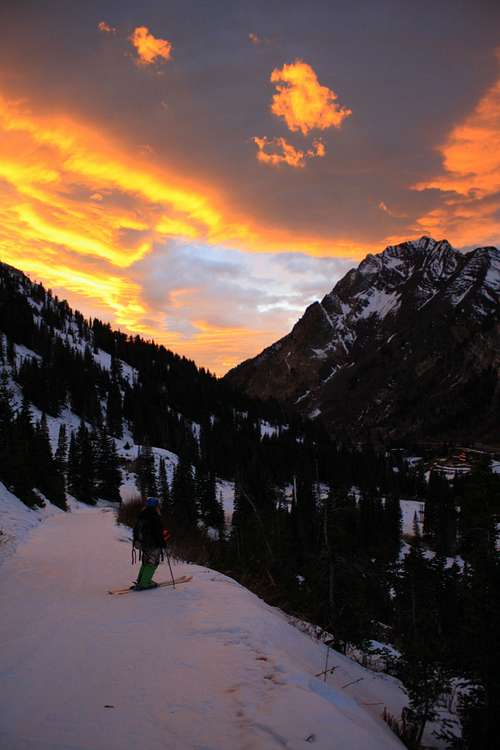
Beautiful Sunset above Mount Superior - by TyeDyeTwins
Winter is considered by many to be their favorite season in the Wasatch. These rugged mountains are beautiful when covered in snow. This is the time when people come here to go skiing, snowboarding, and snowshoeing. Some of the people I know would ski all year if they could. Others, well, they enjoy all seasons equally. Utah is well known in American ski history because of ski resorts like Alta and Brighton. Many people will tell you that the best snow is in the backcountry. If you want to get to the Greatest Snow on Earth, then you can find your special place in Utah's mountains.
The mountains above Salt Lake City are among the most accessible in the United States for backcountry skiing. That area includes Millcreek Canyon, Big Cottonwood Canyon, and Little Cottonwood Canyon. Most people in the backcountry stay close to established trails. Considering the large population that live below, only a small percentage go into the higher areas of these mountains in winter. Millcreek Canyon is full of skiers and snowshoers in winter. Several moderate ski tours are located on the north side of Big Cottonwood Canyon. Good skiing is located on Reynolds Peak, Mount Raymond, and Gobblers Knob. In Little Cottonwood Canyon, popular areas include Grizzly Gulch, Wolverine Cirque, Red Pine and White Pine Canyon. Extreme ski descents can be found on the highest peaks in the range.
SP Member Pages:
Ed's Wasatch Touring : 2006-2009 and 2009-2010 and 2010-2011
Sean's Wasatch & Other Area Touring : 2008-2009
TyeDyeTwins : Central Wasatch Backcountry Skiing
TyeDyeTwins : Wasatch Couloirs Album
TyeDyeTwins : Winter in the Wasatch Album
TyeDyeTwins : Wasatch Backcountry Skiing Album
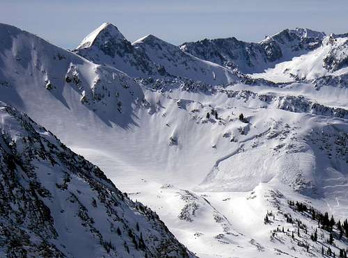 Pfeifferhorn Temptation Ridge Avalanche - by TyeDyeTwins
Wasatch Avalanche Information:
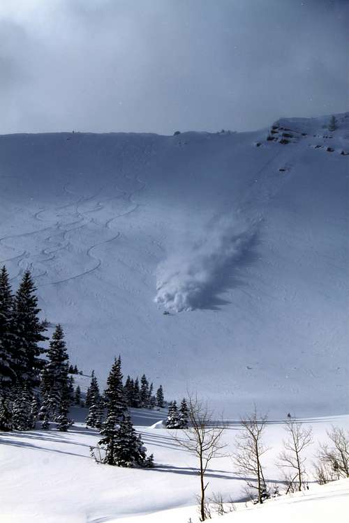
West Monitor Avalanche - by TyeDyeTwins
The biggest concern for backcountry skiers is avalanches. There are several accidents and fatalities each year. Most of the avalanches occur on moderate slopes. Weak layers of snow can be hidden above a layer of stronger snow. After a large storm, try to stay on relatively safe terrain until the snow consolidates again. Having a partner or two, when traveling in the backcountry, is always a good idea. Carry avalanche transceivers, a shovel, and probe. The most important thing is to know how to use this equipment properly and make sure all of your friends do too.
Here are a few links below for avalanche conditions:
Forum Threads : 2009-2010 and 2010-2011 and 2011-2012
Avalanche Conditions Albums : 2009-2010 and 2010-2011
Snow and Avalanche Conditions Links:
Utah Avalanche Center : Salt Lake City
Utah Avalanche Center : Advisories
Wasatch Snow Information Website
Weather Forecast and Conditions Links:
Utah Avalanche Center : Wasatch Mountains Weather
NOAA : Cottonwood Canyons Forecast
NOAA : Salt Lake Area Forecast Discussion
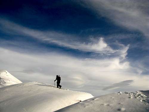 USA Bowl and Willow Fork Ridge - by Ed F
Flagstaff Mountain Proposed Expansion:
Thanks to Dan (d shorb) for the following information: We in the Backcountry community love the town of Alta, and the ski area too. However, the album below shows some of the Wasatch we will lose to ticket holders and development if the Alta expansion to FLAGSTAFF MOUNTAIN goes through. Areas affected include all of the upper part of Cottonwood Ridge, Days Fork, Silver Fork, Cardiff and Mill D, Mount Superior.
This is not just a skier's issue. Hikers will also find that the lift will have a summer access road, and will most likely introduce mountain biking etc., into this area. This is a yearround chairlift. It will be permanent, and most likely (to be cost effective and "modern") will be a quad-chair.
Click on the album below for information and photos on the expansion of Alta and which areas will be affected by this.
Proposed Alta Ski Area Expansion to Flagstaff Mountain: Affected Areas
Save Our Canyons: Alta - Proposed ski lift up Flagstaff Mountain
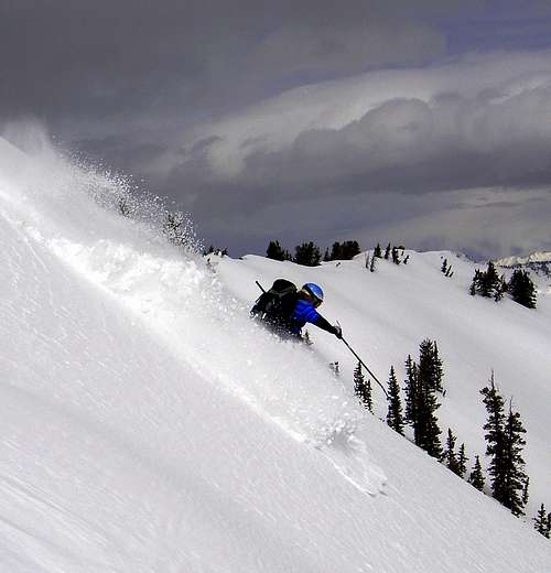
Flagstaff Mountain Skiing - by TyeDyeTwins
Silver Fork Proposed Expansion:
Thanks to Ed for the following information about the Proposed Expansion of Silver Fork. Solitude Resort has proposed to build a ski lift in Silver Fork. If they are allowed to build this lift, it will kill several long-standing touring areas including the Meadow Chutes, and the North and West bowls in upper Silver Fork.
This is just the latest threat to the touring community in the Wasatch. If Alta builds the Flagstaff lift and Solitude expands into Silver Fork, it will drastically reduce the amount of acreage available for touring. All of Silver Fork, Emma, and Flagstaff will become torn-up resort crap skiing. Also, with lifts going up to that ridge, upper Days and Cardiff will turn into "slackcountry," available to anyone who can ride a lift up there and pop out of a gate.
Add to this the fact that the USFS just renewed the PowderPigs heli-skiing lease for another 10 years. Whatever happened to multiple use? The Wasatch is simply too small to allow resorts and heli-skiers endless expansions.
Salt Lake Tribune: Solitude Expansion Article
Save Our Canyons: Solitude - Proposed ski lift in Sliver Fork
If you care about keeping Silver Fork for the touring community, write to the officials below:
Cathy Kahlow District Ranger
Uinta/Wasatch-Cache National Forest
Salt Lake Ranger District
6944 S 3000E
Salt Lake City Utah 84121
EMAIL = ckahlow@fs.fed.us
Brian Ferebee Forest Supervisor
Uinta/Wasatch-Cache National Forest
Federal Building
125S State Street
Salt Lake City Utah 84138
EMAIL = bferebee@fs.fed.us
More Photos from Wasatch Skiers:
 Mill D North Fork Mill D North Fork |
 Emma Ridge Emma Ridge |
 Wills Hill Wills Hill |
 Helicopter Hill Helicopter Hill |
|---|---|---|---|
 Reynolds Peak Reynolds Peak |
 Lambs Canyon Lambs Canyon |
 Point Supreme Point Supreme |
 Mount Baldy Mount Baldy |
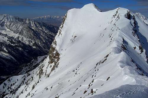 Monte Cristo east ridge - by Phenom
Ski Resorts
The Wasatch Mountain Club, still alive today, was formed in 1912. Club members began leading regular ski treks into the Wasatch Mountains. In 1915, the Norwegian Young Folks Society formed and began organizing ski jumping tournaments on the hills above Salt Lake City. During the early 1900s several organizations began to promote skiing. Ski resort activity didn't take off until the 1940s. The downhill, slalom, and combined ski championships were held at these resorts. The Wasatch Mountains became a mecca for ski racing. There are now resorts in the Cottonwood Canyons of Salt Lake City and Park City.
Solitude Mountain Resort
Solitude is located 12 miles up Big Cottonwood Canyon. This mountain features 1,200 acres of terrain with challenging powder bowls and tree-lined glades with a drop of 2,000 feet. New ski lifts have enabled beginner and intermediate skiers to get up onto the mountain easier than ever before. It is a favorite of Salt Lake City locals due to its abundance of powder and variety of terrain. In recent years Solitude has expanded to include a villiage for out of town skiers and several lodges.
Brighton Ski Resort
Brighton is located at the top of Big Cottonwood Canyon. It was established in 1936 and was the first ski resort in Utah. It is also one of the oldest in the United States. Brighton has some of the most diverse skiing terrain in Utah. The area is located entirely in Wasatch-Cache National Forest which means it is open in the summer to hikers. It is open to both skiers and snowboarders during winter. There is also unlimited access to some of the best backcountry in the Wasatch.
Snowbird Ski Resort
Snowbird is located below Alta and is a winter and summer resort. Snowbird opened in December of 1971 with three lifts, the Tram, the Lodge at Snowbird and the Snowbird Center. The Inn was constructed in 1972. Soon later the Cliff Lodge was built in 1973-74 and the Iron Blosam in the fall of 1974. The Snowbird Ski and Summer Resort offers an Aerial Tram that goes from an elevation of 8,100 feet to 11,000 feet to the top of Hidden Peak. Peruvian Gulch and Gad Valley are located below the mountain.
Alta Ski Resort
Alta is located near the top of Little Cottonwood Canyon. It opened to skiers for the first time on January 15, 1939. This makes it one of the oldest ski resorts in the country and there still remains a "skiers-only" policy at the resort and no snowboarders are allowed. Alta is known for its deep powder and rugged terrain and is a world class destination. A variety of terrain and snow conditions provide skiing opportunities for every level of skier from beginner to expert.
Park City Mountain Resort
This is a year round resort with 3,300 acres of skiable terrain. The Park City Resort is spread over seven peaks and has nine bowls and 100 challenging runs with deep powder. The Resort’s famous Alpine Slide is one of the longest in the world. There are 14 chair lifts that can transport 27,000 skiers uphill per hour. Park City has an extensive skiing program for skiers and offers lessons and programs for adults and children of all skiing levels. Historic "Old Town" of Park City is a tourist attraction.
Deer Valley Ski Resort
Deer Valley is one of fancier ski resorts in Utah. The resort recieves an annual 300 inches of powder and has meticulously groomed ski runs. Deer Valley is covered by four mountains that offer a wide variety of terrain with steep runs for experts and several beginner routes. The resort offers exceptional customer service with consistent quality and attention to every detail. The lift ticket prices are high but you get what you pay for. In the summer, the resort has over 45 miles of trails for mountain bikers.
The Canyons Ski Resort
This resort was first called Park West and then Wolf Mountain until 1997 when the name was changed to The Canyons. It is the largest single ski and snowboard resort in Utah. It is also one of the five largest in the U.S. A decade back, the resort that would become the Canyons was a pretty small, and not too popular, locals hill. The resort is now spread over eight different mountains with 3,500 acres of diverse and exhilarating terrain. Ski lifts are on the east side of the Park City Ridge.
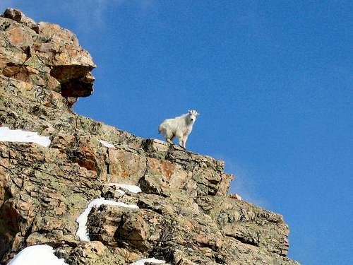 Mountain Goat on Mount Olympus - by Joe Bullough
Wasatch Fauna
There are a wide range and variety of animals living in the Wasatch Mountains. Bear, elk, moose, deer, mountain goats, and cougars are among the larger animals. Bobcats, coyotes, fox, porcupines, raccoons, beaver, badgers, rabbits, weasels, marmots, squirrels, chipmunks, and pikas make up many of the smaller animals. Birds are abundant too, including eagles, owls, hawks, grouse and poorwill. Closer to the ground are lizards, snakes, spiders, and insects.
Bears
In the state of Utah, black bears are present in most of the forested mountain areas and canyons. A few exceptions include the Raft River Mountains, Pilot Range, Deep Creek Mountains, and Henry Mountains. There are about 8.7 million acres of black bear habitat that is mostly located on National Forest land. Utah has a low black bear population of about 800 to 1,000 black bears. The state of Nevada has the lowest black bear population of all the western states with about 300 total. About 80% of bear sightings in the Wasatch Mountains have occurred between 7,000 feet and 10,000 feet in elevation.
The last grizzly bear that lived in Utah was known as Old Ephraim. He was a giant bear that roamed the Bear River Mountains near Logan. Old Ephraim was killed on August 22, 1923, and there have been no grizzly bear sightings in Utah ever since. There is a dirt road or mountain bike trail from Temple Fork or the Right Hand Fork of Logan Canyon where people can go see a stone monument for the bear which is 9 feet 11 inches tall. It represents the height of Old Ephraim when he stood up on his hind legs.
 Ground Squirrel Ground Squirrel |
 Deer Deer |
 Moose Moose |
 Bear Bear |
|---|
Deer, Elk, and Moose
The mule deer is seen throughout the state of Utah. They can be found in many types of habitat, ranging from open deserts to high mountains to urban areas. Mule deer often migrate from high mountainous areas in the summer to lower elevations in the winter to avoid deep snow. The white-tailed deer are not as common to see in Utah.
Elk are prevalent in most mountainous regions of Utah, where they can be found in meadows and forests during the summer, and in the foothills and valley grasslands during the winter. The seasonal changes in elevation allow elk to find food year round. Elk may be active all day but most activity occurs at dusk and dawn.
Moose are relatively recent arrivals to Utah with no record of moose prior to the twentieth century. The moose population above Salt Lake City is plentiful. If you do enough hiking here you will see a few of these animals. Moose are docile animals and do not usually bother people. There are some circumstances when moose can become dangerous like being near a cow moose and her calf. Their parental instincts make the cow moose protective of its offspring and these situations should be avoided.
Not only are the cow moose dangerous, but the bull moose commands respect as well. If you see one it's a good idea to keep a safe distance away. The four-county area above Salt Lake City is home to perhaps a thousand of Utah's estimated 3,200 moose. They have been spotted in some residential areas along the Wasatch. Although, many people live very close to the mountains.
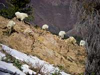 Mountain Goats Mountain Goats |
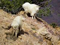 Mountain Goats Mountain Goats |
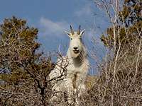 Mountain Goat Mountain Goat |
 Mountain Goat Mountain Goat |
|---|
Mountain Goats
Mountain goats are one of my favorite animals to see in the wilderness. They can often be viewed climbing on cliffs near the mouth of Little Cottonwood Canyon. There probably isn't any other animal that is as symbolic to precipitous mountain terrain as the mountain goat. They are a common sight in the Wasatch Mountains.
They prefer extremely steep and rugged areas above timberline. They are excellent and natural rock climbers. Mountain goats typically migrate to lower elevations in winter. Females give birth during the months of May or June. Young baby goats are able to follow their mothers through rocky cliffs shortly after birth.
Mountain goats are occupants of the highest alpine environments in the Wasatch. Even in winter, they may live as high as as 11,000 feet on windblown ridges. Both male and female mountain goats have beards, short tails, and long dark horns. They are protected from the elements by their woolly white coats of fur. Their coats help them withstand temperatures as low as -50 degrees and winds of up to 100 mph.
Confrontations between mountain goats and humans are rare but it's a good idea to keep a safe distance and remember that they have very sharp horns. Mountain goats eat a variety of grasses and shrubs, as well as lichen, mosses, and conifers. They also love eating salt. Mountain goats can be seen on the rocky slopes of Mount Superior and Monte Cristo especially near Cardiff Pass. They enjoy hanging around the cliffs of Cottonwood Ridge and Alpine Ridge.
 Moose Moose |
 Moose Moose |
 Moose Moose |
 Mountain Goats Mountain Goats |
|---|
Mountain Lions
The mountain lion is also known as a cougar, puma, panther, and catamount. Utah has an alpine and desert environment so it is an ideal place for mountain lions to live. The chances of seeing a mountain lion are slim and they are sure to see you before you see them. They are common in some areas but are extremely shy and secretive. However, mountain lions occasionally wander into cities or other areas where they come into contact with people. They can be found throughout the state except in the barren salt flats west of the Great Salt Lake. They live in habitats where there is abundant prey.
In the Wasatch Mountains, mountain lions like to be near boulders and brushy areas. Within these habitat types, lions prefer areas where there are rocky cliffs, ledges, and tall trees or brush that can be used for cover. Mountain lions often climb trees to avoid detection and danger. Generally, lions avoid areas of low-growing shrubs, areas used for agriculture and pasture lands, and any other areas without adequate tall cover. Female lions with kittens prefer areas with large conifers, boulders, and dense shrubs that provide shelter and protection for the kittens. Like other animals, female mountain lions are very protective of their babies and you should keep a safe distance if you see them.
 Rattlesnakes Rattlesnakes |
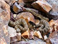 Rattlesnakes Rattlesnakes |
 Common Poorwill Common Poorwill |
 Steller Jay Steller Jay |
|---|
Rattlesnakes
The most common rattlesnake in Utah is the Great Basin Rattler, which is typically light tan or light gray in color, with dark blotches on its back. On average, these snakes live 10 to 20 years and can grow three to five feet long. The Great Basins aren't known for a real high venom toxicity but their bite is usually very painful. Getting bit by a rattlesnake may result in an allergic reaction but it all depends on the person.
Rattlesnakes are notoriously calm and don't like to bother people unless they are being antagonized or feel threatened. They also don't like to be stepped on either. The number of snake bite victims in the Salt Lake valley varies from year to year depending on conditions. The Utah Poison Control Center usually hears of at least 12 to 15 bites. The foothills are a common place to see rattlesnakes during the summer when the weather is warm. Mount Olympus and Wildcat Ridge are well known for their rattlesnake population.
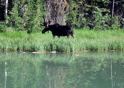 Bull Moose in the Wasatch Mountains - by Dean
Wasatch Flora
The Wasatch Mountains are profuse with wild flowers during a few months of the year. Some of the species only occur here in the higher mountains. Others can also be seen further down the canyon where they bloom earlier in the year. Wild flowers usually cover the mountainsides from April to September. The area above Brighton is a great place to see wildflowers. It is located at the top of Big Cottonwood Canyon at over 9,000 feet. There are many trails in this area to wander around for hours. The lakes and peaks provide a nice background. Cardiff Pass is a nice place to visit when it is covered in wild flowers.
Albion Basin is a favorite place to many people for viewing wild flowers. It is located at the top of Little Cottonwood Canyon above the ski resorts of Alta and Snowbird. The elevation here is over 9,000 feet and almost 10,000 feet at Secret Lake. The best time to visit Albion Basin is during July and August. You will probably find different flowers each time you go there. Cecret Lake is located below the cliffs of Devils Castle and Sugarloaf Peak. It is a special place that was spelled as "Secret" on an early map drawn by a miner who was prospecting for the precious metals to be found in the metamorphic rock of the area.
 Arrowleaf Balsamroot Arrowleaf Balsamroot |
 Jacobs Ladder Jacobs Ladder |
 Long-leaf Phlox Long-leaf Phlox |
 Albion Basin Albion Basin |
 Fireweed Fireweed |
 Flagstaff Mountain Flagstaff Mountain |
 Albion Basin Albion Basin |
|---|---|---|---|---|---|---|
 False Solomon Seal False Solomon Seal |
 Antelope Brush Antelope Brush |
 Rabbitbrush Rabbitbrush |
 Mitrewort Flowers Mitrewort Flowers |
 Purple Thistle Purple Thistle |
 Yellowbell Yellowbell |
 Serviceberries Serviceberries |
Foothill Vegetation
Vegetation located in the foothills include box elder, cottonwoods, juniper trees which are also called cedar trees, buffalo berry, serviceberry with round leaves, and edible blue berries, poison ivy, cliffrose which is similar to bitterbrush, rabbitbrush, and sagebrush which is the most common shrub found in foothills. Some of the flowers in this area include Stork's bill with pink flowers that resembles stork's head, spring beauty, Rocky Mountain bee plant, phlox which has symmetrical blossoms with five spreading petals of white, pink, purple, or blue flowers, mistletoe which resembles a bird's nest, astragalus which is part of the pea family, evening primrose, mullein, and the sego lily which is the state flower of Utah. Vegetation located here can be found at 5,000 to 6,500 feet.
Lower Mountain Area
The tree species in the Lower Montane are similar to those found at higher elevations. You will be able to see larger numbers of aspen groves. There are many types of willows and groups of river birch found near mountain streams. Other plants include mountain ash, alder, dogwood, western chokecherry, Rocky Mountain maple, mountain mahogany, bitterbrush, shrubby cinquefoil, and scrub oak which is also known as Gambel oak. Some of the flowers include Meadow rue, Indian paintbrush, fireweed, violets, geraniums, horsetails, fly amanita which is a fungi, Jacob's ladder, larkspur, Oregon grape with holly-like leaves, gaillardia or brown-eyed susan, and cone flowers which are part of the sunflower family. Vegetation located hear can be found at about 6,000 to 9,500 feet.
 Dalmation Toadflax Dalmation Toadflax |
 Sego Lily Sego Lily |
 Bonneville Peavine Bonneville Peavine |
 Mule Ears Mule Ears |
 Spring Parsley Spring Parsley |
 Morel Morel |
 Spring Beauty Spring Beauty |
|---|---|---|---|---|---|---|
 Columbine Columbine |
 Wasatch Flowers Wasatch Flowers |
 Tapertip Onion Tapertip Onion |
 Gambel Oak Gambel Oak |
 Houndstongue Houndstongue |
 Wandering Daisy Wandering Daisy |
 Browse Milkvetch Browse Milkvetch |
Upper Mountain Area
Some trees that can be found in this area of the Wasatch Mountains include Englemann spruce, Douglas fir, Limber pine, White fir, Sub-alpine fir, and Quaking aspen. Flowers that can be seen in this area include larkspur with dark blue flowers and deeply cut leaves, mountain bells which are bell-shaped with pink or blue flowers, senecio with thick leaves, yellow sunflowers, monkshood which are helmet-shaped purple and blue flowers, daisies, white marsh marigold, monkey flowers, orchids, gentians, columbines, elephanthead, shooting stars which are a dart-shaped flower, pussytoes which are in pink or white clusters, wallflowers that are orange brown or rose-purple, and Indian paintbrush. Vegetation that is located here can be found at 8,000 to 10,000 feet in elevation.
Above Timberline
A few plants are found above timberline on the very highest peaks. Timberline can usually be determined by lack of trees although some trees can still be found at high elevations. The soils in which they grow are shallow and the season short. Many of the plants that are located above timberline have beautiful colors, are smaller in size, and are fragrant. The time of flowering varies among the different species. Plants above timberline include alpine forget-me-nots, Indian paintbrush, cushions of pinkish-purple moss campions, white alpine avens, bistorts which are a slender swaying plant with upright spikes of white flowers that look like tufts of cotton from a distance, harebells which are single dark blue funnel shaped flowers, mat-forming mountain dryads, and alpine willows.
 Giant Coreopsis Giant Coreopsis |
 Pink Speckled Rockets Pink Speckled Rockets |
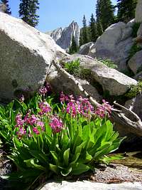 Parry's Primrose Parry's Primrose |
 AF Twin Peaks AF Twin Peaks |
|---|---|---|---|
 Sunset Peak Paintbrush Sunset Peak Paintbrush |
 Evening Primrose Evening Primrose |
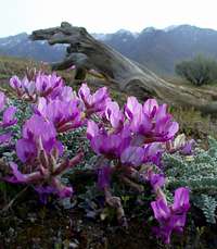 Pink Lady Slipper Pink Lady Slipper |
 Devils Castle Devils Castle |
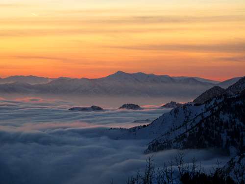 Sunset from Beartrap Fork - by Ed F
Sunsets & Sunrises
If you are like most people you probably enjoy seeing a sunrise or sunset. Even better is seeing them in the mountains. The Wasatch Mountains offer a great setting for photographing sunrises and sunsets. The sun shining on ridges above the Cottonwood Canyons is always spectacular with yellow, red, and orange hues. Twilight happens between sunset and dusk and may produce a purple and blue hue of color. Alpenglow usually happens when the sun is just below the horizon. This is when you will see mountains illuminated with light for a short period of time. We also have inversions which occur most notably in winter. This isn’t a good thing but it does make for interesting photos. Winter has the shortest days while the longest days happen in late June through July.
There are a lot of places to get good photos but some of these seem to always be good. People who hike up to Mount Olympus see a fair share of photogenic sunrises and sunsets. I doubt that any of the other summits and ridges in the Wasatch would disappoint anyone either. You'll want to check out the album by TyeDyeTwins: Sunsets and Sunrises of the Wasatch. Here are a few photos from SP members below.
 Salt Lake Valley Sunset Salt Lake Valley Sunset |
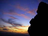 Mount Olympus Sunset Mount Olympus Sunset |
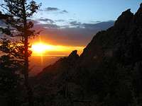 Mount Olympus Sunset Mount Olympus Sunset |
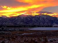 Alpine Ridge Sunrise Alpine Ridge Sunrise |
|---|---|---|---|
 Salt Lake Valley Sunset Salt Lake Valley Sunset |
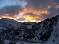 Alta Sunrise Alta Sunrise |
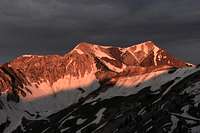 AF Twin Peaks Sunrise AF Twin Peaks Sunrise |
 Flagstaff Mountain Sunset Flagstaff Mountain Sunset |
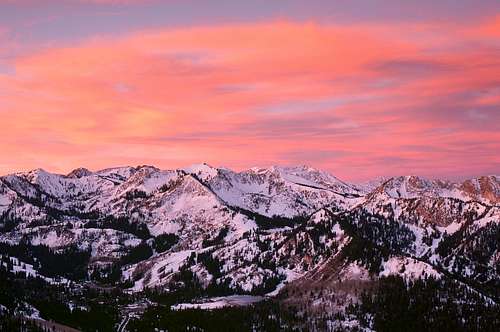 Wasatch Sunrise from Scott Hill - by Pharmacist
Trailheads
Listed below are several trailheads for the Central Wasatch that have pages on Summitpost.
| TRAILHEADS | |||
| Trailhead | SP Page | Main Access | |
|---|---|---|---|
| Big Water | Page | Reynolds Peak, Little Water Peak, Dog Lake, Desolation Lake, Desolation Peak, Murdock Peak and Park City Ridge Peaks | |
| Mill D North | Page | Dog Lake, Desolation Peak, Reynolds Peak, Little Water Peak and the Desolation Trail | |
| Mill B South : Lake Blanche | Page | Lake Blanche, Lake Florence, Lake Lillian, Sundial Peak and Cottonwood Ridge Peaks | |
| Lake Mary : Catherine Pass | Page | Lake Mary, Lake Martha, Lake Catherine, Dog Lake, Preston Peak, Pioneer Peak, Sunset Peak, Mount Tuscarora and Mount Wolverine | |
| White Pine | Page | White Pine Lake, White Baldy, Red Top, Red Pine Lake, Red Baldy, Maybird Lakes, Pfeifferhorn, Obelisk, Bullion Divide and Beatout Hike on Alpine Ridge | |
| Bells Canyon | Page | Lower Bells Reservoir, Upper Bells Reservoir, Bells Cleaver, Rocky Mouth Canyon Peak, North Thunder Mountain, South Thunder Mountain, Upper Bells Peak and Lone Peak | |
Peak Lists
Here are links to several Wasatch and Utah Peak Lists. They include the Salt Lake County Highpoints List, the Wasatch 11,000 foot Peaks List, the Utah County Highpoints List, Utah’s 2,000 foot Prominence Peaks List, and Utah's 100 Most Prominent Peaks List.
Wasatch 11,000 foot Peaks List
This is a list of the 11,000 foot Peaks in the Wasatch by SP member Ammon Hatch in the Central and Southern Wasatch Areas.
Utah County Highpoints List
This is a list of the Utah County Highpoints by SP member Dean. The highest in Salt Lake County is American Fork Twin Peaks.
Utah’s 2,000 foot Prominence Peaks List
This is a list of Utah’s 2,000 foot Prominence Peaks by SP member redsplashman23. There are over 80 of these peaks in Utah.
Utah’s 100 Most Prominent Peaks List
The 100 most prominent peaks in Utah by SP member redsplashman23. Some are located on private land so this is difficult to complete.
This is a list of 11,000 foot peaks in the Central Wasatch Mountains. They are located on the Cottonwood and Alpine Ridges. A worthy goal is to climb all of them. Several other peaks over 11,000 feet are located in the Southern Wasatch. The ratings I listed are during summer when the routes are the easiest to climb. During winter, or other times of the year, expect changing conditions in these mountains.
| CENTRAL WASATCH 11,000 FOOT PEAKS | ||
| Mountain | Elevation | Standard Route |
|---|---|---|
| Alpine Ridge | ||
| West American Fork Twin Peak | 11,489 | Class 3 |
| East American Fork Twin Peak | 11,483 | Class 3 |
| AF Twin Peak South (The Bastard Son) | 11,391 | Class 2 |
| Red Top Mountain (Red Stack) | 11,378 | Class 2-3 |
| Pfeifferhorn | 11,326 | Class 3 |
| White Baldy | 11,321 | Class 3 |
| Lone Peak | 11,253 | Class 3 |
| Red Baldy | 11,171 | Class 2-3 |
| South Thunder Mountain | 11,154 | Class 2-3 |
| North Thunder Mountain | 11,150 | Class 3-4 |
| Upwop Peak | 11,137 | Class 2-3 |
| Mount Baldy | 11,068 | Class 1-2 |
| Sugarloaf Peak | 11,051 | Class 1-2 |
| Peak 11,007 (AF Twin Peak East) | 11,007 | Class 2 |
| Cottonwood Ridge | ||
| East Broads Fork Twin Peak | 11,330 | Class 3 |
| West Broads Fork Twin Peak | 11,328 | Class 3 |
| Sunrise Peak | 11,275 | Class 3 |
| Monte Cristo | 11,132 | Class 2-3 |
| Dromedary Peak | 11,107 | Class 3 |
| Mount Superior | 11,040 | Class 2-3 |
| Peak 11,033 (Blanche Peak) | 11,033 | Class 3-4 |
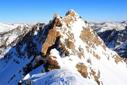 Northern Cardiac Ridge - by Phenom
This is a list of mountains in the Central Wasatch. This includes all major peaks in the area. Many of the them have pages on Summitpost. This area of the Wasatch is the most popular among hikers, skiers, mountain climbers, and rock climbers.
| CENTRAL WASATCH MOUNTAINS | ||
| Mountain | Elevation | SP Page |
|---|---|---|
| 11,000 foot Peaks | ||
| American Fork Twin Peaks | 11,489 | Page |
| "Red Top Mountain" | 11,378 | Page |
| Broads Fork Twin Peaks | 11,330 | Page |
| Pfeifferhorn | 11,326 | Page |
| White Baldy | 11,321 | Page |
| Sunrise Peak | 11,275 | Page |
| Lone Peak | 11,253 | Page |
| Red Baldy | 11,171 | Page |
| South Thunder Mountain | 11,154 | Page |
| North Thunder Mountain | 11,150 | Page |
| "Upwop Peak" | 11,137 | Page |
| Monte Cristo | 11,132 | Page |
| Dromedary Peak | 11,107 | Page |
| Mount Baldy | 11,068 | Page |
| Sugarloaf Peak | 11,051 | Page |
| Mount Superior | 11,040 | Page |
| 10,000 foot Peaks | ||
| "Hidden Peak" | 10,992 | Page |
| Chipman Peak | 10,954 | Page |
| Devils Castle | 10,920 | Page |
| "Little Pfeifferhorn" | 10,897 | Page |
| "Bighorn Peak" (Upper Bells Peak) | 10,877 | Page |
| Mount Wolverine | 10,795 | Page |
| Mount Majestic (Clayton Peak) | 10,721 | Page |
| "Lake Peak" (Point 10,718) | 10,718 | Page |
| Mount Tuscarora | 10,660 | Page |
| Sunset Peak | 10,648 | Page |
| Flagstaff Mountain | 10,530 | Page |
| "Patsy Marley" | 10,525 | Page |
| "Obelisk" (Hogum Divide) | 10,516 | Page |
| "Bells Cleaver" | 10,488 | Page |
| Honeycomb Cliffs | 10,480 | Page |
| Mount Millicent | 10,452 | Page |
| Pioneer Peak | 10,450 | Page |
| "Mount Venture" (Peak 10,420) | 10,420 | Page |
| Kessler Peak | 10,403 | Page |
| Sundial Peak | 10,320 | Page |
| "Preston Peak" | 10,315 | Page |
| "Rocky Mouth Canyon Peak" | 10,292 | Page |
| "Cardiff Peak" | 10,277 | Page |
| Gobblers Knob | 10,246 | Page |
| Mount Raymond | 10,241 | Page |
| Scott Hill | 10,116 | Page |
| "Tri-County Peak" | 10,027 | Page |
| Silver Peak | 10,006 | Page |
| 9,000 foot Peaks | ||
| Jupiter Hill | 9,998 | Page |
| "Desolation Peak" | 9,990 | Page |
| "Rainbow Peak" (Point 9,947) | 9,947 | Page |
| Mount Evergreen | 9,840 | Page |
| Little Water Peak | 9,605 | Page |
| Murdock Peak | 9,602 | Page |
| Storm Mountain | 9,524 | Page |
| Reynolds Peak | 9,422 | Page |
| "Triangle Peak" | 9,410 | Page |
| Park Benchmark | 9,363 | Page |
| Bald Mountain | 9,346 | Page |
| Enniss Peak | 9,322 | Page |
| Flagstaff Mountain | 9,213 | Page |
| Mount Olympus | 9,026 | Page |
| Iron Mountain | 9,018 | Page |
| Peaks below 9,000 feet | ||
| Millvue Peak | 8,926 | Page |
| Bonanza Benchmark | 8,708 | Page |
| "Circle-All Peak" (Circle-Awl Peak) | 8,707 | Page |
| "Thayne Peak" | 8,656 | Page |
| Mount Aire | 8,621 | Page |
| "Summit Park Peak" | 8,618 | Page |
| Church Fork Peak | 8,306 | Page |
| Grandeur Peak | 8,299 | Page |
| "Park City Hill" | 7,202 | Page |
| View Benchmark | 6,682 | Page |
| Steep Mountain / South Mountain | 6,196 | Page |
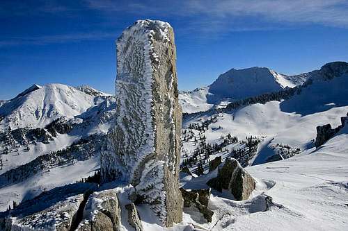 Obelisk Summit - by marauders
This is a list of some of the ridge traverses in the Central Wasatch Mountains. These are not the only traverses that can be done. There are numerous peaks that can be linked together in different combinations. The ratings I listed are during summer when the traverses are easiest to do. Conditions may vary at other times. This list was made because ridge traverses are one of my favorite types of routes.
| CENTRAL WASATCH RIDGE TRAVERSES | |||
| Route | Duration | Difficulty | Comments |
|---|---|---|---|
| Millcreek Ridge | 1 day | Class 2 | This ridge traverse includes Grandeur Peak, Church Fork Peak, Mount Aire, Millvue Peak, and Murdock Peak where it meets Park City Ridge. This can be done in either direction but you start at a higher elevation if going from east to west. |
| Park City Ridge | 1 day | Class 2 | The Park City Ridge can be done in a north to south direction or south to north direction. Some of the mountains include Tri-County Peak, Scott Hill, Silver Peak, and Desolation Peak. Murdock Peak may also be added to the list. |
| Wildcat Ridge | 1 day | Class 4 | This traverse is usually done from Mount Olympus to Mount Raymond in a west to east direction. Triangle Peak and several other points are also climbed along the ridge. You can add Gobblers Knob and more peaks to the hike if you want to. A tamer version of the route is called the Wild Kitten Ridge Traverse. |
| Brighton Ridge Run | 1 day | Class 2 | The Brighton Ridge Run starts at the top of Big Cottonwood Canyon. Mountains include Mount Millicent, Mount Wolverine, Mount Tuscarora, Sunset Peak, Pioneer Peak, and Preston Peak. Other mountains that can be added are the Honeycomb Cliffs, Mount Majestic (Clayton Peak), and Peak 10,420 north of Clayton Peak. |
| Alta Ridge Run | 1 day | Class 2 | This is an alternative version of the Brighton Ridge Run. The hike starts at the top of Little Cottonwood Canyon. You can do it as a loop thats ascends to Catherine Pass and then traverses to Twin Lakes Pass. Mountains include Mount Wolverine and Tuscarora. You can also add Sunset Peak and Honeycomb Cliffs. |
| Triple Traverse | 1 day | Class 3 | This includes Broads Fork Twin Peaks, Sunrise Peak, and Dromedary Peak. Most people start with Twin Peaks either approached from Broads Fork or Storm Mountain. If approaching from Tanners Gulch, the route is done in the opposite direction. |
| Cottonwood Ridge (East) | 1 day | Class 2-3 | This route is done as a loop and starts near Alta in Little Cottonwood Canyon. Mountains climbed on this traverse include Honeycomb Cliffs, Davenport Hill, and Flagstaff Mountain. Many people also include Mount Superior and Monte Cristo. |
| Cottonwood Ridge | 1 day | Class 4 | This traverse is commonly done from Broads Fork to Alta. It can also be done in the opposite direction. This is usually combined with the Triple Traverse Peaks, several unnamed points along Cottonwood Ridge, and Monte Cristo and Mount Superior. |
| Red White Red White | 1 day | Class 3 | This route on Alpine Ridge starts by going up Red Pine Canyon and then to the summit of White Baldy. Then it traverses the ridge over to the summit of Red Baldy and then descends White Pine Canyon, hence the name of the route. |
| Bullion Divide | 1 day | Class 3 | The Alpine Ridge from Albion Basin to Red Pine Canyon or vice versa. This includes Mount Baldy, Hidden Peak, American Fork Twin Peaks, Red Top Mountain, Red Baldy, and White Baldy. Devils Castle and Sugarloaf Mountain may also be added. |
| Beatout Hike | 1 day | Class 3 | This ridge traverse is located on Alpine Ridge. It goes from Red Pine Canyon to Bells Canyon or vice versa. This includes the Pfeifferhorn, Upwop Peak, and South Thunder Mountain. Chipman Peak is a nice bonus peak to add. |
| Hematoma Quad | 1 day | Class 4 | This route includes the summits of North Thunder Mountain, South Thunder Mountain, Bighorn Peak (Upper Bells Peak), and Lone Peak. This ridge traverse is usually done in this order but can be done in either direction. |
| Sunrise to Sunset | 1 to 2 days | Class 4 | This route starts by climbing Sunrise Peak. Then it follows Cottonwood Ridge all the way to Sunset Peak. You'll need two cars for this traverse. Most people will ascend Broads Fork and then descend to Little Cottonwood Canyon at the end. |
| Bullion / Beatout | 1 to 2 days | Class 3-4 | This is also known as the Super Beatout or Alpine Ridge Traverse. This usually starts from Albion Basin and goes to South Thunder Mountain with descent down Bells Canyon. Some people add Bighorn Peak and Lone Peak to the route instead. |
| Wasatch Ultimate Ridge Linkup | 1 to 3 days | Class 4 | This is the horseshoe shaped ridge traverse of the Cottonwood Ridge and Alpine Ridge together. As the name says, this is the ultimate ridge traverse in the Central Wasatch in terms of rugged and beautiful terrain and endurance needed to finish it. The average person will take two or three days but animals can try it in one very long day. |
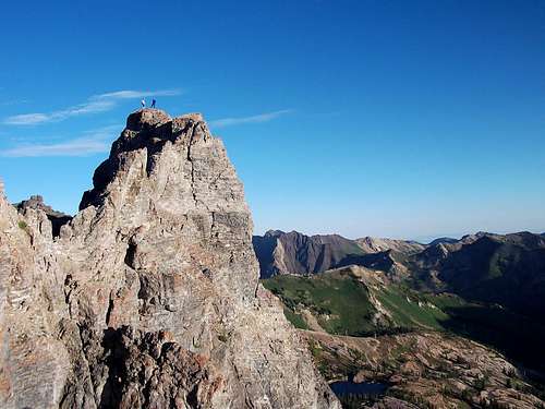 Devils Castle Summit - by Pharmacist
Books and Maps
1) Utah Mountaineering Guide
By Michael R. Kelsey. Descriptions are brief but this is the best book available for an overall guide to many of the major mountains in Utah. There is a sketch map and photo of each peak. He also describes winter routes up many of the mountains.
2) Hiking the Wasatch
By John Veranth. This is the book to get for hiking and climbing in the Wasatch Mountains. It describes hikes from the foothills to many of the highest mountains above Salt Lake City. The book focuses on the areas of Millcreek Canyon, Big Cottonwood Canyon, and Little Cottonwood Canyon.
3) Wasatch Eleveners Climbing Guide
By Randy Winters aka Summitpost member rmjwinters. This book is about climbing all of the 11,000 foot peaks in the Wasatch Mountains.
4) Wasatch Tours (Backcountry Skiing)
By Kelner and Hanscom. These series of books are an introduction to backcountry ski touring in and near the Wasatch Mountains.
5) The Chuting Gallery (Backcountry Skiing)
By Andrew McLean. Steep backcountry skiing guide to the Wasatch Mountains. Book describes many areas above Salt Lake City.
6) Rock Climbing the Wasatch Range
By Stuart and Bret Ruckman. Comprehensive guide to rock climbing areas above Salt Lake City including the Cottonwood Canyons.
7) Hiking The Wasatch (Wasatch Mountain Club)
This is the official map of the WMC. It shows all of the canyons from Millcreek Canyon to Lone Peak with great detail. It is durable and waterproof.
External Links
Albums:
The Wasatch in Black and White
This is an album for Black and White Photography in the Wasatch Mountains.
Wasatch Photos of the Hour
Photos of the Hour for the Wasatch Mountains. Attach any that may belong to this album.
Wasatch Peak Jumping
Peak jumping photos for the Wasatch and other Utah Mountains. Album submitted by Scott Wesemann.
Thursday Hike to Red Pine Lake
Garfimi has an album of his hike to Red Pine Lake above Little Cottonwood Canyon.
Lake Blanche in Fall 2008
This is an album from Garfimi's hike to Lake Blanche above Big Cottonwood Canyon in autumn.
Winter Hike to Lake Blanche 2010
This is an album of Garfimi’s winter hike in January 2010 to Lake Blanche without the crowds.
Brandon's Wasatch Mountains Photo Album
Brandon's album has a list of Wasatch Mountains he has climbed with trail mileages, information, and photos.
Websites:
Utah Avalanche Center
Avalanche conditions, advisories, lists, and accidents for the state of Utah. Updated every morning during winter.
Mick's Mountain Page
Mick's website has trip reports and photos for mountains in every area in the Wasatch Mountains.
Marauders Mountain Album
The Mauraders website has trip reports and photos for the Central and Southern Wasatch Mountains and other places as well.
Lane Pollock's Website
Lane's website has a lot of photos for the Wasatch Mountains, Southern Utah, and mountains in many other states and places.
Eric Willhite's Website
Eric Willhite has trip reports on many mountains in the Central Wasatch and in other areas in Utah.
Wasatch Front 100 Mile Endurance Run
This endurance run stretches from Layton, Utah to The Homestead in Midway, Utah and covers a lot of terrain in the Wasatch Mountains. It is held annually on the first Saturday after Labor Day. The race gains 26,000 cumulative feet in elevation as it traverses the Wasatch Front. The trail goes from 4,700 feet to 10,460 feet at its highest point. The fastest runners typically finish the race in 20 hours or so, while the field is given 36 hours to finish the race.